948
As a man changed the Earth (16 photos)
Technical progress has changed the face of the Earth in just a few decades. All photos were taken by satellites, which are included in the program «Landsat». July 23 this program celebrates its 40th anniversary. The program, jointly managed by NASA and the US Geological Survey aims to systematically collect data on our planet.
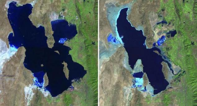
Great Salt Lake, USA, in 1985 and 2010
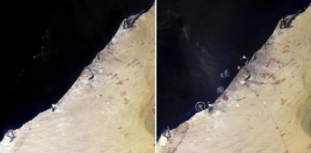
In 1990, the Dubai coast remained virtually untouched by man, but after some 16 years, this area has changed beyond recognition
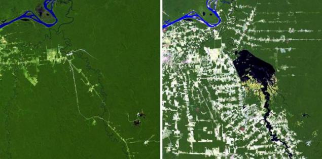
In 1984, Brazil had just begun work on the construction of the dam Samuel, situated on the river in Rondônia Jamar. The second picture taken in 2011, shows how affected by the presence of the dam and reservoir on the surrounding forests.
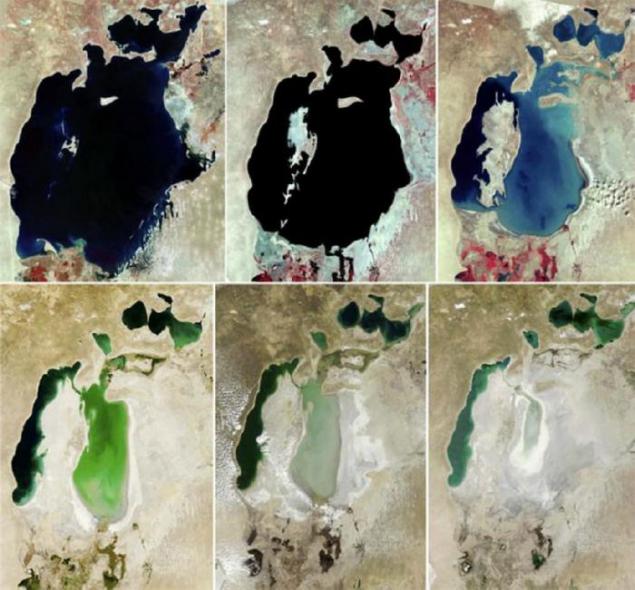
Photographs taken in 1973, 1987, 1999, 2004, 2007 and 2009, shows how disappearing Aral Sea between Kazakhstan and Uzbekistan. Once one of the largest lakes on Earth was destroyed by Soviet irrigation projects.
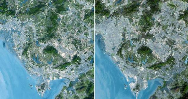
Shenzhen, China, in 1999 and 2008.
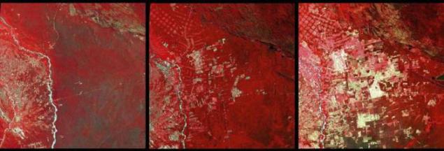
Infrared images in 1975, 1992 and 2000, showing deforestation in the region of Santa Cruz de la Sierra in Bolivia.
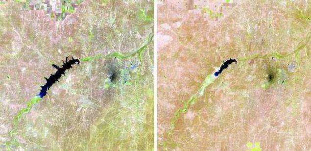
Lake Meredith, USA, in 1990 and 2011.
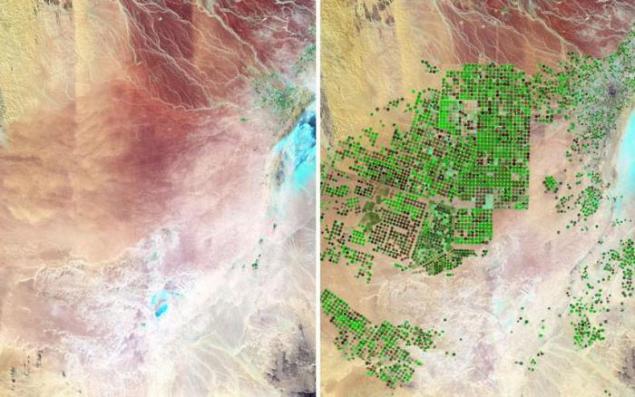
A photograph taken from a satellite in 1987, on this part of Saudi Arabia can only be seen vast desert. But by 2012, the majority of the region turned into farmland, similar to the green dots on the barren lands.
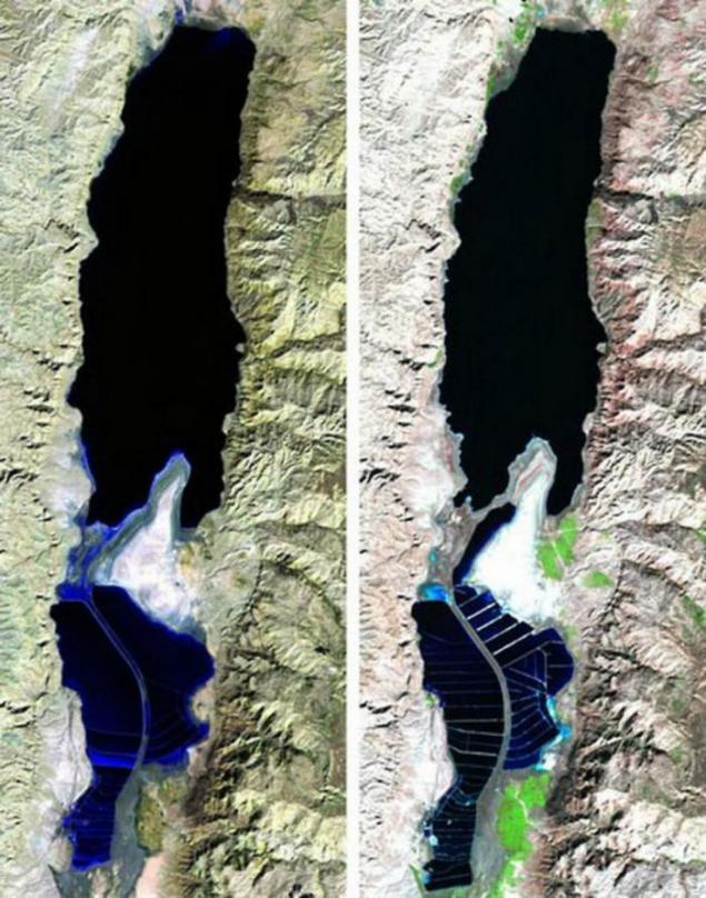
Dead Sea in 1984 and 2011
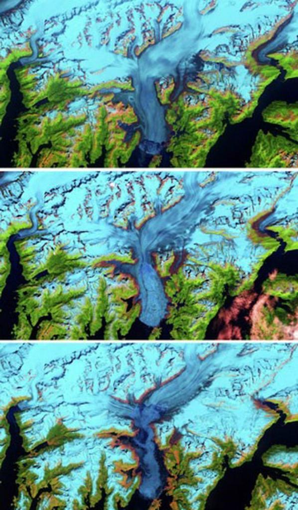
Columbia Glacier, Alaska, 1986, 2000 and 2011
Morocco in 1985 and 2011,
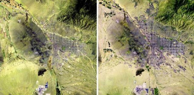
City of Tucson, Arizona, USA, in 1984 and 2011
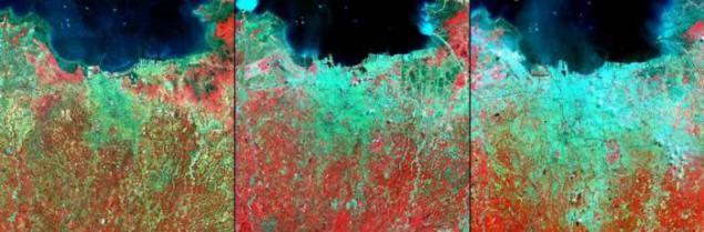
Jakarta, Indonesia, in 1976, 1989 and 2004
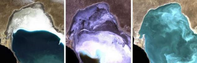
Caspian Sea in 1972, 1987 and 2010
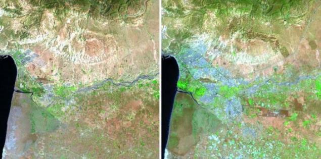
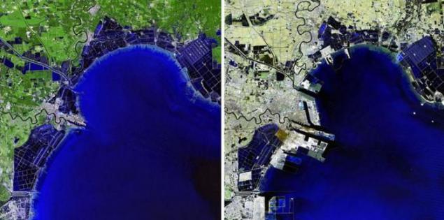
The photograph in 1992 in China Binhai area is sparsely populated, swampy area. But by 2012 the area has turned into a developed economic zone
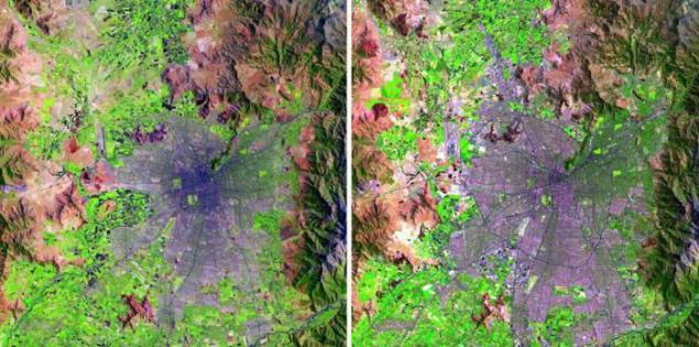
Santiago, Chile, in 1985 and 2010,
Great Salt Lake, USA, in 1985 and 2010

In 1990, the Dubai coast remained virtually untouched by man, but after some 16 years, this area has changed beyond recognition

In 1984, Brazil had just begun work on the construction of the dam Samuel, situated on the river in Rondônia Jamar. The second picture taken in 2011, shows how affected by the presence of the dam and reservoir on the surrounding forests.

Photographs taken in 1973, 1987, 1999, 2004, 2007 and 2009, shows how disappearing Aral Sea between Kazakhstan and Uzbekistan. Once one of the largest lakes on Earth was destroyed by Soviet irrigation projects.

Shenzhen, China, in 1999 and 2008.

Infrared images in 1975, 1992 and 2000, showing deforestation in the region of Santa Cruz de la Sierra in Bolivia.

Lake Meredith, USA, in 1990 and 2011.

A photograph taken from a satellite in 1987, on this part of Saudi Arabia can only be seen vast desert. But by 2012, the majority of the region turned into farmland, similar to the green dots on the barren lands.

Dead Sea in 1984 and 2011

Columbia Glacier, Alaska, 1986, 2000 and 2011

Morocco in 1985 and 2011,

City of Tucson, Arizona, USA, in 1984 and 2011

Jakarta, Indonesia, in 1976, 1989 and 2004

Caspian Sea in 1972, 1987 and 2010

The photograph in 1992 in China Binhai area is sparsely populated, swampy area. But by 2012 the area has turned into a developed economic zone

Santiago, Chile, in 1985 and 2010,