1190
Masurian Canal
Traveling on the Kaliningrad region, one is struck by the abundance of various hydraulic structures that were built before 1945. It is navigable canals Friedrich end of the XV century Königsberg sea channel the end of the XX century, Insterburgsky river channel 20-ies of XX century, the system locks on the Pregel, hydroelectric, ramified system of land reclamation. Finally, the water supply system in Kaliningrad is 80% based on pre-war buildings, the history of which goes into the medal times.
Like any decent from Kaliningrad, I have visited almost all German forts, ruins of castles and other interesting and mysterious places in the area. But, to my shame, recently I learned about the existence of Mazury with its bottomless channel gateways, standing in an open field.
Just yesterday, I was at work just 10 km from the largest of five gateways in the region - the gateway Georgenfelde (Ponds Floor) and decided to take the opportunity.
For the story of the most successful pictures are collected from the Internet and not to be unfounded, at the end of some of my pictures. About 40 photos, the end will tell ...
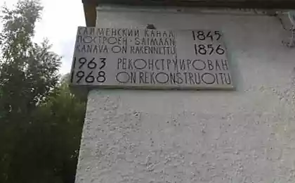
A bit of history. The idea of creating a waterway connecting the Mazury Lake with swimming pool river Pregel, there was more to the medal times. On the necessity of such a waterway also spoke Great Elector Friedrich Wilhelm and Frederick. This is caused by the desire to have a convenient and cheap way for transportation of farm and later - industrial goods up to Konigsberg or Dame in the Curonian Lagoon.
Immediately after the Seven Years' War, in 1764 it developed a plan of construction, onredelivshy destination and route of the Channel Mazury. Under the supervision of Domharta to 1776 (for 12 years) dug a 50-kilometer box, through which water from the lake in the Mazury Mauerzee gravity hill went to Allenburgu which flowed into the Alle. According to the channel downstream, sailed laden boats and barges. As was the case with the movement in the other direction, against the current, I do not know. Obviously, not without "Prussian boatmen." As often happens after the death Domharta v1781, the channel gradually fell into disrepair: shallow channel swamp, coastal embankment collapsed.
It took almost a hundred years, when the channel remembered again. In 1874, a new project for the construction of a canal through the old bed with locks. Then followed a long, long intervals coordination of organizational and financial issues - until 1908.
In 1908, the project was finally approved, and began to practice. Direct supervision was entrusted to the management of the two who were in Insterburg: the northern and southern parts of kanala.Do the First World War (6 years), most of the locks was built. The war interrupted the construction. In 1922, work resumed, but for financial reasons - in connection with the impending depression - were soon curtailed. The final step associated with the modernization of locks and dambirovaniem bed, began in 1934. As you know, it was a time of mass construction of roads throughout Germany. Around the channel up barracks for workers, on the shores stretching rails for trolleys, for the first time earned excavators. Despite the broad scope of work and a lot of participants to apply the measures of secrecy. It was forbidden to take photographs. On the German topographic maps kilometer 1936 and 1939 years are not shown gateways and mainstream channel south of Georgenfelde. This gives grounds to speak about the plans and the use of the channel in the future for the transport of military cargo.
The construction of the channel continued to the beginning of World War II. In 1942, after the first defeats at the front, work has been curtailed. At the beginning of 1945, with the approach of the Red Army, blew up the bridge over the canal. In December 1945, the new channel cut the state border between the USSR and Poland.
So broke the story of this building.
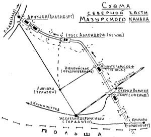
Since the Masurian Canal - primarily waterworks, we can not ignore its engineering characteristics. The channel length is 50 kilometers. Its final destination is Lake Mauerzee (now Polish Mamry) and the river Alley (Lava) a kilometer from Allenburga (now the village. Friendship). The difference in the levels of these places is 111 meters. The channel width of the mirror of water of 14 meters and a depth of 2, 5 - 3 meters. This ensured the movement of barges, tugs, boats with a draft of no more than 1, 5 meters.
The channel is equipped with 10 locks, of which 5 - Kaliningrad on the ground, the other five - in Poland. Gateways are:
- In the Kaliningrad region: in the village. Friendship - gateway 2 in Gross Allendorf, Vilgelmskhofe in the Free Ozerki (former Georgenfelde) - one;
- In Poland: in Langenfeld, Klein Bayorene, Zandhofe - one in Fuerstenau - 2 gateway.
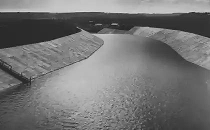
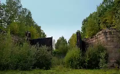
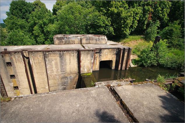
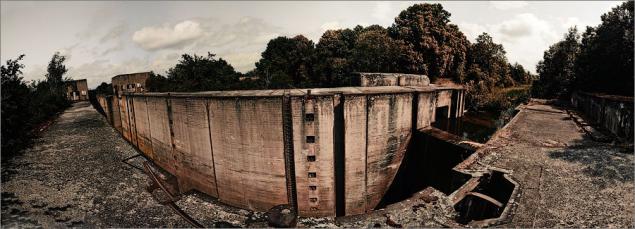
Gateway Georgenfelde
Camera Gateway
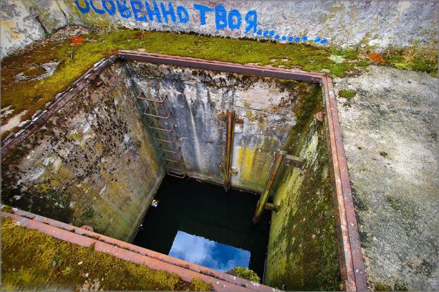
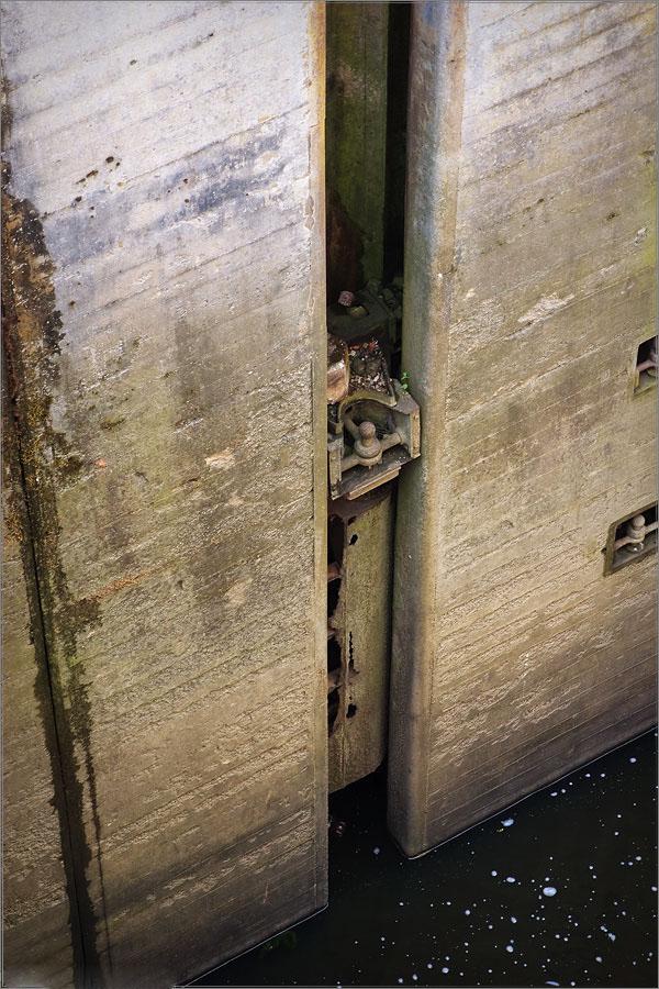
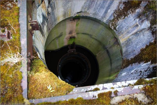
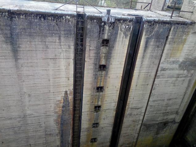
Wells in the control tower. Apparently the bottom flaps have been mounted, and on top of the drive.
The view from the control tower downstream
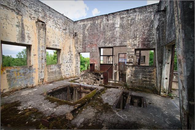
Inside the control tower
...
Headwater gateway
At the bottom is a pipe through which water probably came from the upper pool down
View from the upper pool
Lower gate vertical type
...
...
...
Float ring. To him moored ship and the whole structure fell (or rose) when changing the water level in the lock chamber
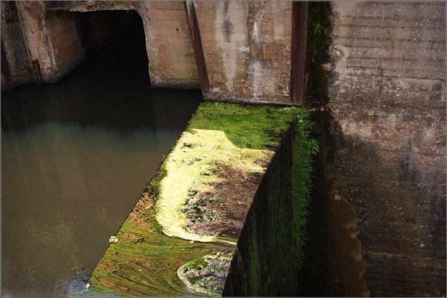
The dam headrace. From left to see the water intake for the passage of water in transit and filling gateway
The upper gate
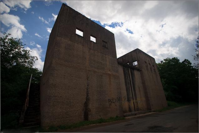
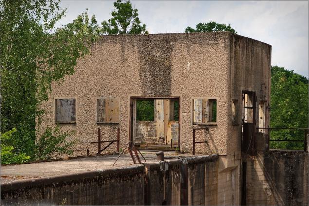
Control tower
Headwater
...
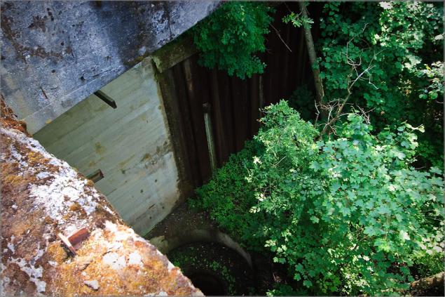
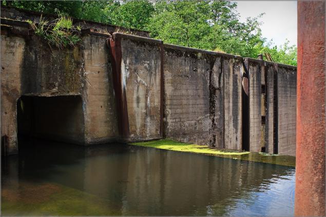
One of the culverts of headwater
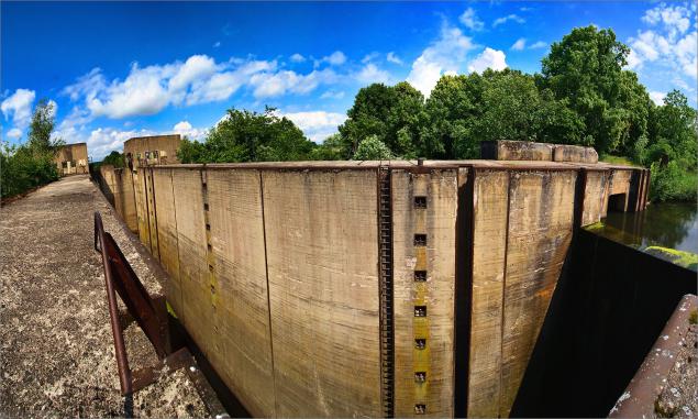
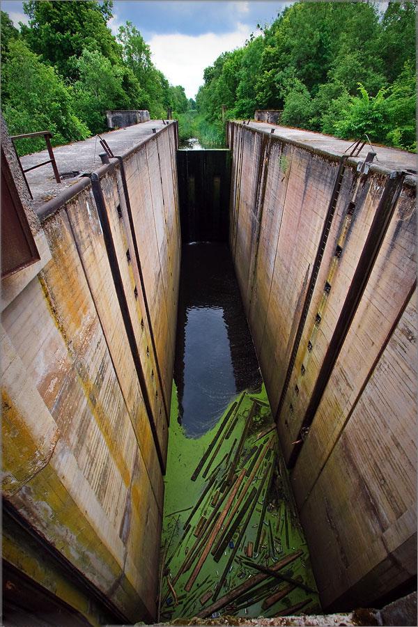
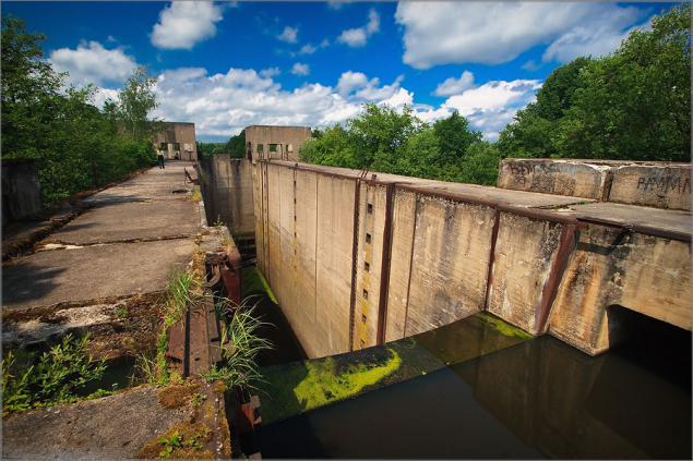
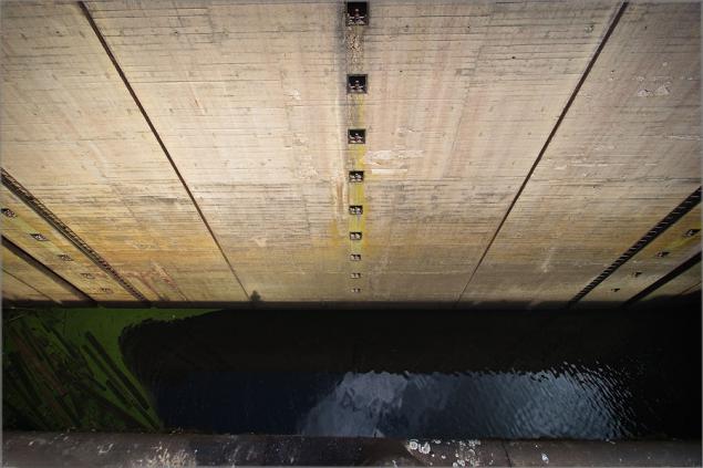
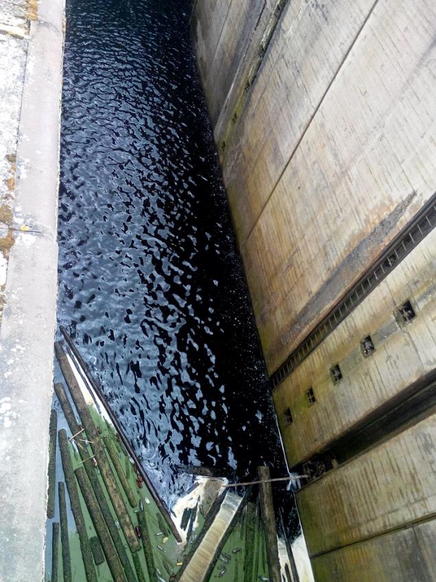
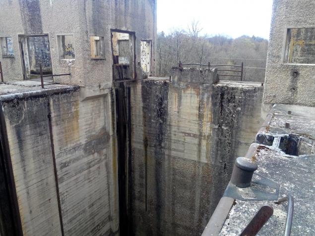
Camera
Shutter tailrace
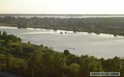
Masurian Canal
Well, my modest photos taken yesterday, you know what
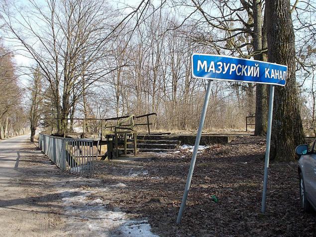
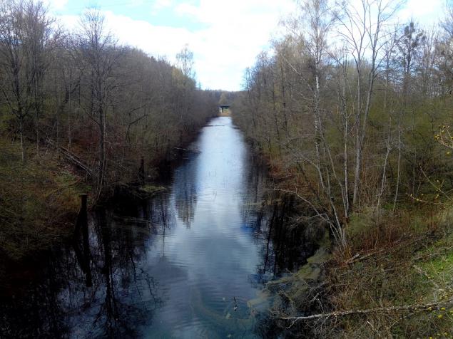
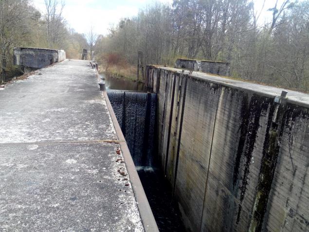
View from the road
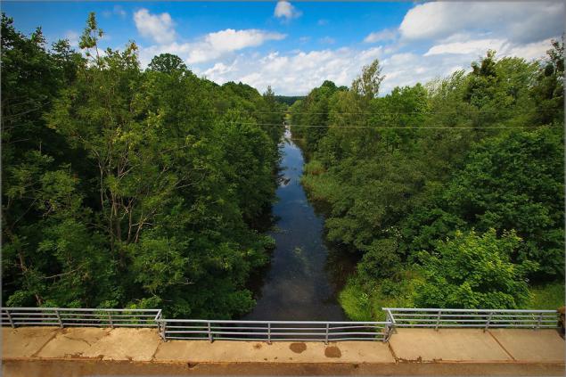
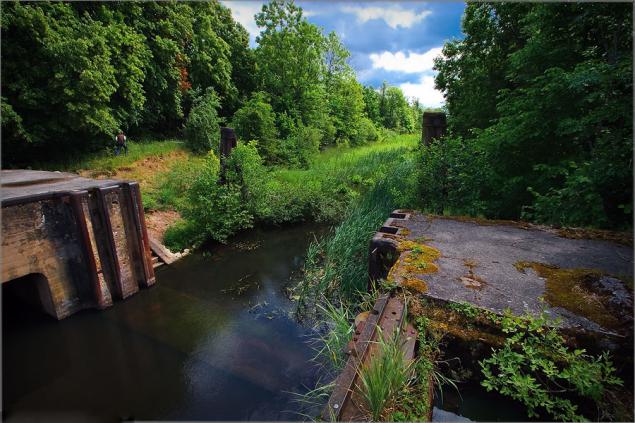
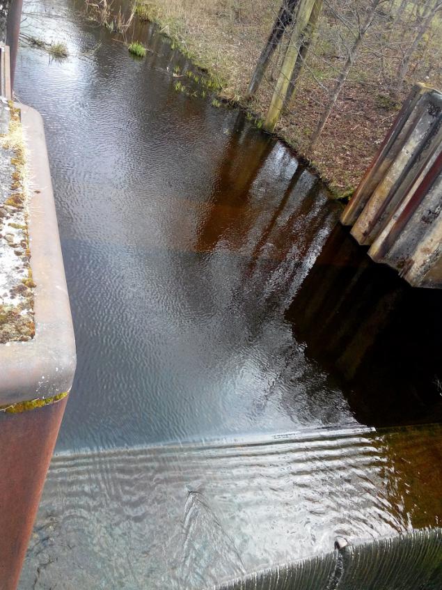
Channel
Climb
Scary
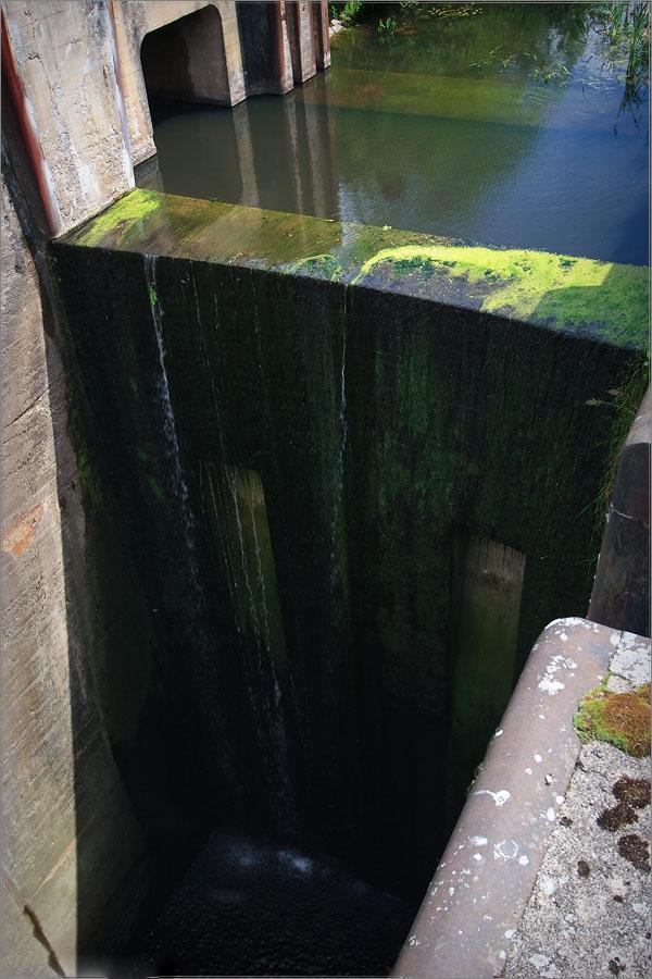
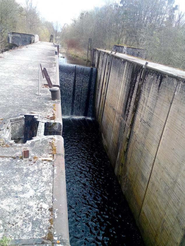
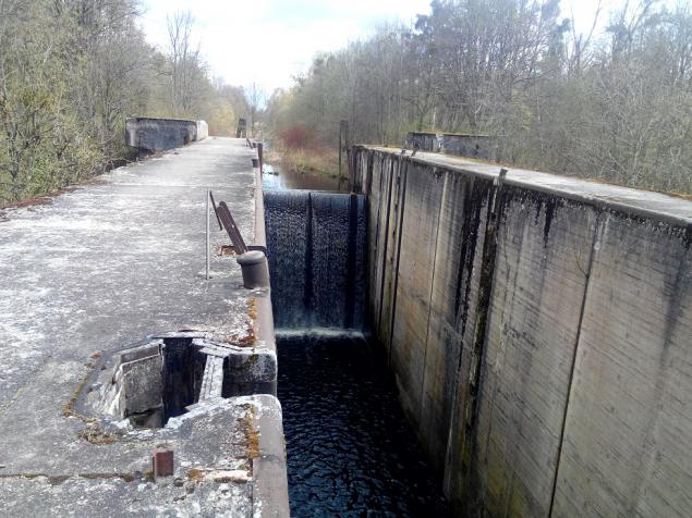
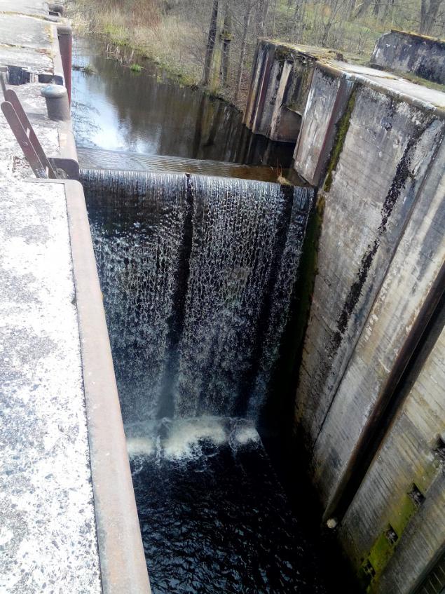
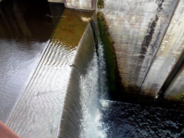
Waterfall
...
...
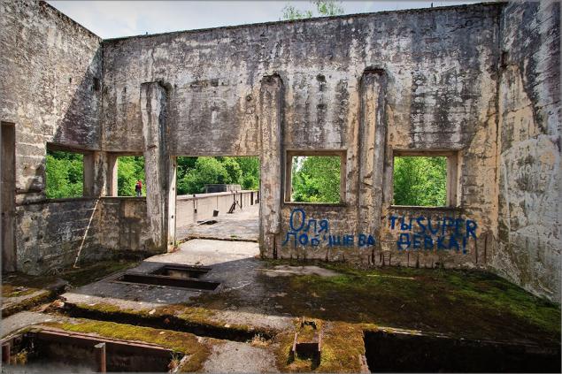
More
...
The depth of the gateway 15, 5 meters, I'm not afraid of heights, but all the same it was not myself
...
Length 45 meters, width of 7, 5 meters

That's all, I hope it was interesting ...
Source:

Like any decent from Kaliningrad, I have visited almost all German forts, ruins of castles and other interesting and mysterious places in the area. But, to my shame, recently I learned about the existence of Mazury with its bottomless channel gateways, standing in an open field.
Just yesterday, I was at work just 10 km from the largest of five gateways in the region - the gateway Georgenfelde (Ponds Floor) and decided to take the opportunity.
For the story of the most successful pictures are collected from the Internet and not to be unfounded, at the end of some of my pictures. About 40 photos, the end will tell ...

A bit of history. The idea of creating a waterway connecting the Mazury Lake with swimming pool river Pregel, there was more to the medal times. On the necessity of such a waterway also spoke Great Elector Friedrich Wilhelm and Frederick. This is caused by the desire to have a convenient and cheap way for transportation of farm and later - industrial goods up to Konigsberg or Dame in the Curonian Lagoon.
Immediately after the Seven Years' War, in 1764 it developed a plan of construction, onredelivshy destination and route of the Channel Mazury. Under the supervision of Domharta to 1776 (for 12 years) dug a 50-kilometer box, through which water from the lake in the Mazury Mauerzee gravity hill went to Allenburgu which flowed into the Alle. According to the channel downstream, sailed laden boats and barges. As was the case with the movement in the other direction, against the current, I do not know. Obviously, not without "Prussian boatmen." As often happens after the death Domharta v1781, the channel gradually fell into disrepair: shallow channel swamp, coastal embankment collapsed.
It took almost a hundred years, when the channel remembered again. In 1874, a new project for the construction of a canal through the old bed with locks. Then followed a long, long intervals coordination of organizational and financial issues - until 1908.
In 1908, the project was finally approved, and began to practice. Direct supervision was entrusted to the management of the two who were in Insterburg: the northern and southern parts of kanala.Do the First World War (6 years), most of the locks was built. The war interrupted the construction. In 1922, work resumed, but for financial reasons - in connection with the impending depression - were soon curtailed. The final step associated with the modernization of locks and dambirovaniem bed, began in 1934. As you know, it was a time of mass construction of roads throughout Germany. Around the channel up barracks for workers, on the shores stretching rails for trolleys, for the first time earned excavators. Despite the broad scope of work and a lot of participants to apply the measures of secrecy. It was forbidden to take photographs. On the German topographic maps kilometer 1936 and 1939 years are not shown gateways and mainstream channel south of Georgenfelde. This gives grounds to speak about the plans and the use of the channel in the future for the transport of military cargo.
The construction of the channel continued to the beginning of World War II. In 1942, after the first defeats at the front, work has been curtailed. At the beginning of 1945, with the approach of the Red Army, blew up the bridge over the canal. In December 1945, the new channel cut the state border between the USSR and Poland.
So broke the story of this building.
Since the Masurian Canal - primarily waterworks, we can not ignore its engineering characteristics. The channel length is 50 kilometers. Its final destination is Lake Mauerzee (now Polish Mamry) and the river Alley (Lava) a kilometer from Allenburga (now the village. Friendship). The difference in the levels of these places is 111 meters. The channel width of the mirror of water of 14 meters and a depth of 2, 5 - 3 meters. This ensured the movement of barges, tugs, boats with a draft of no more than 1, 5 meters.
The channel is equipped with 10 locks, of which 5 - Kaliningrad on the ground, the other five - in Poland. Gateways are:
- In the Kaliningrad region: in the village. Friendship - gateway 2 in Gross Allendorf, Vilgelmskhofe in the Free Ozerki (former Georgenfelde) - one;
- In Poland: in Langenfeld, Klein Bayorene, Zandhofe - one in Fuerstenau - 2 gateway.

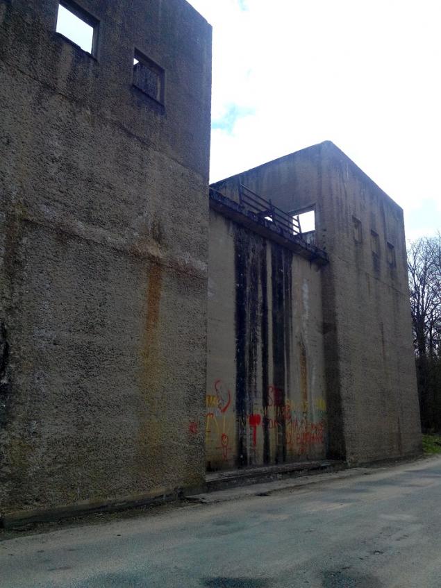
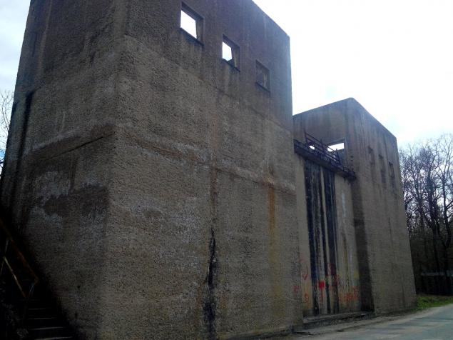
Gateway Georgenfelde

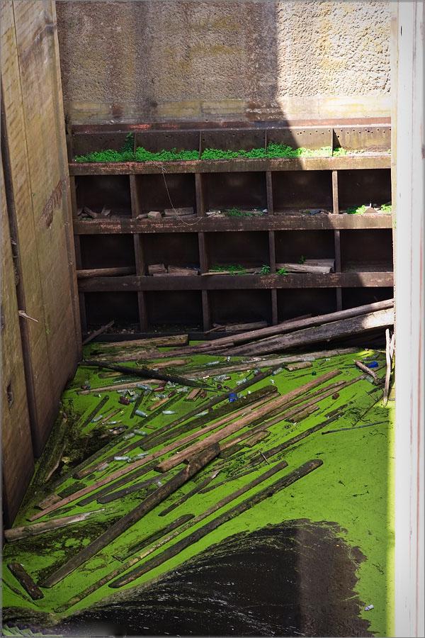
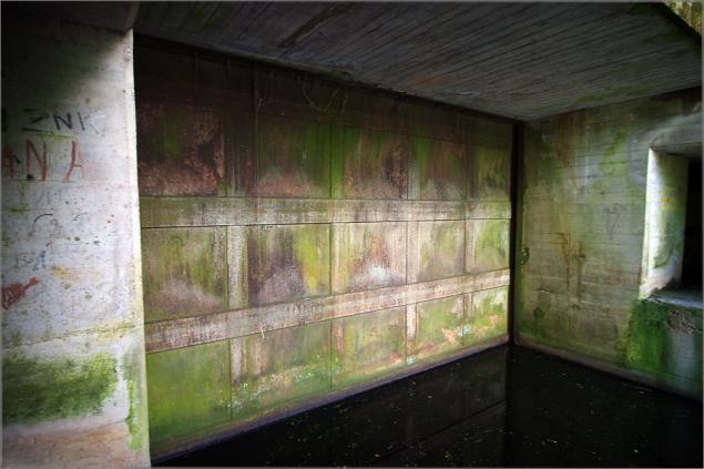
Camera Gateway

Wells in the control tower. Apparently the bottom flaps have been mounted, and on top of the drive.

The view from the control tower downstream

Inside the control tower

...

Headwater gateway

At the bottom is a pipe through which water probably came from the upper pool down

View from the upper pool

Lower gate vertical type

...

...

...

Float ring. To him moored ship and the whole structure fell (or rose) when changing the water level in the lock chamber

The dam headrace. From left to see the water intake for the passage of water in transit and filling gateway

The upper gate

Control tower

Headwater

...

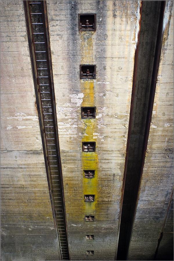
One of the culverts of headwater

Camera

Shutter tailrace

Masurian Canal

Well, my modest photos taken yesterday, you know what

View from the road

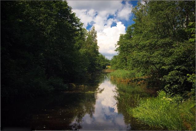
Channel

Climb

Scary

Waterfall

...

...

More

...

The depth of the gateway 15, 5 meters, I'm not afraid of heights, but all the same it was not myself

...

Length 45 meters, width of 7, 5 meters

That's all, I hope it was interesting ...

Source: