695
"Eggs destiny"
Author: cool
Shkotovsky District - one of the most beautiful parts of southern Primorye. It is an area of high concentration of natural monuments. This includes, for example, Shkotovsky plateau with its waterfalls.
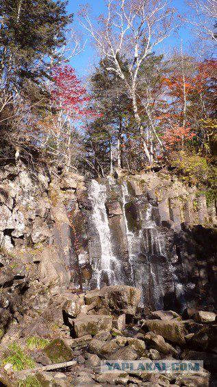
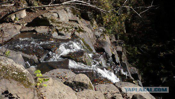
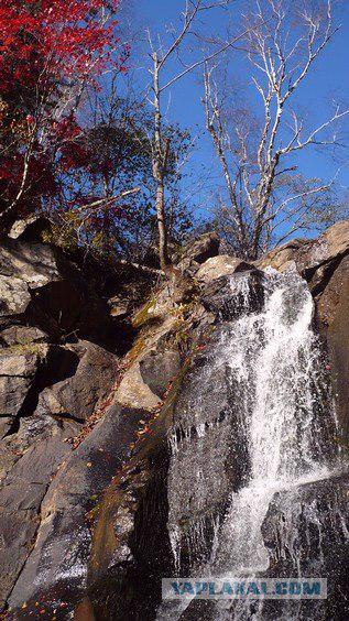
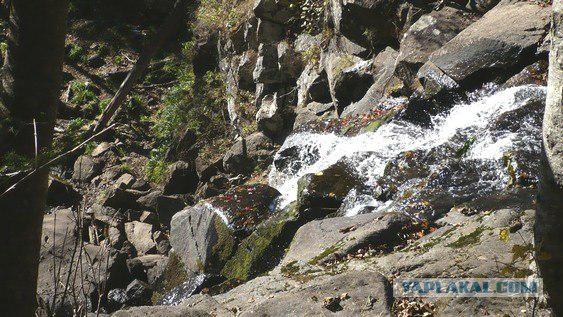
Waterfall "Unexpected" is the most beautiful waterfall in Southern Sikhote-Alin. It is located on a key Left humpback and has a classic shape. Its height - about 14 meters.
So our task is to get from point ... "B" (Vladivostok) to point "G" (Gorbatov waterfall)
*** I will write about the end ***
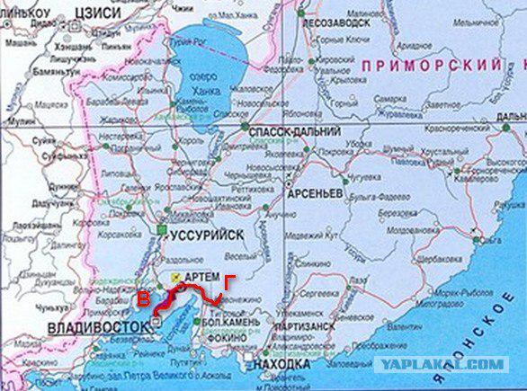
The total length of the path 102, 9 km from the 2nd river Vladivostok and to "stop." At the same time, only 9, 2 km we will have to go along the dirt road. All the main way - on the asphalt.
1. "Good luck!»
Moving from Vladivostok towards guerrilla ie after clew turn left in the direction of Central.
After 7-NIL kilometers after the turn of this we come to the village Steklyanuha.
Until the sixties the village was called Sainbar. Some researchers, passionate search for names in Chinese toponike Primorsky Krai, the Chinese believe that name. This is not true. Sainbar - a Russian word, borrowed from Tatar. It consists of two roots, the first of which, "Sain" - "good". So, Batu Khan was called "Sain". In the Mongolian language, still greet each other - "Bajina Sayn-yy!»
And the root of the "-bar" from the Tatar - "go, go" and in Turkic stands to mean "the road».
Thus, SAINBAR - IS RUSSIAN toponym in meaning - "a good road».
2. How goes the horse?
And not for nothing that the village was called "good way". The fact is that the modern village is located on the site of the border post to guard the road of the ancient Primorye.
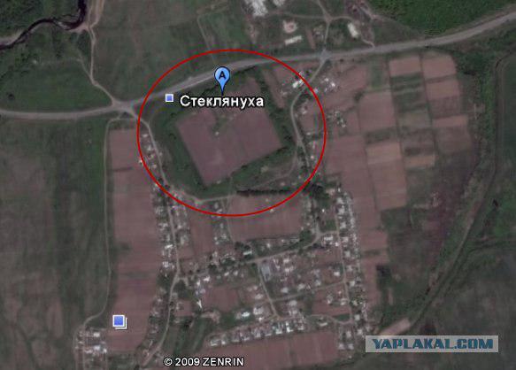
Scientists still can not determine the order, who built it - Fo-hai and Jurchen. Therefore introduced, at the suggestion of the candidate of historical sciences Shavkunova name - "Smolnitsa." Places of their settlement in Primorye are located compactly enough - in the river valleys Steklyanuhi, guerrilla and in the upper Arsen'evka and Ussuri, in other words, in the Southern and Central Primorye. They cover just the area where currently no known reliable and Bohai Jurchen monument.
Shavkunov studying at home Primorye drew attention to the atypical structure Canova. The only channel that channel dug in the ground, and its walls are reinforced posed on the edges and covered with stone slabs on top of the same plates. This type of dwelling with Kan completely unknown in the cultural monuments of the Jurchen. But it is very typical for the Eastern Huns.
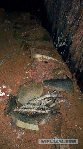
Compare the description of the interior of the house of Hun:
"... Framework of the interior was L-shaped in terms of bench-kan, framing the space on the northern and western walls, inside which runs the channel is heated by its chimney. The only flame channel is usually formed fitted together flat stones, set in two rows on the floor dwelling on edge. They also chimney and ceiling ... »
Let us Hun method of land settlement.
Terrified Chinese wrote about the resettlement of the Huns:
"I do outo to watch the Chinese».
Data collected Taskin Sinologist led to the conclusion that because the Chinese were called "border posts or outposts of the Huns." They represented an "armed camp, which was able to repel the attack of several thousand people».
This post is surrounded by a four-meter earthen rampart. Inside the fort so far it has not survived any visible traces of residential and other buildings, but look down on this building is. Now the fort is under the protection of peasant farming GI Samburova.
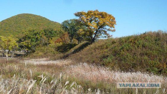
3. Stone eggs
Now we move on towards Partizanska Steklyanuhi to post "24 kilometers". Now, does not accelerate! Not reaching up to 300 meters of column "25 km" will turn left onto a dirt road.
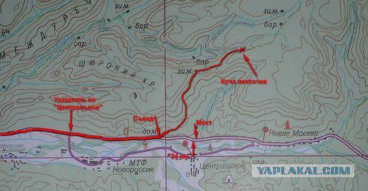
On it we have to drive 9, 2 kilometers, holding all the "main" rules of the road.
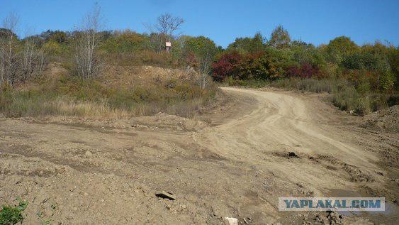
Forest road winds serpentine almost to the pass. On the whole route it passes among the lush vegetation of the Ussuri. Next to the waterfall road runs along the ridge. On one side of the ridge to the left, deep down occurs humpback key Left, on the other hand, on the right, a wall of pine forest.
Left humpback key Steklyanuhu flows into the river, which used to be called stain / Beitz.
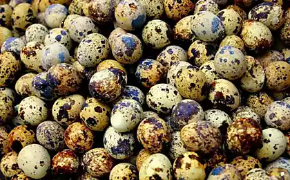
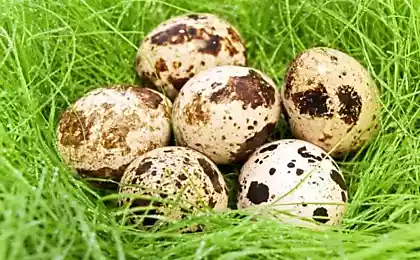
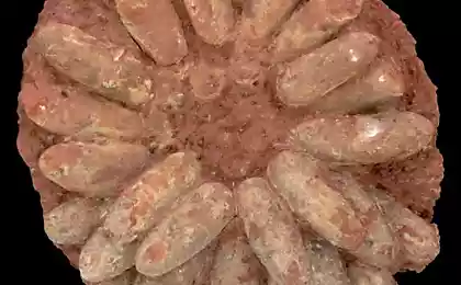
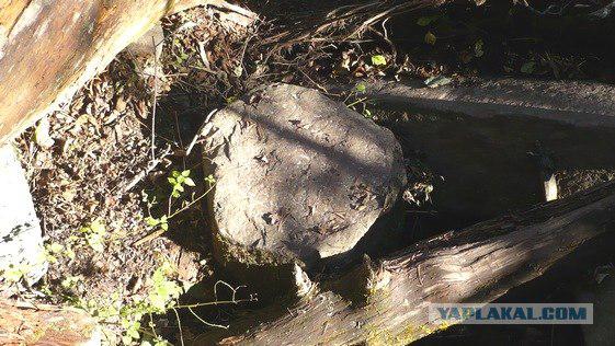
And again, nothing to do with the Chinese, the name does not matter. Word Beitz got into Russian (and still can be heard at the Old Believers) in Hebrew. And it means - "egg." The fact is that along the river sometimes come across rocks resembling eggs, just great.
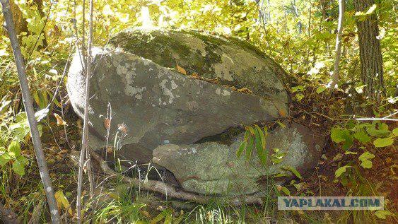
Thus, the stain - IT Old Slavonic words, in the sense - "EGG».
4. Granite "Pencils»
And so we move on "primer" to the place where the trees hanged bunch of ribbons. This is our endpoint.
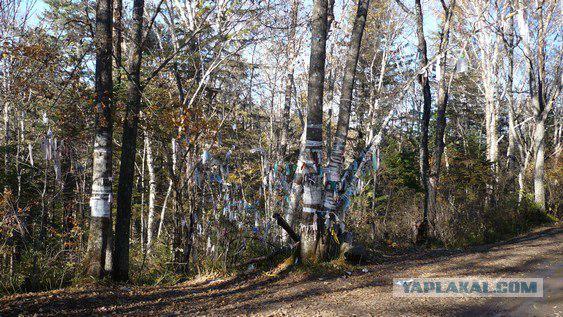
Now the path (left, bottom) we are moving to the canyon, called by the people "Swallow's Nest." Before him, meters 100-150.
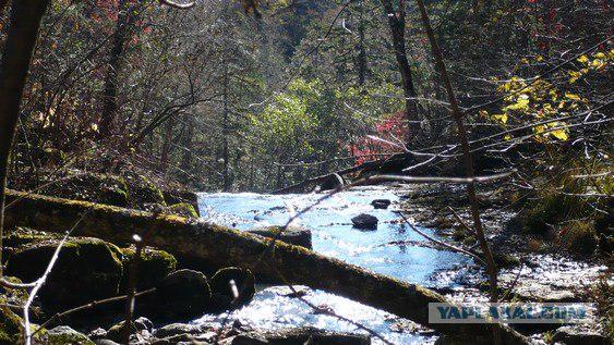
We go down. We turn over the stones the stream and go upstream.
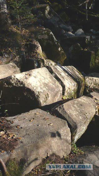
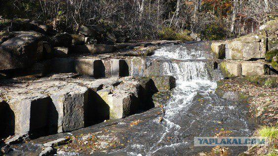
The first interesting monument of nature, which we meet, the so-called columnar jointing.
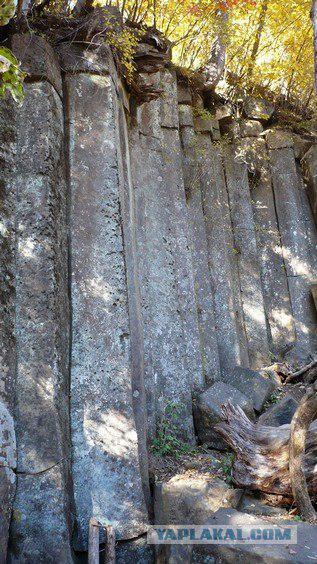
In people, this separateness nicknamed "pencil". Indeed, in the section separateness is a hexagon, and its length is much greater than the width.
Everything from a simple pencil.
5. "Unexpected»
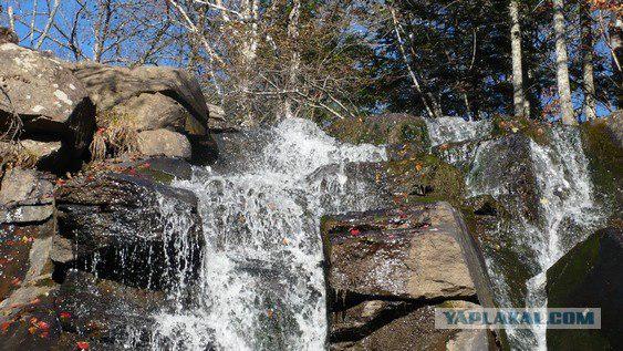
After a little more upstream, on our way suddenly it overlooks the magnificent waterfall.
Photo
Photo
Photo
Photo
Photo
Photo
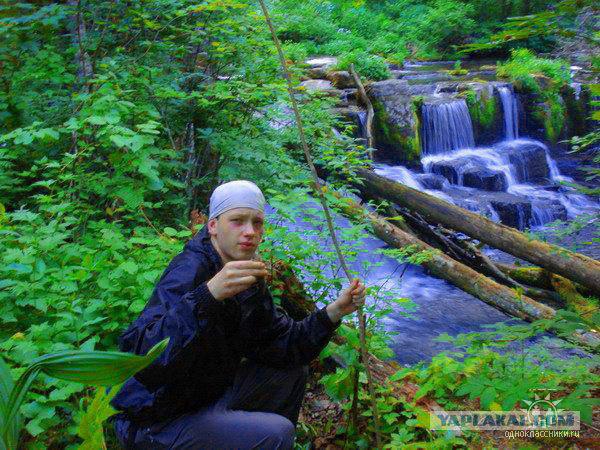
but my author photo from the places) under a waterfall caught fish)
END
Source:
Shkotovsky District - one of the most beautiful parts of southern Primorye. It is an area of high concentration of natural monuments. This includes, for example, Shkotovsky plateau with its waterfalls.
Waterfall "Unexpected" is the most beautiful waterfall in Southern Sikhote-Alin. It is located on a key Left humpback and has a classic shape. Its height - about 14 meters.
So our task is to get from point ... "B" (Vladivostok) to point "G" (Gorbatov waterfall)
*** I will write about the end ***

The total length of the path 102, 9 km from the 2nd river Vladivostok and to "stop." At the same time, only 9, 2 km we will have to go along the dirt road. All the main way - on the asphalt.
1. "Good luck!»
Moving from Vladivostok towards guerrilla ie after clew turn left in the direction of Central.
After 7-NIL kilometers after the turn of this we come to the village Steklyanuha.
Until the sixties the village was called Sainbar. Some researchers, passionate search for names in Chinese toponike Primorsky Krai, the Chinese believe that name. This is not true. Sainbar - a Russian word, borrowed from Tatar. It consists of two roots, the first of which, "Sain" - "good". So, Batu Khan was called "Sain". In the Mongolian language, still greet each other - "Bajina Sayn-yy!»
And the root of the "-bar" from the Tatar - "go, go" and in Turkic stands to mean "the road».
Thus, SAINBAR - IS RUSSIAN toponym in meaning - "a good road».
2. How goes the horse?
And not for nothing that the village was called "good way". The fact is that the modern village is located on the site of the border post to guard the road of the ancient Primorye.

Scientists still can not determine the order, who built it - Fo-hai and Jurchen. Therefore introduced, at the suggestion of the candidate of historical sciences Shavkunova name - "Smolnitsa." Places of their settlement in Primorye are located compactly enough - in the river valleys Steklyanuhi, guerrilla and in the upper Arsen'evka and Ussuri, in other words, in the Southern and Central Primorye. They cover just the area where currently no known reliable and Bohai Jurchen monument.
Shavkunov studying at home Primorye drew attention to the atypical structure Canova. The only channel that channel dug in the ground, and its walls are reinforced posed on the edges and covered with stone slabs on top of the same plates. This type of dwelling with Kan completely unknown in the cultural monuments of the Jurchen. But it is very typical for the Eastern Huns.

Compare the description of the interior of the house of Hun:
"... Framework of the interior was L-shaped in terms of bench-kan, framing the space on the northern and western walls, inside which runs the channel is heated by its chimney. The only flame channel is usually formed fitted together flat stones, set in two rows on the floor dwelling on edge. They also chimney and ceiling ... »
Let us Hun method of land settlement.
Terrified Chinese wrote about the resettlement of the Huns:
"I do outo to watch the Chinese».
Data collected Taskin Sinologist led to the conclusion that because the Chinese were called "border posts or outposts of the Huns." They represented an "armed camp, which was able to repel the attack of several thousand people».
This post is surrounded by a four-meter earthen rampart. Inside the fort so far it has not survived any visible traces of residential and other buildings, but look down on this building is. Now the fort is under the protection of peasant farming GI Samburova.

3. Stone eggs
Now we move on towards Partizanska Steklyanuhi to post "24 kilometers". Now, does not accelerate! Not reaching up to 300 meters of column "25 km" will turn left onto a dirt road.

On it we have to drive 9, 2 kilometers, holding all the "main" rules of the road.

Forest road winds serpentine almost to the pass. On the whole route it passes among the lush vegetation of the Ussuri. Next to the waterfall road runs along the ridge. On one side of the ridge to the left, deep down occurs humpback key Left, on the other hand, on the right, a wall of pine forest.
Left humpback key Steklyanuhu flows into the river, which used to be called stain / Beitz.
And again, nothing to do with the Chinese, the name does not matter. Word Beitz got into Russian (and still can be heard at the Old Believers) in Hebrew. And it means - "egg." The fact is that along the river sometimes come across rocks resembling eggs, just great.

Thus, the stain - IT Old Slavonic words, in the sense - "EGG».
4. Granite "Pencils»
And so we move on "primer" to the place where the trees hanged bunch of ribbons. This is our endpoint.

Now the path (left, bottom) we are moving to the canyon, called by the people "Swallow's Nest." Before him, meters 100-150.
We go down. We turn over the stones the stream and go upstream.
The first interesting monument of nature, which we meet, the so-called columnar jointing.

In people, this separateness nicknamed "pencil". Indeed, in the section separateness is a hexagon, and its length is much greater than the width.

Everything from a simple pencil.

5. "Unexpected»
After a little more upstream, on our way suddenly it overlooks the magnificent waterfall.

Photo

Photo

Photo

Photo

Photo

Photo

but my author photo from the places) under a waterfall caught fish)
END

Source:


