1302
Winter Baikal
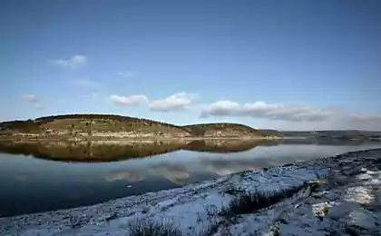
Winter Baikal leaves a lasting impression.
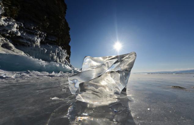
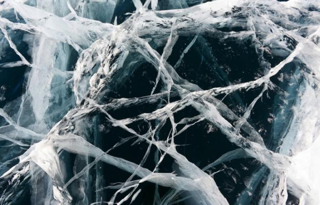
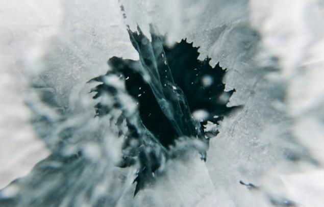
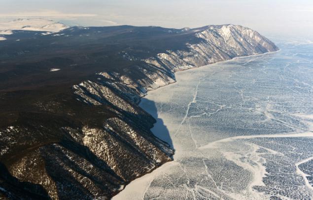
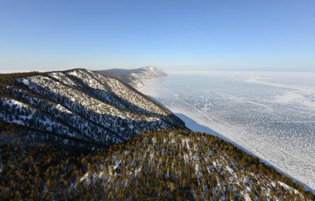
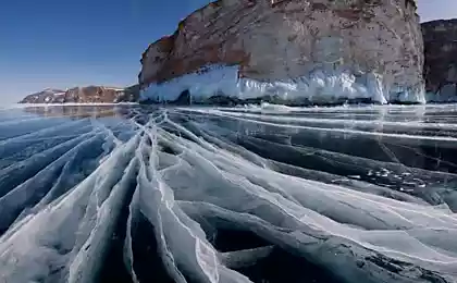
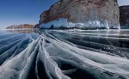
Exceptional transparency of ice makes it possible to see the bottom shelf close to the coast and to look into the mysterious depths of the lake blackened. The thickness of the thick ice, even imperceptible and frightens his uncertainty. Due to the transparency of the ice afraid to go out, although its thickness in some places can exceed 1, 5 meters. Through the Baikal ice can read newspapers and shoot as through a glass, portraits of people.
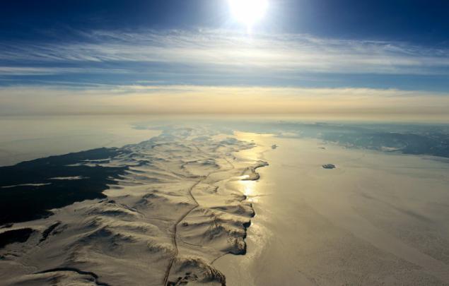
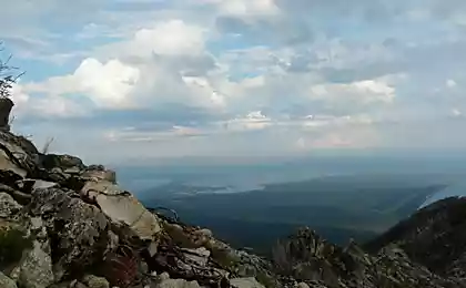
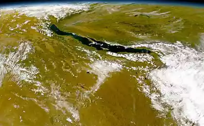
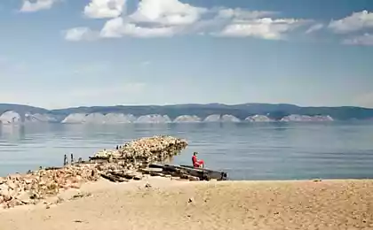
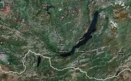
Lake Baikal - the deepest lake on the planet, the largest natural fresh water reservoir, located in Eastern Siberia. The lake stretches from north-east to south-west by 620 km in the form of a giant crescent. The width of the lake ranges from 24 to 79 km.
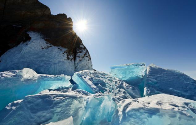
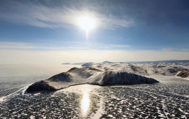
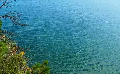
Beauty is not inferior to winter Baikal year. When the water surface is covered with ice, it opens even more opportunities to see the beauty of the Baikal nature. M thick dark transparent ice hummocks turquoise, ice caves with hanging icicles, and, most importantly, a winter Baikal with bird's-eye view - in a post about this unique lake.
In the area of water surface Baikal ranks sixth among the largest lakes in the world.
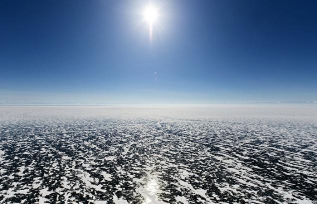
The area of the surface of the lake freezes over - more than 30 thousand square kilometers, which is approximately equal to the area of countries such as Belgium or the Netherlands.
Freeze-up period takes place from early January to early May.
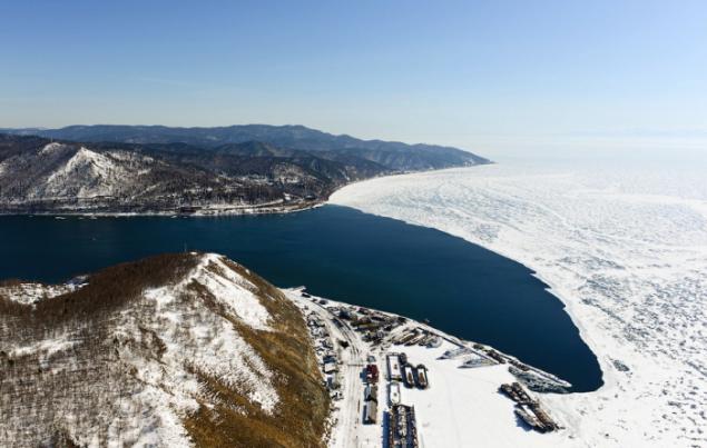
Baikal freezes over completely, except for a small area of 15-20 km length, located at the source of the Angara.
Incidentally, it is interesting that flow into the lake 336 rivers and streams, and follows only one river - Angara.
By the end of winter the thickness of ice on Lake Baikal up to 1 m, and in the bays - 1, 5-2 meters.
The ice thickness of 50 cm can withstand the weight of 15 tons, and about a meter thick - the weight of the helicopter or engine. In the history of the Baikal-known fact laying on the ice track between the stations Baikal and Tankhoi in a particularly severe winter of 1903-1904, the loaded wagons were distilled on the ice the way horse-drawn piece.
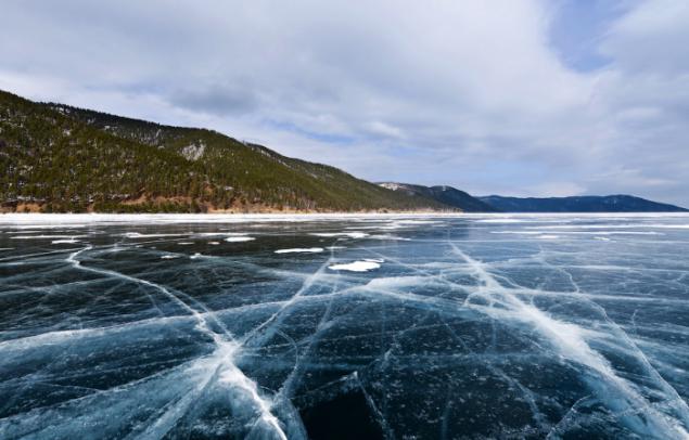
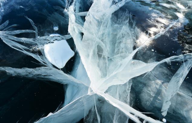
Every year in the same place there becomes a gap - a kind of expansion joints in the ice cover. They are formed in the same places as a rule, in a straight line between the neighboring projecting headlands. Selected through the slit can reach lengths of up to 10-40 km and a width of 4 m, but often there are cracks in width from 0 5 to 1-2 m. The appearance of these cracks caused by the linear expansion or contraction of the ice at daily changes in temperature, sometimes reaching 20 -30 C per day.
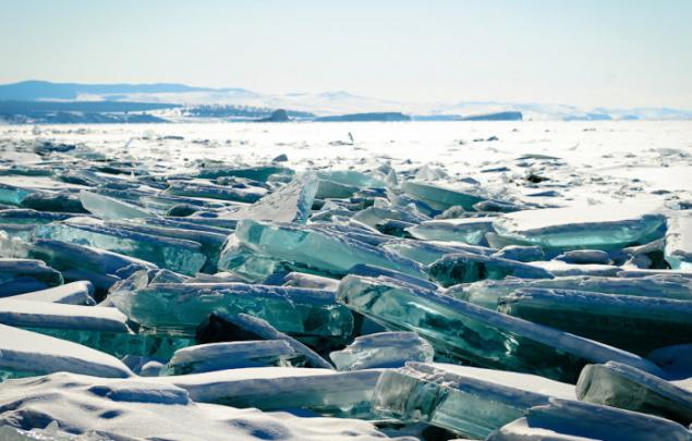
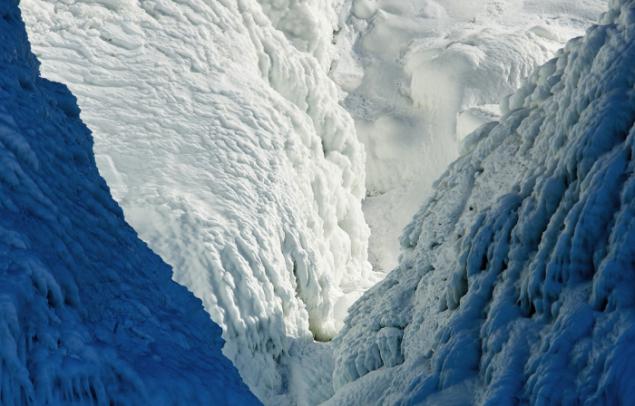
Winter Baikal leaves a lasting impression. At the end of winter comes the powerful movements of the ice, and individual ridges may exceed the height of a man. Hummocky field attracted the attention of photographers unusual conglomeration of sparkling ice. Mirror Baikal ice and amazing blue on chips of ice blocks hit all tourists coming here.
Silent balance hummocks crumbles with the rustle of revived ice. Directly in front of the ice floe squeezed out from under the ice. All this is accompanied by a continuous rumble like an earthquake, the sound comes from under the feet, frightening in its power. Hummocked seam cracks noticeably move, separate ice floe fall and crumble into small pieces.
Horizontal cracks pierce the entire thickness of the ice.
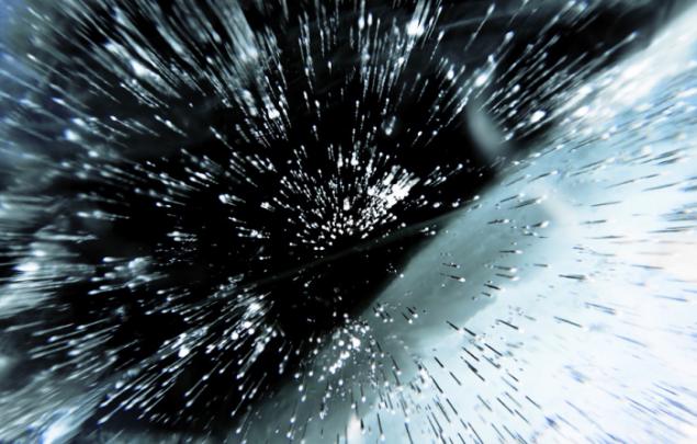
Stagnant air rising up through the ice, forming bizarre columns in the surface layers of ice.
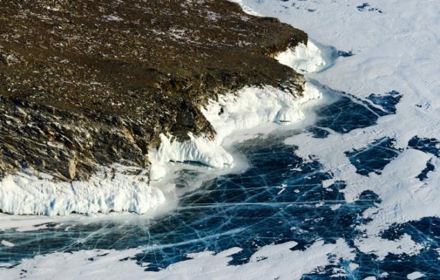
Exceptional transparency of ice makes it possible to see the bottom near the shore, and to look into the mysterious depths of the lake blackened. The thickness of the thick ice, even imperceptible to the eye and is defined only in places, speckled with cracks.
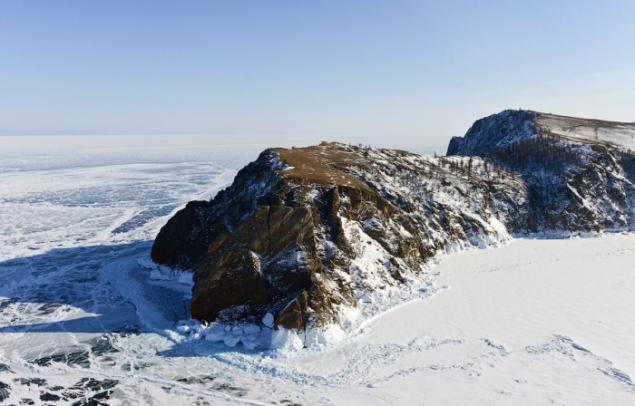
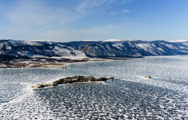
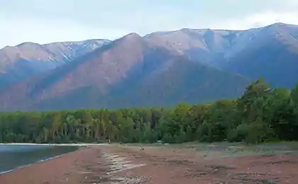
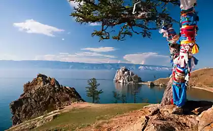
Olkhon - the largest and the only inhabited island of the Lake Baikal. Length - 71 km, width - 12 km.
From the north-western shore of the lake forms the Small Sea and the Straits Olkhon Gate.

Not far from the outside of Olkhon - the deepest place of Baikal (1642 m).
Mount Jima - the highest point of the island
Altitude 1274 m., The height of 818 meters over the lake.
Khoboy Cape - the northernmost point of Olkhon. Khoboy in Buryat "Fang»
Located near the widest point of Lake Baikal (79, 5 km).
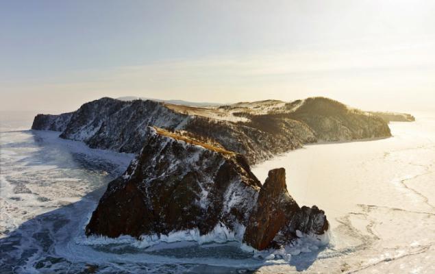
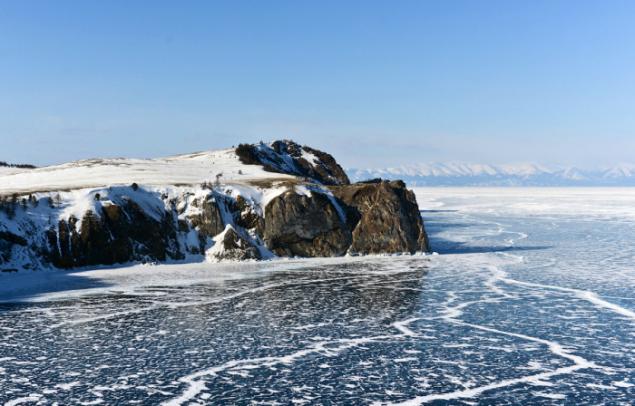
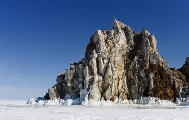
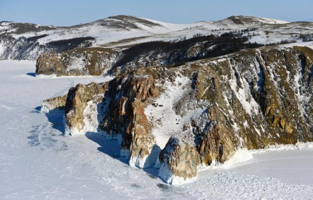
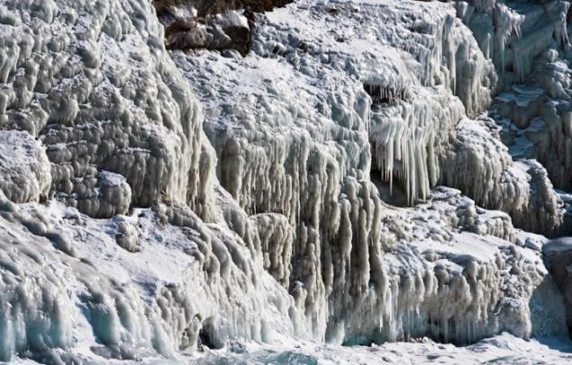
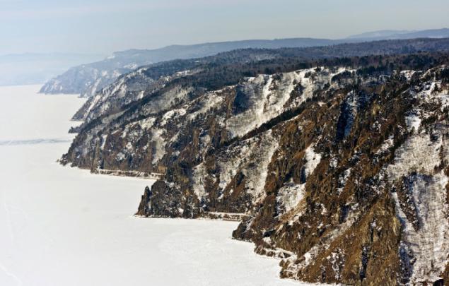
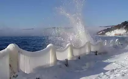
Coastal cliffs in winter many-decorated high, sparkling in the sun ice napleskami. The thickness of ice on the coastal rocks up to several tens of centimeters and the height of the ice on the rocks napleskov upwind in strong autumn storms sometimes exceeding tens of meters. Numerous caves decorated with many large icicles and ice columns. These ice sculptures are created anew each winter. Especially spectacular napleski ice and juice are found on rocks Ushkaniye islands, headlands Olkhon - Kobylya head, Sagan Khushun, Khoboy.
Three Brothers Rock (Cape Sagan Khushun).
Sagan Khushun - "white cape" - an extremely picturesque rocky headland on the island of Olkhon, a length of about 1 km, is made of light-colored marble, densely covered with red lichen and has therefore burgundy tint. In winter ride on the ice past it without noticing, it is impossible. Winter roads are usually held close to the rocks. At the foot of - pile of transparent ice floes, rocks to a height of tens of meters are decorated with delicate branching icicles.
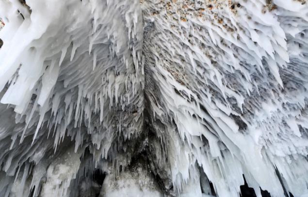
Ice Grotto and spatter (napleski).
These napleski on the rocks formed during freezing lake in the early winter.
They are called juice.
Particularly rapidly growing sokuy during strong winds, accompanied by a blizzard when the wind throws on sokuy than water, a lot of wet snow.
Island Kharantsy
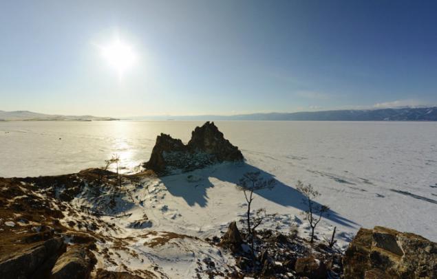
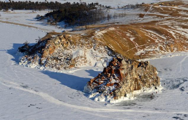
Shaman Rock
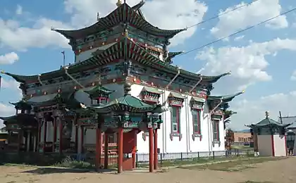
One of the holy places of Asia has become a famous image of Baikal

Bimodal rock composed of marble and dolomite limestone, sometimes full of sequins graphite.
The surface of the rock is covered with bright red lichen.
The name of the cape "Burhan" appeared after the penetration in the Baikal region at the end of the XVII century Tibetan Buddhism.
The word "Burhan" Buryat Buddhists became known as the chief deity of the lake.
A Cape Burhan-through cave in Shaman rock was regarded as his abode.
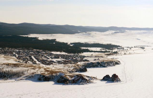
Located near Cape Khuzhir village with a population of 1, 3 thousand. Residents - the largest settlement on the island.
Currently, the main occupation of the locals is a service of tourist flows.
Electricity came here only in 2005.
Island Oltrek and Borg Dagan
Clearly visible traces of snow drifts.
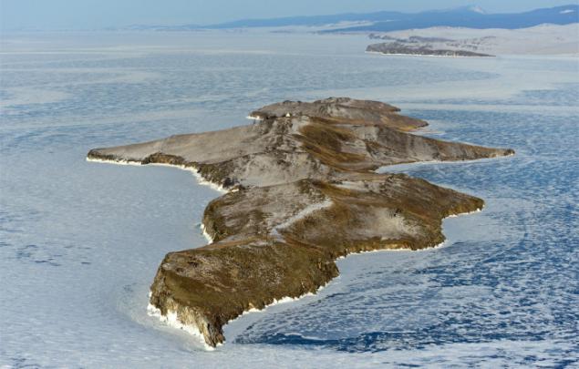
Island Ogoy
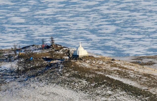
Stupa of enlightenment at the top of the island
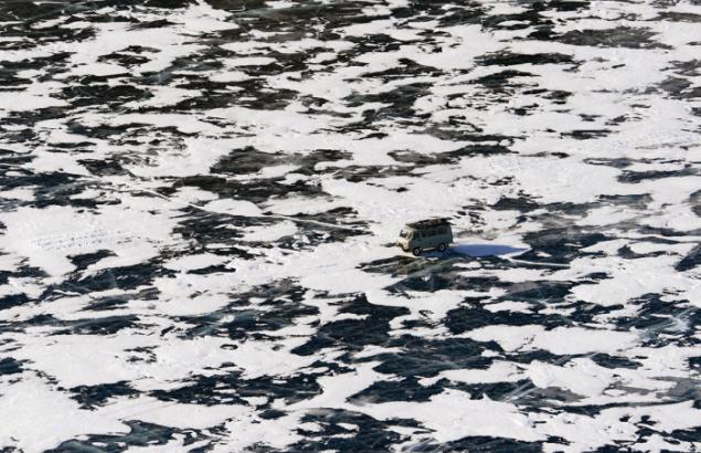
Normally leave the ice early in the morning to catch the magical moment of sunrise. The first rays of the rising sun is usually filled with crystal clear ice hummocks mysterious golden glow. The desire to see the beauty of winter beckons on the ice in the direction of the winter road laid across the ice to extraordinary hummocks or ice-covered rocks. But better without extreme need not to risk it and do not move out of the winter road, and in places where there may be a crack polynya and move with the local guide, knowledgeable especially ice. Unlike roads on the ice - thick pressurizations snow, which is on the trampoline, bouncing car. In overcoming the frozen and snow-covered hummocks cracks suspension machine often has strong impacts. Only at first glance, from a distance, the ice seems to be smooth as a mirror, in practice it is often found that pass straight through the ice is impossible because of the meandering cracks, hummocky fields and snow drifts.
Official winter roads on the ice of Lake Baikal marked frozen into ice wands and numerous signs at the exit from the shore: "Allowable lifting machines 5 tons," "The distance between vehicles of 200 m", "Stopping", "recommended speed of 10 km / h", "time work from 9.00 am to 19.00 ».
But usually, most of the roads are laid by fishermen and no warning signs have not. Experienced drivers will always prefer to stick to the track in the right direction, and if they go straight, then try to go around the crack and suspected sites, which differ in a gray color ice from afar. One hundred percent reliability on the ice road is not even a conductor.
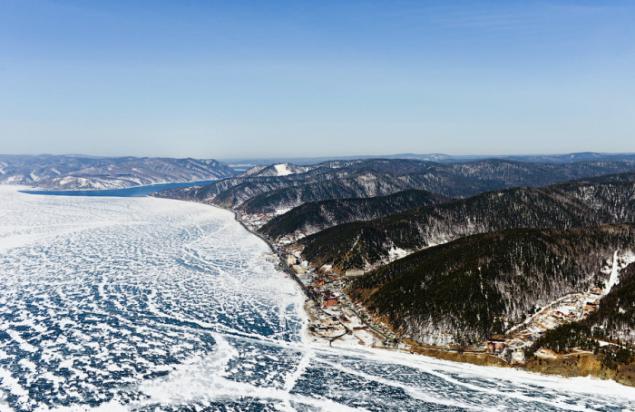
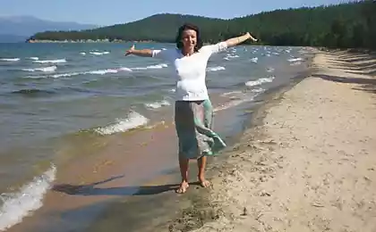
Listvyanka
The basis of the economy of the village - tourism. There Baikal omul and sell souvenirs.
From 65 km to Irkutsk.
The westernmost point of Lake Baikal - Kultuk village.
Here, the federal highway from Irkutsk M55 is divided into two transport arteries - in Tunka valley and along the east coast of Lake in the provincial city of Ulan-Ude and Chita.
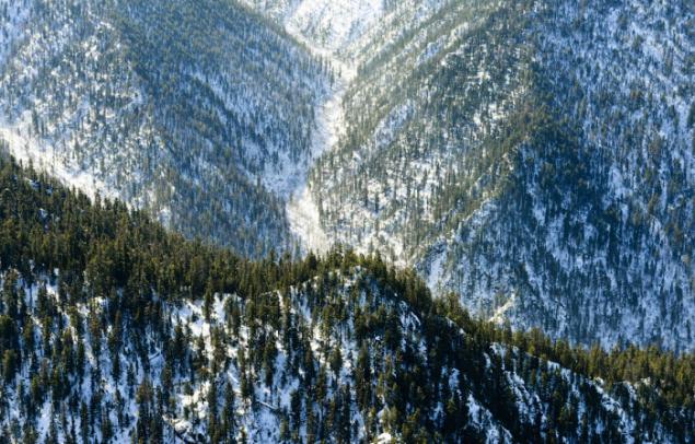
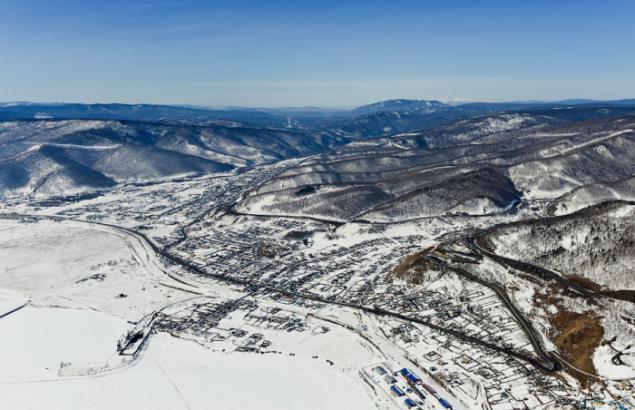
Khamar-Daban - an ancient mass of the planet stretching from west to east more than 350 km.
By Khamar-Daban is the border of the Irkutsk region and Buryatia.
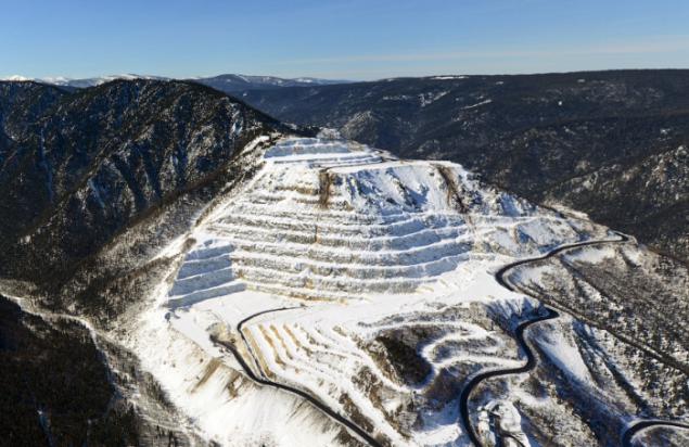
Marble Quarry
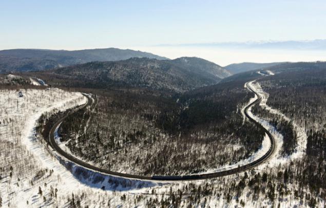
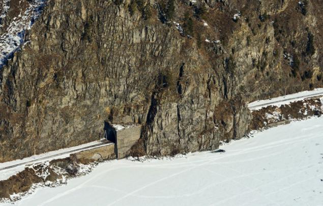
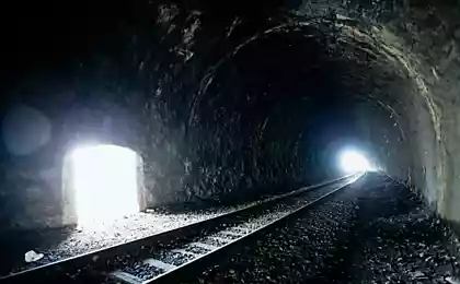
The main course of the Trans-Siberian Railway. Angasolskaya loop.
This redundant section of Circum-Baikal railway from Slyudyanka to Irkutsk was commissioned in 1949.
Prior to the introduction of the backup site was different, and now historical, railway, running along the northern coast of the southern tip of Lake Baikal from Slyudyanka to the town on the southern part of Baikal Olkhinskoye plateau.
Currently, the Circum-Baikal Railway (CBRY) called the branch length of 89 km.
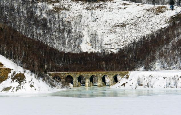
On the Circum used 38 tunnels with a total length of 9063 m (the longest of them - a tunnel through a headland half the length of 777, 5 m), 15 stone galleries with a total length 295 m 3 of concrete galleries with holes, 248 bridges and viaducts, 268 retaining walls. < br />
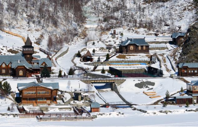
Recreational Sharazhalgay is located on one of the stations Circum
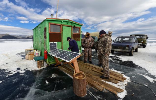
Baikal limnologists
Limnology - the science of physical, chemical and biological aspects of lakes and other freshwater reservoirs.
©


Cat - a nurse Liger
The nature of love. The best way to understand the heart - break it. Harry Harlow