1987
Global wind map almost in real time
Any weather forecast attracts the attention of so many people. Not in vain "weather" sites are among the most visited websites in the world. For a person to know what the weather is waiting for him in the near future, manufacturers of mobile and desktop software applications create, showing temperature, wind speed, the possibility of precipitation and more.
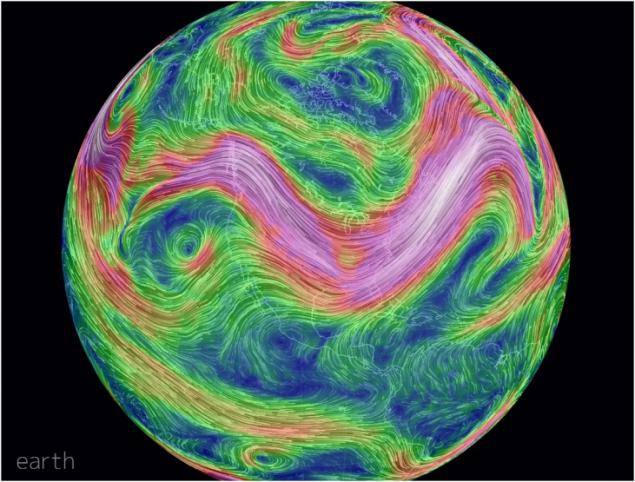
In addition, almost every day there and services that display weather in almost real time. On one of these services, Earth Wind Map , you should pay attention - this resource shows the global wind map for the whole world, and "image" is obtained very interesting.
Service was created as a software engineer Cameron Bekarev (Cameron Beccario). Data for your card he receives from the National Center for Atmospheric Research and the National Centre of weather forecasting. All of these organizations work on the national administrations Oceanic and Atmospheric USA.
Map close to what to display things in real time. But until that map update occurs every three hours as data are collected from many sources, and it takes time to obtain all the information and its subsequent processing.
When you click on any point on the map, we get wind speed, wind direction in degrees, and the coordinates of the point. In this map you can zoom in and out to give a detailed view of air movement in a particular region. It is interesting also that with increasing wind speed, and to achieve a certain value, "picture" changes its color from green to red. So you can immediately see where the hurricane is going to (or already raging in full force).
Source: habrahabr.ru/post/206554/

