830
Japan will prepare a 3D map of all the highway
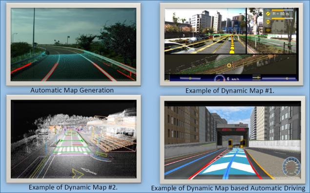
The movement of the autopilot on the road the 3D map. Slide from the presentation by Mitsubishi Electric
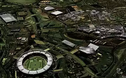
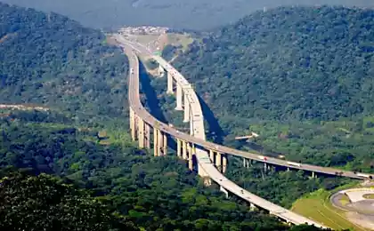
For the Olympic games the host country is always prepared with care. Some are building new stadiums, hotels and paves the tunnels cost billions of dollars. But Japan has decided to invest resources in the creation of 3D maps. After mapping to the Olympic games in 2020, all 30,000 km of highway in the country will be fully fit for the motion of unmanned vehicles.
Probably thanks to the Olympics, Japan will become the first country in the world where all the highway will be open for Abakarov.
The project took on a joint venture, which included mapping company Zenrin and a subsidiary of Dynamic Map Planning, founded on 13 June 2016, and nine of the largest automobile manufacturers of Japan: Toyota, Nissan, Honda, Mazda, Mitsubishi Motors, Suzuki, Fuji Heavy Industries, Isuzu and Hino.
In General, this is a real national project. Unlike the Olympic megastream in other countries, it is carried out with the participation of commercial companies and partially at their expense.
Digitization of key highways will be organized with the help of vehicles equipped with special equipment (pictured below). The parent organization, the joint venture will offer brands computers with necessary software for processing the collected data.
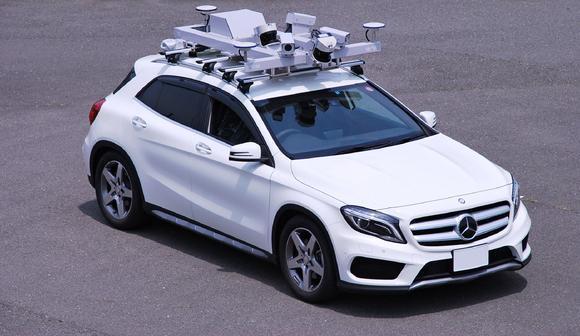
A vehicle equipped for 3D laser scanning of roads. Photo: Mitsubishi Electric
Digitization of 300 km of major highways will be only the first stage on drafting automotive 3D Atlas of Japan. This Atlas is part of the interdepartmental Program for strategic promotion of innovation, which was accepted by the Cabinet of Ministers of Japan and entrusted for execution to the joint venture Dynamic Map Planning.
In the process of 3D laser scanning creates a point cloud of the terrain with a spatial XYZ coordinates and intensity of reflected signal. Resolution of terrestrial laser scanners, which characterizes the density of reflections and the accuracy of their fixation is several millimeters. Scan data can be represented as a three-dimensional model, a drawing of a set of sections that allows to obtain the complete digital picture.
3D laser scanning provides quick and accurate mapping of roads and transport infrastructure grid-locked.
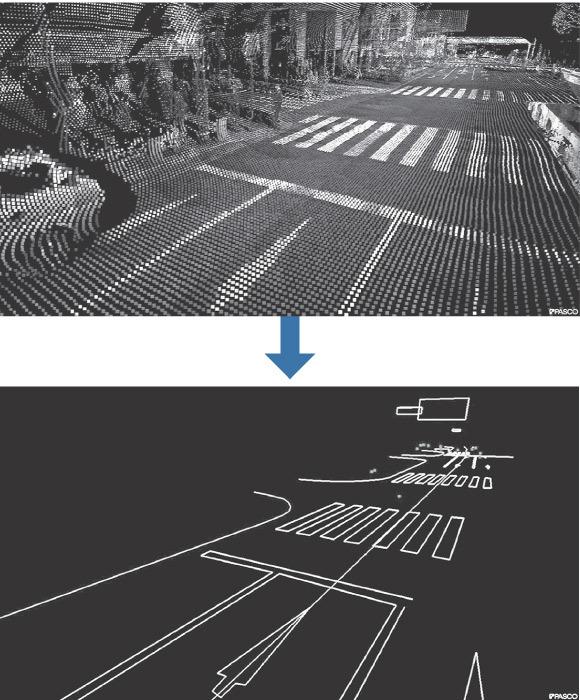
3D laser scanning of the road. Photo: Mitsubishi Electric
The availability of 3D cards is the most important condition for the widespread acceptance of unmanned vehicles. Sooner or later these cards will have to create in all countries of the world. It is understood in Russia: "after 20 years Autonomous cars will replace conventional vehicles, such as those at the time drove of horses" — said recently at a national forum on safety of road traffic head of traffic police, special events and enforcement activities of the traffic police of the Russian Federation Alexander Bykov.
In Russia are going in the near future to prepare for the movement of the unmanned trucks first track, but Russian project on 3D digitizing of all roads probably will take several decades. By concentrating efforts in a short time Japan intends to carry out the task in three years. It is easier for them to do it, because the area of Japan is much smaller than the area of Russia.
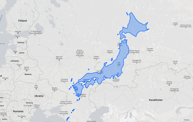
Comparison of area of Japan and Russia. Illustration: thetruesize.com
Three-dimensional road map includes accurate 3D model of the road, and the coordinates of all objects, including road signs, lane markings, obstacles, traffic lights, pedestrian crossings, traffic police, noise strips, fences, etc. ideally, in Navigator with 3D map every minute must be made current information about traffic and operational changes to the maps, as it tries to make the service "Yandex.Tube to unmanned vehicle select the optimal detour route, if necessary.
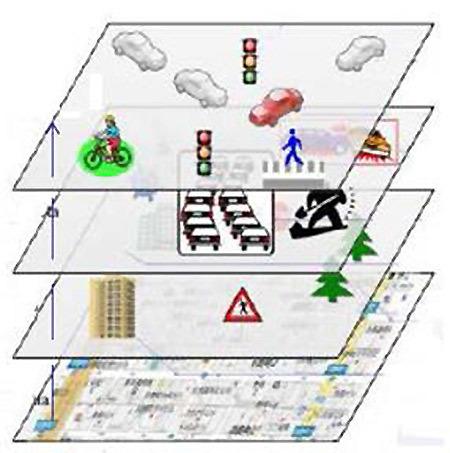
Information layers with different refresh rate on the dynamic road map. Top-down: updates every second; every minute; hourly; statics. Slide from the presentation by Mitsubishi Electric
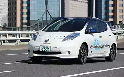
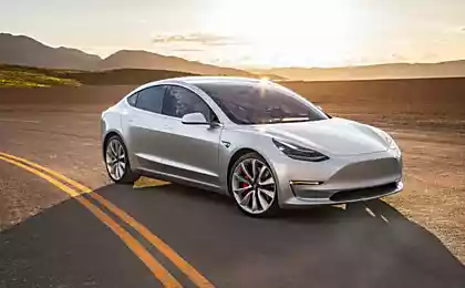
For mass distribution of unmanned vehicles is required not only to create accurate 3D maps of highways, but also to upgrade the software of the car to program the autopilot was not trying to pass between the wheels of the trailer as the autopilot Tesla. It is also necessary to improve car navigation, so that when the positioning takes into account not only the GPS coordinates, but also information about speed and direction of movement. Thus, the autopilot will be able to better navigate the tunnels in the city or on the roads in the dense forest where the GPS signal is weak or missing.
The equipment for 3D laser scanning in Japan, was developed by Mitsubishi Electric. Japanese national project under the state support can be carried out more rapidly than it can today's leaders in the 3D digitizing of roads. Now it is Google, the German company Here and the Dutch TomTom.
After a quick 3D digitizing 30,000 km Expressway will start work on digitizing the rest of the road network, which in Japan has a total length of about 1.27 million km. the Total cost of such a project, according to preliminary estimates, will amount to several hundred million dollars. The organizers intend to carefully work on the cost reduction and optimal resource planning.
Source: geektimes.ru/post/280130/