745
Britain and Spain have scanned lidar
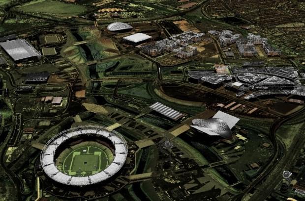
Environment Agency UK публикует open access results of laser scanning Britain. Three-dimensional model of 72% of the island is available for free download. The volume of published files - 11 terabytes.
It is expected that 3D-model of the area will be used for the study of forest resources, search for unknown archaeological artifacts, create game maps for Minecraft, etc. The free license allows you to use any data.
Lidar - active optical rangefinder range. The scanning lidar in machine vision form a three-dimensional picture of the surroundings. They are actively used to scan the surrounding area of unmanned vehicles.
The Environment Agency will update the three-dimensional model year. In this version of the information is obtained over the last 17 years scanning the terrain. Composite data available resolution of 25 cm, 50 cm, 1 m, 2m.
In the near future in the open access will lay out additional information in the framework of Tiled LIDAR, when the sessions were held scanning individual regions. Publish information in multiple formats.
Portal Environment Agency - part of the overall strategy for the opening of the digital data to the public as part of the general strategy of Open Data.
Some interesting links
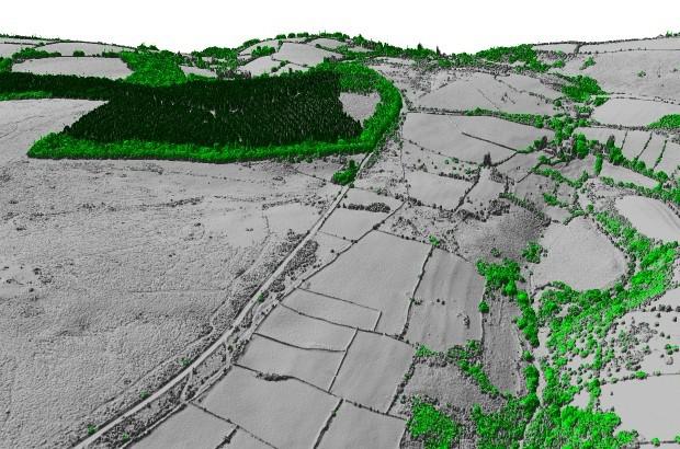
https://houseprices.io/lab/lidar/map?ref=SU1224642189 - Stonehenge
https://houseprices.io/lab/lidar/map?ref=SU1025569962 - Avebury complex of Late Neolithic
https://houseprices.io/lab/lidar/map?ref=ST5895844810 - Field of the Roman era
https://houseprices.io/lab/lidar/map?ref=NY7217242430 - Indefinite phenomenon
https://houseprices.io/lab/lidar/map?ref=SX1025261066 - Roman fort
Funny thing
https://houseprices.io/lab/lidar/map?ref=ST4580543091
https://houseprices.io/lab/lidar/map?ref=TL2327777126
P.S. The Internet is gradually spread card scanning lidar different countries. For example, a three-dimensional scan of Spain can be studied here , scan and Poland - здесь .
Source: geektimes.ru/post/263912/