1310
Trekking in the mountains of Altai - to the magnificent Belukha
Good afternoon!
Last year, I wrote about how to spend the summer on the Kola Peninsula, now I want to tell you about the Altai Mountains. We left from Voronezh to Moscow, where he boarded a train from Moscow to Barnaul, and on arrival in Barnaul boarded a bus that took us to the village Tungur (population 397 people!).
Our route lay first to Akkem lake, where we were to stay for a few days, then jump over the pass Karaturek, access to the lake Kucherlinskoye and return home.
It will be 45 photos and some text.
The Altai Mountains are a complex system of the highest in the Siberian ridges separated by deep valleys and rivers extensive intramontane and hollows.
Mountain system located where the borders of Russia, Mongolia, China and Kazakhstan.
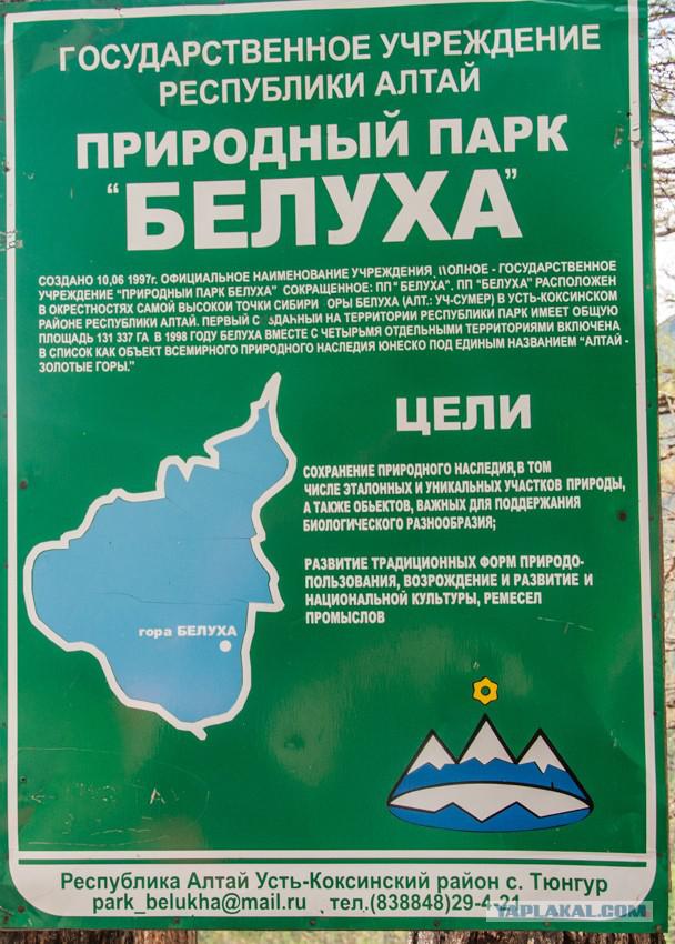
Altai, Katun Nature Reserve and Ukok plateau combine to form a UNESCO World Heritage Site, called "Altai - Golden Mountains».
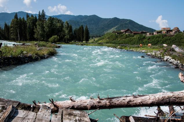
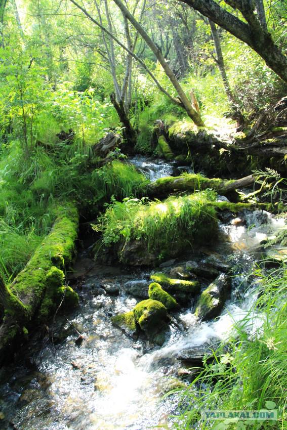
After spending the night on the basis of the tour. club we went to the mountains. Beauty began immediately, which alone is worth crossing the river just such a raging:
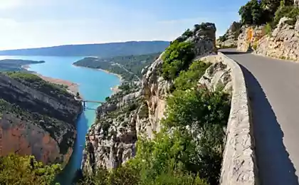
On such roads we were in the mountains. As you can see, the road is quite Rolled - residential villages close, so the local population earns transportation of tourists and things to specific points.
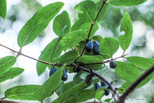
The main berry (At least for us) was the Honeysuckle. She grew up almost everywhere, so in addition to regular eating berries, we have cooked compote.
These rivers was quite a lot. They served us as a source of water, and a place where you could obmytsya. The water is quite cold, so "bath" was held as a "gone-out", even though there was nowhere to go: the water is not gaining even knee-deep, so you had to first lay down on his back and then on her stomach.
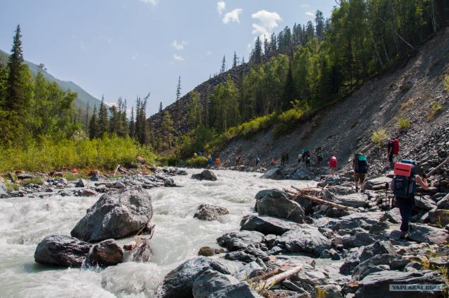
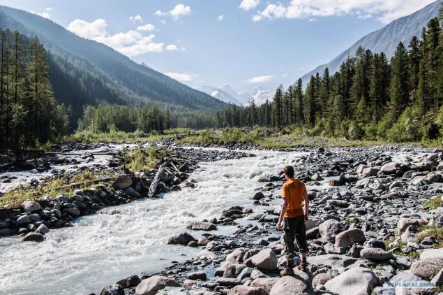
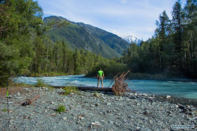
The next day we continued on our way to the Akkem lake and walked along the river Akkem. Before descending to the river was a monument to the dead tourists who took the river. Water flow is quite strong, so you need to be extremely careful.
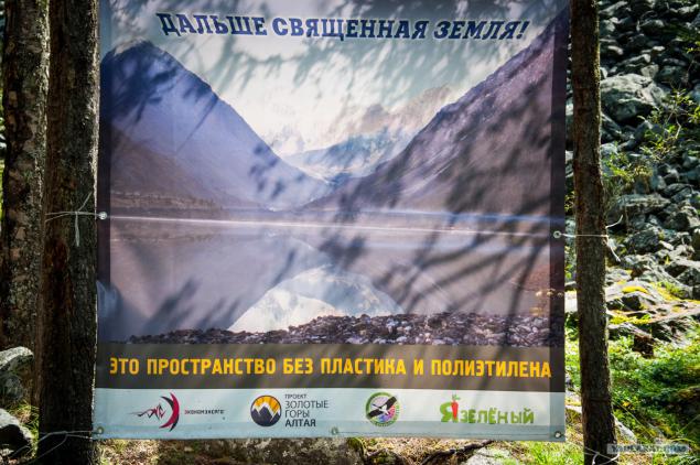
It should be noted that there were a lot of different banners and signage, about what litter is not worth it. Although, as you know, some people do not care about such things, so rubbish for these places there enough.
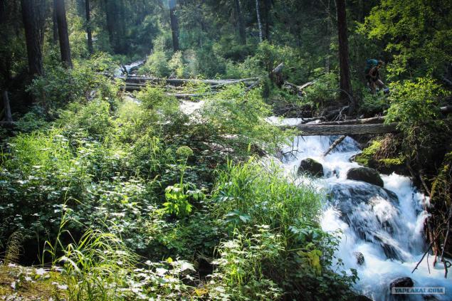
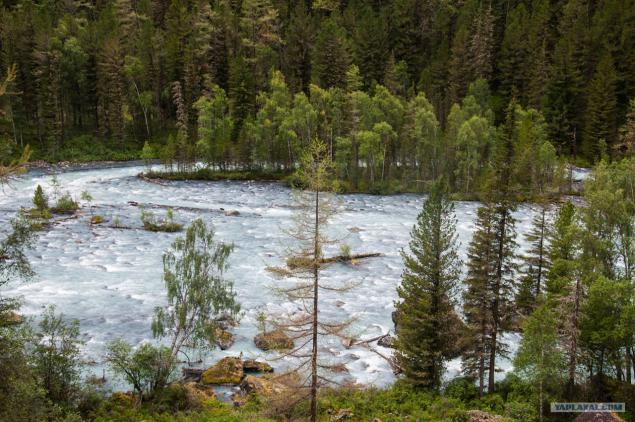
Another passage through small waterfalls. Middle pictures prominence logs - for them we passed water obstacles.
At the next parking lot we went to take pictures and see here an interesting stone. One can only guess how was such a gap?
Gutta cavat lapidem (drop sharpening stone, but what then drop ..)
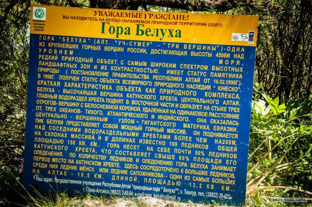
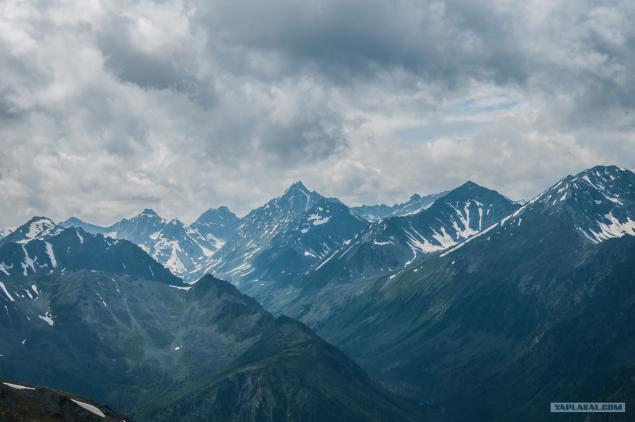
But the main beauty of this park was not just a rock and a mountain-beauty Belukha (4509m), which opened a beautiful view. I think from the name guess yourself. :)
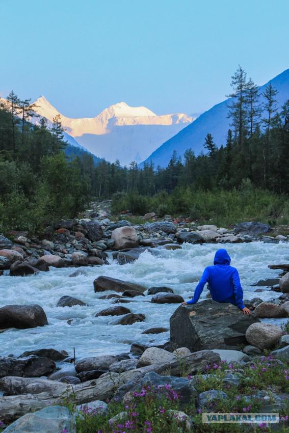
Next day. Again, the exact same river Akkem and wonderful views towards the Belugas. As you can see the picture does not change too much: the left river flows right - Zelenka. Basically, the entire route to Akkem lake had the same picture.
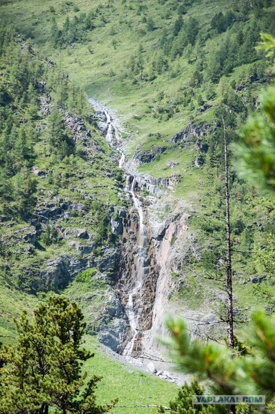
Although if you look to the right, somewhere at the top you could see the waterfalls. :)
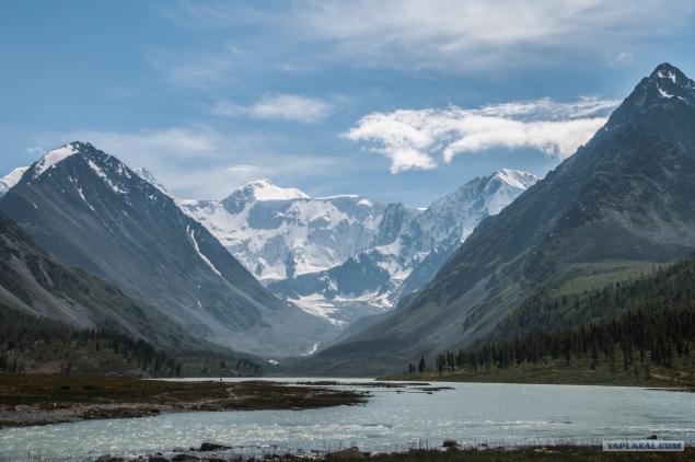
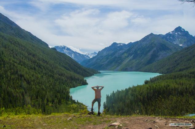
We were approaching the designated point and become a beautiful landscape of snow-white mountains. Before Belukha located Akkem lake, which is blue in color. Do you know why? Blue clay. The answer for the girls: no, not with them brought. :)
Another shield that we met on the way.
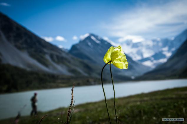
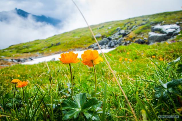
Anyone can ask ourselves what is the beauty of the mountains. Each will be hundreds of responses. One of these answers for me - among such majestic creatures can get out into the world such representatives of the vegetable kingdom. We saw quite a few different color, place them all, I will not, but this picture is probably leave. :)
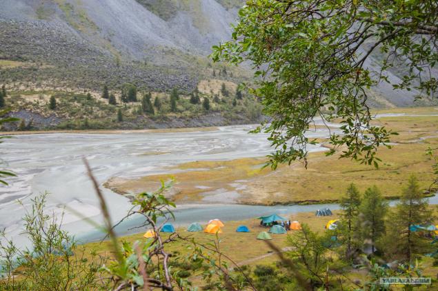
Our today (and for the next three days) was overnight at Akkem lake. All day the sun was shining, so we were pleased with Nature beautiful sunset, which gently lay down on the mountain. Belukha at the border with Kazakhstan, so guards add extra paperwork tourists. Also, due to the border zone have problems with climbing a mountain, so such events were not widely advertised.
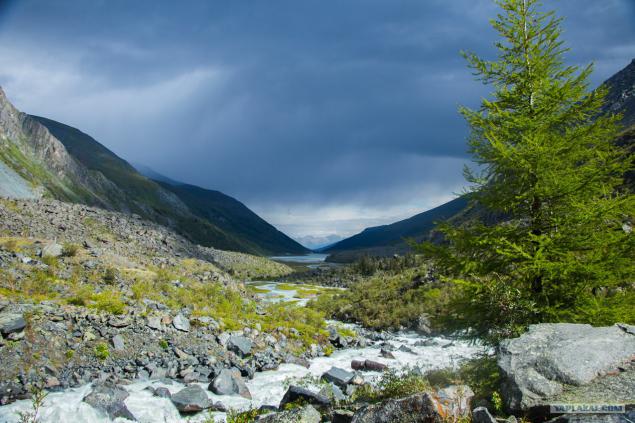
The next day we went closer to the bottom, but we caught several times rain and hail. When was the opportunity to photograph - managed to shoot a view of the lake Akkem. Somewhere to the left of the lake was our camp, and the camp clouds are gathering.
Good photos with no foot - it was all in the cloud haze, sometimes drizzling rain, so the desire to photograph something was not. But on the way back cleared up (maybe just did not want us to go closer to the Belugas?), And somewhere in the distance over the camp the sun was shining. If you look closely - to see people)
But the way of the Akkem glacier. Here begins the Akkem ozero.Kstati, the water temperature in Lake Akkem does not exceed 4, 5 ° C.
Continue its descent to the camp. Weather pleases, so unable to film more or less good scenery. Go through the river on two fixed boards.
The next day we went to the valley Jarl, the stone Roerich. But most of all liked the ridge Mother of the World. As you can see, judging by the fact that I could find on the Internet - this range includes some rocks, and this is due to a color.
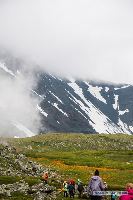
Next we went to the Valley of the Seven Lakes. Again, the flowers that grow at an altitude of ~ 2500 meters, angry rock and snow. Is not that impressive? :)
These flowers studded with whole field far. There is speculation that this Globe-or any of its mountain views.
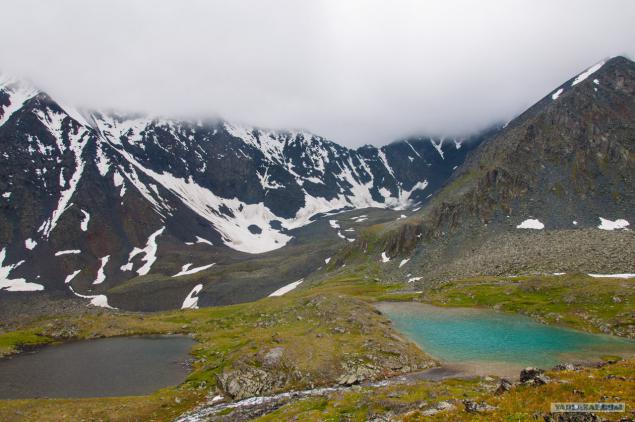
As for the lakes, here are two of them. Located very close, and even the shape is similar, but the colors are quite different. It is believed that each of the lakes symbolizes Chakra, but maybe it's just an opinion.
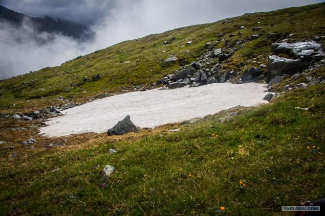
Look the other way - and there is snow. Where else can rest so that summer could play in the snow, eat berries and soak up the sun? :)
We descend from the valley, among pine branches overlooking the camp. On the first day we got up - waded lake because on this side there was a problem with the wood. I have already written that the temperature of the lake is less than 4, 5 ° C, so the legs went numb almost immediately.
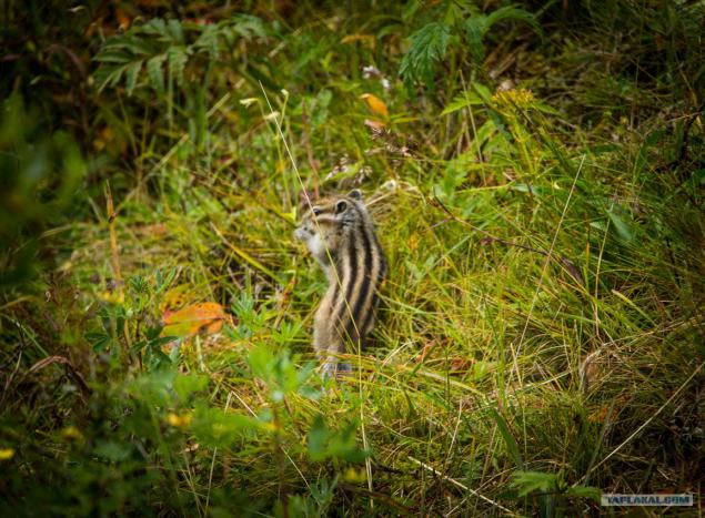
A local resident, who was extremely difficult to photograph. Squirrels quite brisk, and much smarter than our protein.
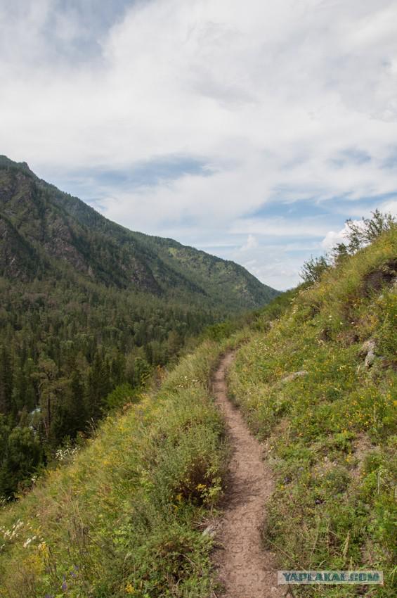
Oh yeah, another attraction. Tourism in these places is very popular, so after rain trails do not have time to dry. Moreover, the trail periodically intersect with horse trails, which is why the road to "kill" even stronger. But if the horse decided it was time to go to the bathroom, it is unlikely that he will go into the bushes. :)
The next day we picked up camp and went to the pass. I would like to note that in the days hiking weather is constantly accompanied - almost always the sun was shining. Here's another view of the mountain range Mother of the World, as you can see, it is not only blue.
Somewhere at the bottom right in the morning was our camp, now just remembering a parking lot and climb.
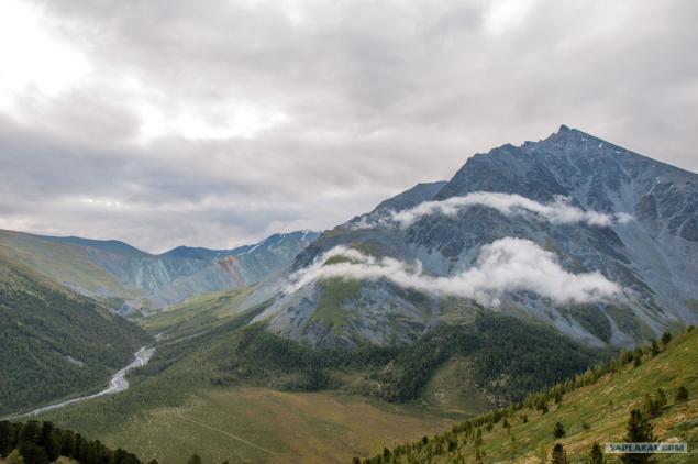
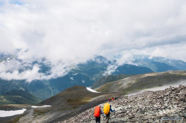
Places had to go down, then to climb up. But it was worth it - we were waiting in front of the pass Karaturek wonderful views.
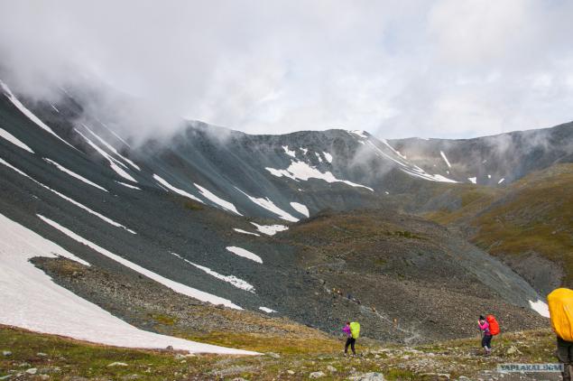
Pass Karaturek (translated as The Black Heart, elevation 3060 m) .Our camp was below 1000 meters, somewhere behind the clouds ...
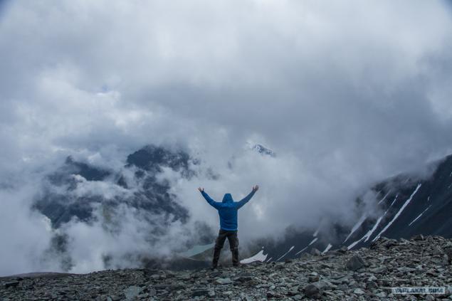
And here is a small circus, in which "climbed" the cloud and could not "get out."
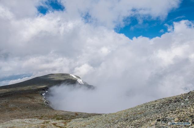
Here's another picture from the pass. Someone from friends, look at pictures, remembered the game Skyrim. Well, in general, yes, something just seems.
Photographed Altai beauty - we went on. Ahead of us waiting cedar parking.
Cedar is one of the most beautiful and majestic trees, it is considered sacred, noble tree. In ancient times cedar wood with gold and silver was considered a first-class war booty.
Another billboard, this time we go to the lake Kucherlinskoye
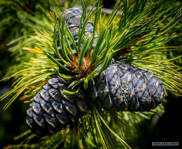
A little lost the trail we've got here are the big shots. By the way, do we cones are boiled, then ate pine nuts.
And here is the very Kucherlinskoye lake. Turquoise water, steep rocky cliffs, forested slopes - all this combined with the sound of falling water with benches attached to the unique beauty of the lake and attracts tourists from all over the world
And this is one more representatives of the local residents.
Standing for a few days Kucherlinskoye lake, we have to go back in Tungur along the river Kucherla. There were also memorials to those killed tourists (water professionals), which floated on the river.
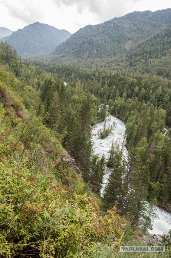
Another photo from our parking lot. Picture does not convey the whole landscape: somewhere in front of me the river itself is divided into 3 parts, and even left it empties into another river. And on most photos it looks as a whole. By the way, in the place where there was a photographer, began after our tent.
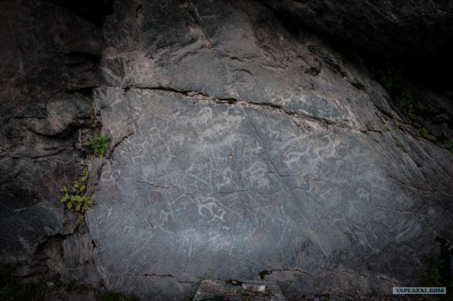
This petroglyphs. Somewhere high above the stone was written something like "Airborne", but that's exactly it - petroglyphs. By the way, they made the tour, but honestly nothing spectacular you do not will withdraw.
We go on the cliff. Right growing strawberries, which at the end of the campaign we have eaten enough.
Breakage? Yes, if we want to look back, we see the following picture.
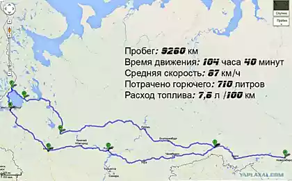
Extreme our parking before returning to base tour. club. As a result: we went ~ 120-140km. Gradually gained altitude, with Tungur (850 m) to Karaturek (3060 m).
The place is very beautiful, so fans should definitely visit tracking Altai. Moreover, our route - only a part of the beautiful creations of nature in the Altai Mountains, so I really hope that I'll get more time in those regions.
Source:
Last year, I wrote about how to spend the summer on the Kola Peninsula, now I want to tell you about the Altai Mountains. We left from Voronezh to Moscow, where he boarded a train from Moscow to Barnaul, and on arrival in Barnaul boarded a bus that took us to the village Tungur (population 397 people!).
Our route lay first to Akkem lake, where we were to stay for a few days, then jump over the pass Karaturek, access to the lake Kucherlinskoye and return home.
It will be 45 photos and some text.
The Altai Mountains are a complex system of the highest in the Siberian ridges separated by deep valleys and rivers extensive intramontane and hollows.
Mountain system located where the borders of Russia, Mongolia, China and Kazakhstan.
Altai, Katun Nature Reserve and Ukok plateau combine to form a UNESCO World Heritage Site, called "Altai - Golden Mountains».
After spending the night on the basis of the tour. club we went to the mountains. Beauty began immediately, which alone is worth crossing the river just such a raging:

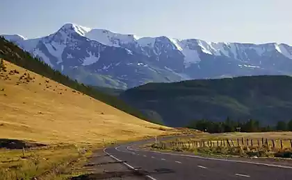
On such roads we were in the mountains. As you can see, the road is quite Rolled - residential villages close, so the local population earns transportation of tourists and things to specific points.

The main berry (At least for us) was the Honeysuckle. She grew up almost everywhere, so in addition to regular eating berries, we have cooked compote.

These rivers was quite a lot. They served us as a source of water, and a place where you could obmytsya. The water is quite cold, so "bath" was held as a "gone-out", even though there was nowhere to go: the water is not gaining even knee-deep, so you had to first lay down on his back and then on her stomach.

The next day we continued on our way to the Akkem lake and walked along the river Akkem. Before descending to the river was a monument to the dead tourists who took the river. Water flow is quite strong, so you need to be extremely careful.

It should be noted that there were a lot of different banners and signage, about what litter is not worth it. Although, as you know, some people do not care about such things, so rubbish for these places there enough.

Another passage through small waterfalls. Middle pictures prominence logs - for them we passed water obstacles.

At the next parking lot we went to take pictures and see here an interesting stone. One can only guess how was such a gap?
Gutta cavat lapidem (drop sharpening stone, but what then drop ..)
But the main beauty of this park was not just a rock and a mountain-beauty Belukha (4509m), which opened a beautiful view. I think from the name guess yourself. :)

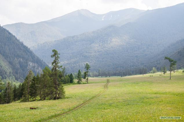
Next day. Again, the exact same river Akkem and wonderful views towards the Belugas. As you can see the picture does not change too much: the left river flows right - Zelenka. Basically, the entire route to Akkem lake had the same picture.

Although if you look to the right, somewhere at the top you could see the waterfalls. :)

We were approaching the designated point and become a beautiful landscape of snow-white mountains. Before Belukha located Akkem lake, which is blue in color. Do you know why? Blue clay. The answer for the girls: no, not with them brought. :)

Another shield that we met on the way.

Anyone can ask ourselves what is the beauty of the mountains. Each will be hundreds of responses. One of these answers for me - among such majestic creatures can get out into the world such representatives of the vegetable kingdom. We saw quite a few different color, place them all, I will not, but this picture is probably leave. :)

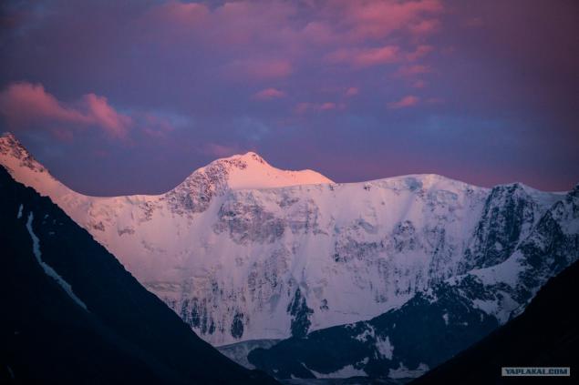
Our today (and for the next three days) was overnight at Akkem lake. All day the sun was shining, so we were pleased with Nature beautiful sunset, which gently lay down on the mountain. Belukha at the border with Kazakhstan, so guards add extra paperwork tourists. Also, due to the border zone have problems with climbing a mountain, so such events were not widely advertised.

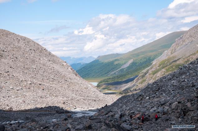
The next day we went closer to the bottom, but we caught several times rain and hail. When was the opportunity to photograph - managed to shoot a view of the lake Akkem. Somewhere to the left of the lake was our camp, and the camp clouds are gathering.

Good photos with no foot - it was all in the cloud haze, sometimes drizzling rain, so the desire to photograph something was not. But on the way back cleared up (maybe just did not want us to go closer to the Belugas?), And somewhere in the distance over the camp the sun was shining. If you look closely - to see people)

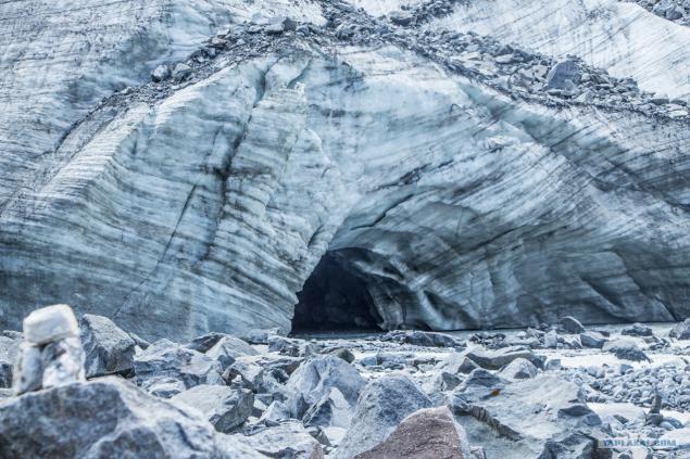
But the way of the Akkem glacier. Here begins the Akkem ozero.Kstati, the water temperature in Lake Akkem does not exceed 4, 5 ° C.

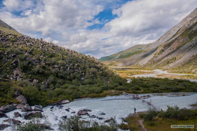
Continue its descent to the camp. Weather pleases, so unable to film more or less good scenery. Go through the river on two fixed boards.

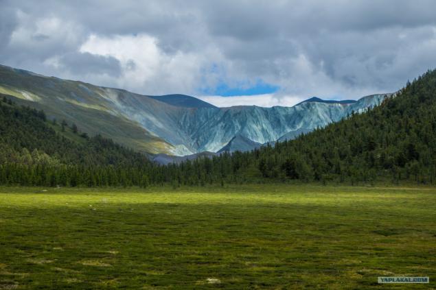
The next day we went to the valley Jarl, the stone Roerich. But most of all liked the ridge Mother of the World. As you can see, judging by the fact that I could find on the Internet - this range includes some rocks, and this is due to a color.

Next we went to the Valley of the Seven Lakes. Again, the flowers that grow at an altitude of ~ 2500 meters, angry rock and snow. Is not that impressive? :)

These flowers studded with whole field far. There is speculation that this Globe-or any of its mountain views.

As for the lakes, here are two of them. Located very close, and even the shape is similar, but the colors are quite different. It is believed that each of the lakes symbolizes Chakra, but maybe it's just an opinion.

Look the other way - and there is snow. Where else can rest so that summer could play in the snow, eat berries and soak up the sun? :)

We descend from the valley, among pine branches overlooking the camp. On the first day we got up - waded lake because on this side there was a problem with the wood. I have already written that the temperature of the lake is less than 4, 5 ° C, so the legs went numb almost immediately.

A local resident, who was extremely difficult to photograph. Squirrels quite brisk, and much smarter than our protein.

Oh yeah, another attraction. Tourism in these places is very popular, so after rain trails do not have time to dry. Moreover, the trail periodically intersect with horse trails, which is why the road to "kill" even stronger. But if the horse decided it was time to go to the bathroom, it is unlikely that he will go into the bushes. :)

The next day we picked up camp and went to the pass. I would like to note that in the days hiking weather is constantly accompanied - almost always the sun was shining. Here's another view of the mountain range Mother of the World, as you can see, it is not only blue.

Somewhere at the bottom right in the morning was our camp, now just remembering a parking lot and climb.

Places had to go down, then to climb up. But it was worth it - we were waiting in front of the pass Karaturek wonderful views.

Pass Karaturek (translated as The Black Heart, elevation 3060 m) .Our camp was below 1000 meters, somewhere behind the clouds ...

And here is a small circus, in which "climbed" the cloud and could not "get out."

Here's another picture from the pass. Someone from friends, look at pictures, remembered the game Skyrim. Well, in general, yes, something just seems.

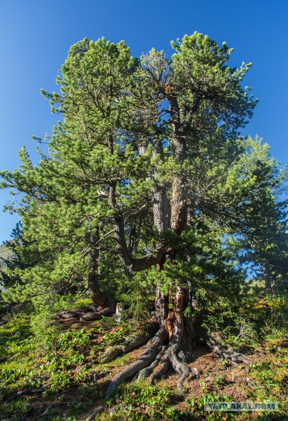
Photographed Altai beauty - we went on. Ahead of us waiting cedar parking.

Cedar is one of the most beautiful and majestic trees, it is considered sacred, noble tree. In ancient times cedar wood with gold and silver was considered a first-class war booty.

Another billboard, this time we go to the lake Kucherlinskoye

A little lost the trail we've got here are the big shots. By the way, do we cones are boiled, then ate pine nuts.

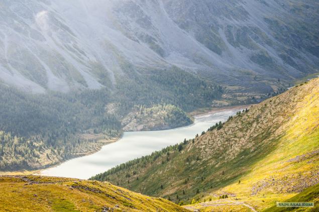
And here is the very Kucherlinskoye lake. Turquoise water, steep rocky cliffs, forested slopes - all this combined with the sound of falling water with benches attached to the unique beauty of the lake and attracts tourists from all over the world

And this is one more representatives of the local residents.

Standing for a few days Kucherlinskoye lake, we have to go back in Tungur along the river Kucherla. There were also memorials to those killed tourists (water professionals), which floated on the river.

Another photo from our parking lot. Picture does not convey the whole landscape: somewhere in front of me the river itself is divided into 3 parts, and even left it empties into another river. And on most photos it looks as a whole. By the way, in the place where there was a photographer, began after our tent.

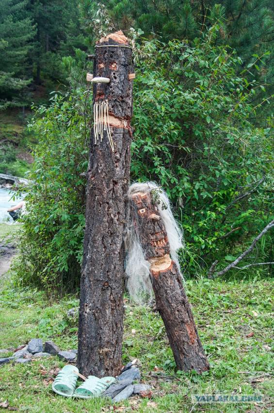
This petroglyphs. Somewhere high above the stone was written something like "Airborne", but that's exactly it - petroglyphs. By the way, they made the tour, but honestly nothing spectacular you do not will withdraw.

We go on the cliff. Right growing strawberries, which at the end of the campaign we have eaten enough.

Breakage? Yes, if we want to look back, we see the following picture.

Extreme our parking before returning to base tour. club. As a result: we went ~ 120-140km. Gradually gained altitude, with Tungur (850 m) to Karaturek (3060 m).
The place is very beautiful, so fans should definitely visit tracking Altai. Moreover, our route - only a part of the beautiful creations of nature in the Altai Mountains, so I really hope that I'll get more time in those regions.
Source: