855
11 most awesome photos from space
Abaldenny!
These eleven pictures of the Earth taken from space, and each of them can not only consider the geographic features imprinted charming place, but also to see the phenomenon of natural character. Nature is not always predictable, agree even weather forecasters, and some of its manifestations are striking in their beauty, and some would like to have seen only in these pictures.
-
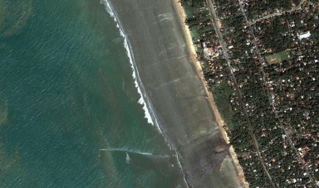
1. 26 December 2004. Sri Lanka Coast
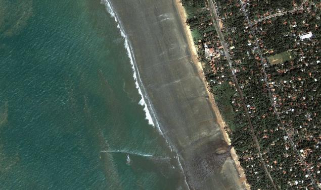
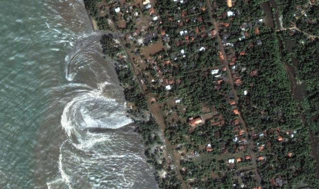
The first picture shows how the ocean recedes to 400 meters from the south-west coast of Sri Lanka, only about 5 minutes on this coast falls devastating tsunami.
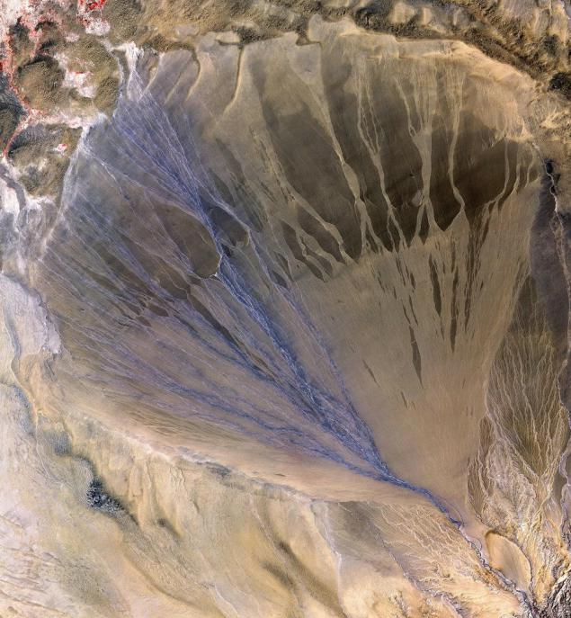
2. Alluvium, the province of Xinjiang, China
First, familiarize yourself with the new term - it does not apply to those who already knows. I think most of them - geologists. Alluvium - (from the Latin alluvio - applied). Alluvial deposits - deposits of permanent and temporary water flows (rivers, streams), composed of clastic material of varying degrees of roundness and sorting (pebbles, gravel, sand, loam, clay).
Second look at this very alluvium from a height. The picture shows oblast56, 6 x 61, 3 km, alluvium formed on the southern border of the desert Taklimakan, and still he had formed - a place in the picture, painted in blue color still active - these are the channels through which water flows, for all the rest - no longer exists.
3. Melting glaciers in the Bhutan-Himalaya
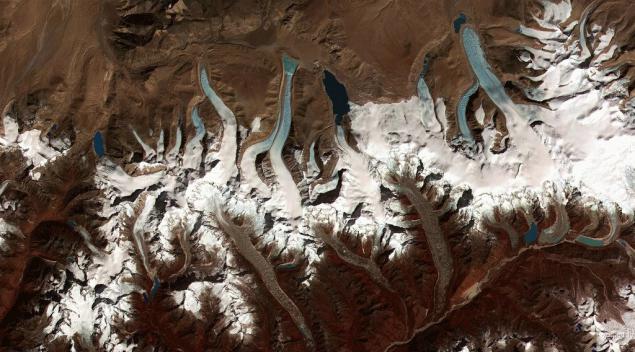
Looks nice, but it's another glacier, which fits into the theory of global warming. If you look closely - you will see that at the ends of these tracks can be seen forming ice blue or blue lakes, this trend began to show not so long ago - just in the last few decades.
4. Hurricane Isabel in 2003
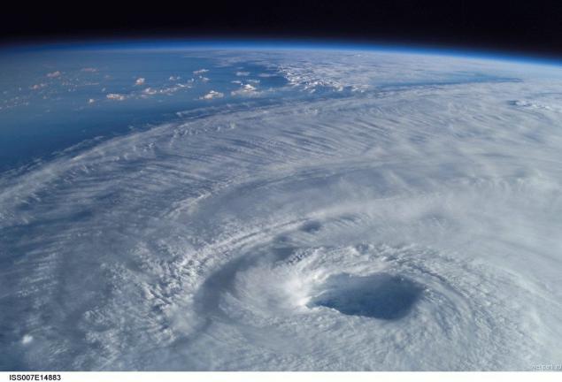
This photograph was taken in 2003 on board the space station - it clearly shows how strong a hurricane. It was one of the most powerful and deadly cyclone winds of up to 165 miles per hour.
5. The eastern coast of Greenland. August 21, 2003
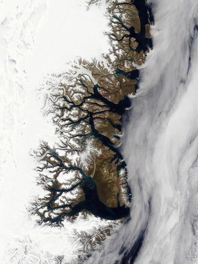
In this photo taken by NASA shows that the east coast of the island are completely covered with snow, bright turquoise spots deep fjords - it is water, and if you look at the NASA site on the photo with a larger resolution can be seen fragments of ice that hit the sea . Number of collapse is growing - this means that the edges of the island ice continues to melt, and this trend is increasing. It also fits the theory of global warming. Does not fit into this theory that the thickness of the ice cover near the center of Greenland is growing every year.
6. Polar Lights (Aurora)
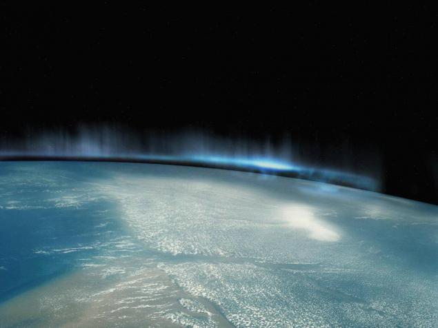
Strikingly beautiful sight - the northern lights made from the board "Space Shuttle" over Antarctica. Auroras are often called called North and South Aurora, after the Roman goddess of the dawn. And since they are observed mainly in the high latitudes of both hemispheres in oval zones, zones surrounding the magnetic poles of the Earth, and these zones are called auroral ovals.
7. The total solar eclipse - view from space, 1999
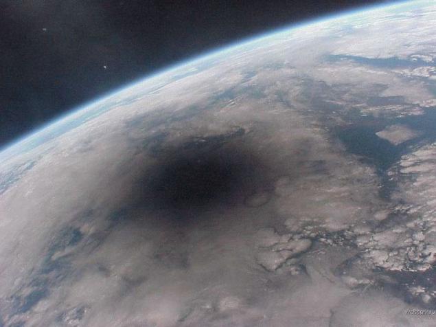
We know it looks like a solar eclipse on the ground - and now, and what it looks like from space. The photo was taken from the space station "Mir" August 11, 1999. Shadow that you see in the picture, swept over the surface of the Earth at a speed of 2000 km / h.
8. National Park Egmont, New Zealand
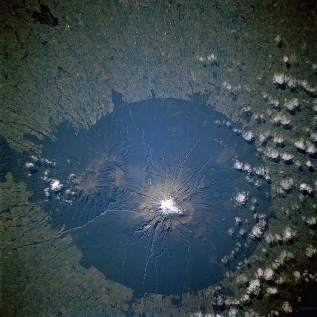
The last eruption occurred in this park in 1755. An extinct volcano, survived eight eruptions, located in the center of the park, and on its slopes grow valuable teak and beech forests - the pride of the park. The top of the volcano is covered with snow all year round cap. This picture was taken with the "Shuttle" in 2002.
9. The eruption of Mount Etna, October 2001
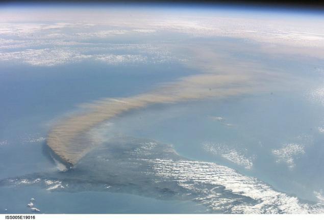
This is a picture of the eruption of the volcano on the island of Sicily, the tail of ash which reached Libya. Lighter smoke - this is not the ashes, burning the forest is set on fire lava.
10. Structure Guell-Air Richat Mauritania
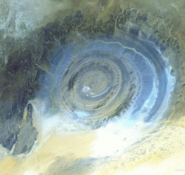
This structure is located on the territory of the Sahara Desert, and is clearly visible from space, as its diameter - about 50 km. It is believed that the oldest of her ring is formed by more than half a billion years ago. But its causes are not clear. Previously it was thought that it arose after hitting the ground a huge meteorite, but the bottom of the structure - not flat, and traces of a stroke at the edges of the structure has not been identified. So today, most researchers believe that the structure - the result of erosion, but to explain it almost perfectly circular shape do not even try - it's a mystery. Picture taken October 7, 2000.
-
These eleven pictures of the Earth taken from space, and each of them can not only consider the geographic features imprinted charming place, but also to see the phenomenon of natural character. Nature is not always predictable, agree even weather forecasters, and some of its manifestations are striking in their beauty, and some would like to have seen only in these pictures.
-

1. 26 December 2004. Sri Lanka Coast


The first picture shows how the ocean recedes to 400 meters from the south-west coast of Sri Lanka, only about 5 minutes on this coast falls devastating tsunami.
2. Alluvium, the province of Xinjiang, China

First, familiarize yourself with the new term - it does not apply to those who already knows. I think most of them - geologists. Alluvium - (from the Latin alluvio - applied). Alluvial deposits - deposits of permanent and temporary water flows (rivers, streams), composed of clastic material of varying degrees of roundness and sorting (pebbles, gravel, sand, loam, clay).
Second look at this very alluvium from a height. The picture shows oblast56, 6 x 61, 3 km, alluvium formed on the southern border of the desert Taklimakan, and still he had formed - a place in the picture, painted in blue color still active - these are the channels through which water flows, for all the rest - no longer exists.
3. Melting glaciers in the Bhutan-Himalaya

Looks nice, but it's another glacier, which fits into the theory of global warming. If you look closely - you will see that at the ends of these tracks can be seen forming ice blue or blue lakes, this trend began to show not so long ago - just in the last few decades.
4. Hurricane Isabel in 2003

This photograph was taken in 2003 on board the space station - it clearly shows how strong a hurricane. It was one of the most powerful and deadly cyclone winds of up to 165 miles per hour.
5. The eastern coast of Greenland. August 21, 2003

In this photo taken by NASA shows that the east coast of the island are completely covered with snow, bright turquoise spots deep fjords - it is water, and if you look at the NASA site on the photo with a larger resolution can be seen fragments of ice that hit the sea . Number of collapse is growing - this means that the edges of the island ice continues to melt, and this trend is increasing. It also fits the theory of global warming. Does not fit into this theory that the thickness of the ice cover near the center of Greenland is growing every year.
6. Polar Lights (Aurora)

Strikingly beautiful sight - the northern lights made from the board "Space Shuttle" over Antarctica. Auroras are often called called North and South Aurora, after the Roman goddess of the dawn. And since they are observed mainly in the high latitudes of both hemispheres in oval zones, zones surrounding the magnetic poles of the Earth, and these zones are called auroral ovals.
7. The total solar eclipse - view from space, 1999

We know it looks like a solar eclipse on the ground - and now, and what it looks like from space. The photo was taken from the space station "Mir" August 11, 1999. Shadow that you see in the picture, swept over the surface of the Earth at a speed of 2000 km / h.
8. National Park Egmont, New Zealand

The last eruption occurred in this park in 1755. An extinct volcano, survived eight eruptions, located in the center of the park, and on its slopes grow valuable teak and beech forests - the pride of the park. The top of the volcano is covered with snow all year round cap. This picture was taken with the "Shuttle" in 2002.
9. The eruption of Mount Etna, October 2001

This is a picture of the eruption of the volcano on the island of Sicily, the tail of ash which reached Libya. Lighter smoke - this is not the ashes, burning the forest is set on fire lava.
10. Structure Guell-Air Richat Mauritania

This structure is located on the territory of the Sahara Desert, and is clearly visible from space, as its diameter - about 50 km. It is believed that the oldest of her ring is formed by more than half a billion years ago. But its causes are not clear. Previously it was thought that it arose after hitting the ground a huge meteorite, but the bottom of the structure - not flat, and traces of a stroke at the edges of the structure has not been identified. So today, most researchers believe that the structure - the result of erosion, but to explain it almost perfectly circular shape do not even try - it's a mystery. Picture taken October 7, 2000.
-


