1223
Kiev half a century ago (51 photos)
Wonderful selection.
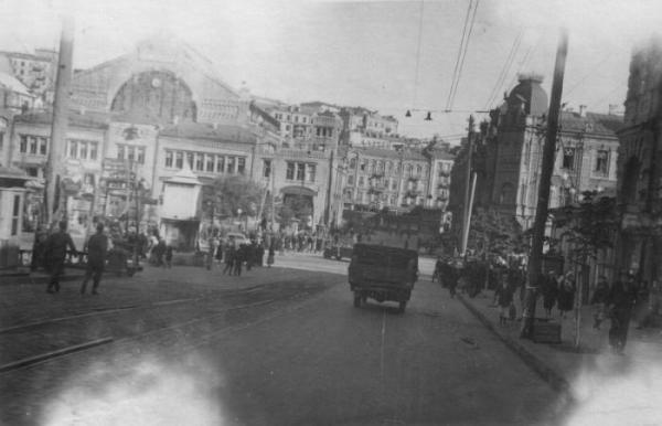
Shevchenko Boulevard, Fall 1941 (the current name of the boulevard is from 1919).
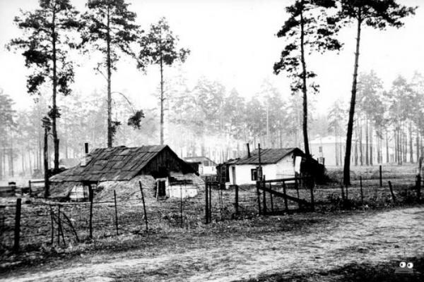
In these post-war population lived in dugouts Darnitsa, 1950
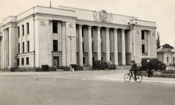
The Supreme Council, 1941
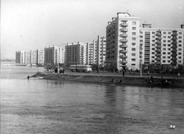
Rusanivka during the floods in April 1970
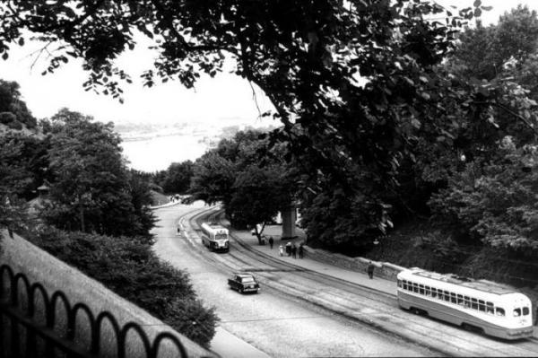
Vladimir descent, the end of the 1950s.
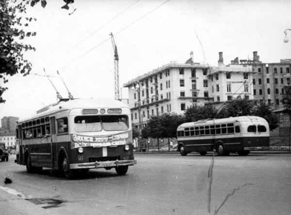
Post-war reconstruction of Khreshchatyk, 1950
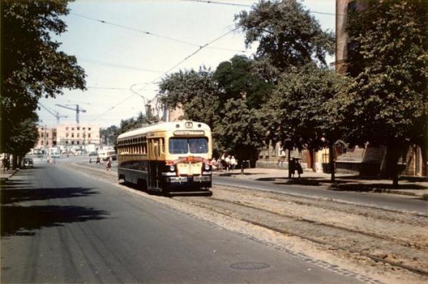
In the background - under construction Circus (Victory Square), 1959
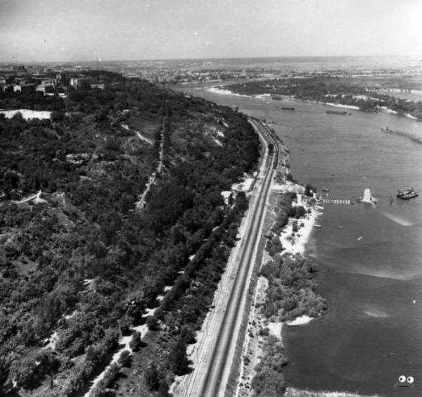
Dnieper embankment. In the place where the photograph visible support of the old Chain Bridge, Bridge Subway is now (early 1960s).
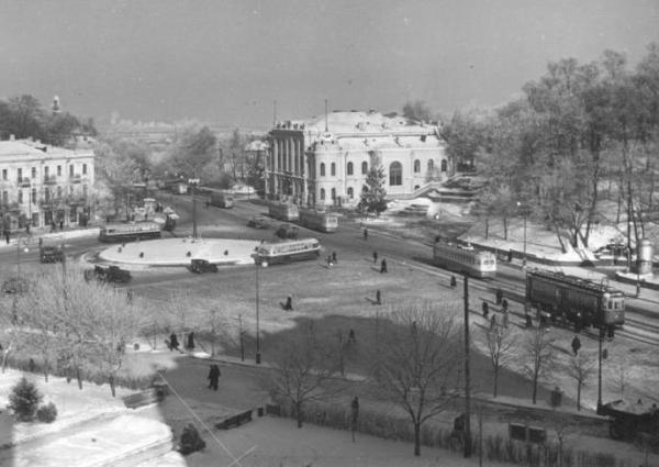
The area of the Lenin Komsomol (now - European area), 1950.
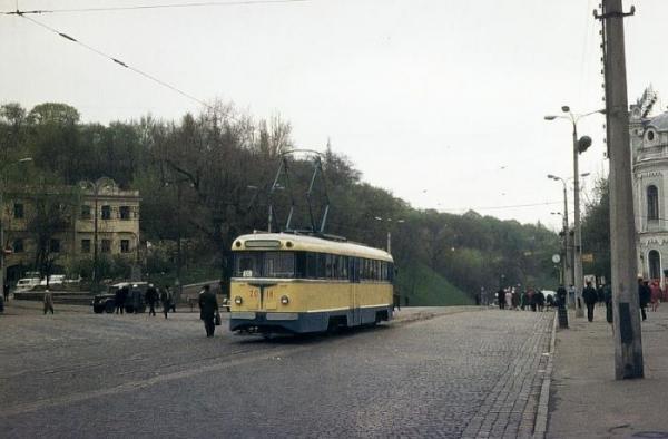
The same area in 1970.
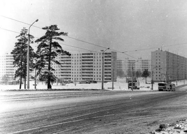
Behind the photographer - metro Chernihiv, in December 1970.
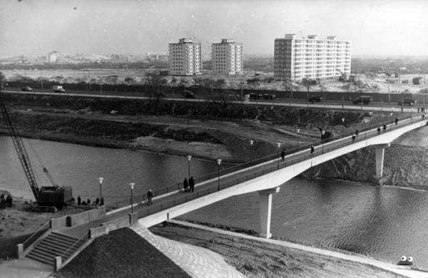
Bereznyakov Buildings, view from the street of Enthusiasts, November 1967.
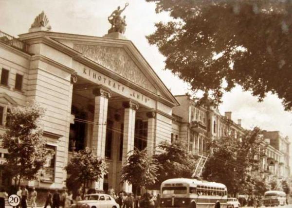
Cinema Kiev, the beginning of the 1960s.
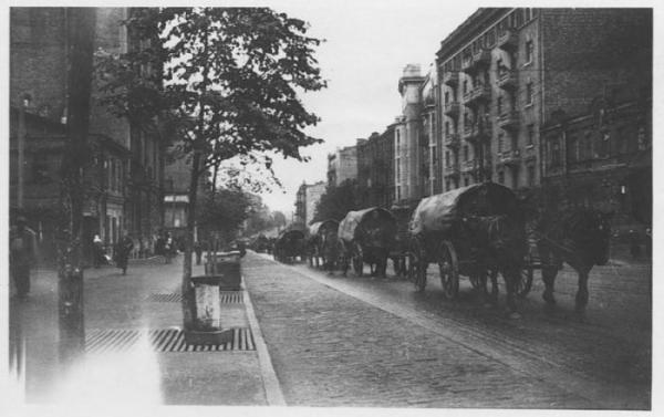
German colonies on the corner of Krasnoarmeyskaya (now - Big Vasylkivska) and Zhylianska.
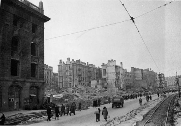
Khreshchatyk, 1944.
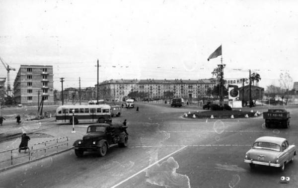
Leningrad area, in November 1958.
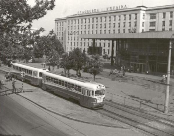
Metro Bolshevik plant (now - Shuliavska), 1962.
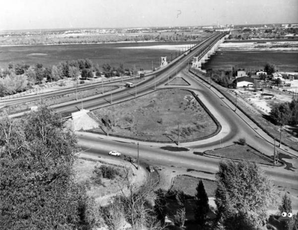
Paton Bridge, 1959.
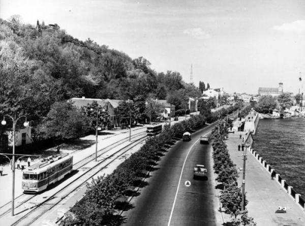
Dnipro Embankment (now - quay highway), 1959.
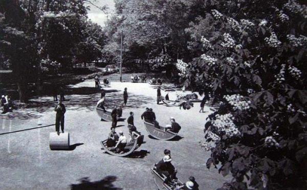
Some park, I can not say more. So we rested our ancestors 50 years ago.
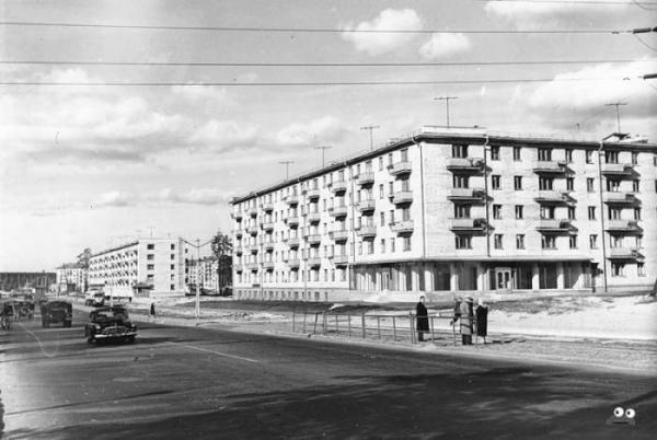
Crossroads of the Kharkiv highway and street Hasek, in August 1962.
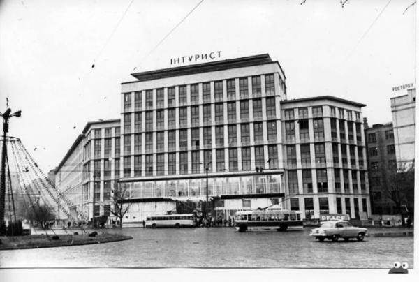
Pl. Lenin Komsomol (now - the European Space), a view of the hotel "Intourist" (the modern name of the hotel - "Dnepr"), 1962.
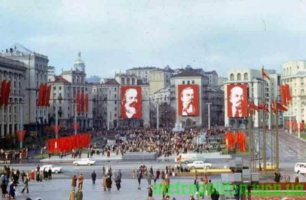
The area of the October Revolution (now - Maidan Nezalezhnosti - Independence Square), in May 1985.
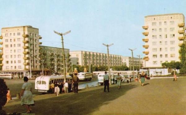
Victory Square, 1960.
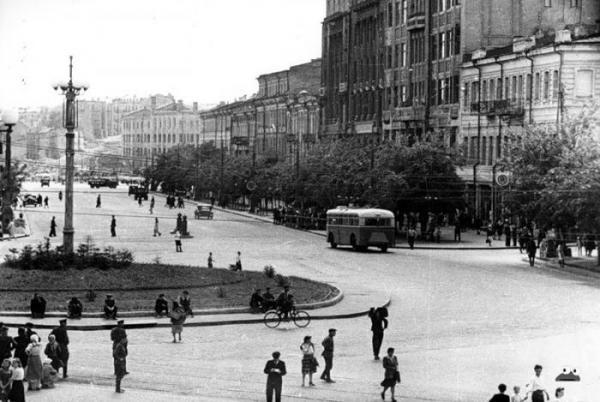
Area Stalin in May 1947. In 1961 it will be renamed the Lenin Komsomol Square, and in 1991, already in independent Ukraine, returned to the area of one of its historical names - European (as it was called from 1851 until 1869).
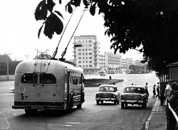
Victory Square, 1961.
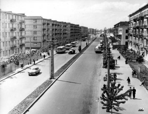
Prospekt Mira, 1963.
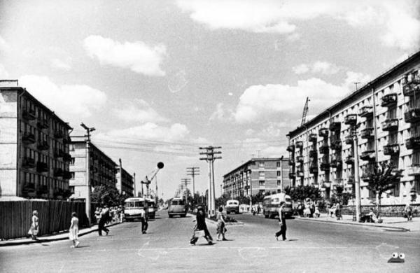
Prospect Mira to Leningrad area, 1959. On the left side of the fence these days is a department store (or already shopping mall) "Darnitsa».
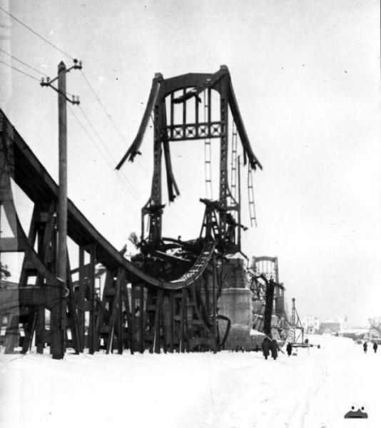
The ruins of the Chain Bridge, 1943-44.
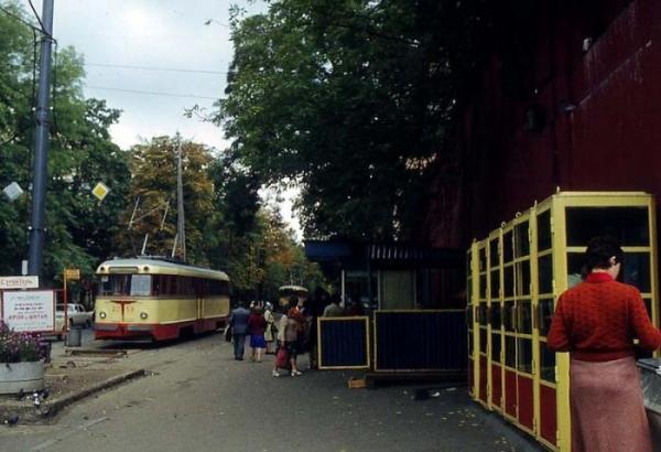
Near the University of Shevchenko, the intersection of the streets and Vladimir Tolstoy, 1978.
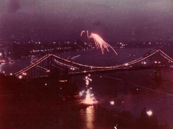
Fireworks over the footbridge, 1960.
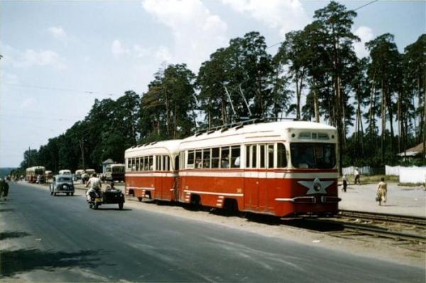
Svyatoshin, 1959.
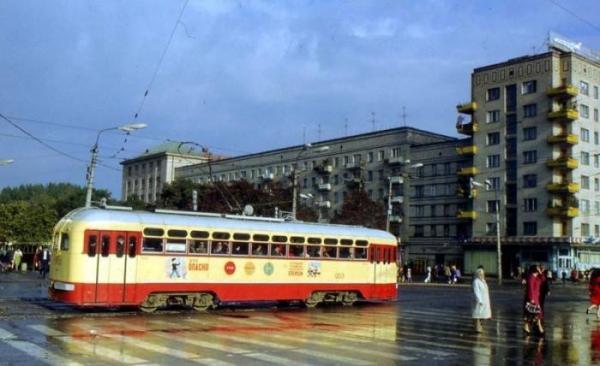
Social Advertising, 1970.
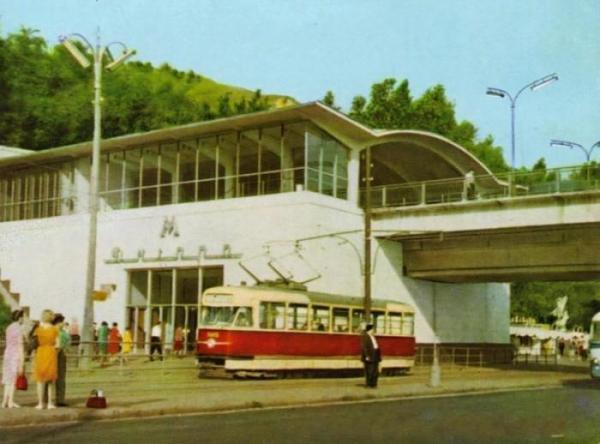
Dnipro metro station, 1965.
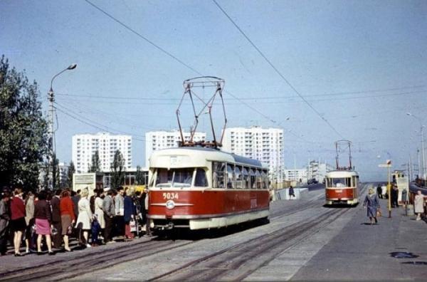
Komsomolskaya metro station (now - Chernigov).
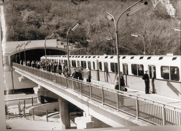
Dnipro metro station, 1960.
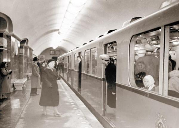
University Metro Station, 1960.
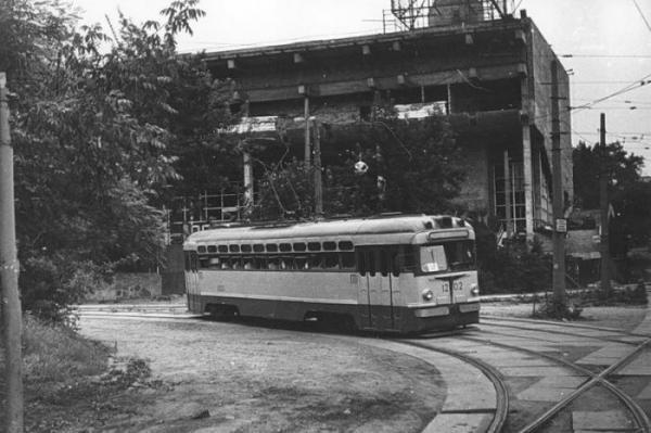
Construction of the cinema Kievan Rus, 1981.
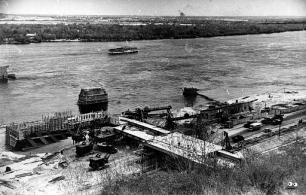
Construction of the subway station Dnipro, the end of the 1950s.
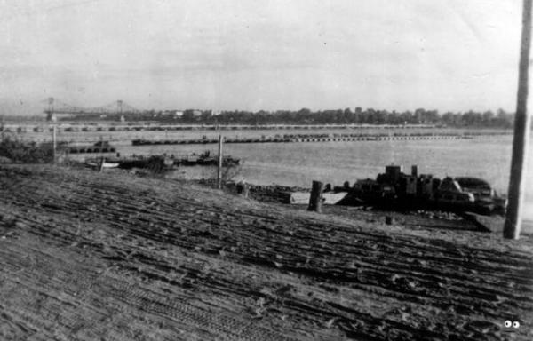
So in 1942, he looked the Dnieper embankment. Away - destroyed the Chain Bridge.
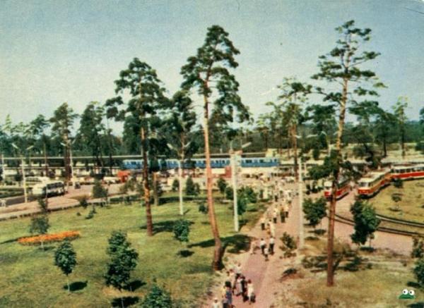
Darnitsa, 1967.
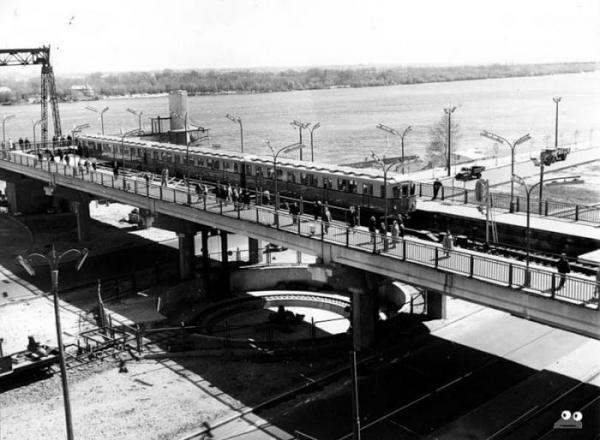
Such was the Dnipro metro station in the first 5 years of operation, in June 1961.
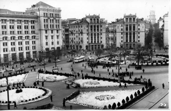
Area Kalinin, 1960. So in those days it was called the Maidan Nezalezhnosti.
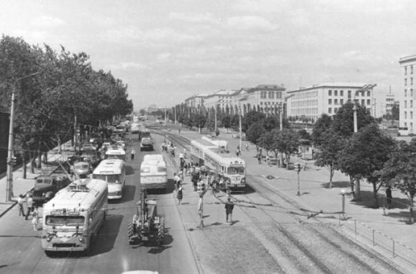
So in the 1960s, was Victory Avenue.
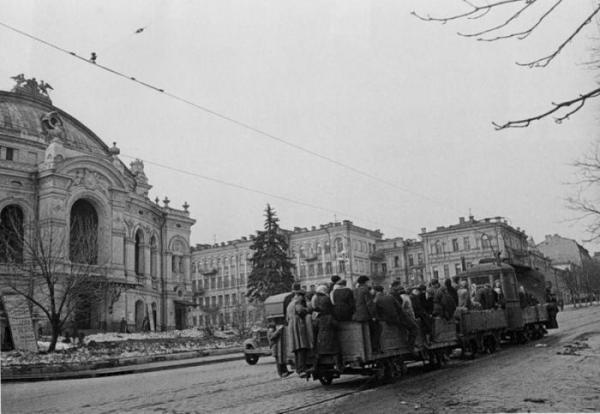
Vladimir Street, Spring 1944.
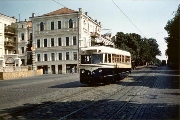
The same Vladimir in summer 1959.
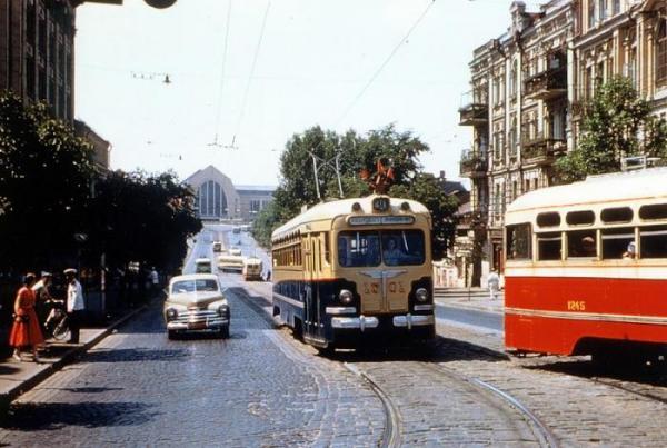
Street of the Comintern in 1959. Away - Central Railway Station.
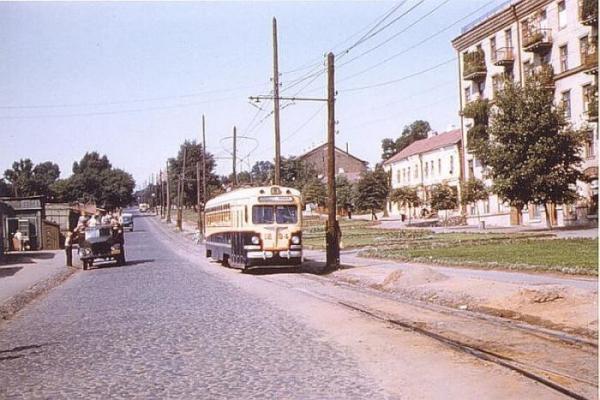
Uritskogo Street, 1959.
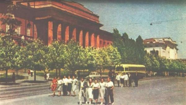
Shevchenko University and college students, 1957.
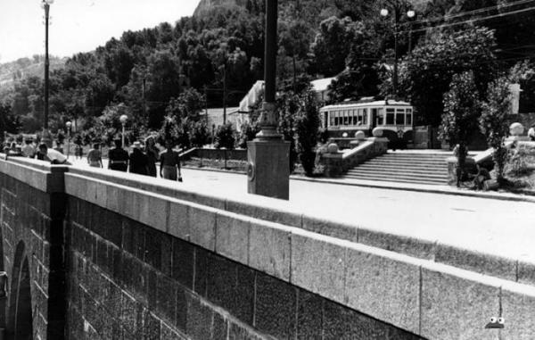
Dnieper embankment, 1955
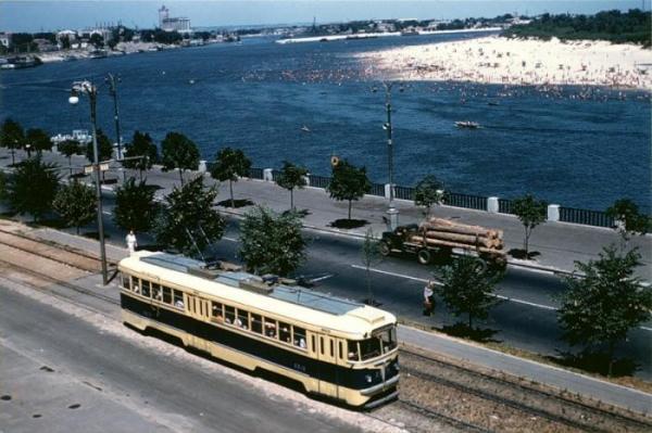
Dnieper embankment and Trukhanov Island, in 1957.

Shevchenko Boulevard, Fall 1941 (the current name of the boulevard is from 1919).

In these post-war population lived in dugouts Darnitsa, 1950

The Supreme Council, 1941

Rusanivka during the floods in April 1970

Vladimir descent, the end of the 1950s.

Post-war reconstruction of Khreshchatyk, 1950

In the background - under construction Circus (Victory Square), 1959

Dnieper embankment. In the place where the photograph visible support of the old Chain Bridge, Bridge Subway is now (early 1960s).

The area of the Lenin Komsomol (now - European area), 1950.

The same area in 1970.

Behind the photographer - metro Chernihiv, in December 1970.

Bereznyakov Buildings, view from the street of Enthusiasts, November 1967.

Cinema Kiev, the beginning of the 1960s.

German colonies on the corner of Krasnoarmeyskaya (now - Big Vasylkivska) and Zhylianska.

Khreshchatyk, 1944.

Leningrad area, in November 1958.

Metro Bolshevik plant (now - Shuliavska), 1962.

Paton Bridge, 1959.

Dnipro Embankment (now - quay highway), 1959.

Some park, I can not say more. So we rested our ancestors 50 years ago.

Crossroads of the Kharkiv highway and street Hasek, in August 1962.

Pl. Lenin Komsomol (now - the European Space), a view of the hotel "Intourist" (the modern name of the hotel - "Dnepr"), 1962.

The area of the October Revolution (now - Maidan Nezalezhnosti - Independence Square), in May 1985.

Victory Square, 1960.

Area Stalin in May 1947. In 1961 it will be renamed the Lenin Komsomol Square, and in 1991, already in independent Ukraine, returned to the area of one of its historical names - European (as it was called from 1851 until 1869).

Victory Square, 1961.

Prospekt Mira, 1963.

Prospect Mira to Leningrad area, 1959. On the left side of the fence these days is a department store (or already shopping mall) "Darnitsa».

The ruins of the Chain Bridge, 1943-44.

Near the University of Shevchenko, the intersection of the streets and Vladimir Tolstoy, 1978.

Fireworks over the footbridge, 1960.

Svyatoshin, 1959.

Social Advertising, 1970.

Dnipro metro station, 1965.

Komsomolskaya metro station (now - Chernigov).

Dnipro metro station, 1960.

University Metro Station, 1960.

Construction of the cinema Kievan Rus, 1981.

Construction of the subway station Dnipro, the end of the 1950s.

So in 1942, he looked the Dnieper embankment. Away - destroyed the Chain Bridge.

Darnitsa, 1967.

Such was the Dnipro metro station in the first 5 years of operation, in June 1961.

Area Kalinin, 1960. So in those days it was called the Maidan Nezalezhnosti.

So in the 1960s, was Victory Avenue.

Vladimir Street, Spring 1944.

The same Vladimir in summer 1959.

Street of the Comintern in 1959. Away - Central Railway Station.

Uritskogo Street, 1959.

Shevchenko University and college students, 1957.

Dnieper embankment, 1955

Dnieper embankment and Trukhanov Island, in 1957.
