1403
Unknown pyramids of Egypt
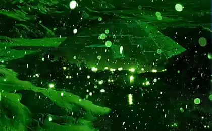
Infrared photographs taken by a satellite group of American scientists helped discover 17 previously unknown Egyptian pyramids. Technology infrared imaging from space is remarkable in that it allows us to identify objects hidden under the ground. As a result of this photograph in Egypt from outer space, scientists were able to find more than one thousand and three thousand tombs of ancient settlements.
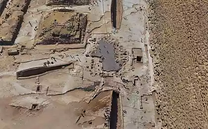
Archaeologists have already started to work on the spot "cosmic discoveries," and, according to preliminary data, confirmed the detection of already two previously unknown pyramid.
"Dig a new pyramid - the dream of every archaeologist," - said study author Sarah Parkak from the University of Birmingham, Alabama.
Scientists recognize that she was very surprised by what the rich results were obtained using infrared imaging.
"During the year we carried out a very intensive research. Of course, I constantly monitor the flow of information, but there came a moment when I suddenly realized how many things we found. I just could not believe that in Egypt found so many new objects ", - says archaeologist.
American experts have studied the images taken with the companion 700-km altitude. Cameras that were used at the same time, are so powerful that they can identify objects on the ground less than a meter in diameter.
In this case, infrared photography was used in order to distinguish between different materials under the ground.
"The Lost City of Egypt»
The thing is that the ancient Egyptians built their houses and other structures of mud bricks, whose density is much higher than the average soil. Therefore, in the pictures you can recognize the shape of houses, temples and tombs.
"It shows how easy it is to underestimate the size and scale of the ancient settlements" - said Parkak.
According to her, scientists expect many more discoveries. "This is only the objects located near the surface of the earth. But there are many thousands of others, who raised his Nile silt. Our work is just beginning, "- said the archaeologist.
Journalists BBC BBC went with Parkak to Egypt to see whether the excavation data collected using surveys from space.
In the documentary "The Lost City of Egypt" tells about her trip to one of the areas in the Egyptian village of Saqqara, the necropolis where the capital of the Egyptian Old Kingdom.
Egyptian authorities initially very skeptical about the research Parkak. But when the archaeologist said that she might have found two new pyramids, Egyptians began excavations and now consider them to be very promising.
However, according to the American archaeologist, was the beginning of the most exciting work in the city of Tanis.
"They have dug built three thousand years ago, the house, which was visible on satellite images - he says. - And pictures almost perfectly coincided with its outlines. It was a real proof of the effectiveness of the technology. "
