1460
In the Chinese desert found the giant figures
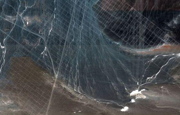
Recently, it was discovered the phenomenon has not yet received an explanation. Satellite Google Maps gave strange patterns in the Gobi Desert in China. Intricate patterns occupy a considerable area, and quite similar to other well-known figures on the ground, for example, the image in Peru Nazca. At the moment, it is difficult even to say what these patterns are applied, let alone argue about their destination. His versions offer both researchers and curious citizens.
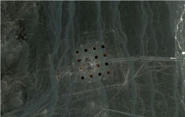
Unexplained figures are in northwest China, the Gobi Desert, on the border with the region of Xinjiang and Gansu Province. The size of the objects is very different. Some of the reach of 2 km in length and 1, 5 km wide, but others may be 1 - 2 km longer or wider.
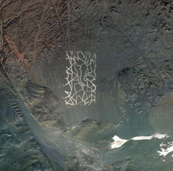
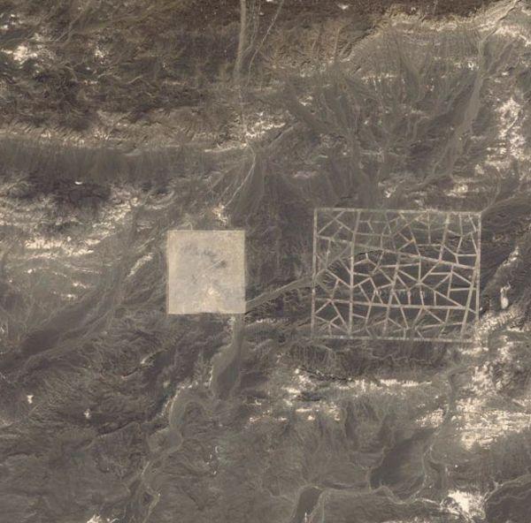
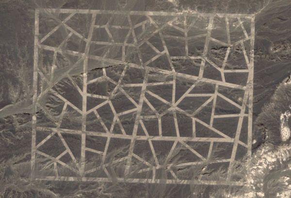
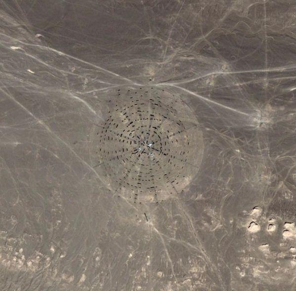
The structure of the image varies, too, that the more baffled researchers. They were found with square and rectangular patterns, something resembling a street map. Within the boundaries of the figures have been laid straight lines, like brochures and crooked curved - like mesh of alleys between them. It is not clear the appointment of image circle with lines radiating from the center. Another object, which caused even more problems were lines of small dark squares.
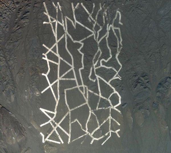
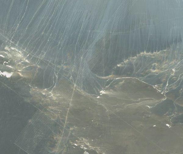
It is not clear how these images are applied to the soil. These pictures from the satellite, even at high magnification not give a clear picture. Some objects seem drawn, while others - probably dug as a shallow trench.
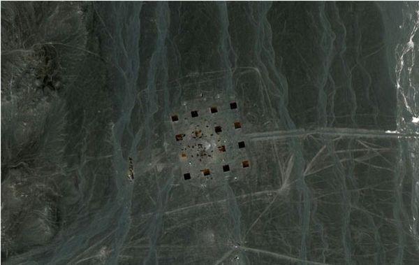
As for the theories of scientists the opinions are divided. Some insist that the images can not be of human origin. Comparative analysis with similar events, however, has not given any results. If Nazca lines evolved into certain patterns - birds, animals or intricate patterns with a clear structure, the Gobi line of form rather primitive image of simple geometric shapes. However, ufologists still convinced that it traces of aliens on Earth.
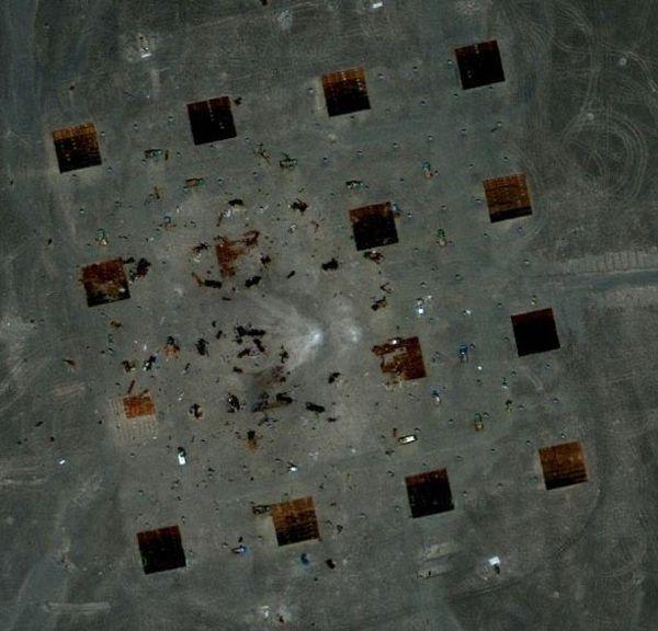
More followers gathered conspiracy theories. The fact that the figures are placed in sufficient proximity to the region of Xinjiang, where the military and space base, already suggestive. Many have begun to apply the image, reminiscent of the street maps of American cities. It is expected that China is preparing an air strike on the United States for conducting this exercise in the Gobi.
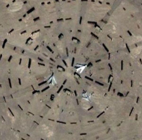
Repeated increase in the photos can be seen at the facilities located aircraft and burned cars. It's just more scare the public Internet, is actively involved in the discussion, causing mass panic messages about the imminent attack China.
Support for that version are that a few kilometers from the Jiuquan spaceport is drawing. It turns out that this scheme can be "ground - air" for the landmark Space Station. Despite the fragility, this version is a lot of followers.
However, a clear answer is no, and the objects have not been studied, so the new theory will still likely occur.
Source: www.utro.ru

Unexplained figures are in northwest China, the Gobi Desert, on the border with the region of Xinjiang and Gansu Province. The size of the objects is very different. Some of the reach of 2 km in length and 1, 5 km wide, but others may be 1 - 2 km longer or wider.

The structure of the image varies, too, that the more baffled researchers. They were found with square and rectangular patterns, something resembling a street map. Within the boundaries of the figures have been laid straight lines, like brochures and crooked curved - like mesh of alleys between them. It is not clear the appointment of image circle with lines radiating from the center. Another object, which caused even more problems were lines of small dark squares.

It is not clear how these images are applied to the soil. These pictures from the satellite, even at high magnification not give a clear picture. Some objects seem drawn, while others - probably dug as a shallow trench.

As for the theories of scientists the opinions are divided. Some insist that the images can not be of human origin. Comparative analysis with similar events, however, has not given any results. If Nazca lines evolved into certain patterns - birds, animals or intricate patterns with a clear structure, the Gobi line of form rather primitive image of simple geometric shapes. However, ufologists still convinced that it traces of aliens on Earth.

More followers gathered conspiracy theories. The fact that the figures are placed in sufficient proximity to the region of Xinjiang, where the military and space base, already suggestive. Many have begun to apply the image, reminiscent of the street maps of American cities. It is expected that China is preparing an air strike on the United States for conducting this exercise in the Gobi.

Repeated increase in the photos can be seen at the facilities located aircraft and burned cars. It's just more scare the public Internet, is actively involved in the discussion, causing mass panic messages about the imminent attack China.

Support for that version are that a few kilometers from the Jiuquan spaceport is drawing. It turns out that this scheme can be "ground - air" for the landmark Space Station. Despite the fragility, this version is a lot of followers.

However, a clear answer is no, and the objects have not been studied, so the new theory will still likely occur.


Source: www.utro.ru


