1218
Maps of the countries
Hopefully, some of these cards will surprise you and you will learn something new.
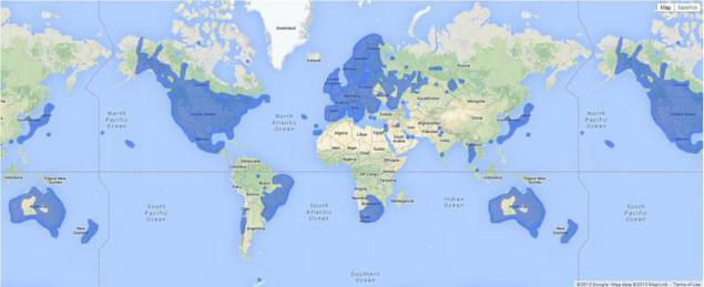
Countries where the service Google Street View is available
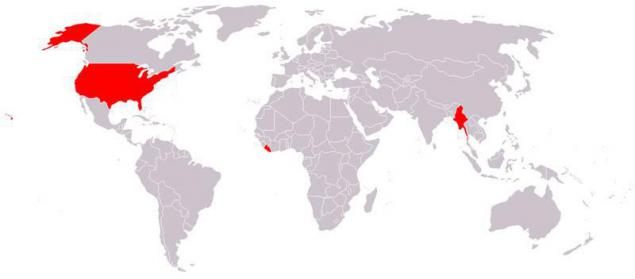
Countries that do not use the metric system
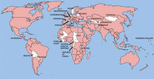
22 countries in which did not invade Britain (not shown Sao Tome and Principe)
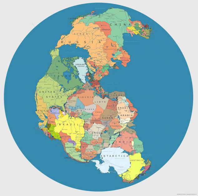
Map "Pangaea", depicting the territory of modern states
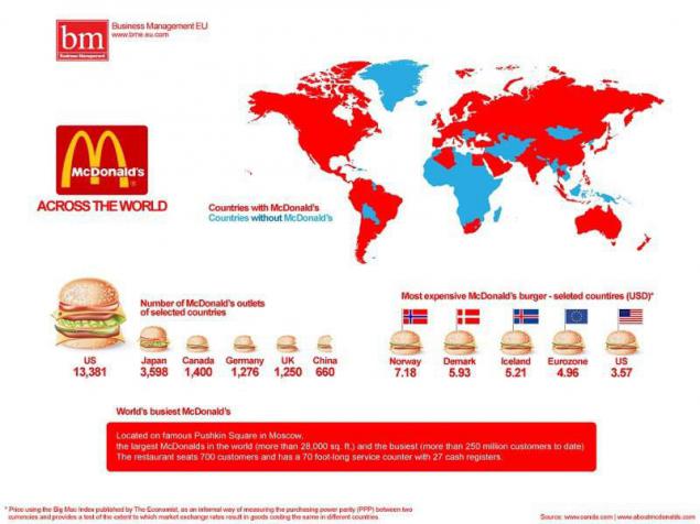
McDonald's worldwide
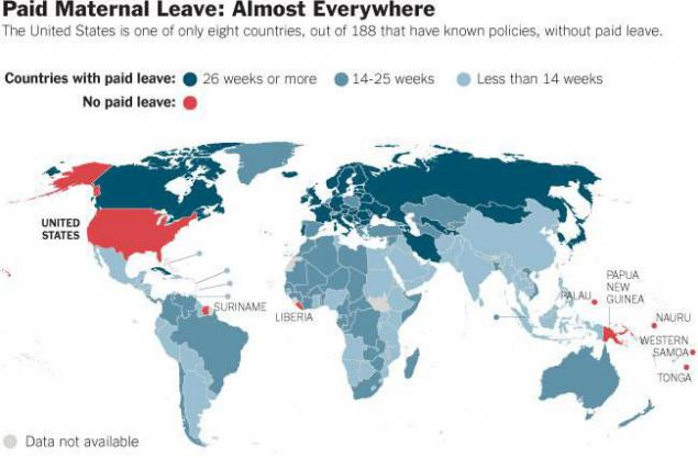
Paid maternity leave in the world (in red - is not paid)
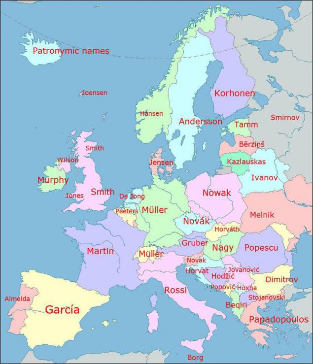
The most frequent names in Europe
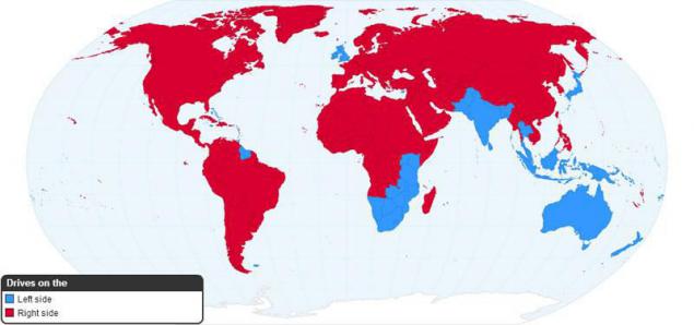
Right- and left-hand traffic in the world (the red-right-left blue)
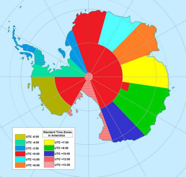
Map of time zones in Antarctica
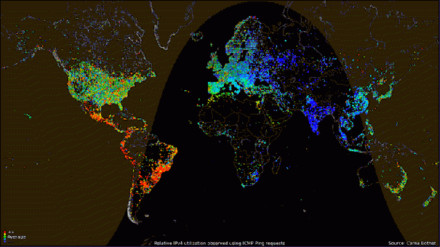
Using the Internet, depending on the time of the day
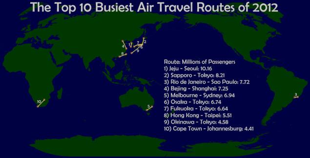
The busiest air routes in the world, 2012
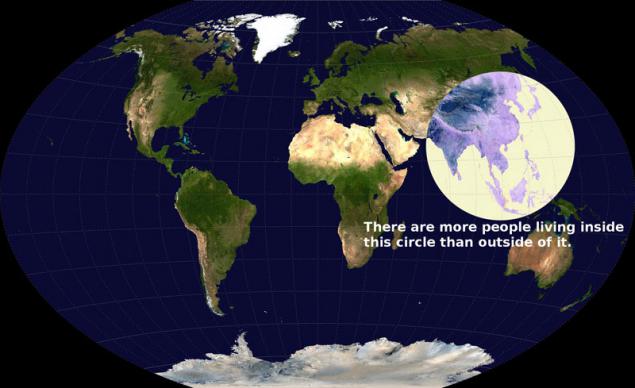
Visualization of global population density (in terms of people living longer than outside)
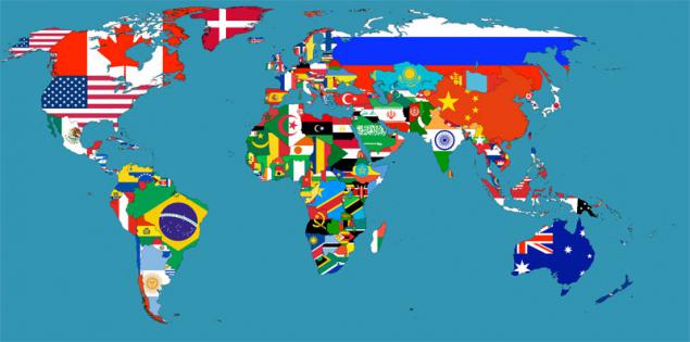
Flags of the World
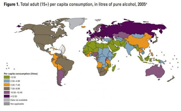
Map of alcohol consumption in the world
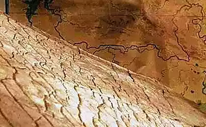
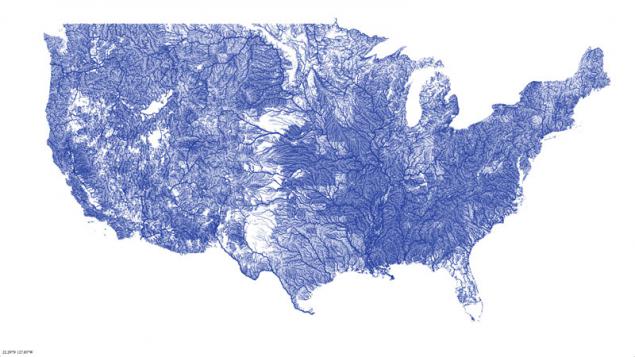
Map of rivers in the United States
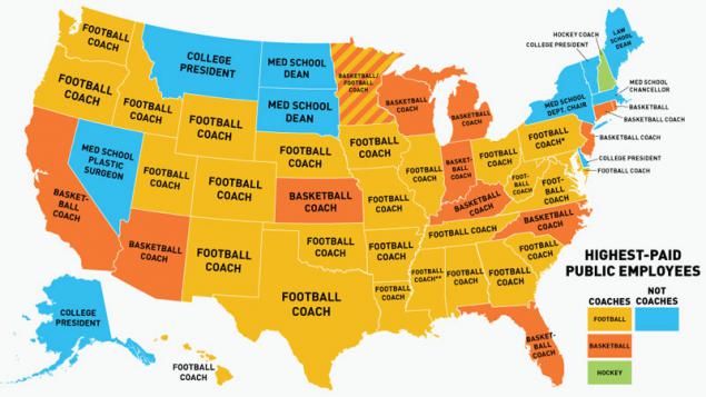
Map of the most highly paid professions in the US
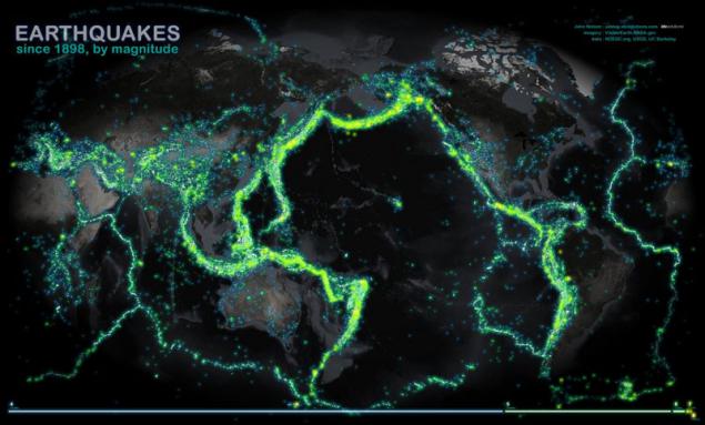
World Map earthquakes
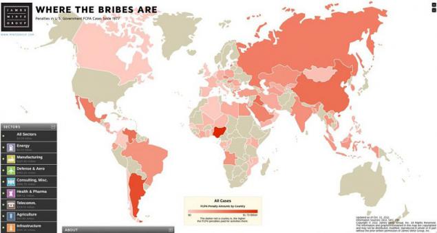
Map of the countries where they take bribes
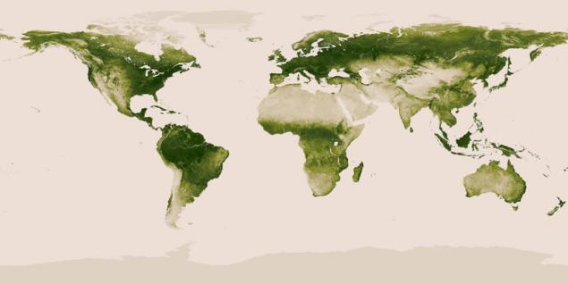
World map of vegetation on Earth
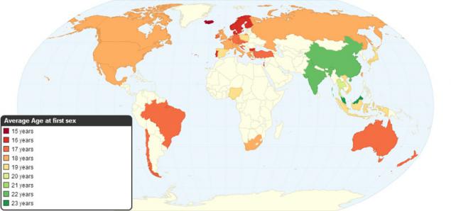
The average age of first sexual intercourse
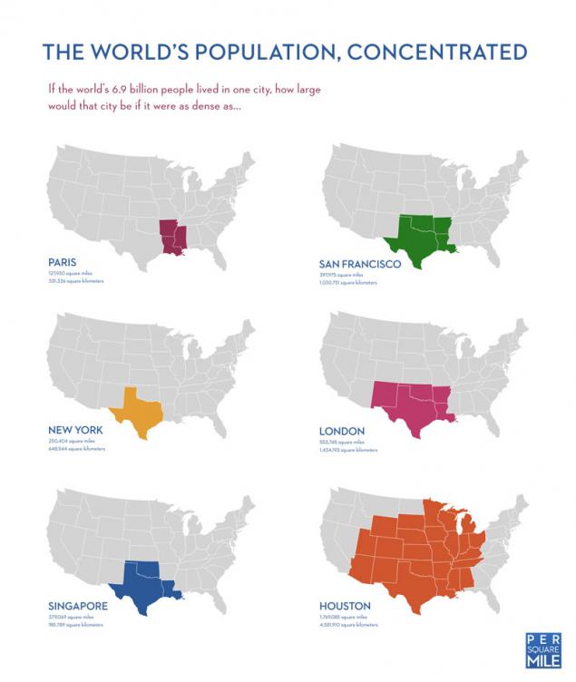
If the world's population lived in the same city
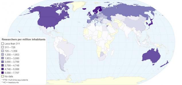
The number of researchers per million inhabitants
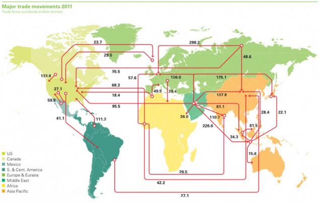
Import and export of oil
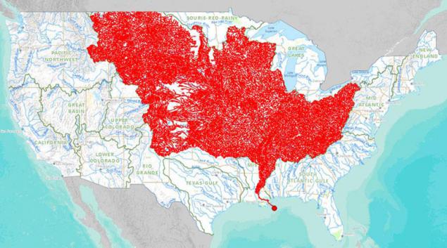
The rivers that flow into the Mississippi basin
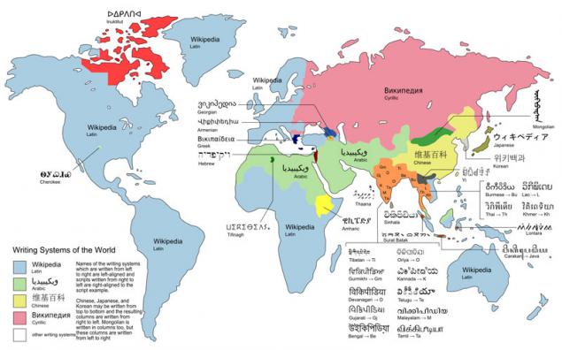
Style / font letter
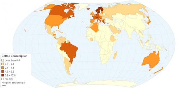
The annual consumption of coffee per capita
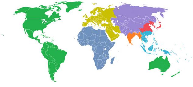
The world was divided into seven regions, each with a population of 1 billion
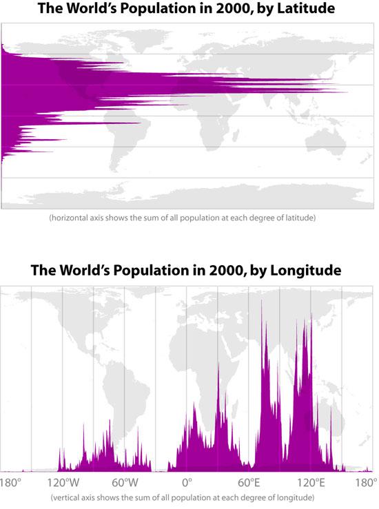
The population of the Earth's latitude and longitude
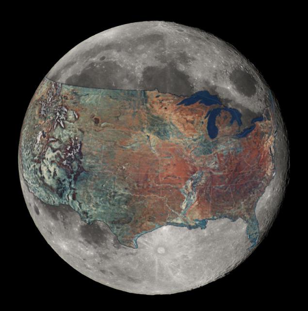
Map of the United States during the imposition of the Moon
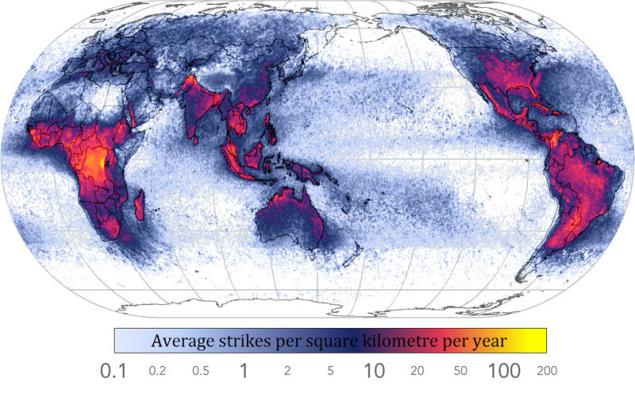
The frequency of lightning strikes worldwide
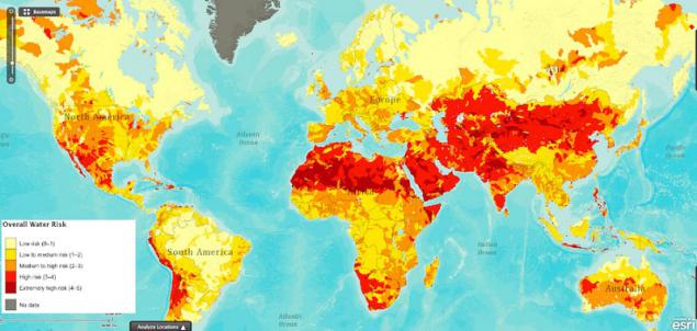
Map of global water issues
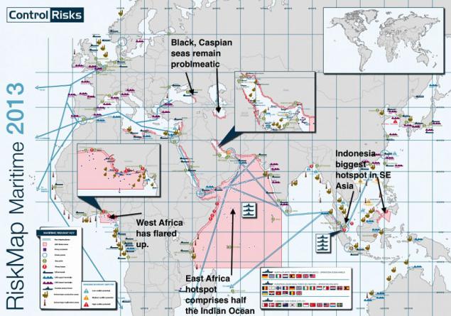
The most dangerous areas of the world
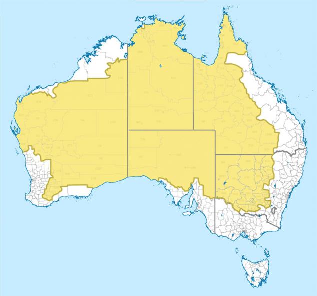
The population of Australia
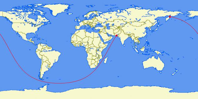
The longest direct route from Pakistan to Kamchatka (20,000 miles)
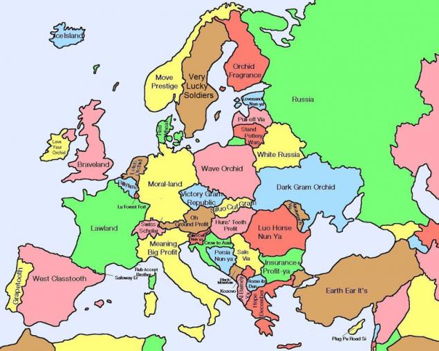
The literal translation of the Chinese name for the European
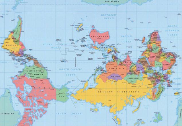
The world as it is seen by the Australians
Source: twistedsifter.com

Countries where the service Google Street View is available

Countries that do not use the metric system

22 countries in which did not invade Britain (not shown Sao Tome and Principe)

Map "Pangaea", depicting the territory of modern states

McDonald's worldwide

Paid maternity leave in the world (in red - is not paid)

The most frequent names in Europe

Right- and left-hand traffic in the world (the red-right-left blue)

Map of time zones in Antarctica

Using the Internet, depending on the time of the day

The busiest air routes in the world, 2012

Visualization of global population density (in terms of people living longer than outside)

Flags of the World

Map of alcohol consumption in the world

Map of rivers in the United States

Map of the most highly paid professions in the US

World Map earthquakes

Map of the countries where they take bribes

World map of vegetation on Earth

The average age of first sexual intercourse

If the world's population lived in the same city

The number of researchers per million inhabitants

Import and export of oil

The rivers that flow into the Mississippi basin

Style / font letter

The annual consumption of coffee per capita

The world was divided into seven regions, each with a population of 1 billion

The population of the Earth's latitude and longitude

Map of the United States during the imposition of the Moon

The frequency of lightning strikes worldwide

Map of global water issues

The most dangerous areas of the world

The population of Australia

The longest direct route from Pakistan to Kamchatka (20,000 miles)

The literal translation of the Chinese name for the European

The world as it is seen by the Australians

Source: twistedsifter.com
