853
Space Tunnels and iron on the head, or why do we need the cosmodrome "East"
The other day I was asked to advise the infographic RIA Novosti dedicated to the first launch from the cosmodrome "East". And there will be one major simplification due to the limitations of the material format. In fact, the cosmodrome "East" we need not for the fact that most of the civilian launches from the Baikonur is happening "Baikonur". But to explain why we need it, will have to explain why the spacecraft's orbit can be compared with the tunnel, as well as to explain that the "iron" falling from the sky, and on whom it falls.
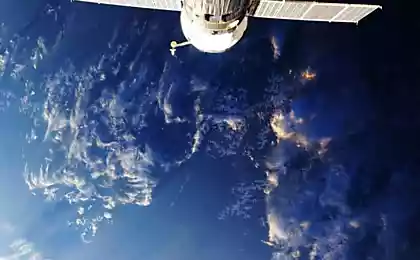
Tunnel in nebeFizika orbital movement totally intuitive. It is rather the opposite of what is currently an ordinary person. And even good movies, like striving for realism, give a completely wrong idea about how to fly satellites and spaceships. Remember "Gravity," which famously flew from the "Hubble" to the ISS, and then to the Chinese station? Even if we ignore the difference in altitude orbits, one parameter of the orbital motion kills even the slightest chance for such flights. This option is called "inclination»
The inclination of the orbit -. Is the angle between the plane of the satellite's orbit and the plane of the equator (for Earth satellite) 80,116,378
For example, in the case of "Gravity" is such a picture:
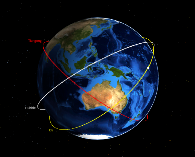
And the fact that the plane of the orbit is not the same - it does not matter. The real problem is that a low circular orbit (a "Hubble", ISS, "Tiangong" and lots of other satellites - is a low circular orbit) change mood very expensive. In order to "rotate" the orbit of 45 ° we will have to change its speed about 8 km / s, as much as we needed to enter into orbit. A rate of change - it's a waste of fuel and discharge stages. That is, if a rocket weighing 300 tons into orbit 7 tons, after the change of inclination of 45 ° will be a total of 150 kilograms. In fact, each orbiter flies within an invisible tunnel, the diameter of which depends on its ability to change its speed. Therefore, the launch of their satellites try to withdraw immediately to the desired inclination.
The beaten track for some inclination is used for existing orbiters? Now a lot of satellites in Earth orbit:

If you look closely, you can see that on some orbiting satellites more. Here is a picture showing the movement of the satellites relative to the Earth:
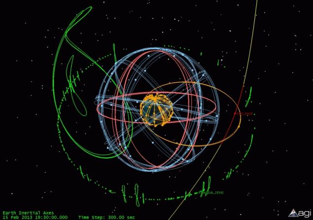
Geostationary orbit (green). This circular orbit with a height of 36 000 km and an inclination of 0 °. Sputnik on it is over one point of the earth's surface, so the picture is correct geostationary orbit indicated by a green dot. Green loop - is broken satellites or those in which the fuel is over. Geostationary orbit is a disturbance of the moon, and to spend the fuel just to stay in place. On this orbit inhabited by telecommunication satellites, which make a profit, so the free space on it is difficult to find.
The orbits of GLONASS / GPS (blue and red). These orbits have a height of about 20 000 km and an inclination near 60 °. As the name implies, they are navigation satellites.
Polar orbit (yellow). These orbits are the inclination in the region of 90 ° and usually not more than the height of 1000 km. In this case, the satellite will fly over the poles of each turn and will see the entire territory of the Earth. A separate subspecies of these orbits are sun-synchronous orbit with an altitude of 600-800 km and an inclination of 98 °, at which the satellites fly over different parts of the Earth around the same local time. These orbits in demand for weather, mapping and reconnaissance satellites.
In addition, it should be noted the ISS orbit with the altitude of 450 km and an inclination of 51, 6 °.
Heartless geografiyaNu well, with inclinations we have understood, the reader will say. And where does the spaceport? The fact that there is such an unpleasant physical law:
The initial inclination of the orbit can not be less latitude Baikonur Why is it.? Everything becomes clearer, if you draw a path on the Earth's satellite map:
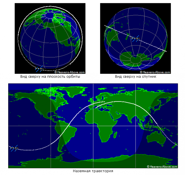
If we started from Baikonur, will begin to be dispersed to the East, you get an orbit with an inclination of Baikonur latitude, 45 ° (red). If we begin to accelerate to the northeast, the most northern point of the orbit is to the north of Baikonur, that is, the inclination will be more (yellow). If we try to cheat and start to accelerate in the south-east, the resulting orbit will still be the northernmost point north of Baikonur and, again, the greater the inclination (blue).
But such an orbit is physically impossible because it does not pass through the center of mass of the Earth. More precisely, it is not possible to fly with the engine switched off. You will be able for a time to be on such an orbit with the engine, but the fuel will end very quickly.
Thus, if we want to launch satellites into geostationary orbit from the equator not, we need to somehow reset the inclination of the orbit, consuming fuel. These costs and explain why one and the same rocket "Soyuz-2.1a" successfully launches satellites into geostationary orbit from Kourou near the equator, but is not used for these tasks from Baikonur.
Russia - a northern country. And if the polar orbit and the orbits of the GLONASS can safely launch satellites from Plesetsk, which is located at a latitude of 63 °, then to the geostationary orbit closer to the south is the cosmodrome, the better. And here comes into force the second problem - not every area is suitable for the spaceport
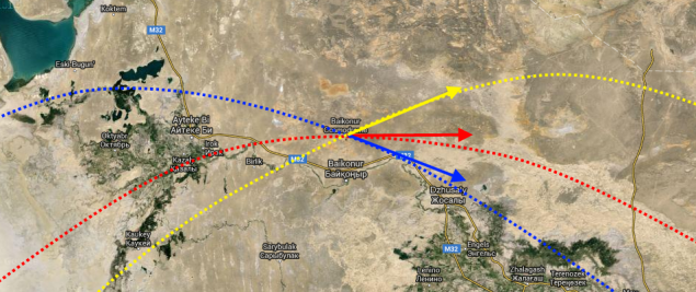
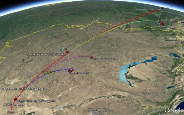
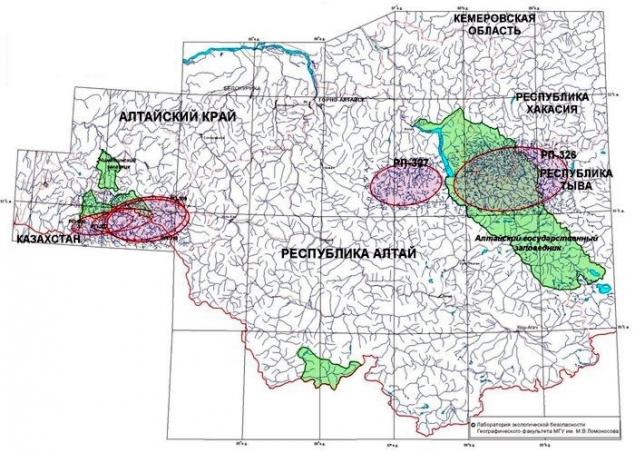
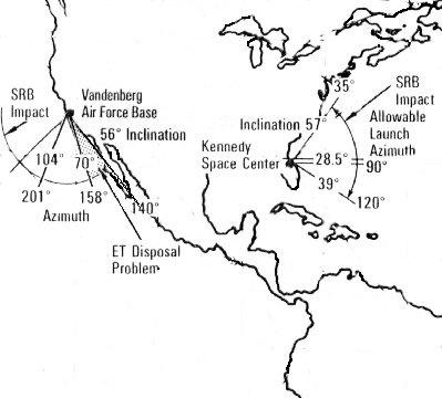
steps of kumpoluVse modern missile at the satellite launching dump the waste stage and payload fairing that fall to Earth.. If the crash site is in another country - you have to agree with that country on each launch. Therefore, for example, the minimum inclination of the Baikonur cosmodrome is not 45 °, and 51 °, because otherwise the second stage will fall in China:
And in the place of the first stage of the fall is necessary to negotiate with Kazakhstan and to pay for the use of these areas. Sometimes there are problems, and the satellite launch is delayed. Districts have to fall to alienate rather big:
And a good place for the spaceport is not in the European part of Russia. I played with cards, the Caucasus can dodge and try to run from the area of Mozdok, and then have to try to get the second stage did not fall in Kazakhstan. If a missile launch from the Crimea, the first stage will fall in populated areas near Rostov-on-Don, and the second stage will again fall norovit in Kazakhstan. And that's not taking into account the problems with infrastructure in both versions. Against this background, look at the available inclination US spaceports and regret about the heartlessness of physics and geography.
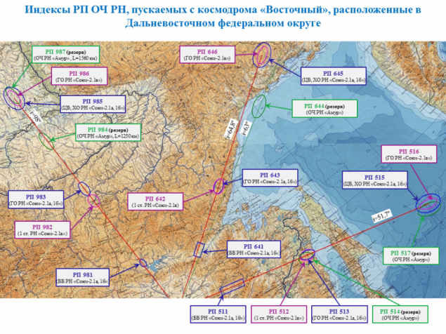
But we also have the east coast. And, if we place the spaceport there, it will be possible to find a dull areas to drop waste levels for the most popular inclinations: 51, 6 ° (on the International Space Station and geostationary orbit), 64, 8 ° (GLONASS, some Earth-sensing satellites), 98 ° (polar orbit).
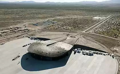
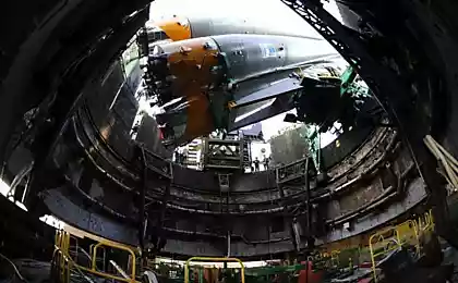
again tezisnoKosmodrom East will enable us to launch payloads into geostationary orbit and the ISS without the need to harmonize these launches with other countries and pay them for the use of exclusion areas. It is located in the southern part of the country and provides the initial inclination of the orbit is not worse Baikonur. The launch complex for the new launch vehicle "Angara" irrational building in Baikonur (again, matching starts and impact areas), but from the East it will provide not less load.
Nice detail: the new launch complex with a tower service in Kourou, will run the western payloads that must be installed on the launch vehicle in an upright position
. The bonus also are infrastructure development, boost the development of the territory, and other science town.
Source: geektimes.ru/post/274797/


SpaceX will try again to put the Falcon 9 stage of an offshore platform
Pip-boy in reality: the computers on the forearm