988
Concrete navigation arrows
When landing somewhere in Utah or Wyoming, on the ground you can see that's such a huge boom. This boom was not alone, hundreds of them, each up to 25 meters in length! From the West Coast to East.
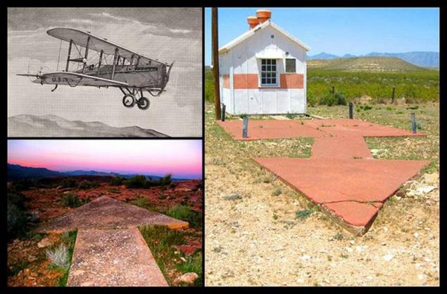
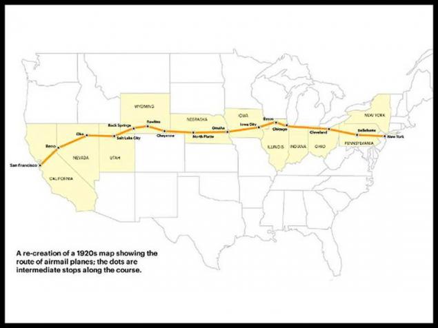
An explanation of these simple arrows: August 20, 1920 in the United States began its work airmail. Since then aviation charts really was not, so we had to fly through the ground reference, making air travel in bad weather (even just a night) is almost unreal.
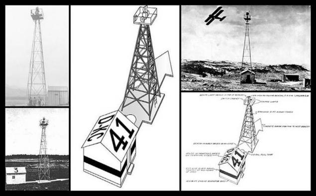
But the United States Postal Service has found a way - has created a network of ground-based visualization, which includes lighthouses spotlights capacity of 1 000 000 cd and concrete arrows every 10 miles. How it looks:
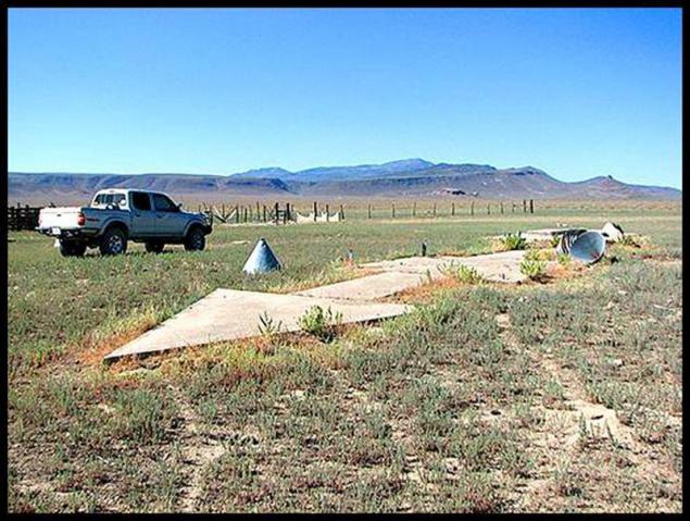
After 20 years, this system has ceased to exist and the towers were melted down for the needs of the military industry, but arrows remain.
For comparison: in 1927 the airline Imperial Airways for the same purposes ditch used continuously over several hundred kilometers away, which had been dug in a deserted desert between the cities of Cairo and Basra.
Source: engineering-ru.livejournal.com

An explanation of these simple arrows: August 20, 1920 in the United States began its work airmail. Since then aviation charts really was not, so we had to fly through the ground reference, making air travel in bad weather (even just a night) is almost unreal.

But the United States Postal Service has found a way - has created a network of ground-based visualization, which includes lighthouses spotlights capacity of 1 000 000 cd and concrete arrows every 10 miles. How it looks:

After 20 years, this system has ceased to exist and the towers were melted down for the needs of the military industry, but arrows remain.
For comparison: in 1927 the airline Imperial Airways for the same purposes ditch used continuously over several hundred kilometers away, which had been dug in a deserted desert between the cities of Cairo and Basra.

Source: engineering-ru.livejournal.com