709
10 facts about the study of our planet through space
If you are concerned about the possibility of appearing on Google Street View images or panoramas Yandex.Cards, relax: there are many other ways to shoot you from orbit during a scientific research. It becomes even a little scared of how scientists and astronauts can tell us about our planet — and us — from a distance of many kilometers.
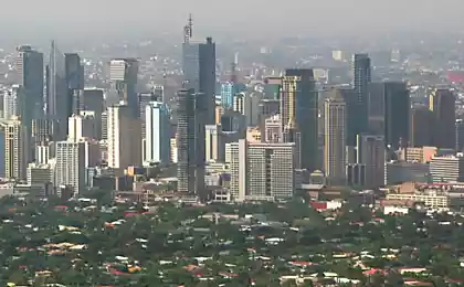
Energy use festive света
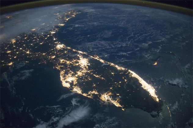
Perhaps you could guess that NASA scientists enjoying the beautiful festive lights of the city. But they not only enjoy them, and find them to good use.
Over the past few years, scientists at NASA, using satellite images, has created a worldwide picture of who a holiday celebrated — and you'll never guess why. During the holidays people deviate from their normal patterns of behaviour. They go out more, sit up late and burn more electricity than usual, which greatly affects the world's energy use.
To obtain an accurate picture of this light turned out to be surprisingly difficult. In 2011 was launched a satellite that could detect such a weak light that lit somewhere in private homes off the coast of Africa. And the same satellite can also understand the amounts of data that come from the most populated areas of the world. After the first year of data collection, scientists have understood that I can tell what countries celebrate what the holiday is.
Analysis of the increased use of energy leads scientists to other thoughts like determine the level of carbon emissions as it changes throughout the year and oscillate as the energy needs of the people. Sometime this data can lead to more effective ways of using energy.
Measurement of salinity океана
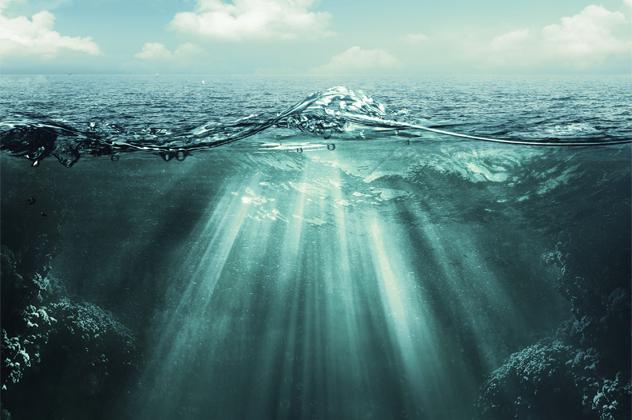
With the launch of the Aquarius satellite, NASA gets a completely new picture of the levels of salinity of water on our planet. Aquarius is 650 kilometers above the planet and revolves in a pattern that covers the entire Earth every seven days. Being able to measure salinity of water with incredible accuracy, the satellite has already collected a staggering amount of data for the first two months of work — more than we've collected over the past 125 years.
The picture that he created that allows scientists to track not only the salinity level of the ocean, but streams, to monitor the melting of glaciers and the influence of water movement on the ice cap. The satellite is also kartografie freshwater flow, allowing scientists to look at how mixed two different types of water.
Launched in 2011, the satellite cost NASA $ 400 million. After twenty years of construction and design of a small spacecraft finally rose over the vast waters of the earth.
Space парфюмерия

When it comes to using science for awesome, innovative discoveries that change our lives for the better, the last thing you think about is the creation of a new kind of perfume. Unless you work for the perfume manufacturer International Flowers & Fragrances.
In 1998 they teamed up with NASA to create a special kind of greenhouses for growing flowers in the space. They Packed the plants that we used to see on Earth, but after rose spent 10 days in space, she returned with a surprisingly different scent. It all depends on the environment of the plant, since depending on it it produces essential oils, which give them a special smell. On Earth, these oils are produced for pests or pollinators, but in space they simply do not.
According to scientists, the rose that they got into space, had a stronger scent than its earthly counterparts. Aromatic molecules are taken into space roses were then integrated into a new perfume. The company continues to send into space the plants, trying to develop a great new perfume.
The observation of white медведями
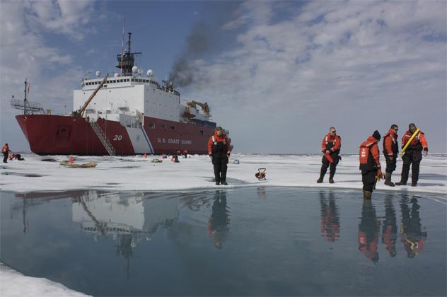
Even today, the Arctic climate poses several challenges for researchers who have to work in sub-zero temperatures. They are so severe that some scientists believe that it is easier to observe the Arctic from space.
In particular, scientists are trying to determine what impact the loss of Arctic ice affects wild animals which survive on the ice. Maintaining accurate data on how many individuals remained in the wild populations can be difficult, but thanks to satellite technology, scientists can accurately know and see how many white bears and where to move.
The original data were collected throughout the canadian Arctic, where there are a variety of organizations — from the Bureau of ocean management from the University of Minnesota using satellite imagery to record about bears. It was not so simple: scientists need visual confirmation that the spot on which they look, are really polar bears. But after they saw this, they were able to compare visual data with satellite imagery and to monitor the activities of wild animals which otherwise would have been impossible to observe.
Measurement гравитации
The mass of the planet is impermanent, if you measure it at different points, and that means that gravity also changes depending on where you are in the world. Most noticeable at the poles, but gravity fluctuates everywhere. Here comes to the place of measurement GRACE. Launched in 2002, the GRACE satellites have spent my life mapping the gravitational field of the planet and its changes for many years. This project requires two identical spacecraft equipped with GPS technology which could measure the gravitational effect of the planet on them.
At first glance, doesn't sound like it can measure a lot. But the gravitational force is incredibly delicate, and scientists can arrive at a clearer picture of how earth events like the melting of the glacier or its shear can change the gravity of the planet. It also allowed them to begin construction of accurate maps of the ocean bottom, which is based on the interaction of underwater mountain ranges and gravitational forces. Upon completion, these data will reveal the scheme of the geographical changes of the Earth and in turn how this affects oceanic flows on the surface and in deep water.
Cartography humidity почвы
In January 2015, NASA launched the Observatory Soil Moisture Active Passive (SMAP) in a three-year mission to gather data about the soil of the planet. No matter what the weather is at its height of 9 kilometers will fly the satellite, its instruments can measure the moisture of the upper 5 cm of soil in any part of the world not covered by water.
SMAP will record a lot of data from orbit, as it can measure the water in the soil, in plants and in parts of the roots. On a larger scale, the satellite will also be able to tell where the ground is frozen, although not able to measure the ice.
The satellite will travel from pole to pole every 98 minutes, passing and mapping the same area every two to three days creating an extremely detailed map of the changes of soil conditions over many years. The effect can be incredible because it will allow scientists to predict weather conditions to determine the best time for growing, harvesting and sowing crops, to predict storms, rainy seasons and changes in weather conditions. Having obtained annual data, they will also be able to analyze changes in the weather from year to year, as well as to suggest bad years for the harvest.
Three-dimensional mapping лесов
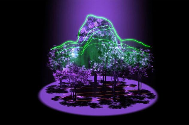
Not so long ago the green light he received the project of the University of Maryland, which will deal with NASA, the Global Ecosystem Dynamics Investigation, or GEDI. After starting GEDI will be able to create incredibly detailed three-dimensional images of the planet's forests.
The project will include a series of optical sensors and lasers that will Shine through the forest crown and be reflected into space. The time needed to return reflections, along with any interference, which will meet on your way will be transformed into a map of the forest below. The plan is to use 16 billion laser pulses every year to display each forest in temperate and tropical latitudes of the planet. These cards will be so detailed that project managers believe they will be able to estimate the age of each tree in each forest.
The satellite will be able to tell the crone of trees, what is its thickness and looks like the forest itself. This, in turn, will be displayed on a detailed map, however, as climate change and deforestation change of forest cover of the planet, how much carbon is stored in trees in the world and how healthy are the forests from the point of view of biodiversity and the presence of animals.
ECOSTRESS
ECOSystem Spaceborne Thermal Radiometer Experiment (ECOSTRESS) is one of the NASA projects that are currently in the early stages of development, and its ambitious goal is to track the health of plants around the world. The satellite will be capable of conducting high frequency measurement with high resolution, which show how much water you lose plants, together with evaporation from the soil. It will also monitor the temperature of individual plants worldwide, measuring heat the surface of the planet relatively heat signatures of specific plants.
Since all plants need a certain amount of water for survival, information of the satellite will be able to identify the problem before the plants actually begin to show signs of stress related to lack of water. Scientists who monitor the data, will be able to see crop failures even before they happen, and drought conditions before the plants are affected. Most importantly, they will be able to do something, before the plants begin to die.
The satellite will pass through the same area over the four days, making a constantly changing map of the households and gardens and state of the ecosystem. Ultimately, scientists hope to be able to convey this information to the farmers to do the best elections concerning the irrigation of their crops. In many areas there are serious differences regarding opinions as to water use, and ECOSTRESS will be able to draw a General picture of the water cycle of the planet, to help maximize efficient use of water and crop quality.
Map just high разрешении
ASTER — long joint project of NASA and the Ministry of economy, trade and industry of Japan — is part of the mission, another satellite, originally launched in 1999. ASTER makes incredibly high-quality images of everything on the planet, and watching some very interesting things.
One of the most interesting uses of photos, taken by ASTER, was archaeology. High resolution images revealed such things as fossils, bones and stone tools at Olduvai gorge in Tanzania. Estimates are that these fossils belong to the earliest human civilizations in history that lived back 2.1 million years ago. The area that was excavated in the 1930-ies, also hides the oldest fossils of man.
Data from ASTER, show an incredible variety of amazing natural phenomena. ASTER predicts a volcanic eruption signaled the beginning and spread of forest fires, the creation of the lava lakes, massive changes in the landscape due to erosion, sea level rise and deforestation. His data also help to monitor protected areas like national parks and reserves.
Mapping of the earth воды
USA, Canada and France are cooperating in the framework of the project on creation of a map of the world waterways, which promises to be ridiculously accurate. Mission Surface Water and Ocean Topography (SWOT) began in 2007 with the aim of creating a global picture of the world of water.
The satellite made a map of the 90% of the world's water, by reading the surface height with a precision up to 0.8 cm. This provides an unparalleled look into ocean currents, which we, until now, knew next to nothing. Until recently most of our knowledge about the oceanic streams were born in the process of monitoring the movement of debris, but with the SWOT program, scientists can compare images of oceanic flows in real-time with other data like weather conditions, to provide a complete picture of how to change the water of the planet over time.
He will also be able to provide new information about freshwater water is essential for all parts of our world. The amount of data collected by satellite, very impressive — and he will help us to predict the behavior of weather to oceanic travel and navigation became more effective and safe. published
Source: hi-news.ru