637
10 charts that prove that our planet is still a lot of open space
People are distributed on the surface of the earth is so uneven that it can capture the imagination. The reason for this is often the landscape that makes some areas unsuitable for settlement.
Of course, if on the planet, enough space for ten billion people — it does not mean that it has enough resources for all of them. The main purpose of these cards is to show you how different the reality from our perceptions of the world.
The editors of the Website received a dose of wonder once again.
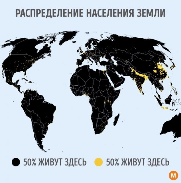
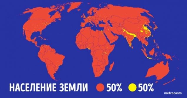
Look at this map: the areas marked with yellow circles, living the same people as the rest of the land.
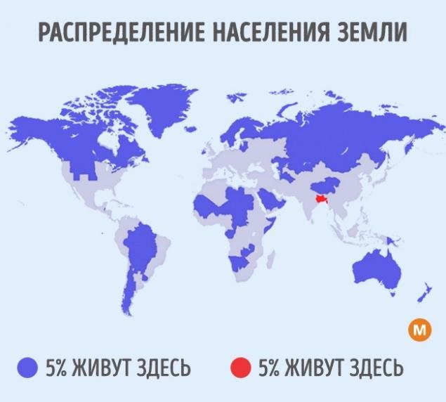
And this map shows the ratio of the density of inhabitants on the other side of our planet. Hard to believe, but over large areas, which are marked in blue, lives only 5 percent of the population of the whole Earth. Even more strange is that the other 5 percent live on a small "piece of land", marked in red.
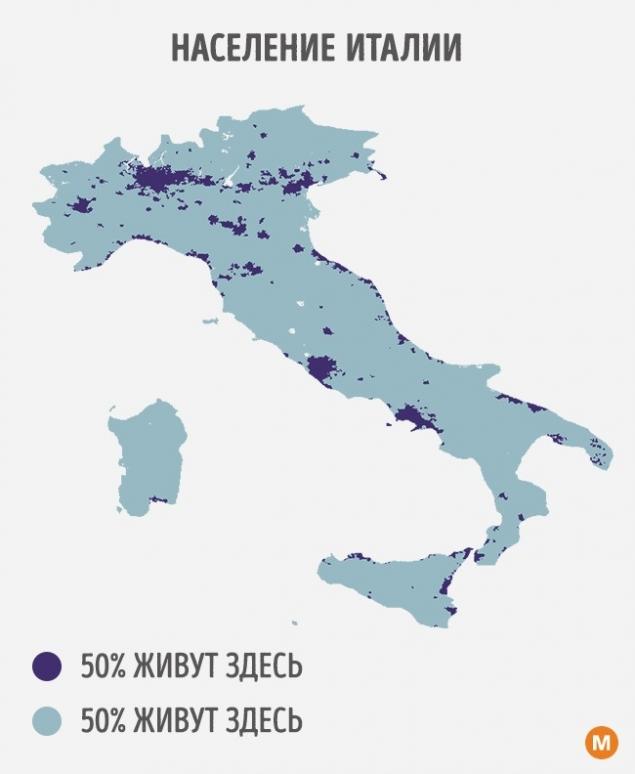
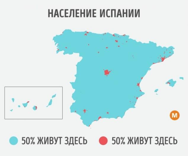
This map shows that half of all residents of Italy is home to only 8 percent of the country. The main reason for this is that the Central part of the Peninsula is mountainous.
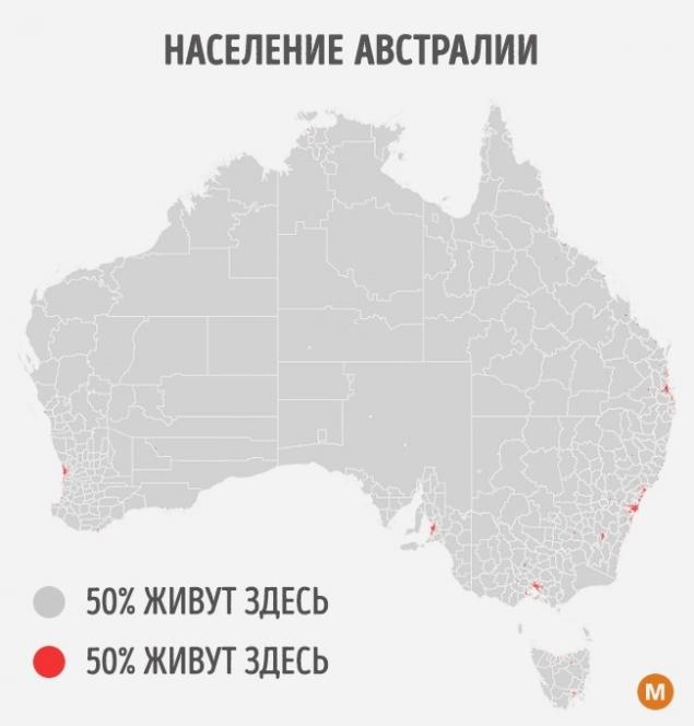
In Australia the situation is even more unusual: about 11 million people (half the total population) "huddles" on a tiny, in comparison with the rest of the mainland sites.
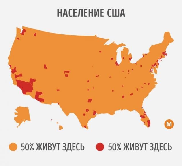
Half of the US population settles in large cities, which are distributed throughout the country. The great red spot is California, the most populous state.
About 90 percent of the country's area is mountainous, so the population are only 10 percent.
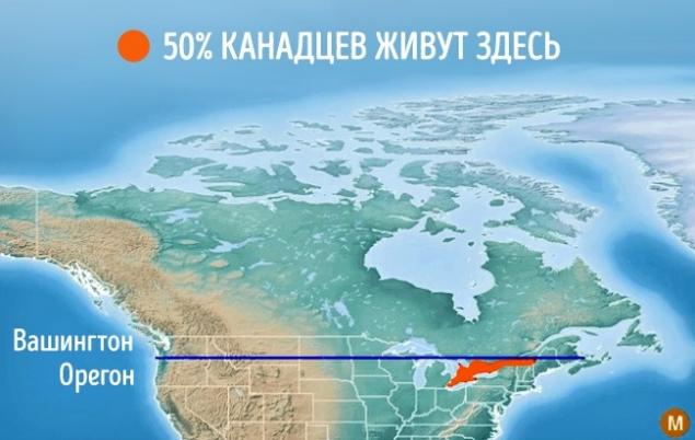
Historically, the border between the United States and Canada ran along the 49th parallel. But half of Canadians live South of that line — on the same latitude as Oregon.
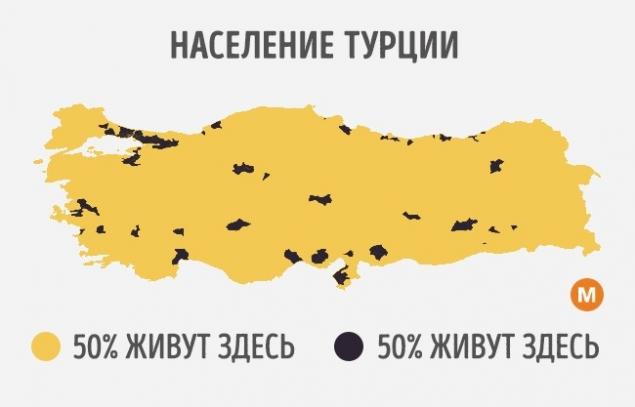
Terrain Turkey consists almost entirely of mountains and plateaus that were poorly suited to the construction of cities. Therefore, a map of the distribution of the population has such a point.
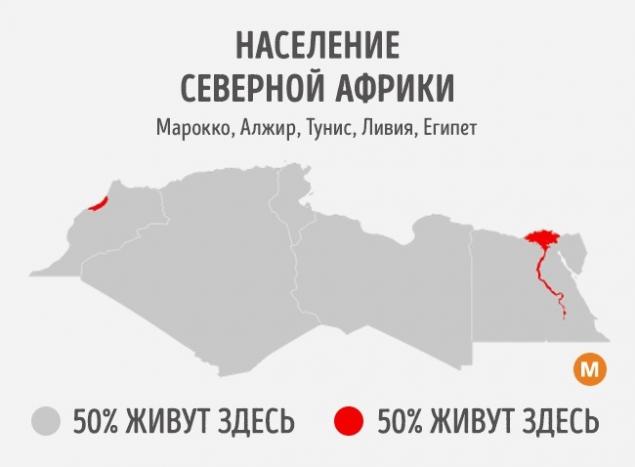
The Sahara desert is one of the most desolate places on the planet. It occupies most of the North African region. The two red areas that you see on the map, is the largest city of Morocco is Rabat and Casablanca — with the suburbs as well as the area along the Nile river in Egypt.
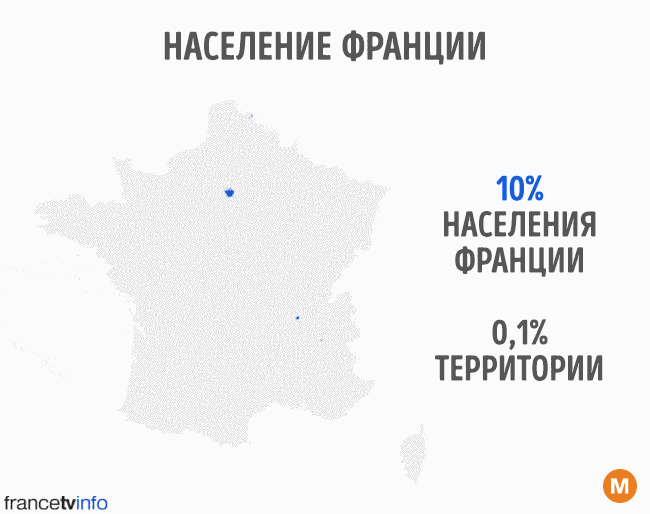
And on this animated image, a few maps combined into one. They show how the territory is 10, 20 and more percent of the French population. This is one of the few countries that are populated almost completely.
Photos on the preview metrocosm
According to the materials metrocosm
See also
20 cards that reveal the world from a new angle
16 maps that will change your view of the world forever
via www.adme.ru/zhizn-nauka/16-kart-kotorye-izmenyat-vash-vzglyad-na-mir-navsegda-1331165/


Why is yawning so damn contagious
Useful crib, once and for all to understand the icons car dashboard