1763
Different boundaries
The boundaries of states - not just a dotted line on the map of the world. In reality, many governments are making every effort to cross the border of their state was impossible. But not all
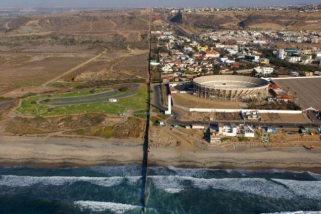
USA (right) and Mexico (left).
And then you yourself would not have guessed.
Sweden and Norway

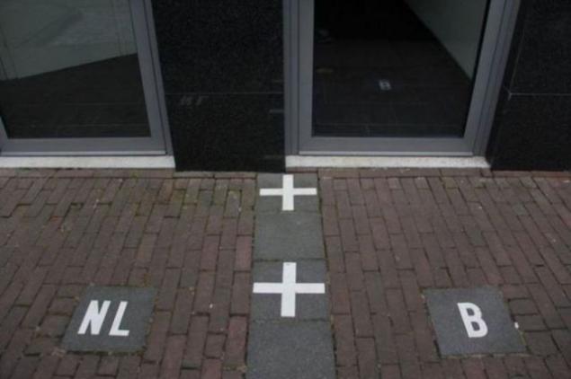
The Netherlands and Belgium
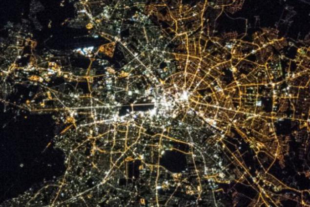
Former East and West Berlin
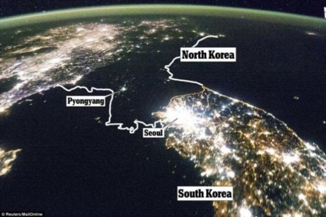
North and South Korea
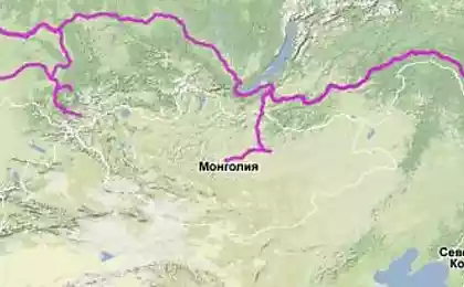
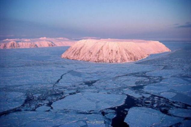
Russia and the United States.
Diomede Islands. Western (Russian) is located just over
4 kilometers from the eastern (US),
but the time difference between them is 21 hours.
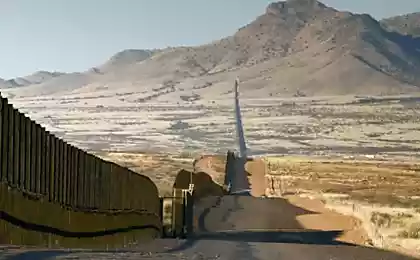
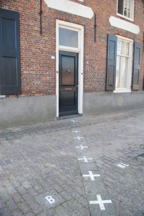
US and Canada
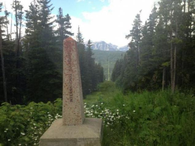
The border runs through town of Derby Line, sharing some of the buildings on the US and Canadian territory
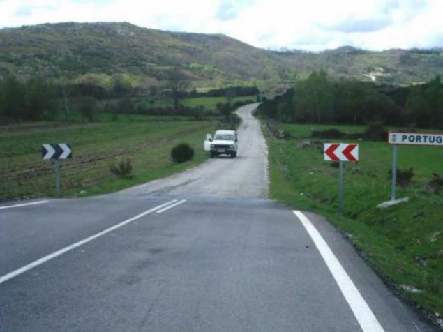
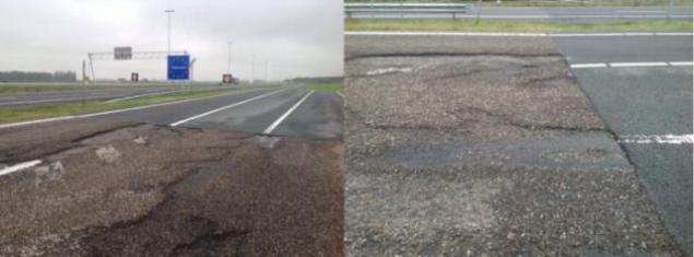
Spain and Portugal.
Compare the quality of roads
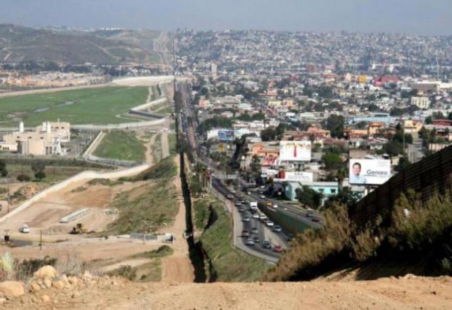
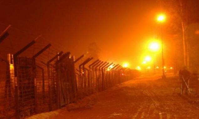
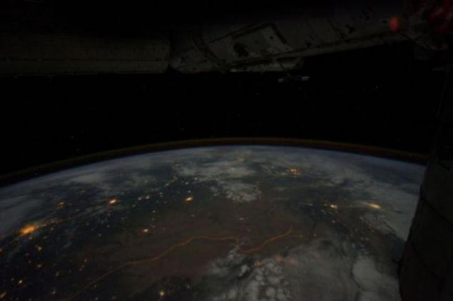
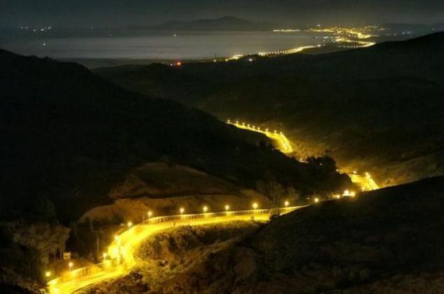
India and Pakistan.
Bright orange spotlights illuminating the border, clearly visible from space
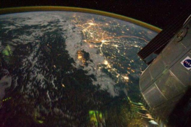
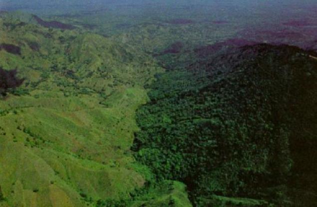
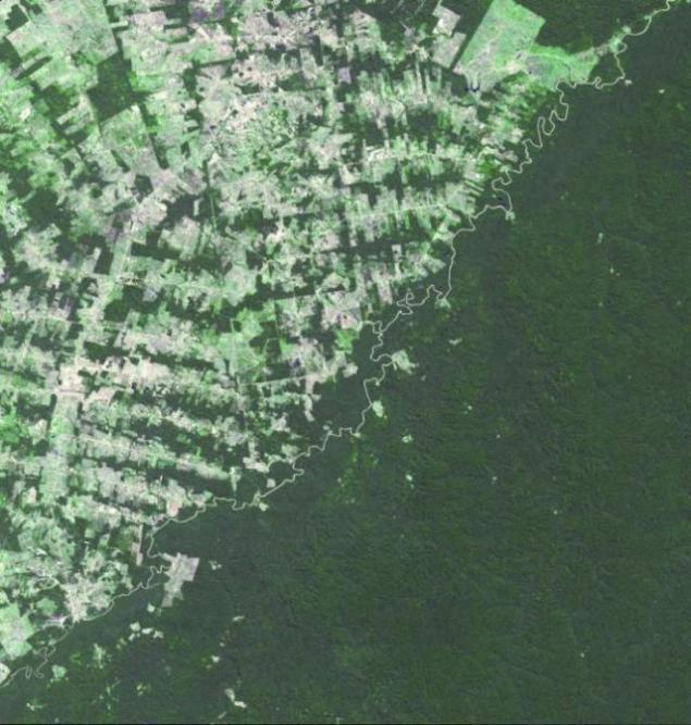
Haiti and the Dominican Republic
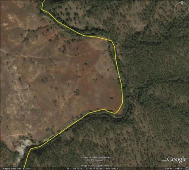
In Haiti is practically no control over deforestation, while in the Dominican Republic forests protected
Poland and Ukraine
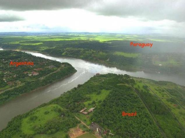
Argentina, Paraguay and Brazil
China and Macau
In China, the right-sided traffic and Macau (former British colony) - left hand.
Therefore the border crossing here can give you a lot of inconvenience.

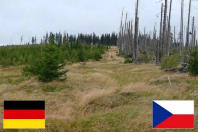
Germany and the Czech Republic

Germany and Poland.
The border on the Oder River
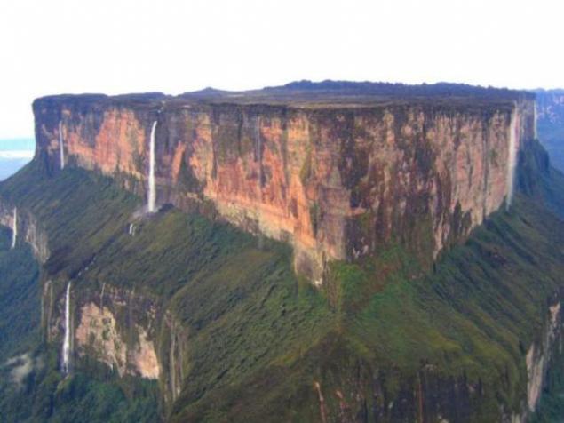
Venezuela, Brazil and Guyana
Roraima (mesa), over which hangs a large cloud constantly,
separates these three states
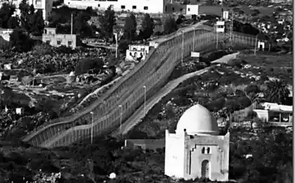
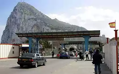
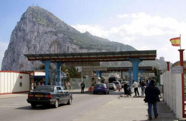
Spain and Gibraltar
Belgium (left) and the Netherlands (right)
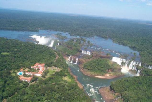
Argentina (left) and Brazil (right)
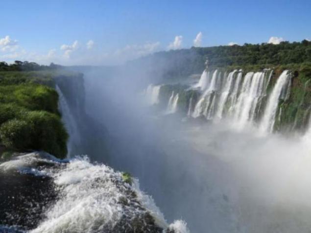
The border runs along the Iguazu Falls
Brazil (left) and Venezuela (right)
Germany and the Czech Republic
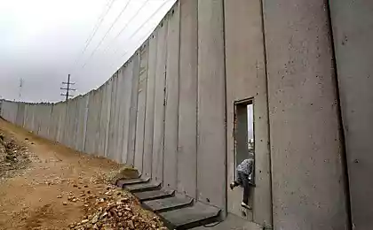
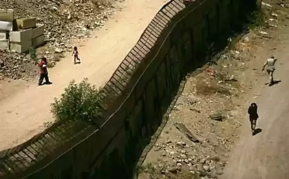
Spain and Morocco.
Belongs to the town of Ceuta Spain, located on the northern coast of Africa and is surrounded on all sides by Morocco.
The city is separated from the solid wall of Morocco.
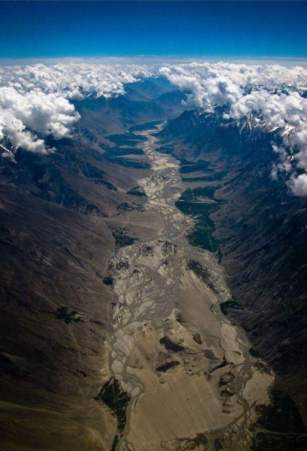
India and Pakistan
Himalayan border. Here trespassers will be difficult to cross

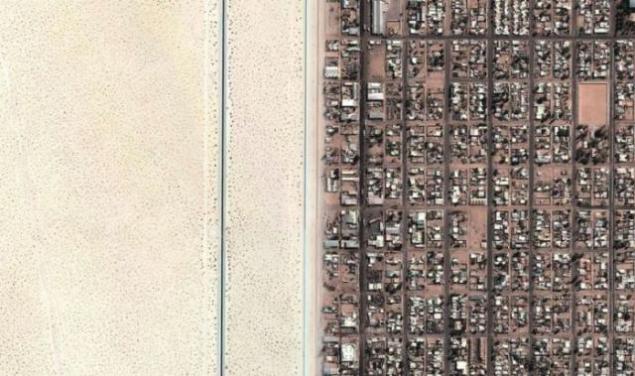
USA (right) and Mexico (left).
And then you yourself would not have guessed.


Sweden and Norway

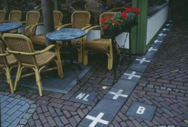
The Netherlands and Belgium


Former East and West Berlin

North and South Korea

Russia and the United States.
Diomede Islands. Western (Russian) is located just over
4 kilometers from the eastern (US),
but the time difference between them is 21 hours.

US and Canada

The border runs through town of Derby Line, sharing some of the buildings on the US and Canadian territory

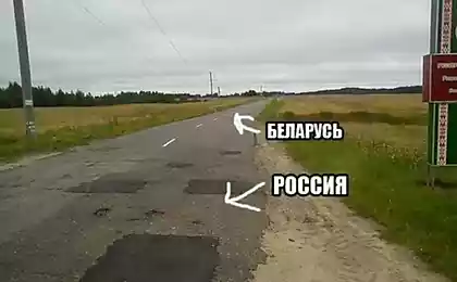
Spain and Portugal.
Compare the quality of roads

India and Pakistan.
Bright orange spotlights illuminating the border, clearly visible from space


Haiti and the Dominican Republic

In Haiti is practically no control over deforestation, while in the Dominican Republic forests protected

Poland and Ukraine

Argentina, Paraguay and Brazil

China and Macau
In China, the right-sided traffic and Macau (former British colony) - left hand.
Therefore the border crossing here can give you a lot of inconvenience.

Germany and the Czech Republic

Germany and Poland.
The border on the Oder River

Venezuela, Brazil and Guyana
Roraima (mesa), over which hangs a large cloud constantly,
separates these three states

Spain and Gibraltar

Belgium (left) and the Netherlands (right)

Argentina (left) and Brazil (right)

The border runs along the Iguazu Falls

Brazil (left) and Venezuela (right)

Germany and the Czech Republic

Spain and Morocco.
Belongs to the town of Ceuta Spain, located on the northern coast of Africa and is surrounded on all sides by Morocco.
The city is separated from the solid wall of Morocco.

India and Pakistan
Himalayan border. Here trespassers will be difficult to cross