1125
The boundaries between different countries of the world
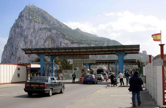
Today we will visit the most unusual borders that divide the various states. Under the cut you'll see a picnic table, which is the place where the borders of three countries of the European Union, a ride on a snowmobile, perelezete over the high fence in Spain and take a lot of interesting things. Britain and Spain - is a checkpoint at the international border between the British overseas territory - Gibraltar and Spain.
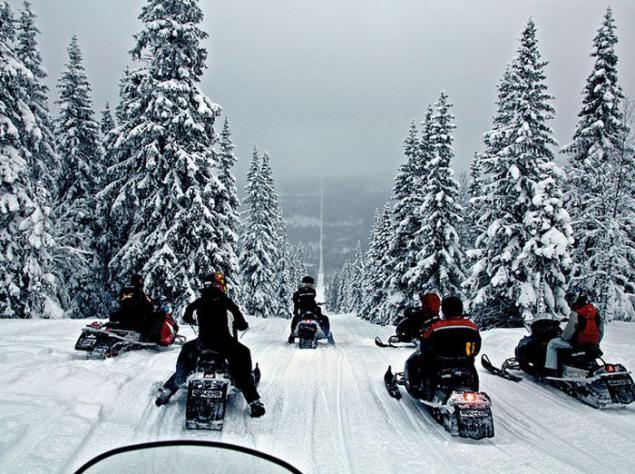
Norway and Sweden - People are prepared to drive a snowmobile on the trail that separates the two northern states.
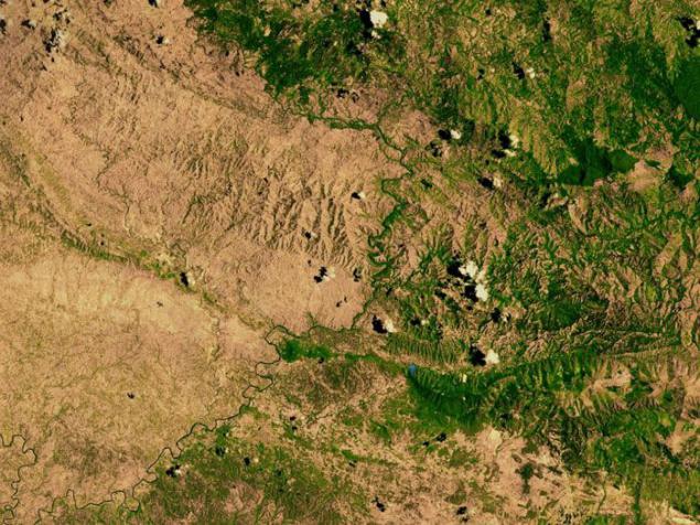
Haiti and the Dominican Republic - The photo shows deforestation in the territory of Haiti (left) and land Dominican Republic (right).
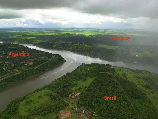
Argentina, Paraguay and Brazil - is the triple border - a place where converge the river Iguazu and Parana, connecting the three South American nations.
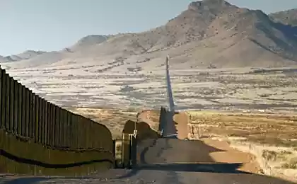
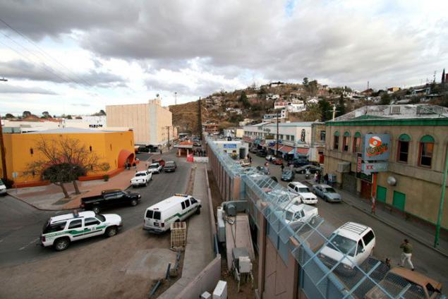
United States and Mexico - is a photo on the border between the city of Nogales, Arizona (left) and the City of Nogales in Sonora (right). Each year, this limit, the length of more than 3 thousand kilometers legally crossed almost 350 million. People, making it the most crossed border in the world.
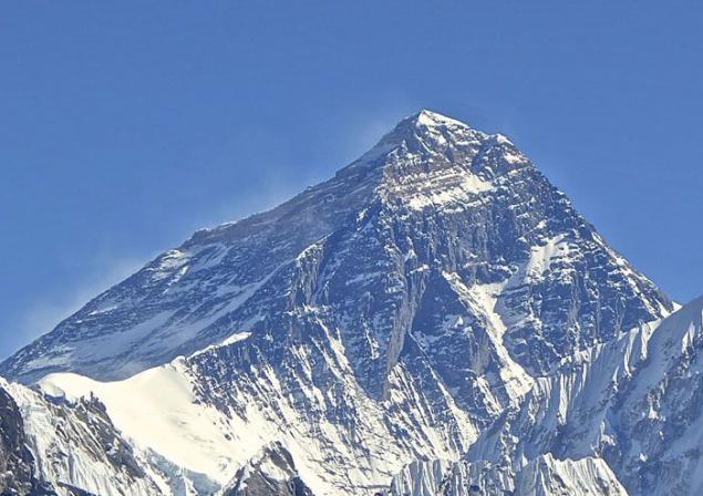
China and Nepal - The top of the highest mountain in the world - Mount Everest lies on the border of two small sovereign states.
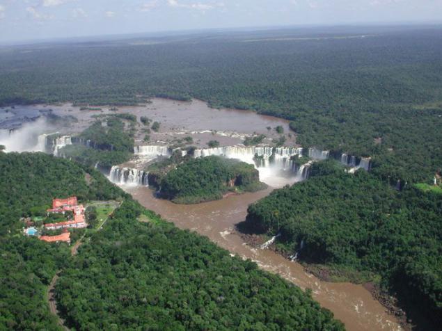
Argentina and Brazil - Iguazu Falls are on the border of the Brazilian state of Paraná and the Argentine province of Misiones.
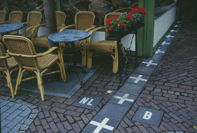
The Netherlands and Belgium - The border passing in the village of Barla, is the most controversial and confusing world. The whole village is surrounded by the Netherlands, but its 26 separate territories belong to Belgium. In order not to confuse tourists abroad are marked by white crosses in the middle of the streets. Thus, it becomes clear whether you are in Belgium (Barla-Hertos) or the Netherlands (Baarle-Nassau).
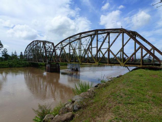
Costa Rica and Panama - This Plank Bridge on the River sixaola river is a natural border between the two countries in Central America, through which every day thousands of passing cars and trucks.
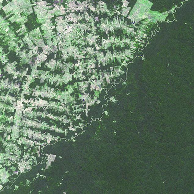
Brazil and Bolivia - The river that separates the two countries, carries a clear boundary between the tropical forests of Brazil, where deforestation is carried out (light green) and forests of Bolivia (dark green).
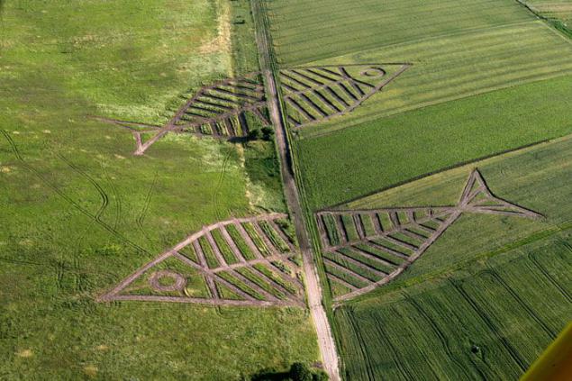
Poland and Ukraine - this part of the border between the two European countries every year decorate before the local art festival (Festival of Land Art).
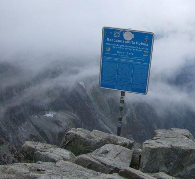
Slovakia and Poland - Mount Rysy in the High Tatras is located on the border between the two countries - members of the European Union.
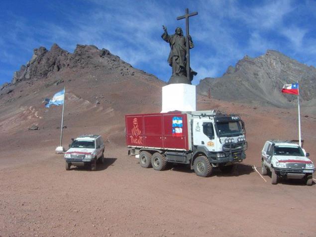
Argentina and Chile - Statue of Jesus Christ, towering high in the Andes, symbolizes peace between the two South American countries.
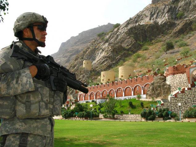
Afghanistan and Pakistan - American sentry on duty at the gates of Torkham, which are one of the main ways of crossing the border between Afghanistan and Pakistan.
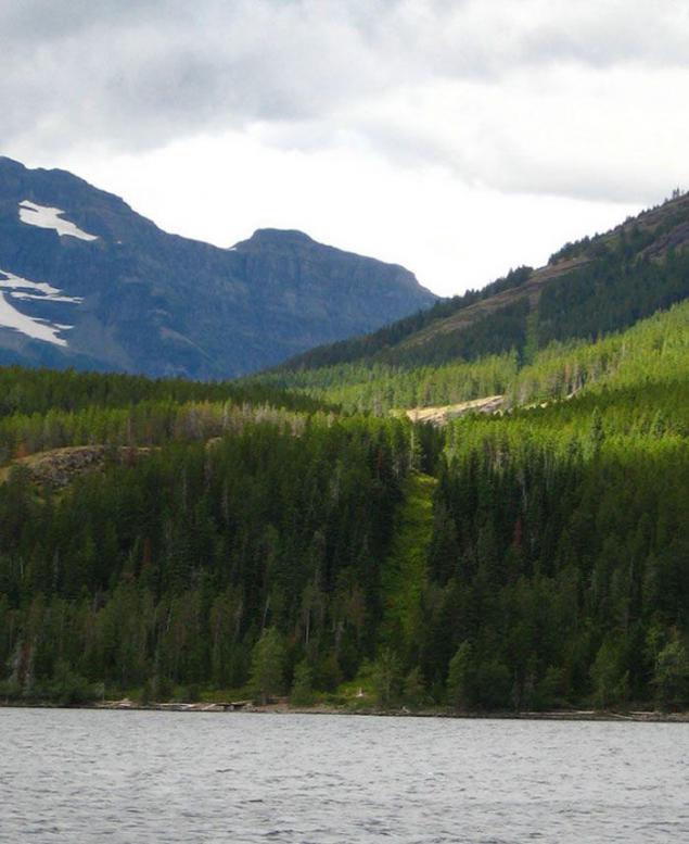
USA and Canada - This is the longest international border in the world, extending almost nine thousand kilometers.
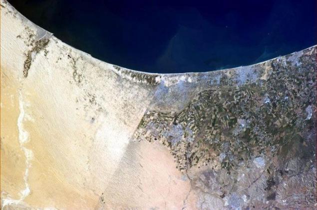
Egypt and Israel - Canadian astronaut Christopher Hadfield did an amazing photo from the International Space Station. In the picture is seen Egypt (left), Israel (right) and the self-governing territory of the Gaza Strip, which stretches along the Mediterranean Sea.
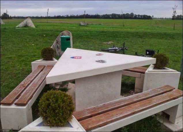
Austria, Hungary and Slovakia - this picnic table is a place where the borders of three countries of the European Union.
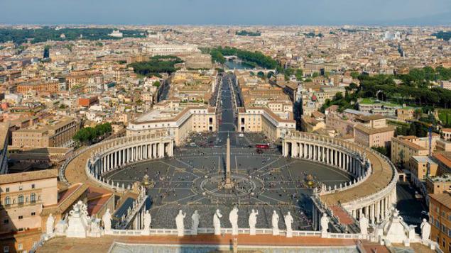
The Vatican and Spain - Entrance to St. Peter's Square is the border between Italy and the Catholic sovereign city-state of Vatican.
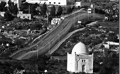
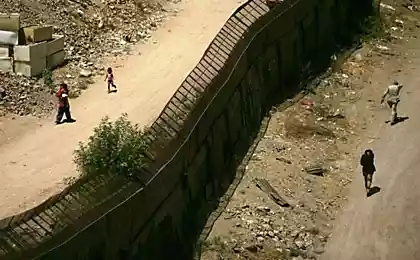
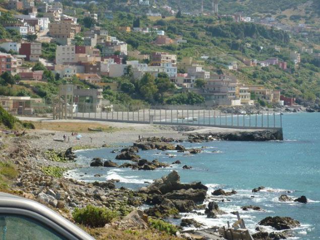
Spain and Morocco - a high fence to prevent the entry of illegal immigrants in Spain, marks the boundary of the two North African exclaves Spain - Ceuta and Melilla, that border Morocco. These two Spanish cities are completely surrounded by Morocco. The photo depicts Ceuta.
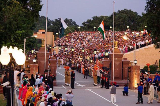
Pakistan and India - Every evening at Wagah ceremony takes place called 'lowering of the flags ", the first of which was held in 1959. Wagah border in between the two Asian countries, often called the "Berlin Wall of Asia».
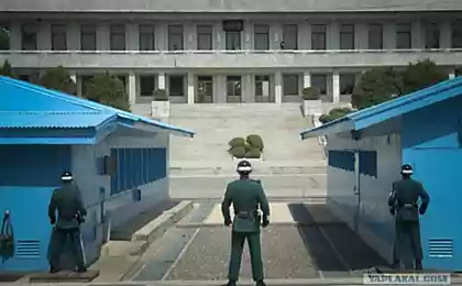
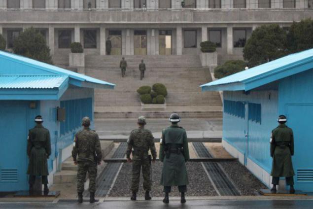
North Korea and South Korea - is depicted here Joint Security Area is only a part of the Korean demilitarized zone, where face-to-face are South Korean and North Korean forces.
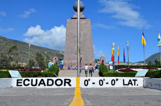
Northern and southern hemisphere - is not state border and the line drawn in the park of Ecuador, which is located at a latitude of 0 degrees - a meeting place of the two hemispheres.
Source: www.viralnova.com

Norway and Sweden - People are prepared to drive a snowmobile on the trail that separates the two northern states.

Haiti and the Dominican Republic - The photo shows deforestation in the territory of Haiti (left) and land Dominican Republic (right).

Argentina, Paraguay and Brazil - is the triple border - a place where converge the river Iguazu and Parana, connecting the three South American nations.

United States and Mexico - is a photo on the border between the city of Nogales, Arizona (left) and the City of Nogales in Sonora (right). Each year, this limit, the length of more than 3 thousand kilometers legally crossed almost 350 million. People, making it the most crossed border in the world.

China and Nepal - The top of the highest mountain in the world - Mount Everest lies on the border of two small sovereign states.

Argentina and Brazil - Iguazu Falls are on the border of the Brazilian state of Paraná and the Argentine province of Misiones.

The Netherlands and Belgium - The border passing in the village of Barla, is the most controversial and confusing world. The whole village is surrounded by the Netherlands, but its 26 separate territories belong to Belgium. In order not to confuse tourists abroad are marked by white crosses in the middle of the streets. Thus, it becomes clear whether you are in Belgium (Barla-Hertos) or the Netherlands (Baarle-Nassau).

Costa Rica and Panama - This Plank Bridge on the River sixaola river is a natural border between the two countries in Central America, through which every day thousands of passing cars and trucks.

Brazil and Bolivia - The river that separates the two countries, carries a clear boundary between the tropical forests of Brazil, where deforestation is carried out (light green) and forests of Bolivia (dark green).

Poland and Ukraine - this part of the border between the two European countries every year decorate before the local art festival (Festival of Land Art).

Slovakia and Poland - Mount Rysy in the High Tatras is located on the border between the two countries - members of the European Union.

Argentina and Chile - Statue of Jesus Christ, towering high in the Andes, symbolizes peace between the two South American countries.

Afghanistan and Pakistan - American sentry on duty at the gates of Torkham, which are one of the main ways of crossing the border between Afghanistan and Pakistan.

USA and Canada - This is the longest international border in the world, extending almost nine thousand kilometers.

Egypt and Israel - Canadian astronaut Christopher Hadfield did an amazing photo from the International Space Station. In the picture is seen Egypt (left), Israel (right) and the self-governing territory of the Gaza Strip, which stretches along the Mediterranean Sea.

Austria, Hungary and Slovakia - this picnic table is a place where the borders of three countries of the European Union.

The Vatican and Spain - Entrance to St. Peter's Square is the border between Italy and the Catholic sovereign city-state of Vatican.

Spain and Morocco - a high fence to prevent the entry of illegal immigrants in Spain, marks the boundary of the two North African exclaves Spain - Ceuta and Melilla, that border Morocco. These two Spanish cities are completely surrounded by Morocco. The photo depicts Ceuta.

Pakistan and India - Every evening at Wagah ceremony takes place called 'lowering of the flags ", the first of which was held in 1959. Wagah border in between the two Asian countries, often called the "Berlin Wall of Asia».

North Korea and South Korea - is depicted here Joint Security Area is only a part of the Korean demilitarized zone, where face-to-face are South Korean and North Korean forces.

Northern and southern hemisphere - is not state border and the line drawn in the park of Ecuador, which is located at a latitude of 0 degrees - a meeting place of the two hemispheres.

Source: www.viralnova.com

