878
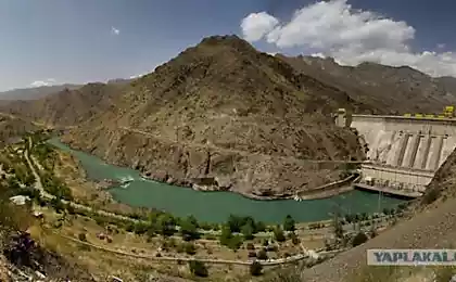
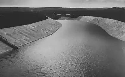
Who and when built the dam in Africa at the now dried-up rivers?
North Africa, the Sahara desert, most recently in geologic time was flourishing edge, with deep rivers, and cities. This is confirmed by water erosion from showers in the Egyptian sphinx.
And it turns out traces of an advanced civilization in these places there abound. And it's not only the Egyptian pyramids, the temples, the Sudanese pyramids. Remained whole and broken dam in parched riverbeds.
This blogger writes about petgraph:
& Quot; ... More recently, with an incredible surprise I realized that North Africa (I was, I must say, do not read anything practically about changing history can guess once) completely in the recent past was the green continent. And here the evidence is not necessary - they are in full view, we need only to look out the window while sitting in the flies from the resort in Marsa Alam plane.
All the east coast pitted deltas, river beds and lakes! All of this is now dried up, but the fact that recently was different - a fact! Seen dilapidated mud huts that are built by following the curves of this as though only in the wild flowing rivers of antiquity! Ie not a pyramid, not something monumental, namely villages. Well, who on earth is disturbed as the need to build a house, say, at the bottom of the former river?
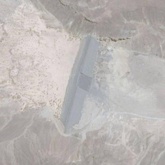
So, just 10-15 minutes after takeoff, when the aircraft has not yet gained the height, I noticed an incredible facility, which subsequently did not find anything on the network:
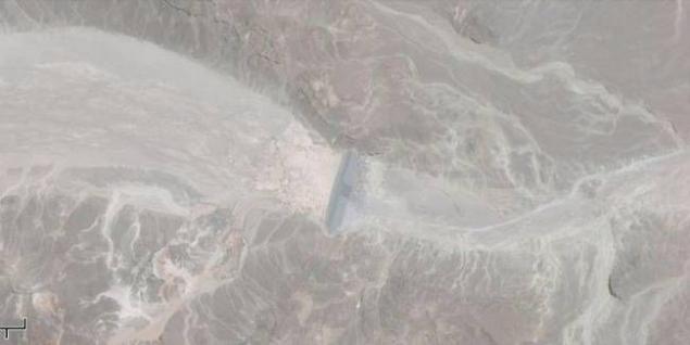
maps.google.ru/maps?q=%D0%9C%D0%B0%D1%80%D1%81%D0%B0-%D0%90%D0%BB%D0%B0%D0%BC, +% D9% 82% D8% B3% D9% 85 +% D9% 85% D8% B1% D8% B3% D9% 89 +% D8% B9% D9% 84% D9% 85, +% D0% 90% D0% BB% D1% 8C-% D0% 91% D0% B0% D1% 85% D1% 80-% D0% B0% D0% BB% D1% 8C-% D0% 90% D1% 85% D0% BC % D0% B0% D1% 80, +% D0% 95% D0% B3% D0% B8% D0% BF% D0% B5% D1% 82 & amp; hl = ru & amp; ie = UTF8 & amp; ll = 25.82424, 34.387679 & amp; spn = 0.007832, 0.013937 & amp; sll = 26.344499, 34.104996 & amp; sspn = 0.247055, 0.356712&oq=%D0%BC%D0%B0%D1%80%D1%81%D0%B0&t=h&hnear=%D0%9C%D0%B0%D1%80%D1%81%D0%B0-%D0%90%D0%BB%D0%B0%D0%BC, + Qesm + Marsa + Alam, +% D0% 90% D0% BB% D1% 8C-% D0% 91% D0% B0% D1% 85% D1% 80-% D0% B0% D0% BB% D1% 8C -% D0% 90% D1% 85% D0% BC% D0% B0% D1% 80, +% D0% 95% D0% B3% D0% B8% D0% BF% D0% B5% D1% 82 & amp; z = 17
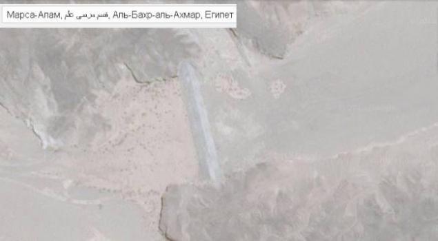
Dam! 200 meters long, pyramidal cross-sectional and well noticeable from the plane. So my question is, what kind of design? How old is it, and when East Africa was green and affluent, if left in rivers here are similar to the construction of the dam?
Later, looking at it in Google, I noticed the 2 nd, just east. Less - "only" 100 meters long - the dam "smaller" And all this despite the fact that close to a radius of 300 km is no civilization other than hotels there.
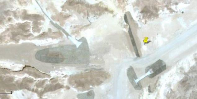
Another found the dam in line with long-dried-up river

And another. We see three dams, a sectional trapezoid
--img6--
Riddle. With dams - a snapshot of Google. Without the dam - from Bing ( binged.it/MMs4UQ )
I do not think that there is some bingo cards newer than Google, it turns out that the dam appeared in the last 5 (?) Years.
--img7--
What do you think?
--img8--
Source:
And it turns out traces of an advanced civilization in these places there abound. And it's not only the Egyptian pyramids, the temples, the Sudanese pyramids. Remained whole and broken dam in parched riverbeds.
This blogger writes about petgraph:
& Quot; ... More recently, with an incredible surprise I realized that North Africa (I was, I must say, do not read anything practically about changing history can guess once) completely in the recent past was the green continent. And here the evidence is not necessary - they are in full view, we need only to look out the window while sitting in the flies from the resort in Marsa Alam plane.
All the east coast pitted deltas, river beds and lakes! All of this is now dried up, but the fact that recently was different - a fact! Seen dilapidated mud huts that are built by following the curves of this as though only in the wild flowing rivers of antiquity! Ie not a pyramid, not something monumental, namely villages. Well, who on earth is disturbed as the need to build a house, say, at the bottom of the former river?
So, just 10-15 minutes after takeoff, when the aircraft has not yet gained the height, I noticed an incredible facility, which subsequently did not find anything on the network:


maps.google.ru/maps?q=%D0%9C%D0%B0%D1%80%D1%81%D0%B0-%D0%90%D0%BB%D0%B0%D0%BC, +% D9% 82% D8% B3% D9% 85 +% D9% 85% D8% B1% D8% B3% D9% 89 +% D8% B9% D9% 84% D9% 85, +% D0% 90% D0% BB% D1% 8C-% D0% 91% D0% B0% D1% 85% D1% 80-% D0% B0% D0% BB% D1% 8C-% D0% 90% D1% 85% D0% BC % D0% B0% D1% 80, +% D0% 95% D0% B3% D0% B8% D0% BF% D0% B5% D1% 82 & amp; hl = ru & amp; ie = UTF8 & amp; ll = 25.82424, 34.387679 & amp; spn = 0.007832, 0.013937 & amp; sll = 26.344499, 34.104996 & amp; sspn = 0.247055, 0.356712&oq=%D0%BC%D0%B0%D1%80%D1%81%D0%B0&t=h&hnear=%D0%9C%D0%B0%D1%80%D1%81%D0%B0-%D0%90%D0%BB%D0%B0%D0%BC, + Qesm + Marsa + Alam, +% D0% 90% D0% BB% D1% 8C-% D0% 91% D0% B0% D1% 85% D1% 80-% D0% B0% D0% BB% D1% 8C -% D0% 90% D1% 85% D0% BC% D0% B0% D1% 80, +% D0% 95% D0% B3% D0% B8% D0% BF% D0% B5% D1% 82 & amp; z = 17

Dam! 200 meters long, pyramidal cross-sectional and well noticeable from the plane. So my question is, what kind of design? How old is it, and when East Africa was green and affluent, if left in rivers here are similar to the construction of the dam?
Later, looking at it in Google, I noticed the 2 nd, just east. Less - "only" 100 meters long - the dam "smaller" And all this despite the fact that close to a radius of 300 km is no civilization other than hotels there.

Another found the dam in line with long-dried-up river

And another. We see three dams, a sectional trapezoid
--img6--
Riddle. With dams - a snapshot of Google. Without the dam - from Bing ( binged.it/MMs4UQ )
I do not think that there is some bingo cards newer than Google, it turns out that the dam appeared in the last 5 (?) Years.
--img7--
What do you think?
--img8--
Source:
