1694
National Geographic company posted a net of more than 500 historical maps on Google Maps Engine
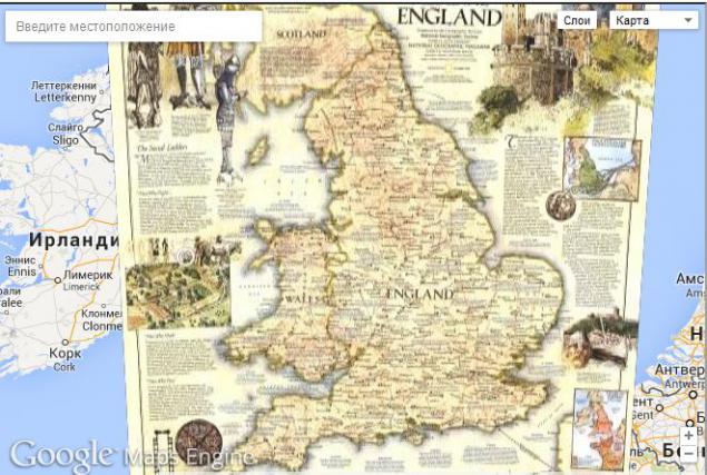
National Geographic and Google are now a small project to rebuild the maps of past centuries in digital form. Under this project, several hundred historical maps have been posted to the Web, ispolschuya platform Google Maps Engine. These cards, according to the initiator of the project, director of digital development of National Geographic Biasi Frank (Frank Biasi), going for many years, and now they are available to everyone.
True available for all cards are laid out not in the high-resolution, HD-version of the maps will be available in digital form only for the money. However, and what is done can be important - both for historians and for all those who are simply interested in historical science.
Paid version will be available through the app for iOS.
It is worth noting that the cards are available as an additional layer to Google Maps, and look at all this can here . The project team Download data in digital form, create layers, merge the layers in the map, and maps are composed of disparate "pieces" that exist on paper.
On the resulting map data, the project team also posted links to various historical documents, research papers and other.
Via googleenterprise
Source: habrahabr.ru/post/205250/