906
Complex Flood Protection Barrier Peter
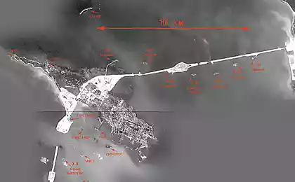
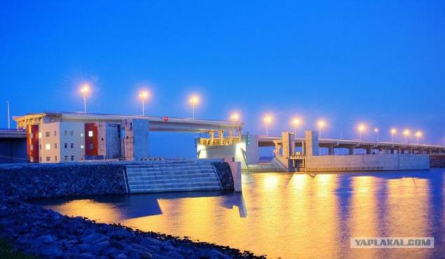
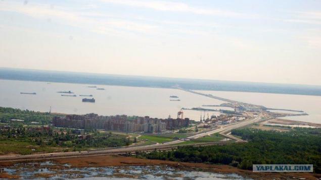
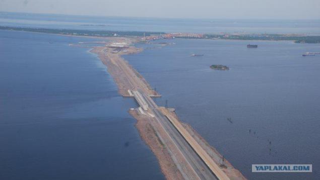
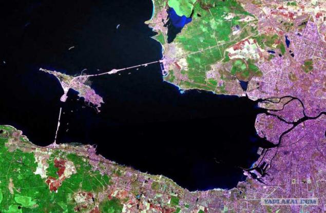
Saint Petersburg Dam - a complex of dams and related hydraulic structures (culverts and navigation openings), which stretches across the Gulf of Finland from Bronchi to Sestroretsk (Highland village), through the island of Kotlin, which is the town of Kronstadt (part of St. Petersburg).
Construction is carried out since 1979, was suspended in the late '80s, and in 2001 it resumed again. The cost of the project as of the first decade of August 2010 amounted to 87, 3 billion rubles. 2011 should be completed in its construction.
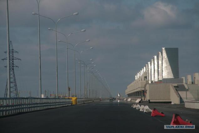
The complex consists of two navigation openings (C1 and C2), six culverts (B1-B6), 11 dams (D1-D11). Also, the entire length of the complex was built six-lane motorway (part of Ring Road), which includes an underwater tunnel length 1961 m (at the navigable channel C1), bridges and road interchanges (at the intersection with the Ring Road GLC). Navigation openings C1
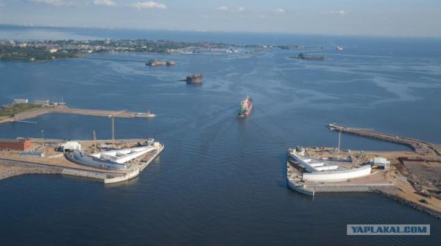
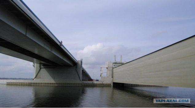
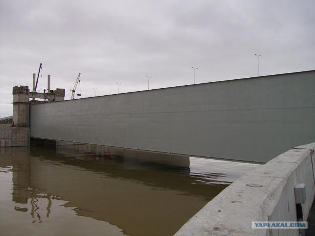
Navigation openings C1 is intended for the passage of vessels throughout the year. C1 is a navigable passage segment floating-gate caisson gate. The width of the navigable bays of 200 m, depth of water on the threshold of 16 m.
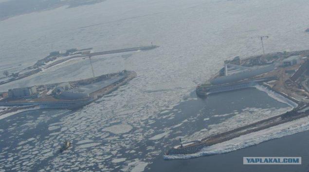
With the threat of flooding dock chamber in which there are gates, filled with water, pop and push the caisson gate in the middle of the channel. Reaching the center closures begin to fill with water and under his weight slowly sink to the bottom threshold. Thus, blocking the way for the further promotion of the Baltic wave surge to St. Petersburg. Normally, the caisson gate are dry dock chambers.
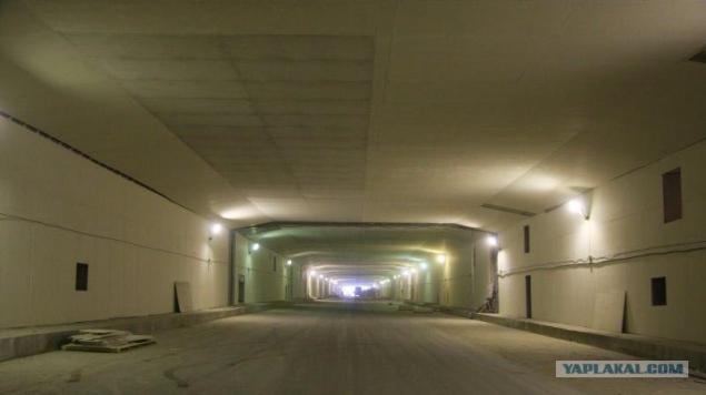
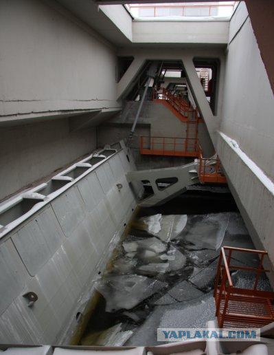
Under a shipping canal runs underground six-lane road tunnel with a total length 1961 m. The lowest point of the tunnel is located on the mark - minus 28 m.
Construction of a navigation-2
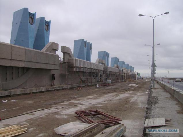
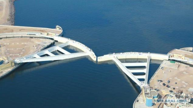
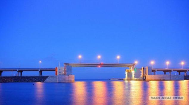
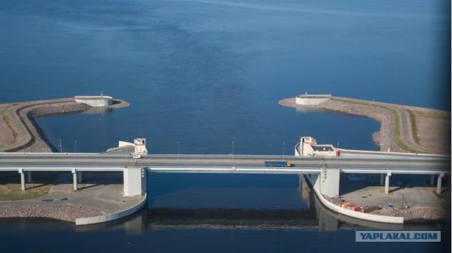
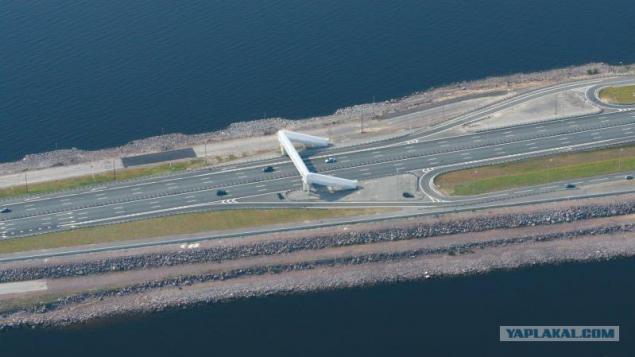
A navigation structure C2 is intended for the passage of small boats with a draft of up to 5, 5 m. It is a navigable span with up-and-a downward gate. The width of the navigable bays - 110 m depth at the threshold - 7 m. Across it is the bolt weight 2500t lying in the groove under the concrete slab of the shipping channel.
In the case of floods it rises to a height of 4, 55 m above the normal water level.
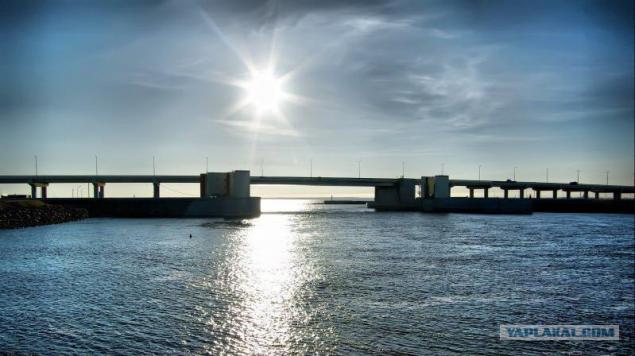
Over C2 goes long with a road bridge overpass embankments and 1483 m. The central span is made vertikalnopodёmnym, dimensions 120 x 30, 2 m and weighing 2300 tonnes plus two counterweight 1140t. The height of the bridge in building position - 16 m in the up - 25 m.
...
...
Culverts B1 - B6
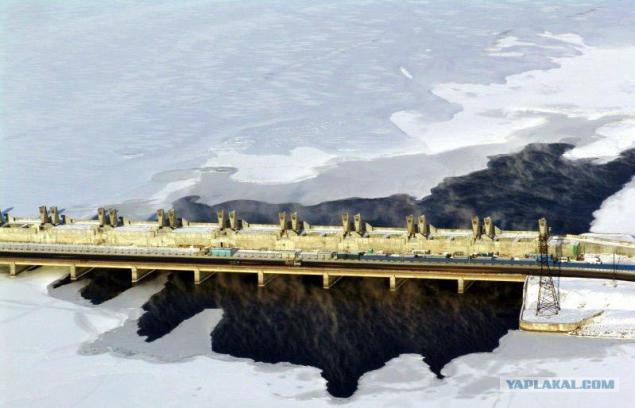
Designed to minimize the impact of the Barrier construction on the hydrological regime and ecological status of the Neva Bay and the Eastern Gulf of Finland.
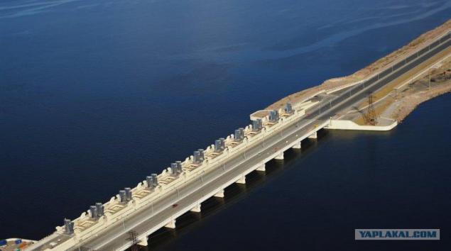
Structures B1 and B2 have 12 culvert span width 24 0m and the water depth at the threshold of 2 to 5 m. Structures B4, B5 and B6 are 10 culvert span width 24 0m and water depth 5 0 m. In the construction B3 - 10 culvert spans the width of 24, 0 m water depth 2, 5 m.
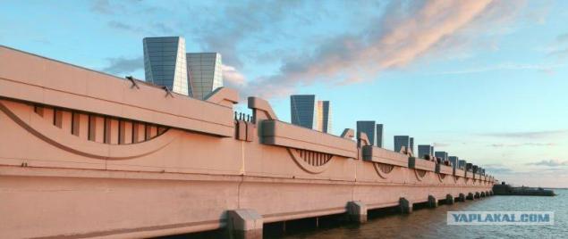
All culvert spans equipped with radial gates.
...
Protective levees D1 - D11
Designed to protect the city from flooding and create a foundation under the highway on a line of protective structures.
The total length of the dams 23, 4 km, exceeding the sea wall above the water level 8, 0m.
After receiving information from the Hydrometeorological Center of the rise of water level management in advance of the GLC (3 hours) prevents the administration of the Big port of the threat of flooding and the cessation of navigation. Preparation for maneuvering the gate of protective structures. With the threat of the flood gates are closed first navigation openings C1 and C2, and then cross-sections of culverts (B1 - B6).
All!!!
Source:
Construction is carried out since 1979, was suspended in the late '80s, and in 2001 it resumed again. The cost of the project as of the first decade of August 2010 amounted to 87, 3 billion rubles. 2011 should be completed in its construction.

The complex consists of two navigation openings (C1 and C2), six culverts (B1-B6), 11 dams (D1-D11). Also, the entire length of the complex was built six-lane motorway (part of Ring Road), which includes an underwater tunnel length 1961 m (at the navigable channel C1), bridges and road interchanges (at the intersection with the Ring Road GLC). Navigation openings C1

Navigation openings C1 is intended for the passage of vessels throughout the year. C1 is a navigable passage segment floating-gate caisson gate. The width of the navigable bays of 200 m, depth of water on the threshold of 16 m.

With the threat of flooding dock chamber in which there are gates, filled with water, pop and push the caisson gate in the middle of the channel. Reaching the center closures begin to fill with water and under his weight slowly sink to the bottom threshold. Thus, blocking the way for the further promotion of the Baltic wave surge to St. Petersburg. Normally, the caisson gate are dry dock chambers.

Under a shipping canal runs underground six-lane road tunnel with a total length 1961 m. The lowest point of the tunnel is located on the mark - minus 28 m.

Construction of a navigation-2

A navigation structure C2 is intended for the passage of small boats with a draft of up to 5, 5 m. It is a navigable span with up-and-a downward gate. The width of the navigable bays - 110 m depth at the threshold - 7 m. Across it is the bolt weight 2500t lying in the groove under the concrete slab of the shipping channel.

In the case of floods it rises to a height of 4, 55 m above the normal water level.

Over C2 goes long with a road bridge overpass embankments and 1483 m. The central span is made vertikalnopodёmnym, dimensions 120 x 30, 2 m and weighing 2300 tonnes plus two counterweight 1140t. The height of the bridge in building position - 16 m in the up - 25 m.

...

...

Culverts B1 - B6

Designed to minimize the impact of the Barrier construction on the hydrological regime and ecological status of the Neva Bay and the Eastern Gulf of Finland.

Structures B1 and B2 have 12 culvert span width 24 0m and the water depth at the threshold of 2 to 5 m. Structures B4, B5 and B6 are 10 culvert span width 24 0m and water depth 5 0 m. In the construction B3 - 10 culvert spans the width of 24, 0 m water depth 2, 5 m.

All culvert spans equipped with radial gates.

...

Protective levees D1 - D11

Designed to protect the city from flooding and create a foundation under the highway on a line of protective structures.

The total length of the dams 23, 4 km, exceeding the sea wall above the water level 8, 0m.

After receiving information from the Hydrometeorological Center of the rise of water level management in advance of the GLC (3 hours) prevents the administration of the Big port of the threat of flooding and the cessation of navigation. Preparation for maneuvering the gate of protective structures. With the threat of the flood gates are closed first navigation openings C1 and C2, and then cross-sections of culverts (B1 - B6).
All!!!

Source: