1006
Unusual card (40 photos)
Monsters, devours ships, dangerous currents and other pleasures of the first explorers, who could also draw and in his spare time watches.
When we were small children, who among us did not paint himself maps and plans? And who has not played since a geographical map, reading books about pirates and sailors? Who has not dreamed of visiting Australia or open your island? Now you can buy the island, but the impressions will not return, it would seem ... I'll try to do it!
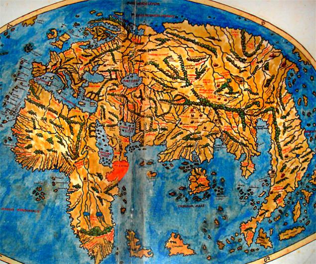
This is a map of the world on Posidonius, about 150-130 years BC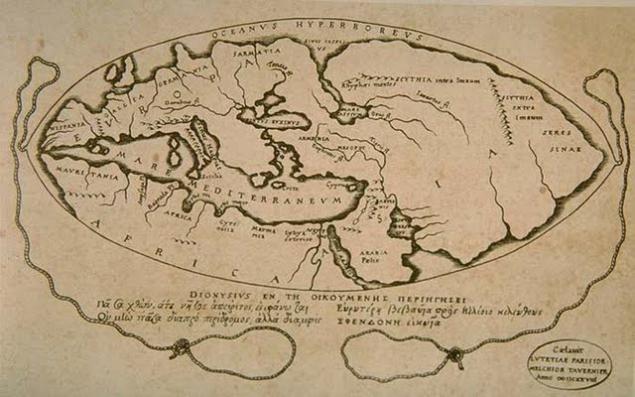
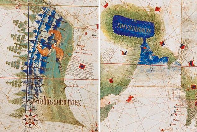
These Portuguese maps of the 16th century is considered one of the first images of America. There is Brazil and Florida, and the Caribbean Islands.
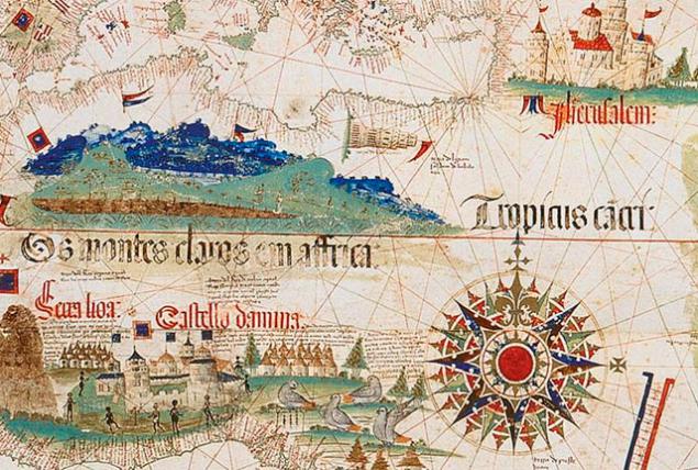
Fragment: Europe and Jerusalem
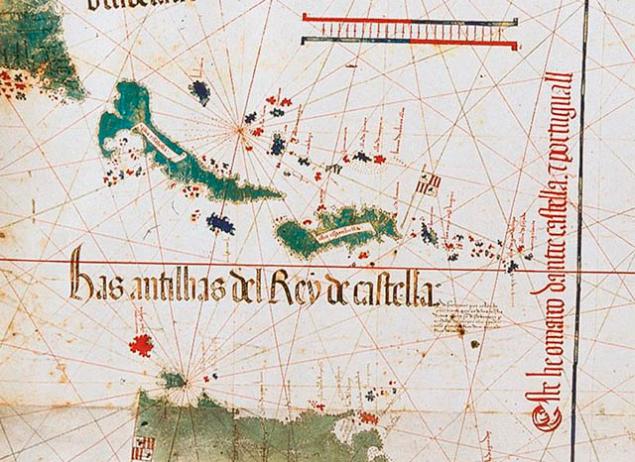
Fragment: Caribbean islands
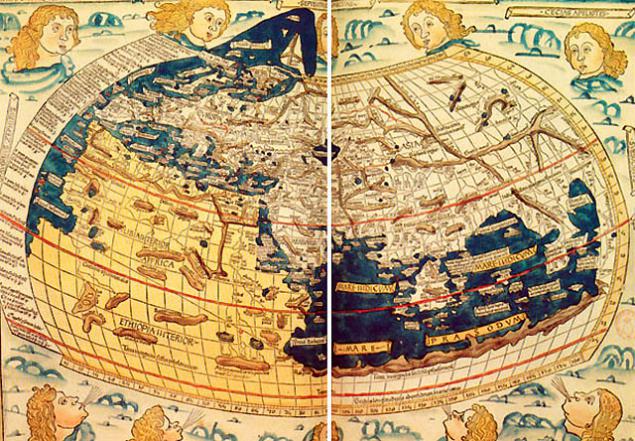
The original vision of the world from Peter Solly 1520, when from Asia to the Indian Ocean issued a Dragon`s Tail
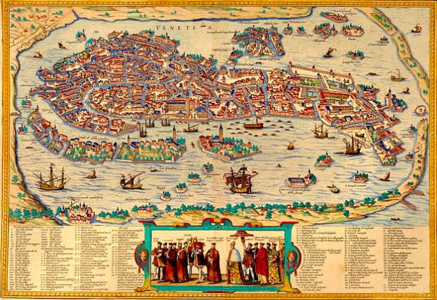
Here's a great map of the city of Venice, showing most of the major buildings in 1565. Maps in this style is still quite often used on postcards and in tourist city guide:
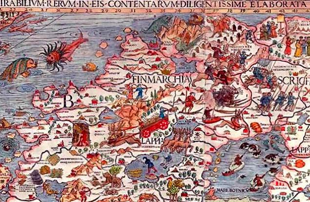
Ornate Charter Marina, dated 1539, may seem a little crude by today's standards, but modern satellite imagery showed that the sea monsters in the parts of the ocean on the map actually correspond to a well-known storm front, dangerous currents and other marine risks. This was possible only by the image of the relevant processes at the time (about like I was something someone said, referring to the importance of the study of alchemy, for the psychologist, if he wants to be a piece of shit, though, and as a member of the "United Russia", and expensive professional):
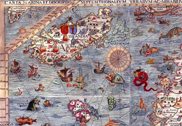
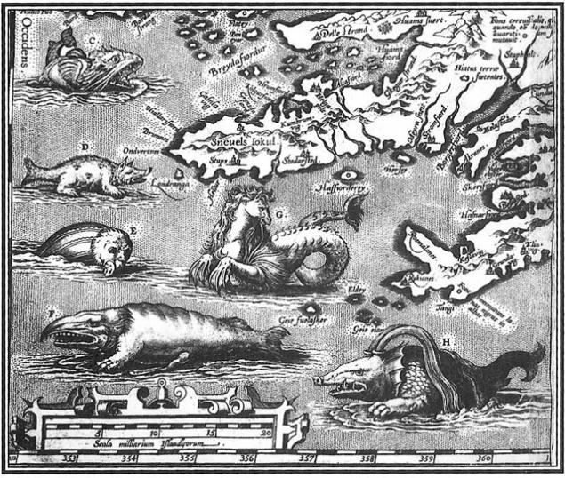
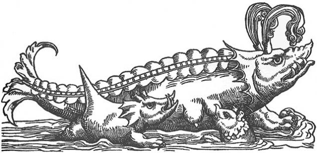
This is similar, indicating the monsters living in the seas around Iceland in the early sixteenth century:
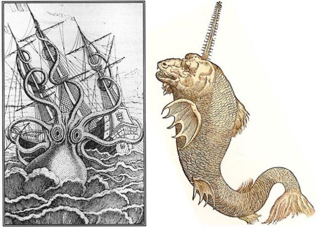
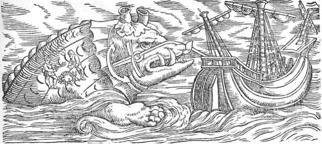
It's right katolog sea monsters and other fantasy sailors of the time when their diet consisted of plant drugs and other goodies.
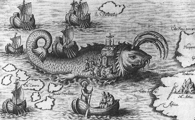
and, finally, the whale, as the island! - Published in Orbis Indiae OCCIDENTALIS, 1621:
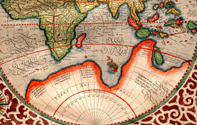
Various incarnations in the «Land Down Under» including ... undiscovered Antarctica
In the southern part of the world some of the latest new land will be inscribed by Europeans since the era of "Discovery", but the idea of 'Terra Australis' lived since the time of Aristotle in the fourth century BC. There are various theories about it - even supposed that some land in the south must have been to "balance the planet." In 1820, she was finally discovered Antarctica, but here is the map of the mythical continent, occupying a significant portion of the southern hemisphere from 1587:
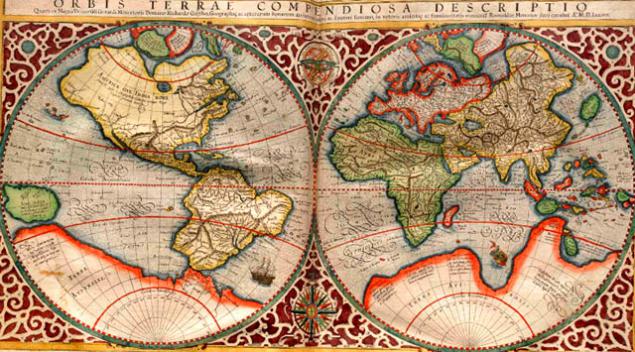
These very decorative map of the world, Antarctica, as well as parts of North America which are still missing, were issued in Amsterdam in 1689.
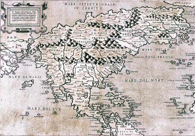
Here the Italian map of North America from 1566; One of the first descriptions of the northern part of Canada:
Alternative history in hypothetical maps
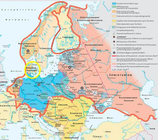
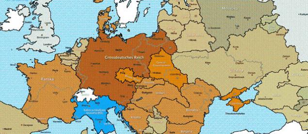
In this version, the Germans won, but disdained Finland. It is clear that it is kind of like an ally, but maybe they knew something ?!
This is an illustration of the book in 1964, based on the assumption that the Germans still won. Based on the legend of the map, marked with a blue neutral territory, ie Siberia was not fuck anyone need that in principle, and now the reality is.
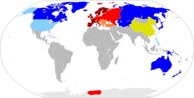
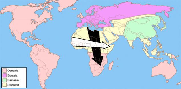
This is a classic vision of a world alignment of Orwellian in its 1984.
Back in the seventies, C. Etzel Pearcy, geography professor, proposed to redraw the boundaries of the American states. It was planned that the country will consist of thirty-eight states, not fifty, with new names that reflect the physical and cultural identity. The idea was not implemented, as we know, of course, but very intriguing. And tell me who some of you know about it ?!

The same theme, beat in advertising.
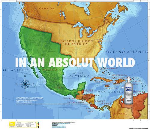
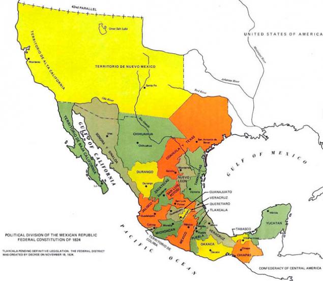
Previous figure - Here is a map of Mexico with the very areas that they later lost in favor of the United States.
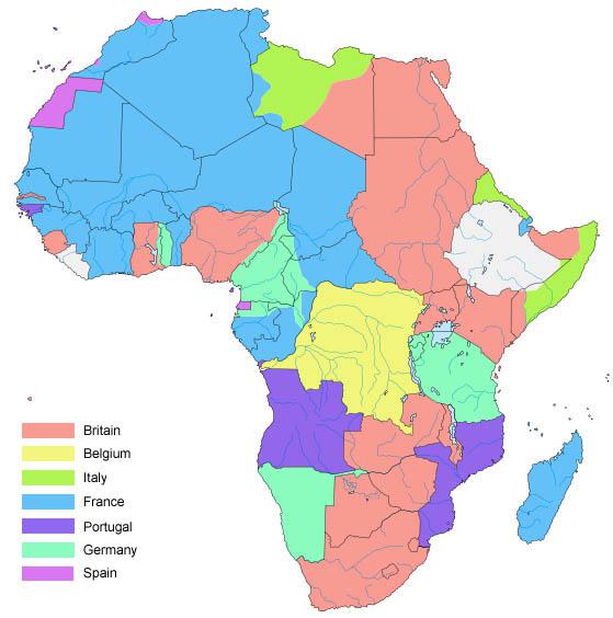
Afrikak as one large area of the colonies. Not the worst time for it, no kidding.
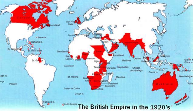
England's colonial possessions.
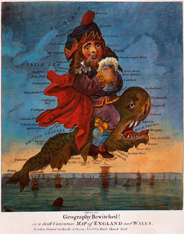
Caricature map of England by Robert Dighton from 1795:
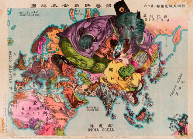
Here are some similar charts of the late nineteenth and early twentieth centuries. This Asian view of the situation in the world during the Chinese Revolution in 1912. This card was actually published in Japan, but points out that there were a lot of foreign influence on China.
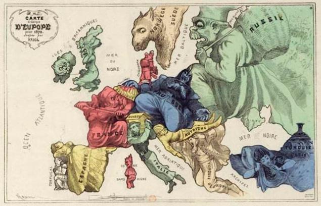
Shortly before the outbreak of World War I, the Russian bear is just hanging over Europe and Asia, the United Kingdom is portrayed as a sea monster, reflecting the position of the country with a dominant naval power in the world (at the time), while Germany is not more than a sullen warthog:
It is fairly well-known map, but I slide it to remind.
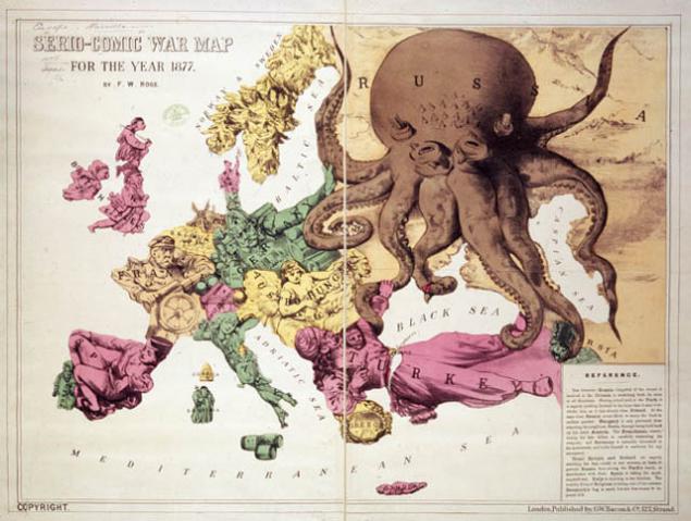
The so-called card "Octopus", released a few years later. While the Russian Empire was considered as adopted very expansionary and already having its tentacles around Turkey and Persia, but turned away from Germany:
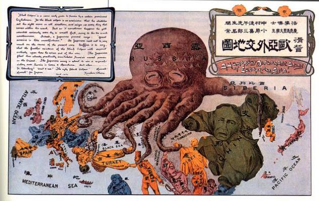
This Octopus little more ohrenevshy.
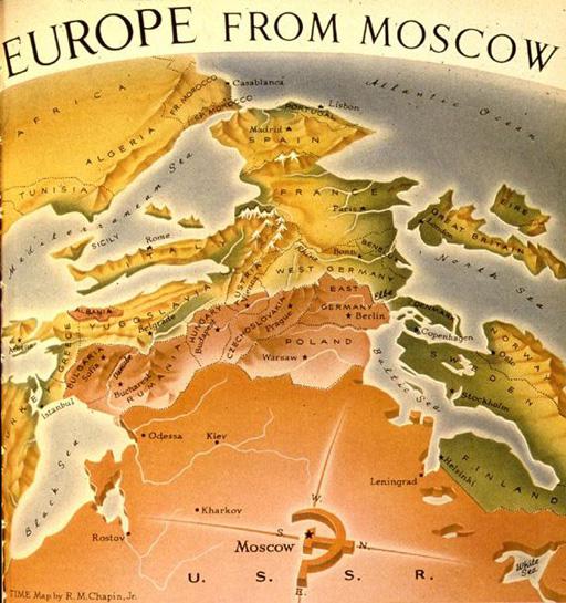
Of the "hand of Moscow" of the victory in World War II.
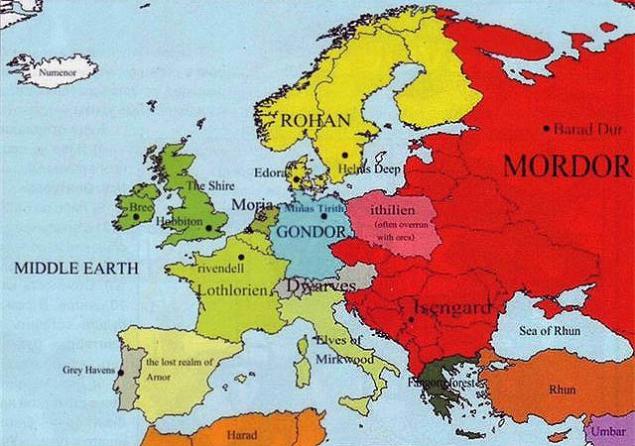
"The Lord of the Rings" -stayl IEP.
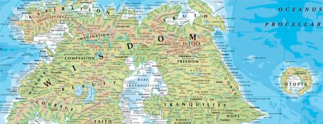
This is one of the variants of unusual view of the world.
When we were small children, who among us did not paint himself maps and plans? And who has not played since a geographical map, reading books about pirates and sailors? Who has not dreamed of visiting Australia or open your island? Now you can buy the island, but the impressions will not return, it would seem ... I'll try to do it!
This is a map of the world on Posidonius, about 150-130 years BC


These Portuguese maps of the 16th century is considered one of the first images of America. There is Brazil and Florida, and the Caribbean Islands.

Fragment: Europe and Jerusalem

Fragment: Caribbean islands

The original vision of the world from Peter Solly 1520, when from Asia to the Indian Ocean issued a Dragon`s Tail

Here's a great map of the city of Venice, showing most of the major buildings in 1565. Maps in this style is still quite often used on postcards and in tourist city guide:

Ornate Charter Marina, dated 1539, may seem a little crude by today's standards, but modern satellite imagery showed that the sea monsters in the parts of the ocean on the map actually correspond to a well-known storm front, dangerous currents and other marine risks. This was possible only by the image of the relevant processes at the time (about like I was something someone said, referring to the importance of the study of alchemy, for the psychologist, if he wants to be a piece of shit, though, and as a member of the "United Russia", and expensive professional):

This is similar, indicating the monsters living in the seas around Iceland in the early sixteenth century:

It's right katolog sea monsters and other fantasy sailors of the time when their diet consisted of plant drugs and other goodies.


and, finally, the whale, as the island! - Published in Orbis Indiae OCCIDENTALIS, 1621:

Various incarnations in the «Land Down Under» including ... undiscovered Antarctica
In the southern part of the world some of the latest new land will be inscribed by Europeans since the era of "Discovery", but the idea of 'Terra Australis' lived since the time of Aristotle in the fourth century BC. There are various theories about it - even supposed that some land in the south must have been to "balance the planet." In 1820, she was finally discovered Antarctica, but here is the map of the mythical continent, occupying a significant portion of the southern hemisphere from 1587:


These very decorative map of the world, Antarctica, as well as parts of North America which are still missing, were issued in Amsterdam in 1689.
Here the Italian map of North America from 1566; One of the first descriptions of the northern part of Canada:

Alternative history in hypothetical maps
In this version, the Germans won, but disdained Finland. It is clear that it is kind of like an ally, but maybe they knew something ?!

This is an illustration of the book in 1964, based on the assumption that the Germans still won. Based on the legend of the map, marked with a blue neutral territory, ie Siberia was not fuck anyone need that in principle, and now the reality is.


This is a classic vision of a world alignment of Orwellian in its 1984.

Back in the seventies, C. Etzel Pearcy, geography professor, proposed to redraw the boundaries of the American states. It was planned that the country will consist of thirty-eight states, not fifty, with new names that reflect the physical and cultural identity. The idea was not implemented, as we know, of course, but very intriguing. And tell me who some of you know about it ?!

The same theme, beat in advertising.

Previous figure - Here is a map of Mexico with the very areas that they later lost in favor of the United States.

Afrikak as one large area of the colonies. Not the worst time for it, no kidding.

England's colonial possessions.

Caricature map of England by Robert Dighton from 1795:

Here are some similar charts of the late nineteenth and early twentieth centuries. This Asian view of the situation in the world during the Chinese Revolution in 1912. This card was actually published in Japan, but points out that there were a lot of foreign influence on China.

Shortly before the outbreak of World War I, the Russian bear is just hanging over Europe and Asia, the United Kingdom is portrayed as a sea monster, reflecting the position of the country with a dominant naval power in the world (at the time), while Germany is not more than a sullen warthog:

It is fairly well-known map, but I slide it to remind.

The so-called card "Octopus", released a few years later. While the Russian Empire was considered as adopted very expansionary and already having its tentacles around Turkey and Persia, but turned away from Germany:

This Octopus little more ohrenevshy.
Of the "hand of Moscow" of the victory in World War II.

"The Lord of the Rings" -stayl IEP.

This is one of the variants of unusual view of the world.