800
NASA laid out hi-res photos of the canyon Ofir
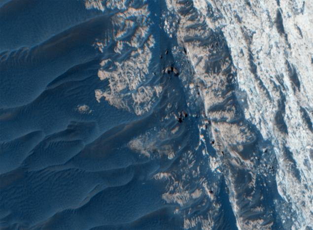
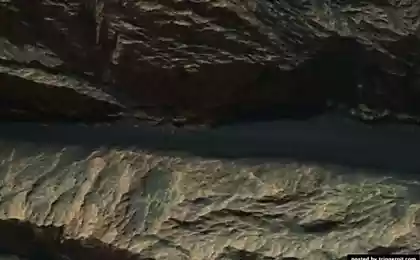
Agency NASA continues to explore Mars, at the same time attracting attention to their work. Recently the agency post pictures Ophir Canyon, which is part of the system Valles Marineris. In Laid-photos clearly distinguishable details of the structure of the canyon, and the image was acquired station Mars Reconnaissance Orbiter (MRO) with the camera HiRISE (High Resolution Imaging Science Experiment) at an altitude of 300 km. Image resolution is only 30 cm per pixel.
Долины Mariner , or Valles Marineris - the giant canyon system on Mars. Discovered in 1971-1972, the spacecraft "Mariner 9" and was named in honor of the "Mariner". Tharsis province stretches from the south-east. Valles Marineris have a length of 4,500 km (a quarter of the circumference of the planet), width - 200 km and depth - up to 11 km. This system of canyons exceed the famous Grand Canyon 10 times the length of a 7 - in width and 7 - in depth, and is the largest in the solar system. Most researchers believe that the Mariner Valley were formed during the early stages of the formation of Mars as a result of cooling the planet. Width canyons increased over time as a result of erosion. Perhaps these valleys were formed by a process similar to the appearance of rift rift in East Africa.
36,449,989
NASA / JPL / University of Arizona i>
The picture shows clearly distinguishable aeolian structures that resemble sand dunes. Actually, this is the dunes, only the material of the term - not quite the sand. Rocky outcrops exhibit sedimentary layers, which are also clearly visible in the photo. The rocks can be formed zastyvayuschiey magma, followed by sedimentary environment.
Images like this help geologists to study the mechanisms of major tectonic systems on Mars and other planets. Incidentally, the difference of Mars from Earth is the lack of lithospheric plates - they are not on Mars.
The length of the canyon is 317 kilometers of Ophir.
Source: geektimes.ru/post/265580/
The University of Leeds promise to create robots that will be able to maintain and restore urban infrastructure
The orbit of the most distant objects in the solar system can detect undiscovered planet
