2796
NASA The Martian Chronicles
Cool pictures of our red neighbor in the solar system.
1. Southern wall of the crater Holden. Rays of the sun, pulled out from under the peaked rocks, highlighting the transparent clouds in the shape of a star. (Image Credit: Data: NASA / Art: Kees Veenenbos)
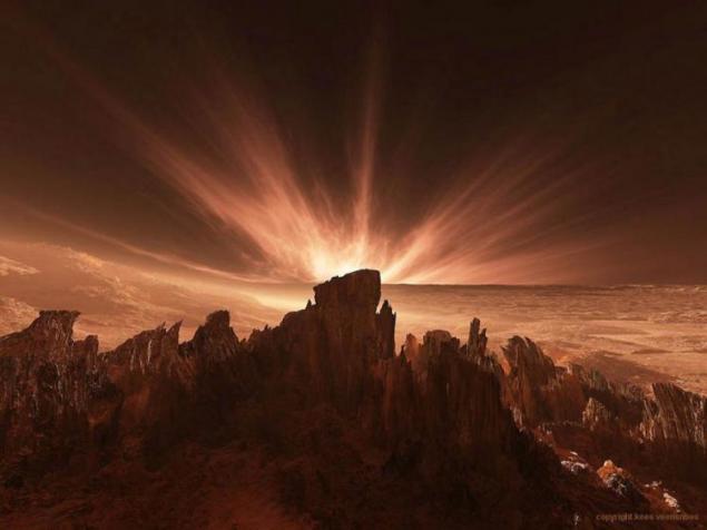
2. Gusev Crater on ancient Mars. Once there land rover «Spirit MER2003». Panorama of the ancient planet after the dust storm. (Image Credit: Data: NASA / Art: Kees Veenenbos)
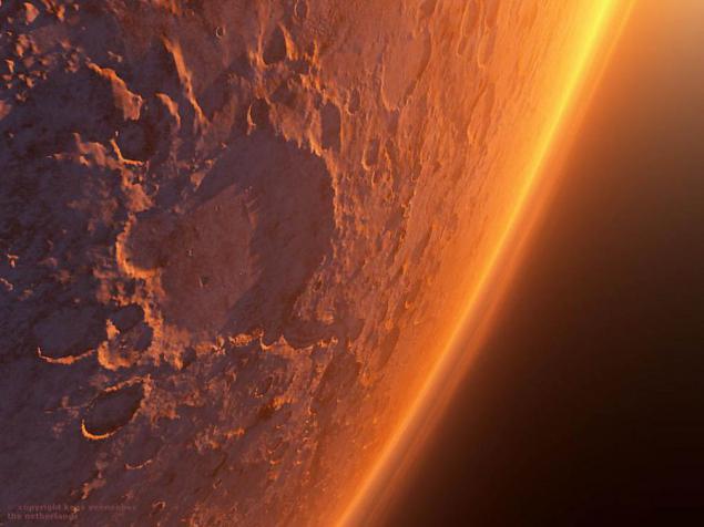
3. Valles Marineris. The consequences of dust storms in the canyon Koprat (front), in the Valles Marineris. (Image Credit: Data: NASA / Art: Kees Veenenbos)
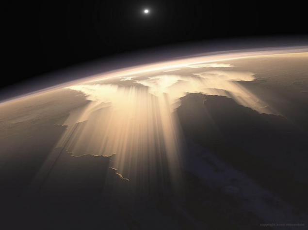
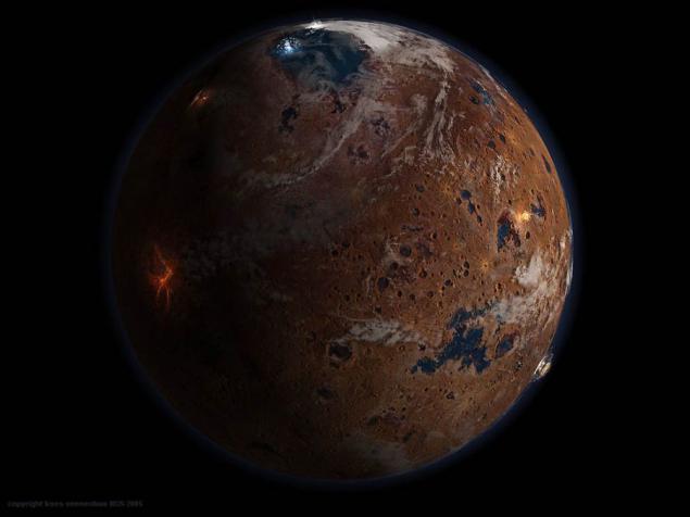
4. The image of Mars Noachianskoy era. The planet about 4 billion. Years ago. The picture shows the crater, located on the Great Plains of North (Vastitas Bolearis), filled with water. A large lake located in the lower right corner of the image - a district of the meridians. Here rover «Opportunity» found signs of an inland sea. This image was made for the July issue of the journal National Geo in 2005. (Image Credit: Data: NASA / Art: Kees Veenenbos)
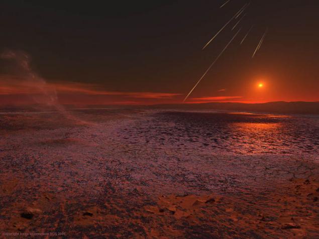
5. Argyre Planitia (Argyre Planitia). Concept for National Geographic. View of Mars during the evaporation of water from its surface a few billion. Years ago. The images show the salt deposits, cracks in the surface, with the content of hematite dust devils and falling meteorites. (Image Credit: Data: NASA / Art: Kees Veenenbos)
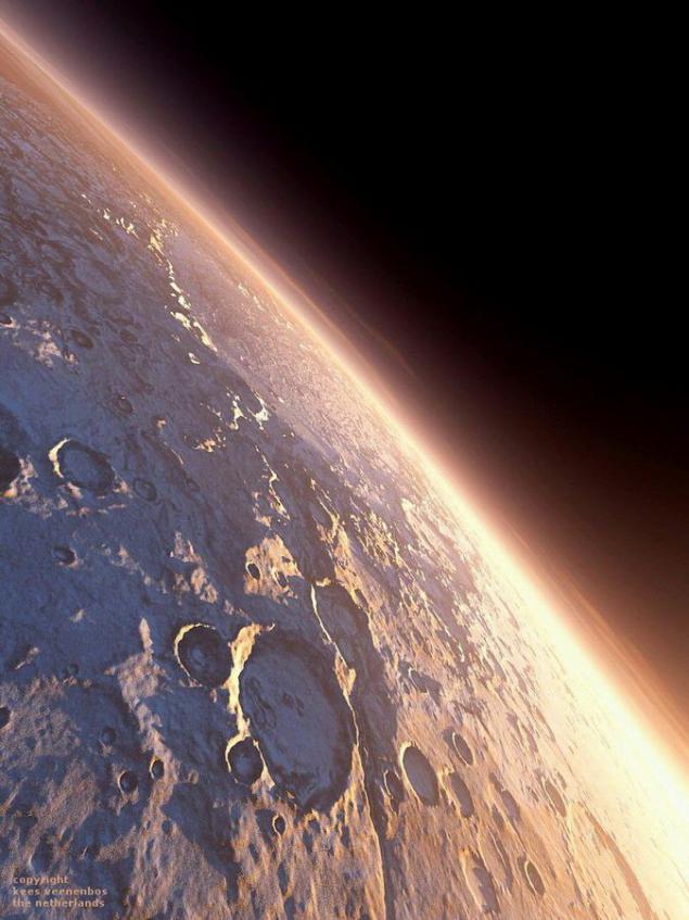
6. Maraldi Crater, located on the surface of Mars, covered with ice. The image was taken for the cover of the January issue of National Geographic magazine in 2004. (Image Credit: Data: NASA / Art: Kees Veenenbos)
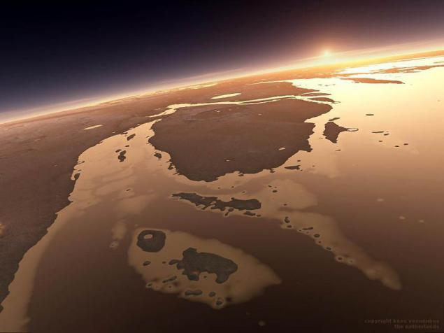
7. Ancient view of the southern region of Chryse Planitia, covered with a layer of water and surrounded by Ares Vallis and Valles Marineris. (Image Credit: Data: NASA / Art: Kees Veenenbos)
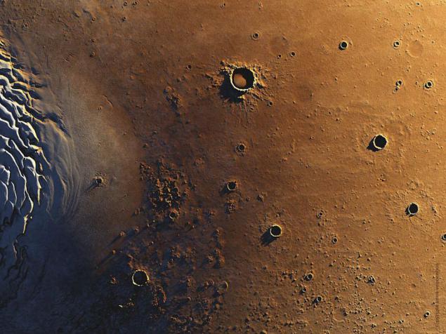
8. North Pole of Mars (left) and craters of the Great Northern Plains (Vastitas Borealis). A large crater, pictured at the top of the picture - a crater Queen, the diameter of which is 85 km away. (Image Credit: Data: NASA / Art: Kees Veenenbos)
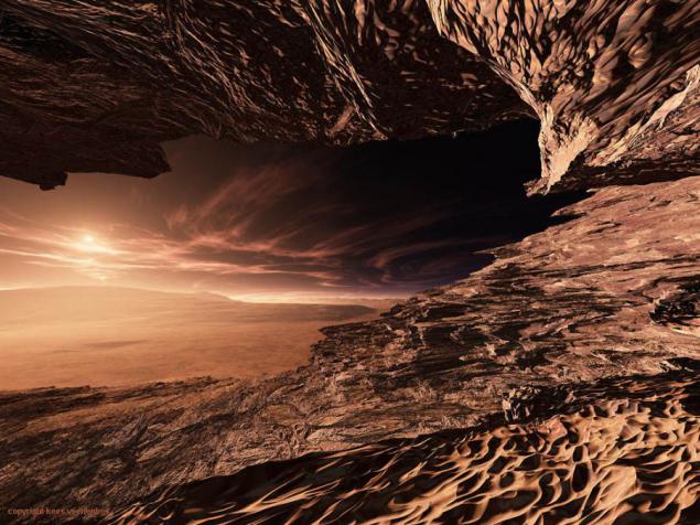
9. The view from the cave formed in the northern part of the shaft of a Martian crater Gale. The left is central peak of the crater Gale. (Image Credit: Data: NASA / Art: Kees Veenenbos)
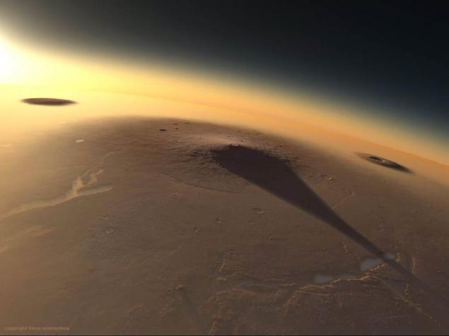
10. Elysium volcanoes plains, illuminated by the rays of the rising sun. The image was made for an exhibition dedicated to the planet Mars, held in Madrid Planetarium. To the left in the picture shows the volcano dome Hecate, right - Volcano Albor Tholus. (Image Credit: Data: NASA / Art: Kees Veenenbos)
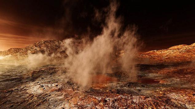
11. Place of landing the rover «Spirit». Gusev crater (background image - Hill Hazbend Hill). Panorama of ancient Mars: fumaroles, deposits of sedimentary rocks formed by hot water. (Image Credit: Data: NASA / Art: Kees Veenenbos)
12. View of Martian ice age. Picture made for the magazine National Geographic. (Image Credit: Data: NASA / Art: Kees Veenenbos)
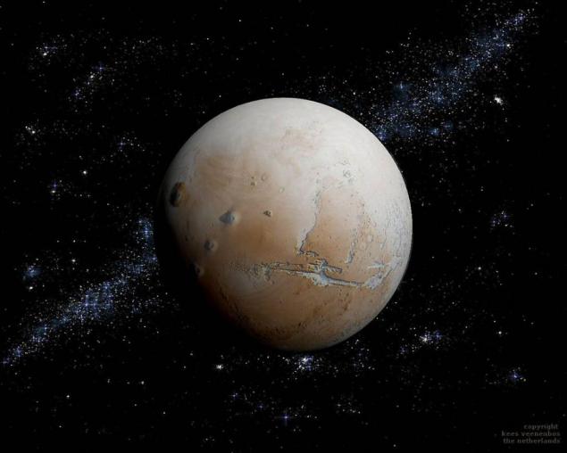
13. The volcano Olympus, lit by the rays of the rising sun. Misty dawn in Tarsis. Views of Mount Olympus from the field faults Lycus Sulci. (Image Credit: Data: NASA / Art: Kees Veenenbos)
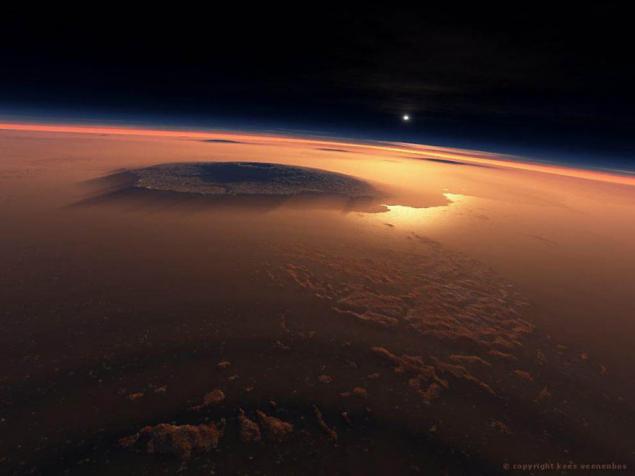
14. Valles Marineris. Foggy morning on eroded slopes of one of the mountains Valles Marineris. (Image Credit: Data: NASA / Art: Kees Veenenbos)
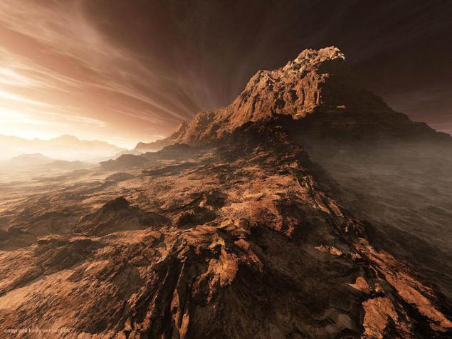
15. Schiaparelli Crater. With such a low position of the sun, its rays do not reach the western part of the crater wall. The diameter of the crater Schiaparelli reaches 450 km. (Image Credit: Data: NASA / Art: Kees Veenenbos)
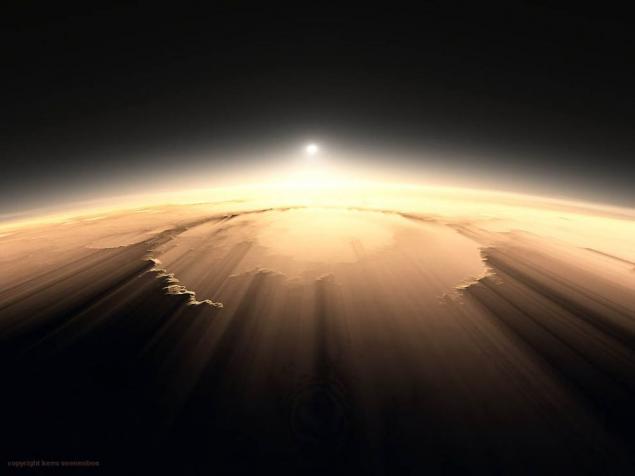
Orcus Patera 16. Crater illuminated by the setting sun. Orcus Patera Crater has a regular oval shape, it was formed by a meteorite, which was held tangentially to the surface of the planet. (Image Credit: Data: NASA / Art: Kees Veenenbos)
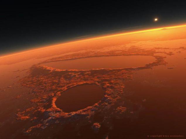
17. The southern slope of the crater Gale. Unusual cloud over the ravine runs in the direction of the crater Gale. Central peak of the crater Gale is a picture almost immediately under the sun. (Image Credit: Data: NASA / Art: Kees Veenenbos)
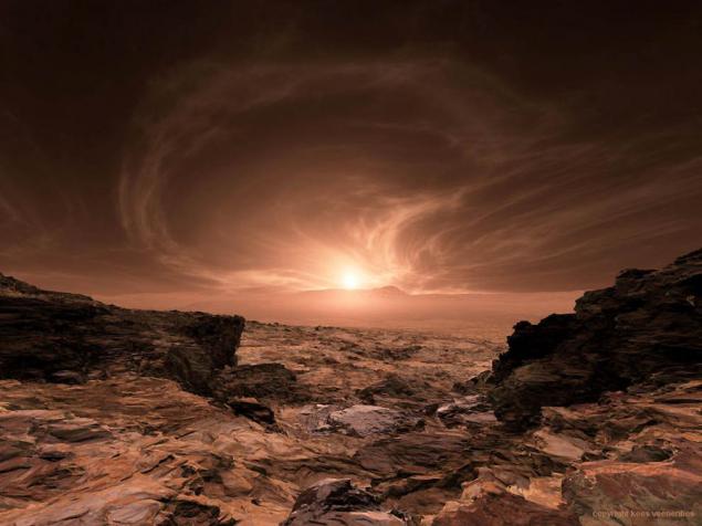
18. Gale Crater. Sunset near the Cimmerian land (Terra Cimeria). View Gale crater by aeolian plateau (Aeolis Mensae). (Image Credit: Data: NASA / Art: Kees Veenenbos)
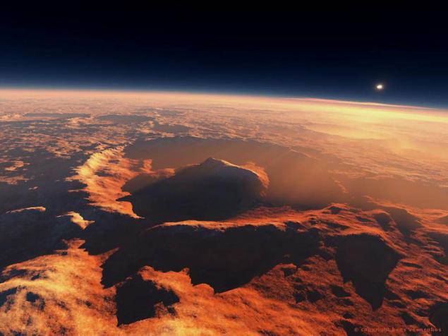
19. Place of landing the rover «Spirit». Type of Gusev Crater Noachianskoy era. Another concept with plenty of water and fumaroles. (Image Credit: Data: NASA / Art: Kees Veenenbos)
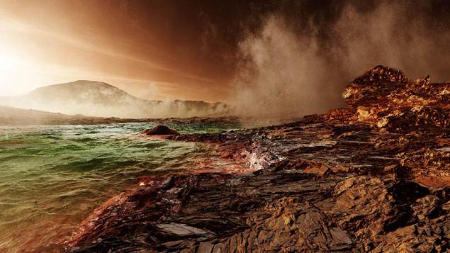
20. Canyon Melas in the rays of the rising sun. Picture Research rover. (Image Credit: Data: NASA / Art: Kees Veenenbos)
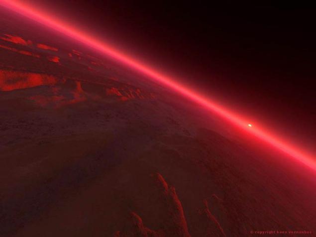
21. Modern Mars. This image has been posted with the image of Mars Noachianskoy era (below) in 2005 in the July issue of National Geographic. (Image Credit: Data: NASA / Art: Kees Veenenbos)
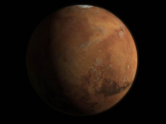
22. Valley Kase and Chryse Planitia on the background of nebulae and star sky. At the bottom of the image shows a passage in the Valles Marineris. (Image Credit: Data: NASA / Art: Kees Veenenbos)
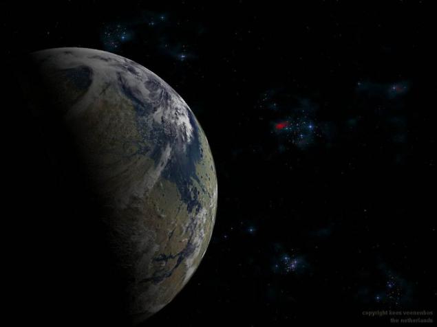
23. Place the rover landing «Phoenix». The images on the right wall of the crater Heimdall. (Image Credit: Data: NASA / Art: Kees Veenenbos)
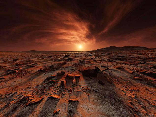
24. The North Pole and the Great Northern Plains (Vastitas Bolearis). On the left shows one of the biggest Martian crater - Crater Queen, whose diameter is 85 km away. (Image Credit: Data: NASA / Art: Kees Veenenbos)
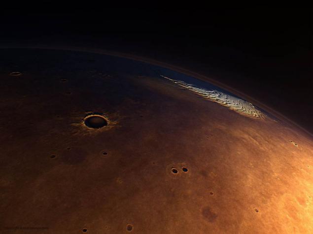
25. Located in the lower reaches of the Mariner Valley Canyon Io in a cloud of dust and smoke. (Image Credit: Data: NASA / Art: Kees Veenenbos)
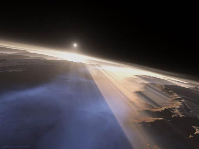
26. Volcanoes region Tharsis: Arsiya, Pavonis and Askraeus. View from the southwest to the northeast. Left shows patera Byblis (Biblis Patera) and Ulysses (Ulysses Patera). (Image Credit: Data: NASA / Art: Kees Veenenbos)
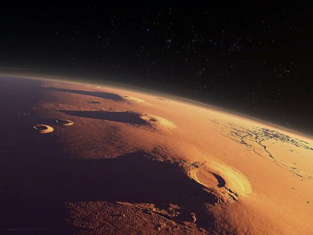
27. View of Mount Olympus Mars about 4 billion. Years ago, when Mars was more dense atmosphere and water. The image was made for an exhibition held at the planetarium of Madrid. (Image Credit: Data: NASA / Art: Kees Veenenbos)
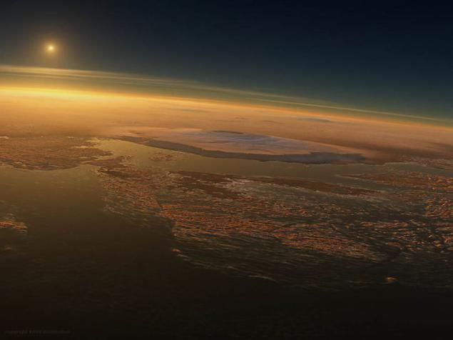
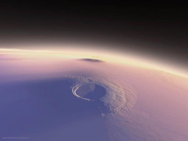
28. Volcano Arsiya. Diameter Arsiya volcano, which rises above the surrounding plains more than 20 km, is 450 km and the diameter of the caldera more than 120 km. (Image Credit: Data: NASA / Art: Kees Veenenbos)
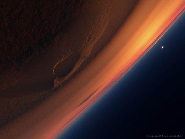
29. The dome of Tharsis. Tharsis dome during a sandstorm, the top down. From the cloud of dust storm peep Tharsis volcanoes region. (Image Credit: Data: NASA / Art: Kees Veenenbos)
1. Southern wall of the crater Holden. Rays of the sun, pulled out from under the peaked rocks, highlighting the transparent clouds in the shape of a star. (Image Credit: Data: NASA / Art: Kees Veenenbos)

2. Gusev Crater on ancient Mars. Once there land rover «Spirit MER2003». Panorama of the ancient planet after the dust storm. (Image Credit: Data: NASA / Art: Kees Veenenbos)

3. Valles Marineris. The consequences of dust storms in the canyon Koprat (front), in the Valles Marineris. (Image Credit: Data: NASA / Art: Kees Veenenbos)

4. The image of Mars Noachianskoy era. The planet about 4 billion. Years ago. The picture shows the crater, located on the Great Plains of North (Vastitas Bolearis), filled with water. A large lake located in the lower right corner of the image - a district of the meridians. Here rover «Opportunity» found signs of an inland sea. This image was made for the July issue of the journal National Geo in 2005. (Image Credit: Data: NASA / Art: Kees Veenenbos)

5. Argyre Planitia (Argyre Planitia). Concept for National Geographic. View of Mars during the evaporation of water from its surface a few billion. Years ago. The images show the salt deposits, cracks in the surface, with the content of hematite dust devils and falling meteorites. (Image Credit: Data: NASA / Art: Kees Veenenbos)

6. Maraldi Crater, located on the surface of Mars, covered with ice. The image was taken for the cover of the January issue of National Geographic magazine in 2004. (Image Credit: Data: NASA / Art: Kees Veenenbos)

7. Ancient view of the southern region of Chryse Planitia, covered with a layer of water and surrounded by Ares Vallis and Valles Marineris. (Image Credit: Data: NASA / Art: Kees Veenenbos)

8. North Pole of Mars (left) and craters of the Great Northern Plains (Vastitas Borealis). A large crater, pictured at the top of the picture - a crater Queen, the diameter of which is 85 km away. (Image Credit: Data: NASA / Art: Kees Veenenbos)

9. The view from the cave formed in the northern part of the shaft of a Martian crater Gale. The left is central peak of the crater Gale. (Image Credit: Data: NASA / Art: Kees Veenenbos)

10. Elysium volcanoes plains, illuminated by the rays of the rising sun. The image was made for an exhibition dedicated to the planet Mars, held in Madrid Planetarium. To the left in the picture shows the volcano dome Hecate, right - Volcano Albor Tholus. (Image Credit: Data: NASA / Art: Kees Veenenbos)

11. Place of landing the rover «Spirit». Gusev crater (background image - Hill Hazbend Hill). Panorama of ancient Mars: fumaroles, deposits of sedimentary rocks formed by hot water. (Image Credit: Data: NASA / Art: Kees Veenenbos)

12. View of Martian ice age. Picture made for the magazine National Geographic. (Image Credit: Data: NASA / Art: Kees Veenenbos)

13. The volcano Olympus, lit by the rays of the rising sun. Misty dawn in Tarsis. Views of Mount Olympus from the field faults Lycus Sulci. (Image Credit: Data: NASA / Art: Kees Veenenbos)

14. Valles Marineris. Foggy morning on eroded slopes of one of the mountains Valles Marineris. (Image Credit: Data: NASA / Art: Kees Veenenbos)

15. Schiaparelli Crater. With such a low position of the sun, its rays do not reach the western part of the crater wall. The diameter of the crater Schiaparelli reaches 450 km. (Image Credit: Data: NASA / Art: Kees Veenenbos)

Orcus Patera 16. Crater illuminated by the setting sun. Orcus Patera Crater has a regular oval shape, it was formed by a meteorite, which was held tangentially to the surface of the planet. (Image Credit: Data: NASA / Art: Kees Veenenbos)

17. The southern slope of the crater Gale. Unusual cloud over the ravine runs in the direction of the crater Gale. Central peak of the crater Gale is a picture almost immediately under the sun. (Image Credit: Data: NASA / Art: Kees Veenenbos)

18. Gale Crater. Sunset near the Cimmerian land (Terra Cimeria). View Gale crater by aeolian plateau (Aeolis Mensae). (Image Credit: Data: NASA / Art: Kees Veenenbos)

19. Place of landing the rover «Spirit». Type of Gusev Crater Noachianskoy era. Another concept with plenty of water and fumaroles. (Image Credit: Data: NASA / Art: Kees Veenenbos)

20. Canyon Melas in the rays of the rising sun. Picture Research rover. (Image Credit: Data: NASA / Art: Kees Veenenbos)

21. Modern Mars. This image has been posted with the image of Mars Noachianskoy era (below) in 2005 in the July issue of National Geographic. (Image Credit: Data: NASA / Art: Kees Veenenbos)

22. Valley Kase and Chryse Planitia on the background of nebulae and star sky. At the bottom of the image shows a passage in the Valles Marineris. (Image Credit: Data: NASA / Art: Kees Veenenbos)

23. Place the rover landing «Phoenix». The images on the right wall of the crater Heimdall. (Image Credit: Data: NASA / Art: Kees Veenenbos)

24. The North Pole and the Great Northern Plains (Vastitas Bolearis). On the left shows one of the biggest Martian crater - Crater Queen, whose diameter is 85 km away. (Image Credit: Data: NASA / Art: Kees Veenenbos)

25. Located in the lower reaches of the Mariner Valley Canyon Io in a cloud of dust and smoke. (Image Credit: Data: NASA / Art: Kees Veenenbos)

26. Volcanoes region Tharsis: Arsiya, Pavonis and Askraeus. View from the southwest to the northeast. Left shows patera Byblis (Biblis Patera) and Ulysses (Ulysses Patera). (Image Credit: Data: NASA / Art: Kees Veenenbos)

27. View of Mount Olympus Mars about 4 billion. Years ago, when Mars was more dense atmosphere and water. The image was made for an exhibition held at the planetarium of Madrid. (Image Credit: Data: NASA / Art: Kees Veenenbos)

28. Volcano Arsiya. Diameter Arsiya volcano, which rises above the surrounding plains more than 20 km, is 450 km and the diameter of the caldera more than 120 km. (Image Credit: Data: NASA / Art: Kees Veenenbos)

29. The dome of Tharsis. Tharsis dome during a sandstorm, the top down. From the cloud of dust storm peep Tharsis volcanoes region. (Image Credit: Data: NASA / Art: Kees Veenenbos)

