2120
The tragedy of the Aral Sea
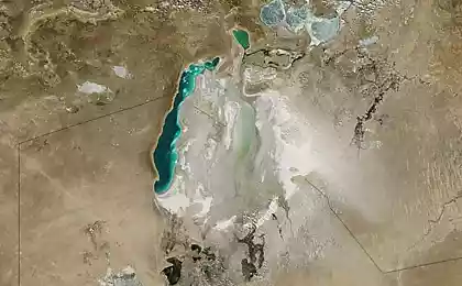
Aral Sea - endorheic salt lake in Central Asia, on the border of Kazakhstan and Uzbekistan. Since 1960-ies of XX century, the sea level (and the amount of water in it) decreases rapidly due to diversion of water from the main feeding rivers Amu Darya and Syr Darya. Until the early depletion of the Aral Sea was the fourth largest lake in the world. Over-extraction of water for irrigation of agricultural land converted lake-sea, before a rich life in a barren desert. What is happening to the Aral Sea - a real ecological disaster, the blame for which lies with the Soviet regime.
Today, intensive irrigation of cotton fields and rice takes up a large part of the flow of the two rivers, which drastically reduces the flow of water to their delta and, respectively, in the sea itself. Precipitation in the form of rain and snow, and underground sources give Aral Sea water is much less than it is lost by evaporation, whereby the volume of the lake water, sea decreases and increases in salinity level. (Port Aralsk, 1970, has already seen how the water is gone)
In the Soviet Union the deteriorating state of the Aral Sea was hidden for decades, until 1985, when MS Gorbachev made this ecological disaster made public.
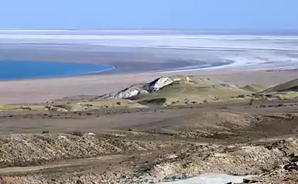
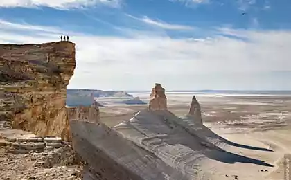
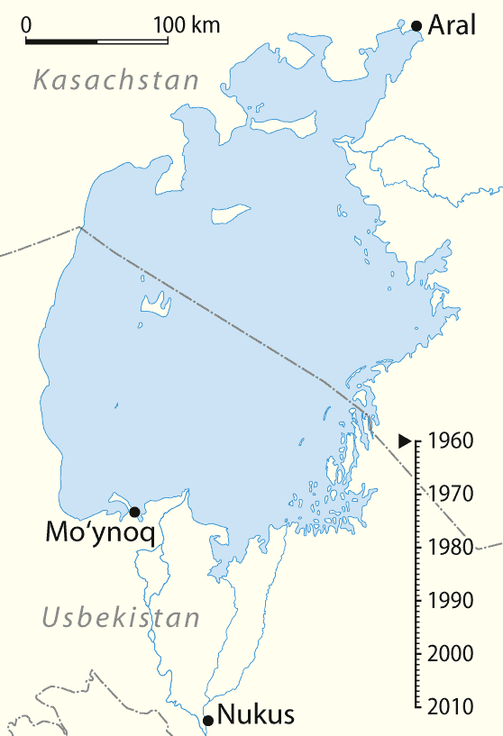
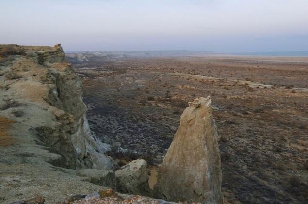
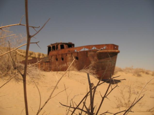
At the moment, the shrinking Aral Sea was spent on 100 km from its former coastline near the town of Muinak in Uzbekistan.

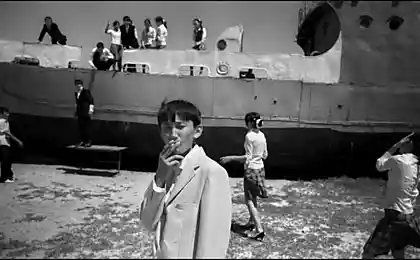
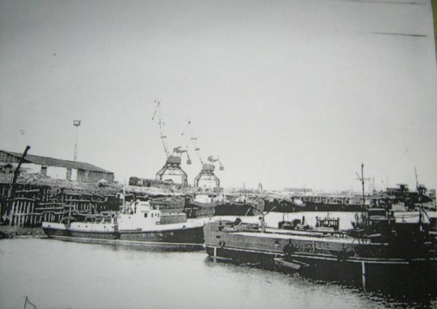
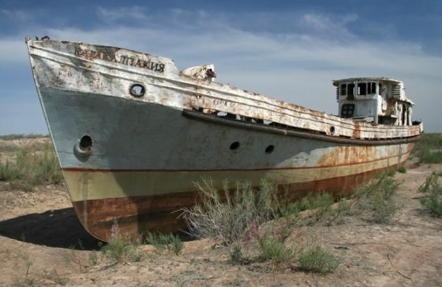
Almost all the water inflow to the Aral Sea is provided Amudarya and Syrdarya rivers. For millennia, it happened that the Amu River took away from the Aral Sea (the Caspian), causing a decrease in the size of the Aral Sea. However, with the return of the River Aral invariably restored within its former borders. (In the photo port of Aralsk, in the foreground TCP "Leo Berg", 1960)
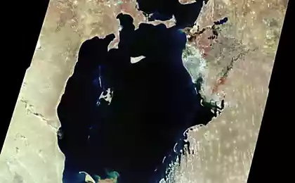
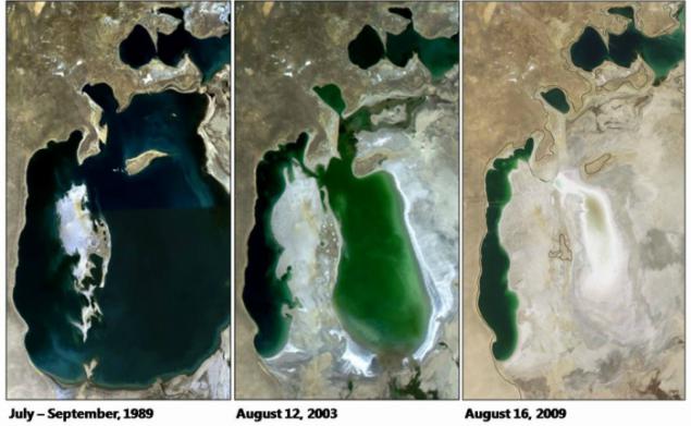
At the end of the 1980s. the water level dropped so much that the whole sea was divided into two parts: the northern Small Aral and the southern Big Aral. By 2007, in the southern part were clearly identified deep western and eastern shallow waters, as well as the remains of a small separate bay. The volume of the Large Aral was reduced from 708 to only 75 km3, and salinity increased from 14 to more than 100 g / l.
With the collapse of the USSR in 1991, the Aral Sea had been divided between the newly formed states - Kazakhstan and Uzbekistan. Thus, put an end to the grand Soviet plan for the transfer of water here distant Siberian rivers and turned competition for melting water.
We can only be glad that it was not possible to finish the project on the transfer of Siberian rivers, because we do not know what would have followed this disaster.
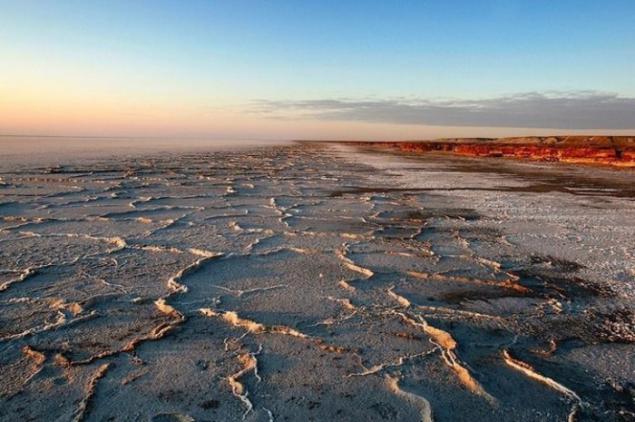
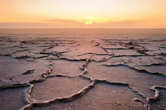
Drainage water coming from the fields into the mainstream of the Syr Darya and Amu Darya caused deposits of pesticides and various other agricultural pesticides, appearing in some places by 54 thousand. Km2 of former seabed covered with salt.
Dust storms spread salt, dust and toxic chemicals at a distance of 500 km. Sodium bicarbonate, sodium chloride and sodium sulfate airborne and destroy or slow the development of natural vegetation and crops. The local population suffers from a high incidence of respiratory diseases, anemia, cancer of the larynx and esophagus, as well as digestive disorders. Participation liver and kidney disease, eye disease.
Desiccation of the Aral Sea had serious consequences. Due to the sharp decrease in river flow ceased spring floods, supplied the flooded lowlands of the Amu Darya and Syr Darya rivers with fresh water and fertile sediments. The number of species of fish living there dropped from 32 to 6 - the result of increasing the level of salinity, loss of spawning and feeding grounds (which have remained basically only in the river deltas).
In 1960 fish catch reached 40 thousand. T, by the mid-1980s. local commercial fishing simply ceased to exist and was lost for more than 60 thousand. related jobs. The most common inhabitant of the Black Sea plaice remained adapted to life in salt water and brought here as early as the 1970s. However, by 2003, the Large Aral was gone and she could not stand the salinity of more than 70 g / l - in 2-4 times more than usual for her marine environment.
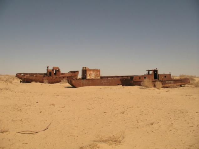
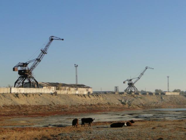
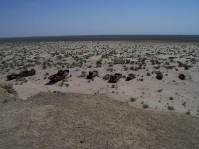
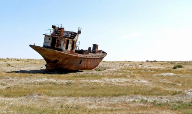
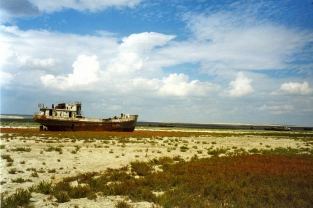
Shipping on the Aral stopped because the water receded many kilometers from the area's major ports - the city of Aral in the north and in the south of the city Muinak. And to maintain the navigability of the increasingly long channels to ports proved too costly affair. With decreasing water level in both parts of the Aral Sea has fallen and the groundwater level, which has accelerated the process of desertification areas.
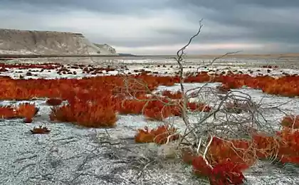
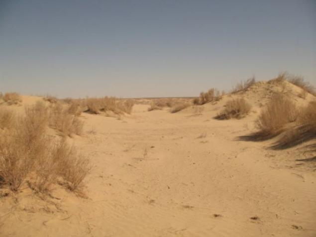
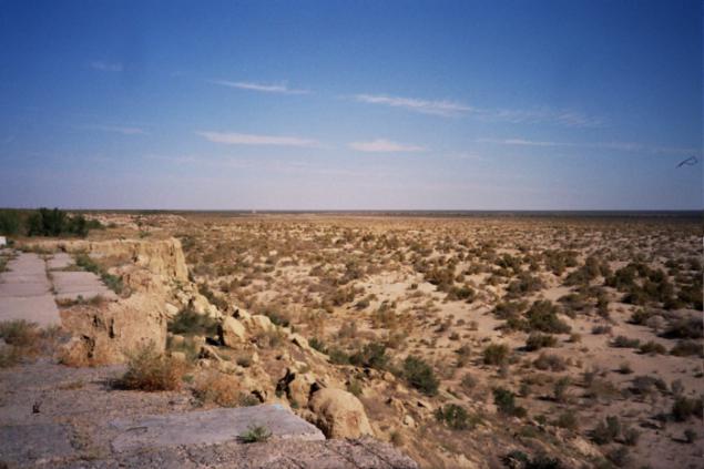
By the mid-1990s. instead of lush green trees, shrubs and grasses on the former sea shores were seen only rare halophytes and xerophytes beams - plants adapted to saline soils and dry habitats. While maintaining only half of local species of mammals and birds. Within 100 km from the original shoreline climate has changed: it became hotter in summer and colder in winter, reduced the level of humidity (or decreased rainfall), reduced the duration of the growing season, most were observed drought.
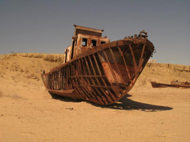
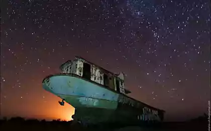
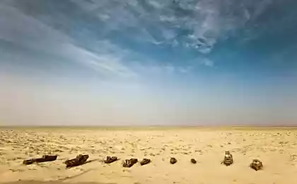
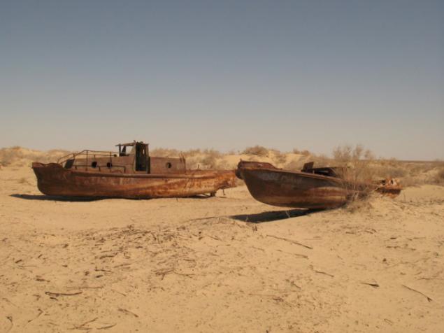
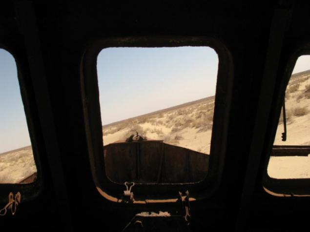
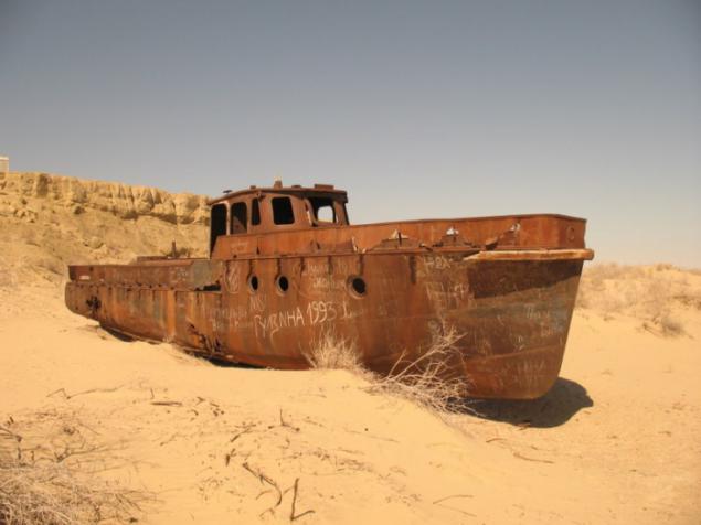
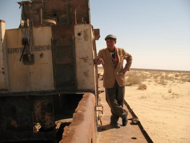
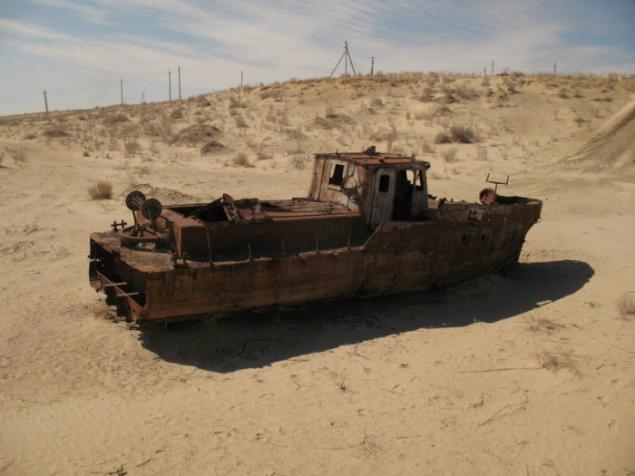
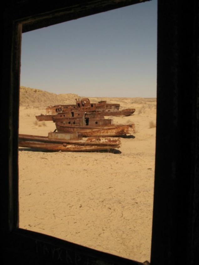
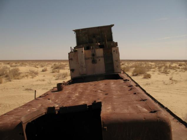
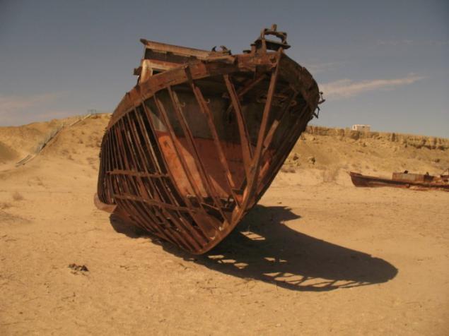
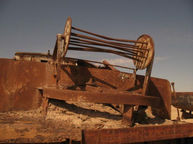
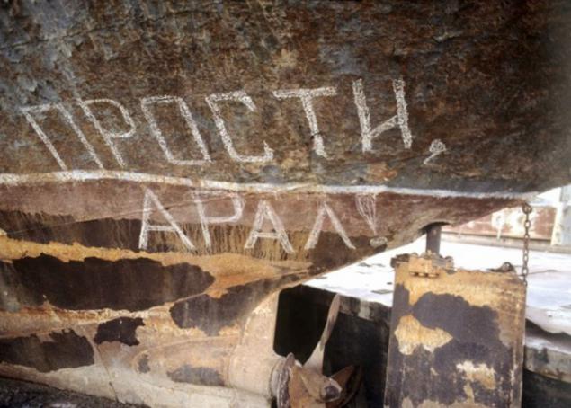
On the former coastline hundreds of skeletons of ships.
Despite the extensive drainage basin, the Aral Sea is almost not getting water because of irrigation canals that take water from the Amu Darya and Syr Darya rivers for hundreds of kilometers of flow through several countries. Among other consequences - the disappearance of many species of animals and plants.
Restore the entire Aral Sea is impossible. This would require a four-fold increase in the annual inflow of waters of the Amu Darya and Syr Darya, compared with the current average of 13 km3. The only possible way would be to reduce irrigation, which takes 92% of the water intake. However, four of the five former Soviet republics in the Aral Sea basin (except for Kazakhstan) intends to increase the volume of irrigating farmland - mostly to feed a growing population.
In this situation, would help the transition to a less moisture-loving culture, such as replacing cotton with winter wheat, however, two major water consuming countries in the region - Uzbekistan and Turkmenistan - are going to continue to grow cotton is for sale abroad. It could also significantly improve existing irrigation canals, many of whom are ordinary trench, which seeps through the walls and goes in the sand enormous amounts of water. Modernization of the entire irrigation system would help save annually about 12 km3 of water, but would have cost $ 16 billion.
However, if you look at the history of the Aral Sea, the sea has dried out, and the back again in the old bank. So, how was the Aral last few centuries and how to change its size?
In the historical period there were significant fluctuations in the level of the Aral Sea. Thus, at the bottom of the retreat were found the remains of trees that grew on the site. In the middle of the Cenozoic Era (21 million years ago), the Aral Sea was connected to the Caspian Sea. Until 1573 the Amu Darya on the sleeve Uzboi flows into the Caspian Sea and the river Turgay - the Aral Sea. On the map drawn by the Greek scientist Claudius Ptolemy (1800 years ago), showing the Aral and Caspian Sea, the Caspian rivers flow into the Amu Darya and Zarafshan.
In the late 16th and early 17th century due to lower sea levels formed island Barsakelmes, Kaskakulan, Kozzhetpes, Uyaly, Biyiktau, Renaissance. River Zhanadarya 1819, Kuandarya since 1823 have ceased to fall into the Aral Sea. Since the beginning of systematic observations (XIX century) and to the middle of the XX century the level of the Aral Sea remained practically unchanged. In the 1950s, the Aral Sea was the fourth largest lake in the world, occupying about 68 thousand. Km2; Its length is 426 km, width - 284 km, maximum depth - 68 m.
In 1930 began large-scale construction of irrigation canals in Central Asia, which is particularly intensified in the early 1960s. Since the 1960s, the sea was shallow because of the fact that the water of the rivers flowing into it, in ever increasing volumes diverted to irrigation. From 1960 to 1990 the second area of irrigated land in Central Asia increased from 4, 5 million to 7 million hectares. Needs of the economy of the region in water increased from 60 to 120 km3 per year, of which 90% is used for irrigation.
Starting from 1961, the sea level dropped at an increasing rate from 20 to 80-90 cm / year. Until the 1970s, lived in the Aral Sea 34 species of fish, 20 of them have commercial value. In 1946, the Aral Sea caught 23 thousand tons of fish, in the 1980s, the figure was 60 thousand tons. On the Kazakh part of the Aral Sea Fisheries was 5, 1 Fish Cannery, 45 fish processing items on the Uzbek (Republic of Karakalpakstan) - 5 Fisheries, 1 fish cannery, fish processing more than 20 points.
Receding sea has left behind 54 thousand. Km2 dry seabed covered with salt, and in some places even deposits of pesticides and various other agricultural chemicals washed off once the run-off from local fields.
Another very unusual problem with the island of Renaissance. When he was away at sea, the Soviet Union used it as a proving ground for testing biological weapons. Anthrax, tularemia, brucellosis, plague, typhus, smallpox, and botulinum toxin were tested here on horses, monkeys, sheep, donkeys and other laboratory animals. In 2001, as a result of withdrawal of water Renaissance Island connected to the mainland on the south side. Doctors fear that dangerous microorganisms retained viability, and infected rodents may be their distributors in other regions.
The sad fate of the Aral Sea are starting to repeat other major reservoirs of the world - most notably Lake Chad in Central Africa and the Salton Sea in the south of the US state of California.
©