1022
At the bottom of the Aral Sea (28 photos)
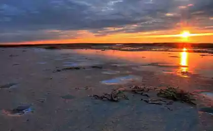
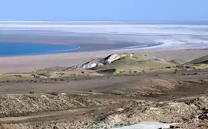
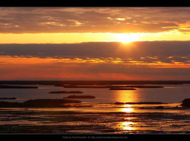
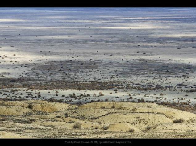
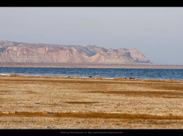
Lake Sudoche (Sudovshin) - the largest body of water vnutrideltovy Amu Darya. As long as the river flood season, two of her sleeves and Raushan Priemuzyak entertained Sudoche, which was connected through a duct to the Aral Sea. Today, much of the water is gone from here for about 150 km, and the lake became shallow and split into several smaller ones. In the background stands the Ustyurt plateau. The coastal area is covered with small bushes, salt, and ground affects a variety of textures and colors.
Proud loneliness
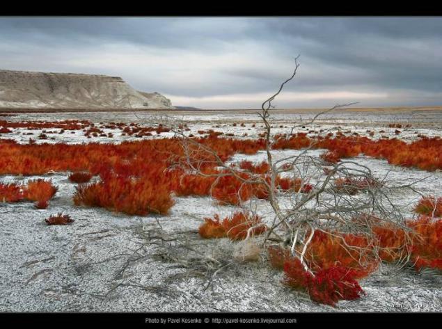
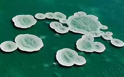
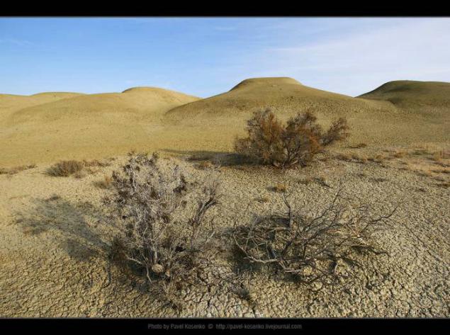
Saksaul - a cross between bushes and stunted trees, grows in the deserts and steppes of Asia. Its root system extracts moisture at a depth of 30 meters, and some species can withstand saline soils. In the Large Aral Sea salt content is now close to 100 grams per liter (imagine a pack of salt dissolved in a bucket), and in the shallow eastern part - and even higher. The Aral Sea while inferior in salinity except that the absolute champion among the major reservoirs of the planet, the Dead Sea. However, the lake Sudoche spring was bland and osolonyalos until the fall. I understand that now it always salty. White deposits on the ground - it does not snow, it's just salt.
Depths of the sea
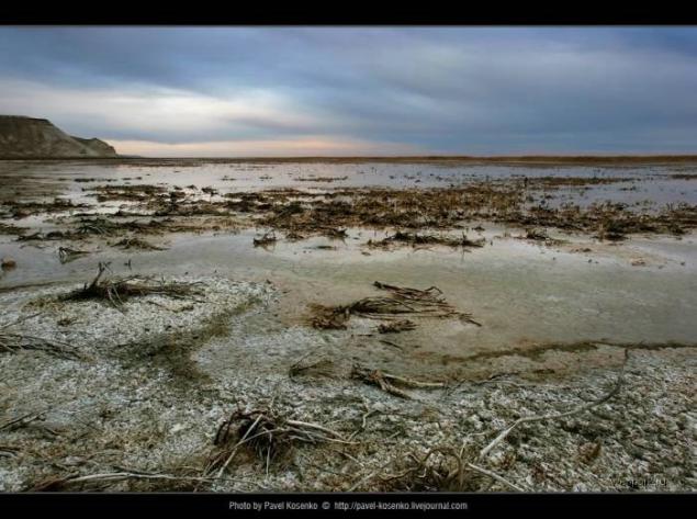
The weather was overcast and chilly. Generally expedition Usturt rare in themselves, and in late November the more. Did you see some of the rare pictures of Lake Sudoche this time of year.
Instead algae
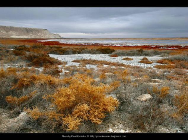
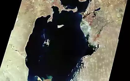
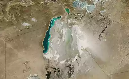
It is believed that the main reason for the drying of the Aral Sea was the irrational use of water resources, feeding it Amudarya and Syrdarya rivers and excessive analysis of water for irrigation of cotton. Many experts, however, tend to think that in such a rapid decrease in the sea to blame not only the person, the more that there are serious geological and archaeological indications that similar retreat of the Aral Sea occurred in the past. Most likely, there was a superposition of anthropogenic and natural causes (reduced rainfall, increased evaporation due to warming). In addition, there is the theory of crustal faults and overflow of water from the Aral Sea to the Caspian, with the causes of this fault include both tectonic processes and secret research on biological weapons, which were held on the island of Renaissance Soviet military since 1949. For certain causes drying of the Aral Sea is not exactly known.
16th releyka
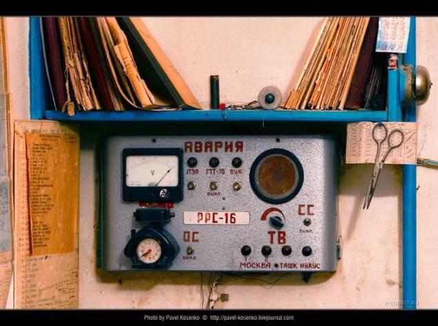
Nothing human is alien to the natural beauty of the harsh edges. Despite the fact that you can Ustiurt weeks without seeing a soul, we have managed to never use tents. We aspire to it, because the weather was -0-10 instead of the expected + 0 + 5 degrees Celsius. Releyki (radio relay station) located every 50 km and have served for broadcasting transmission signal to distant villages. With the development of satellite television and the disappearance of these settlements Ustiurt miracle of modern technology has long ceased to operate. Almost all of them are uninhabited, except for a few who converted under spetsnuzhdy - usually the security of the pipeline. Nearest from Nukus on the Ustyurt plateau releyka has the number 16, and here we are sheltered watchman on the first night of our expedition. In the following days we got almost to the 21st releyki (inhabited was still only 19th, though releykah we no longer spend the night). In general, for 4 days at Ustyurt we drove a jeep about 1000 km.
Curious origin of the word Sudoche. Contrary suggests associations to fish walleye name of the lake to do. As I told the captain of the expedition clancyloox, in Uzbek lake called "Suvdoshin", from the words "suv" (water) and "tire" (true).
On the road with clouds
All points of the route are tied to sunrise and sunset. To catch a beach sunrise, had to get up at 5 am. Then, for almost an hour looking for the descent from the escarpment and get to the intended points of the evening shooting.
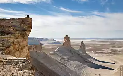
Chink - (literary form; Kazakh. And Turkmen. Shyn), open, shelf, limiting plateau or small dining outliers. The name is common in Kazakhstan, Turkmenistan, Uzbekistan. Most often called Charles cliffs Ustyurt. Height Ch reaches 300-350 m. The origin of the erosion, denudation and tectonic.
Smile
Panorama 147 x 70 degrees, 16 vertical frames. Effect is achieved due to the two successive actions:
a) strong compression of the panorama to a ratio of 2: 1 (ratio chosen experimentally for a particular frame)
b) expanding the central portion towards the edges using Edit - & gt; Transform - & gt; Warp
Puff pie
First Sudoche was the most extensive vnutrideltovym pond with a water mirror of 350 square kilometers and a depth of 3 meters. It turns out that today beneaped lake probably can walk through the entire ford.
There are no fish
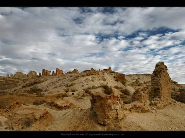
In the 50s on the banks Sudoche was a fishing village with a population of Urga a few hundred inhabitants. Our guide told in October that there was a club and a post office. The last inhabitants left here in 1971. Now about the village is easy to find even a mention.
South-western region of the Aral Sea, salt lake Borsa Kelmas. In translation from Uzbek means "who will not come back." The edge of the shore - a real swamp, but the surface itself - unshakable firmament. The main thing - to break through. And then come back.
Empty-handed
We're back - knee-deep in mud, tired but satisfied. Good half hour fooling around under the bright sun, occasionally tasting the salt from under the soles of your own. Shooting genre.
Towards the sun
Because naked girls among us was not, as the models had to act themselves.
Badwater in Uzbek
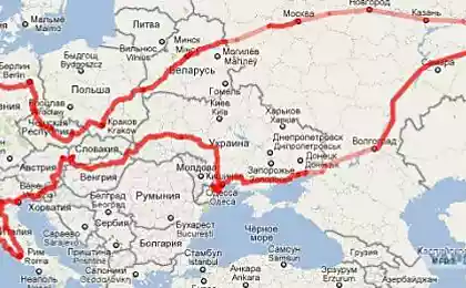
And still on the lake have a factory - not salt, not soda. The plant seems very secret, because even Google about it does not know anything.
But the map is quite fresh, and even today the Aral Sea coast on it almost untrue.
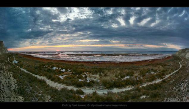
On the edge of the earth
Panorama collage 200h134 degrees, 17 frames. The proportions of approximately met, but you do not believe them. Too much angle + distortion wide-angle lens. I was already pretty scolded for geometry, but I can not help myself - I like this photo, it was his insane.
This Schimberg, our driver. Second driver called Bakbergen. In both names ending means "gave". Bakbergen - "gave feed", ie feed the one who gave the child (God). A Schimberg - is "honestly gave" (remember Sudovshin, ship - "water", "bus" - the truth). In general, just like Lyolik and Bolik, very nice people. And our guide was called in October, is in honor of the revolution. He, too, is a good man - a historian, archaeologist. I have narrate how in your favorite movie "Abdullajon", remember? "It is our collective farm chairman - a good man." And though hoe we did not fly, but the jeeps went smoothly. Thanks guys!
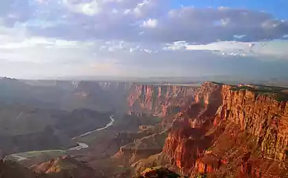
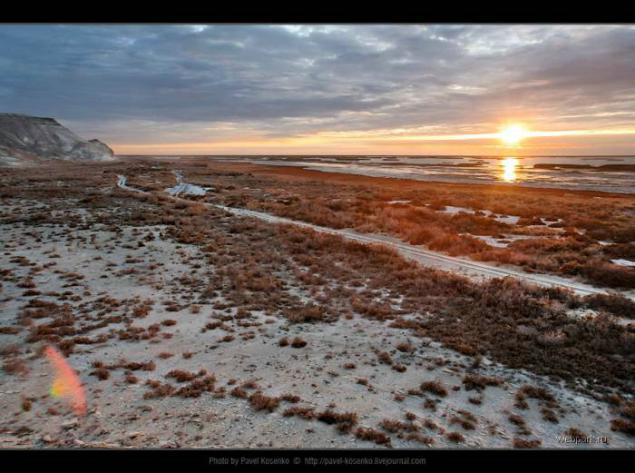
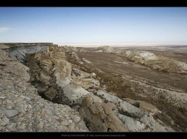
The biggest banality that only you can say, is on the eastern escarpment of Ustyurt plateau - the phrase "the former bed of the Aral Sea." I personally bottom imagined everywhere, even where it actually was not. This phrase is thoroughly permeated offscreen (and intraframe) comments our video recording. And when it comes to this the very bottom of the former sea, already do not dare to say that in fact it was there and I had to say.
Uzbek canyons
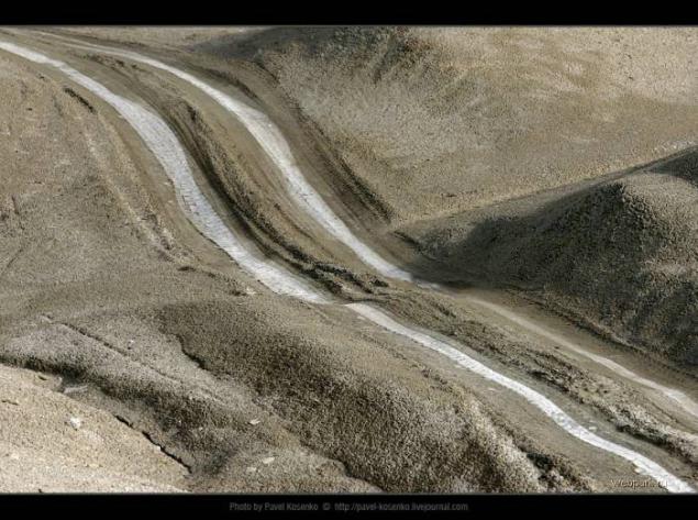
Three black dots in the bottom right of the frame - a cow. Our guide said that he had met them here is not the first time, apparently strayed from the flock. Do not understand how they live - in fact no people, no water, no food in these places do not have.
Scale can be defined in the footsteps of jeeps in the background - where before there was water, now drive cars.
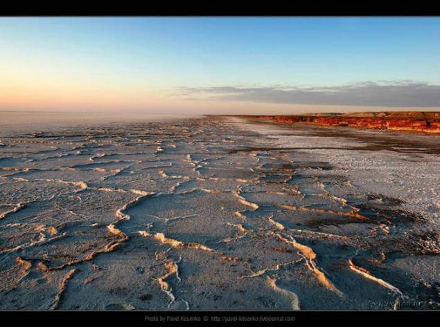
Prior to the 1961 year, when the shallowing of the Aral Sea, the level of water stood at 53, 40 m, and annual fluctuations did not extend beyond ± 0, 4 meters. By 2003, the rate dropped to a mark of 30, 90 m, ie more than 22 meters. And in 2002, a decline of 1, 26 m, and in 2001 to the 1, 14 m. This is the most recent data that I have found on the Internet. Based on these figures we can assume that to date, the level of the Aral Sea has fallen for at least another 5 meters, and the total reduction in the order of 27-30 meters. Imagine this figure is not difficult, it is approximately equal to that of a 9-storey residential building.
Interruption in this photo, though high, but clearly below the nine-. In the upper right corner we see the sea. Drop of water from the present coast to the foot of the cliff a little, because about the points are on the flat surface of the former seabed. So point shooting had also been under water.
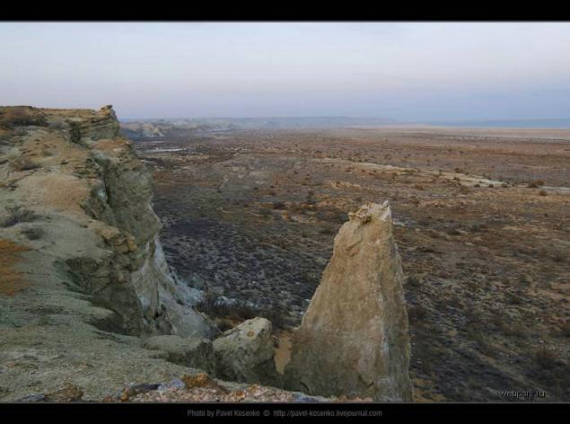
But the far cliff just from a different angle and with a great approach.
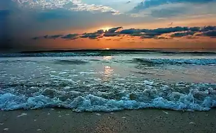
The very edge of the water foams as hand-washing, and along the coast flying white flakes. The sea is very shallow, it is seen by the oncoming waves. I was 30 meters deep, but the water was ankle-deep as, and remains. Bottom unpleasant, clay-silt and smacking as in the swamp. In general, it was cold, and the wind about 0, but, you know - do not swim I could not :) Health, thank God, was not affected.
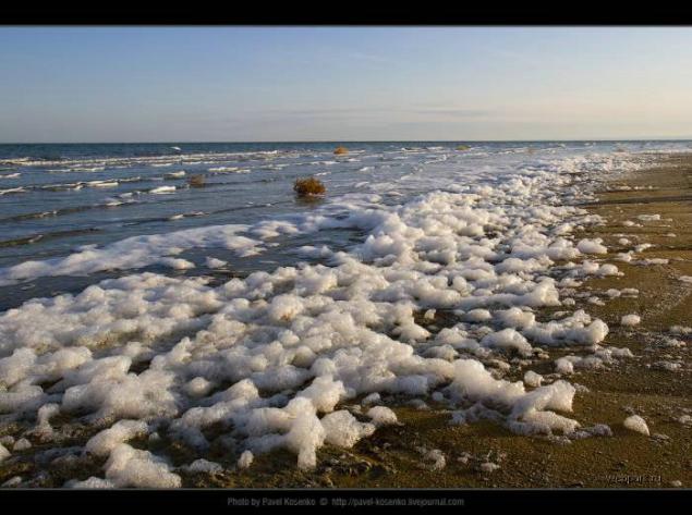
But looked like the last 100-200 meters of the road before she emerged on a rocky ledge. The one with a view of the high water and was removed from the first in this series of photos.
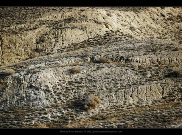
Loy Takyr
In the group of Turkic languages "Loy" means clay, takyr - "even, smooth." Here's what I found by searching in dictionaries. Takyr - a form of relief in sand, clay and stony deserts and semi-deserts of the tropical and subtropical zones. Surface clay-solonetsization solid horizon broken cracks into polygons. Spring takyrs usually filled with water, turning into temporary lakes. Takyrs common in Central Asia, Kazakhstan, Mongolia, Southwest Asia, North America, Australia.
It's hard to believe, but some 40-50 years ago it really was the bottom of the sea.
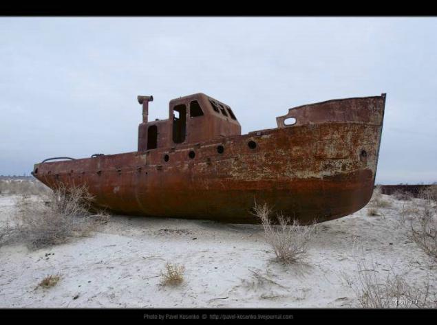
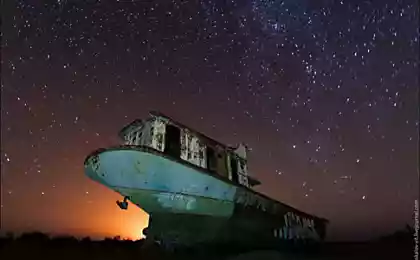
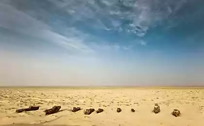
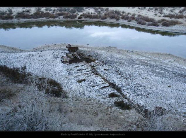
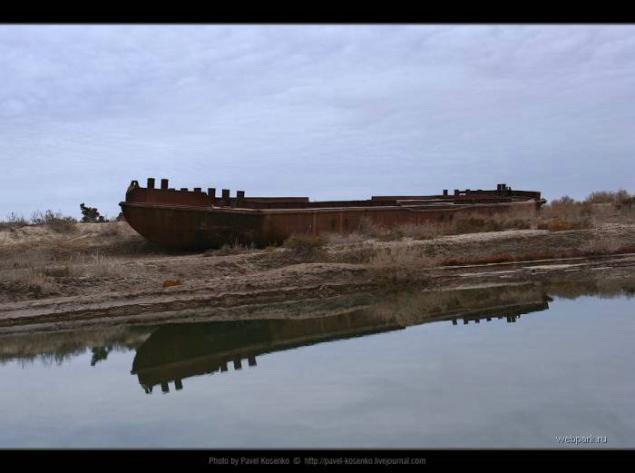
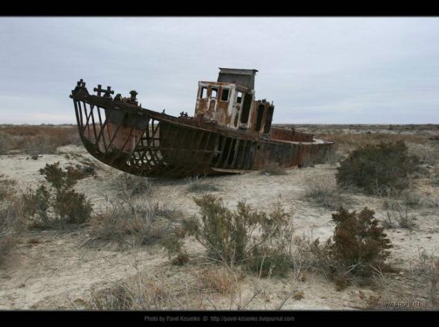
I understand that all have got a series of cards of the Aral Sea. I myself am tired, but if we do not dobyu material, it runs the risk of permanently remain in the table. In addition, some Aral no ships of the desert? Although we brought on a former pier crack of dawn, no light of dawn or not found. Atrocious weather, literally "gray haze." As a result, the protocol before you pictures, but I decided that without them, the series will be informative not finished.
Until the 1960s, the city was Muinak port on the same island, and here you can reach by boat or by plane. They say the first night shallowing water at once went to the 200 meters. On the morning the people had fled overseas and wept. Over time, tried to dig a canal from the port to the beach, but the water goes faster construction. Today, from here to the sea more than 100 km. What does the current population, remains a mystery to me, but that's where I saw the Aral Sea tragedy. Ustiurt, away from people, what is happening is perceived more as a natural process. There is scientific evidence that the Aral shoaling and filled several times, long before people settled here (although the current drop in sea level, of course, not without its participation). But where the process broke settled for life, broke human destiny - it looks really like a tragedy.
Author
Proud loneliness

Saksaul - a cross between bushes and stunted trees, grows in the deserts and steppes of Asia. Its root system extracts moisture at a depth of 30 meters, and some species can withstand saline soils. In the Large Aral Sea salt content is now close to 100 grams per liter (imagine a pack of salt dissolved in a bucket), and in the shallow eastern part - and even higher. The Aral Sea while inferior in salinity except that the absolute champion among the major reservoirs of the planet, the Dead Sea. However, the lake Sudoche spring was bland and osolonyalos until the fall. I understand that now it always salty. White deposits on the ground - it does not snow, it's just salt.
Depths of the sea

The weather was overcast and chilly. Generally expedition Usturt rare in themselves, and in late November the more. Did you see some of the rare pictures of Lake Sudoche this time of year.
Instead algae

It is believed that the main reason for the drying of the Aral Sea was the irrational use of water resources, feeding it Amudarya and Syrdarya rivers and excessive analysis of water for irrigation of cotton. Many experts, however, tend to think that in such a rapid decrease in the sea to blame not only the person, the more that there are serious geological and archaeological indications that similar retreat of the Aral Sea occurred in the past. Most likely, there was a superposition of anthropogenic and natural causes (reduced rainfall, increased evaporation due to warming). In addition, there is the theory of crustal faults and overflow of water from the Aral Sea to the Caspian, with the causes of this fault include both tectonic processes and secret research on biological weapons, which were held on the island of Renaissance Soviet military since 1949. For certain causes drying of the Aral Sea is not exactly known.
16th releyka

Nothing human is alien to the natural beauty of the harsh edges. Despite the fact that you can Ustiurt weeks without seeing a soul, we have managed to never use tents. We aspire to it, because the weather was -0-10 instead of the expected + 0 + 5 degrees Celsius. Releyki (radio relay station) located every 50 km and have served for broadcasting transmission signal to distant villages. With the development of satellite television and the disappearance of these settlements Ustiurt miracle of modern technology has long ceased to operate. Almost all of them are uninhabited, except for a few who converted under spetsnuzhdy - usually the security of the pipeline. Nearest from Nukus on the Ustyurt plateau releyka has the number 16, and here we are sheltered watchman on the first night of our expedition. In the following days we got almost to the 21st releyki (inhabited was still only 19th, though releykah we no longer spend the night). In general, for 4 days at Ustyurt we drove a jeep about 1000 km.
Curious origin of the word Sudoche. Contrary suggests associations to fish walleye name of the lake to do. As I told the captain of the expedition clancyloox, in Uzbek lake called "Suvdoshin", from the words "suv" (water) and "tire" (true).
On the road with clouds

All points of the route are tied to sunrise and sunset. To catch a beach sunrise, had to get up at 5 am. Then, for almost an hour looking for the descent from the escarpment and get to the intended points of the evening shooting.
Chink - (literary form; Kazakh. And Turkmen. Shyn), open, shelf, limiting plateau or small dining outliers. The name is common in Kazakhstan, Turkmenistan, Uzbekistan. Most often called Charles cliffs Ustyurt. Height Ch reaches 300-350 m. The origin of the erosion, denudation and tectonic.
Smile

Panorama 147 x 70 degrees, 16 vertical frames. Effect is achieved due to the two successive actions:
a) strong compression of the panorama to a ratio of 2: 1 (ratio chosen experimentally for a particular frame)
b) expanding the central portion towards the edges using Edit - & gt; Transform - & gt; Warp
Puff pie

First Sudoche was the most extensive vnutrideltovym pond with a water mirror of 350 square kilometers and a depth of 3 meters. It turns out that today beneaped lake probably can walk through the entire ford.
There are no fish

In the 50s on the banks Sudoche was a fishing village with a population of Urga a few hundred inhabitants. Our guide told in October that there was a club and a post office. The last inhabitants left here in 1971. Now about the village is easy to find even a mention.
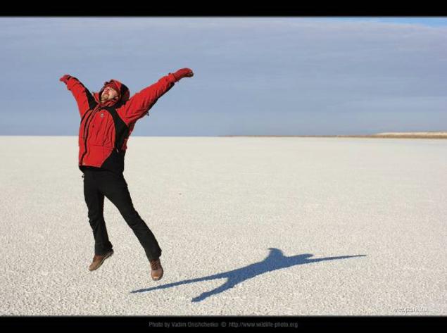
South-western region of the Aral Sea, salt lake Borsa Kelmas. In translation from Uzbek means "who will not come back." The edge of the shore - a real swamp, but the surface itself - unshakable firmament. The main thing - to break through. And then come back.
Empty-handed

We're back - knee-deep in mud, tired but satisfied. Good half hour fooling around under the bright sun, occasionally tasting the salt from under the soles of your own. Shooting genre.
Towards the sun

Because naked girls among us was not, as the models had to act themselves.
Badwater in Uzbek

And still on the lake have a factory - not salt, not soda. The plant seems very secret, because even Google about it does not know anything.
But the map is quite fresh, and even today the Aral Sea coast on it almost untrue.
On the edge of the earth

Panorama collage 200h134 degrees, 17 frames. The proportions of approximately met, but you do not believe them. Too much angle + distortion wide-angle lens. I was already pretty scolded for geometry, but I can not help myself - I like this photo, it was his insane.

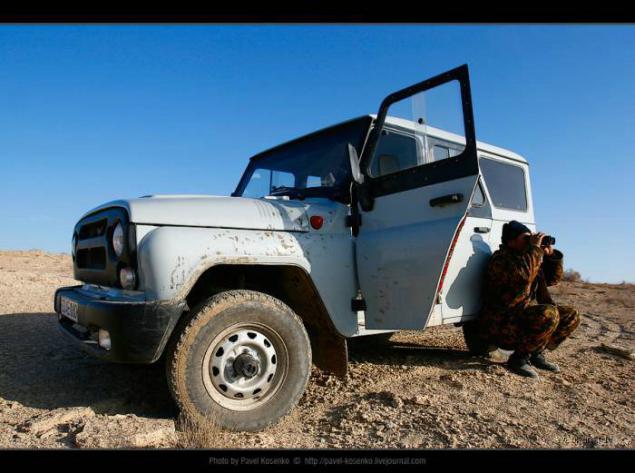
This Schimberg, our driver. Second driver called Bakbergen. In both names ending means "gave". Bakbergen - "gave feed", ie feed the one who gave the child (God). A Schimberg - is "honestly gave" (remember Sudovshin, ship - "water", "bus" - the truth). In general, just like Lyolik and Bolik, very nice people. And our guide was called in October, is in honor of the revolution. He, too, is a good man - a historian, archaeologist. I have narrate how in your favorite movie "Abdullajon", remember? "It is our collective farm chairman - a good man." And though hoe we did not fly, but the jeeps went smoothly. Thanks guys!
The biggest banality that only you can say, is on the eastern escarpment of Ustyurt plateau - the phrase "the former bed of the Aral Sea." I personally bottom imagined everywhere, even where it actually was not. This phrase is thoroughly permeated offscreen (and intraframe) comments our video recording. And when it comes to this the very bottom of the former sea, already do not dare to say that in fact it was there and I had to say.
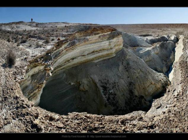
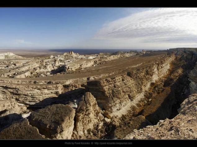
Uzbek canyons


Three black dots in the bottom right of the frame - a cow. Our guide said that he had met them here is not the first time, apparently strayed from the flock. Do not understand how they live - in fact no people, no water, no food in these places do not have.

Scale can be defined in the footsteps of jeeps in the background - where before there was water, now drive cars.


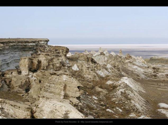
Prior to the 1961 year, when the shallowing of the Aral Sea, the level of water stood at 53, 40 m, and annual fluctuations did not extend beyond ± 0, 4 meters. By 2003, the rate dropped to a mark of 30, 90 m, ie more than 22 meters. And in 2002, a decline of 1, 26 m, and in 2001 to the 1, 14 m. This is the most recent data that I have found on the Internet. Based on these figures we can assume that to date, the level of the Aral Sea has fallen for at least another 5 meters, and the total reduction in the order of 27-30 meters. Imagine this figure is not difficult, it is approximately equal to that of a 9-storey residential building.
Interruption in this photo, though high, but clearly below the nine-. In the upper right corner we see the sea. Drop of water from the present coast to the foot of the cliff a little, because about the points are on the flat surface of the former seabed. So point shooting had also been under water.

But the far cliff just from a different angle and with a great approach.

The very edge of the water foams as hand-washing, and along the coast flying white flakes. The sea is very shallow, it is seen by the oncoming waves. I was 30 meters deep, but the water was ankle-deep as, and remains. Bottom unpleasant, clay-silt and smacking as in the swamp. In general, it was cold, and the wind about 0, but, you know - do not swim I could not :) Health, thank God, was not affected.

But looked like the last 100-200 meters of the road before she emerged on a rocky ledge. The one with a view of the high water and was removed from the first in this series of photos.

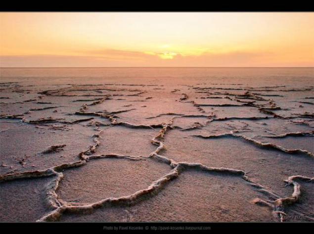
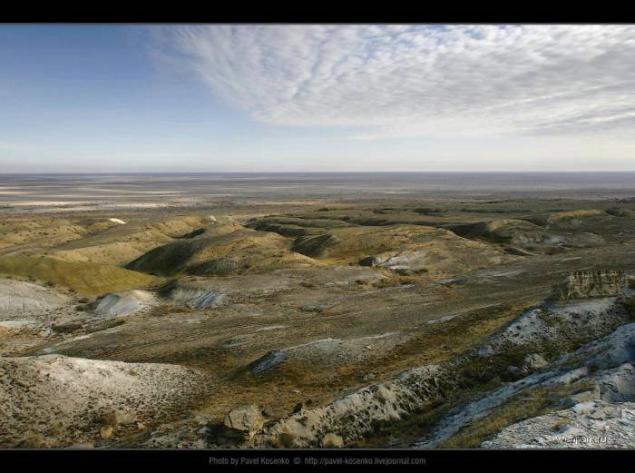
Loy Takyr
In the group of Turkic languages "Loy" means clay, takyr - "even, smooth." Here's what I found by searching in dictionaries. Takyr - a form of relief in sand, clay and stony deserts and semi-deserts of the tropical and subtropical zones. Surface clay-solonetsization solid horizon broken cracks into polygons. Spring takyrs usually filled with water, turning into temporary lakes. Takyrs common in Central Asia, Kazakhstan, Mongolia, Southwest Asia, North America, Australia.

It's hard to believe, but some 40-50 years ago it really was the bottom of the sea.

I understand that all have got a series of cards of the Aral Sea. I myself am tired, but if we do not dobyu material, it runs the risk of permanently remain in the table. In addition, some Aral no ships of the desert? Although we brought on a former pier crack of dawn, no light of dawn or not found. Atrocious weather, literally "gray haze." As a result, the protocol before you pictures, but I decided that without them, the series will be informative not finished.
Until the 1960s, the city was Muinak port on the same island, and here you can reach by boat or by plane. They say the first night shallowing water at once went to the 200 meters. On the morning the people had fled overseas and wept. Over time, tried to dig a canal from the port to the beach, but the water goes faster construction. Today, from here to the sea more than 100 km. What does the current population, remains a mystery to me, but that's where I saw the Aral Sea tragedy. Ustiurt, away from people, what is happening is perceived more as a natural process. There is scientific evidence that the Aral shoaling and filled several times, long before people settled here (although the current drop in sea level, of course, not without its participation). But where the process broke settled for life, broke human destiny - it looks really like a tragedy.


Author