1493
Lake landslide in Pakistan
Five months ago, on January 4, 2010, in a remote valley of Hunza in northern Pakistan
the strongest landslide buried the village of Attabad, destroying 26 houses, killing 20 people and blocked the Hunza River.
As the newly formed lake authorities rushed to evacuate the local residents and to help the victims of the landslide.
Who formed the lake is 91 meters deep and 16 km in length, it has absorbed most of the highways, farms and homes.
Earlier this week, the lake reached the top of the natural dam and began to pour. This rapid erosion of the landslide debris
He forced the authorities became worried about a potential breakthrough dam, and local residents began to leave their homes.
Nearby residents came to the place of the strongest of the landslide that occurred in the valley of Hunza on January 5.
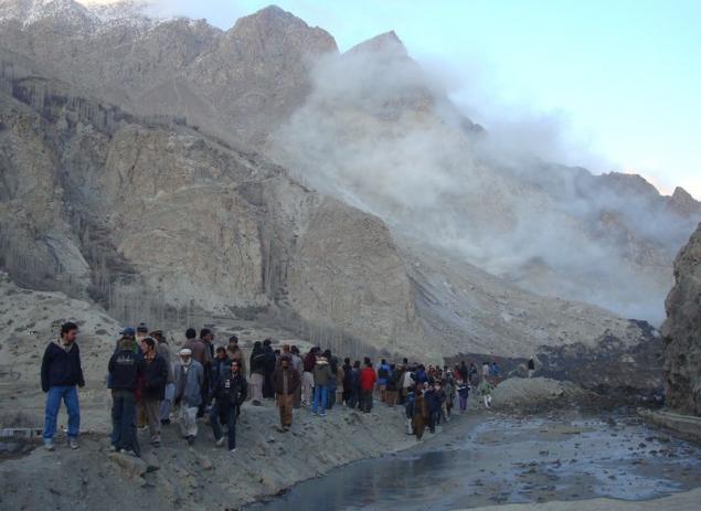
The newly-formed lake formed due to the overlap of the river Hunza (in the photo a few days after the landslide).
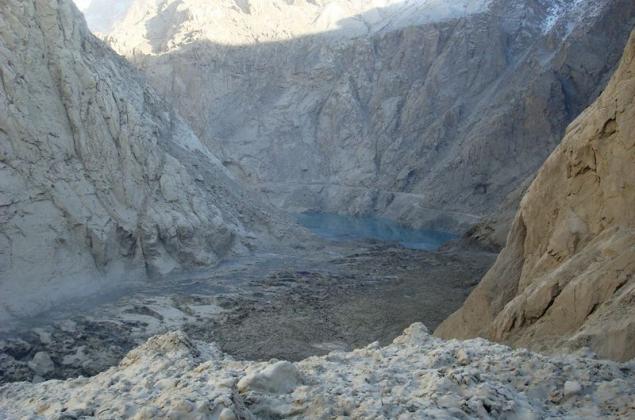
"Cracks lake" seen in the land, not far from what was left of the village of Attabad February 1. Geologists «FOCUS» warned that some places cracked rocks can fall at any time.
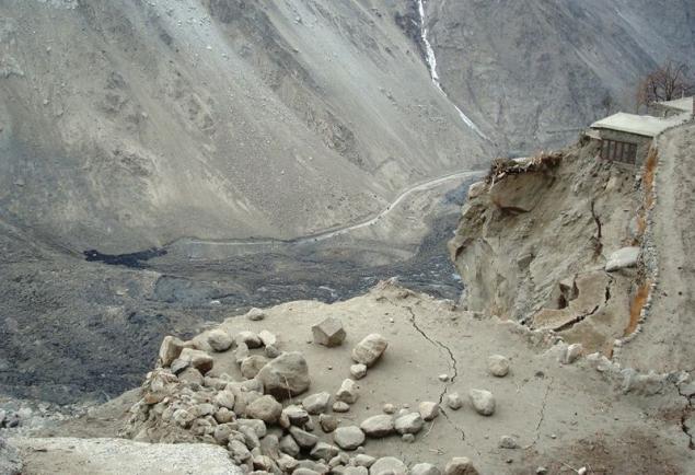
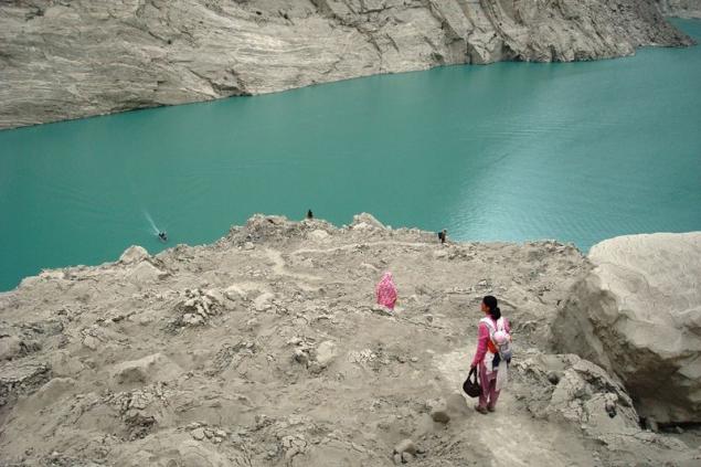
Another view of the fast-growing lake formed after the landslide. Picture taken from that place where once was a village Attabad February 1.
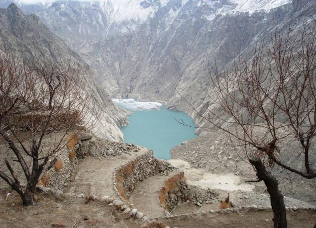
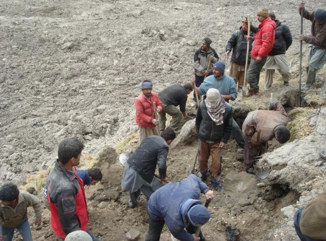
Local volunteers conduct search operations at the site of the former village Attabad January 6.
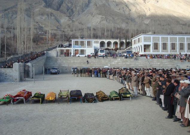
The funeral of the victims of a landslide in the Hunza Valley 6 January.
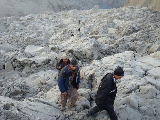
Men go for landslide blockages in the Hunza Valley on 7 January. In the background you can see a lake.
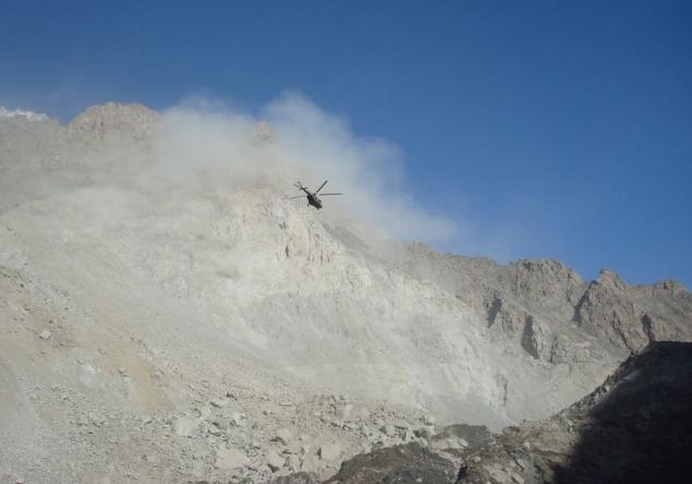
Since the only highway leading to the village was under the rubble, the authorities resorted to helicopters to evacuate the injured and bring provisions.
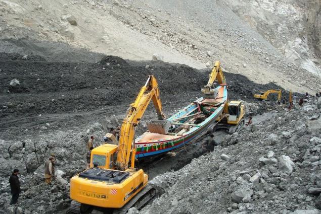
To make the rise of goods and to take a wooden boat to the lake, where it will be used for evacuation and delivery of provisions, hired heavy machinery
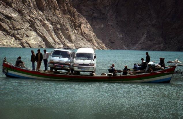
In this photo taken on April 30, locals carry their vehicles to China by boat on the lake, which cut off part of the highway. The lake is about to come out of the banks and the authorities are afraid of possible flooding, which leave thousands of people homeless.
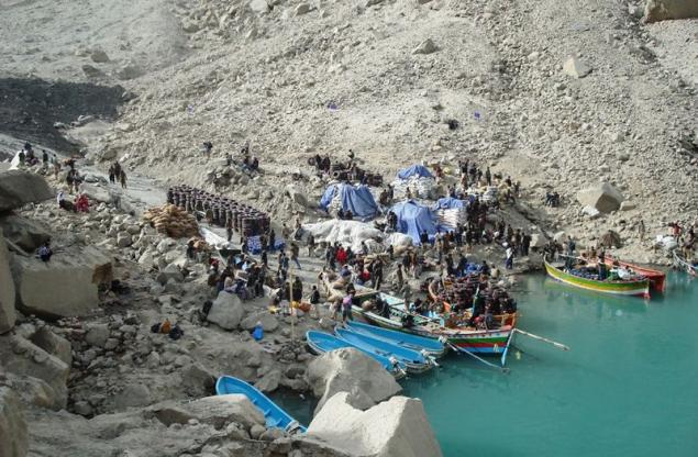
In this photo taken on March 11 Pakistani transporters with goods imported from neighboring China, carry them across the lake. Strong landslide formed a natural dam in the Hunza Valley, which now absorbs the shore and spreads more and more. If the dam burst, flooding threatens the inhabitants of villages down the hill.
The view from the helicopter on the natural dam formed after a landslide. Thousands of people were evacuated from their homes this week in northern Pakistan because of fears that the lake could break the dam.
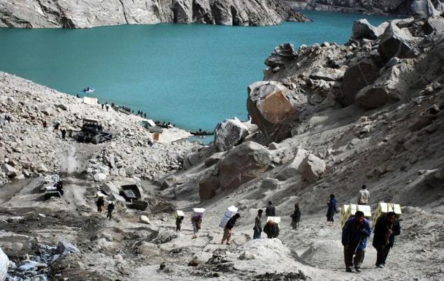
Aerial view of the natural dam in the village of Attabad, northern Pakistan.
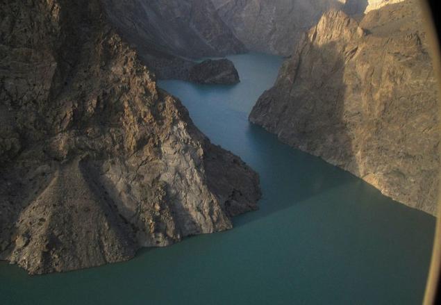
Aerial view of the lake, absorbing the village near the river Hunza.
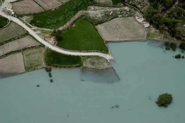
Sishghat Villagers living near the lake formed after the landslide, gather their belongings in preparation for evacuation.
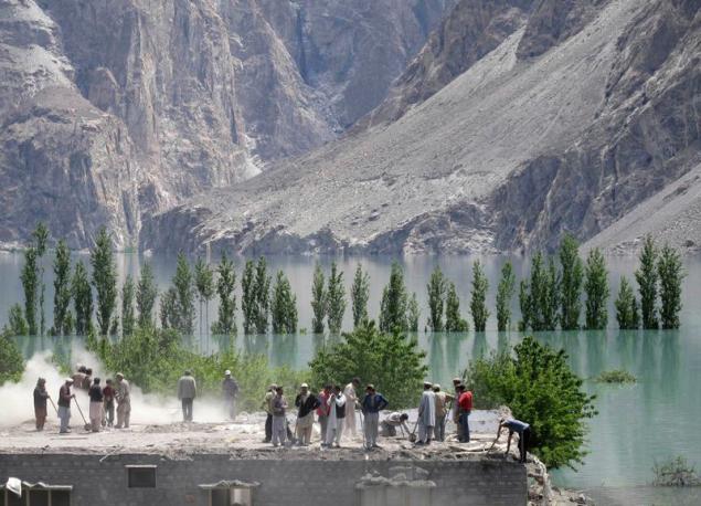
Women who live far away from the landslide lake, cut barley in a field in the village Sishghat May 24.
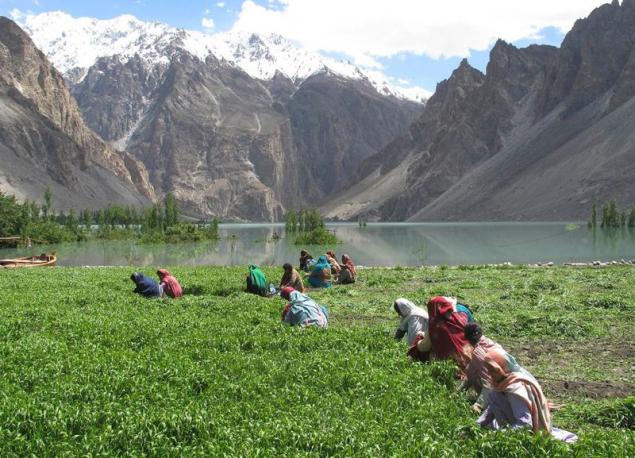
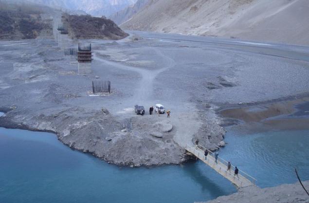
The water level in the lake rises and the locals here are building bridges for evacuation and delivery provisions. Towering behind the left column of the "bridge of friendship", which is under construction in place of the partially destroyed highway.
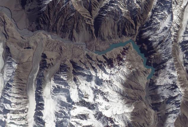
In this photo taken from space, visible to the overlapped portion of the Hunza River and spreads the lake, then another 11 km in length, engulfed several villages and a part of the Karakoram Highway.
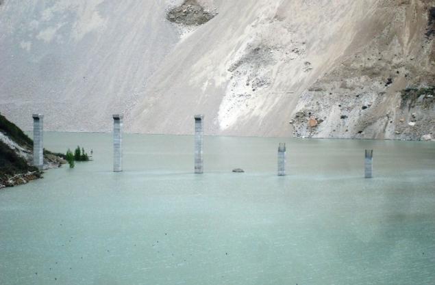
Columns under construction "bridge of friendship" instead of the Karakoram Highway, now flooded,
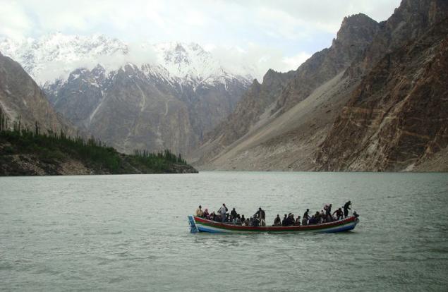
Although boats carrying people to the new lake, greatly helping those who suffer, their safety is still a major concern.
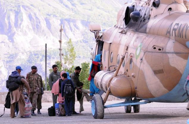
Pakistani soldiers are helping the villagers to climb aboard a military helicopter in the village Altitin near Hunza River. Due to the large-scale flooding, which may occur in northern Pakistan, affected 40,000 inhabitants of 34 villages. Now comes the urgent evacuation of people to a safe place
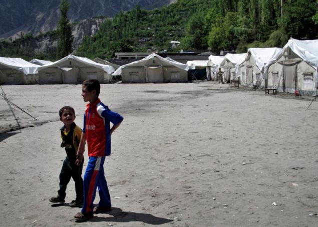
Children walk past the tents set for the refugees affected by the landslide lake, in the village of Attabad.
The girl was crying along with other protesters during the announcement of the government will not pay compensation to refugees, victims of the landslide lake

Residents of the valley Gojayev floating on the lake, the water level which rises daily
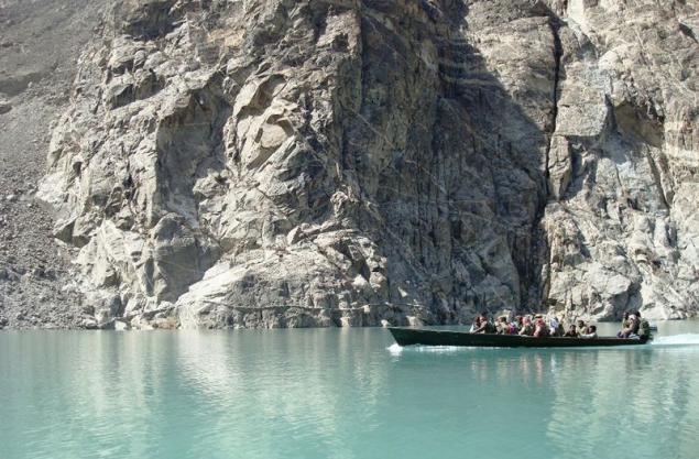
On this photograph, taken from a military helicopter, you can see the lake, the growing of the natural dam caused by a landslide.
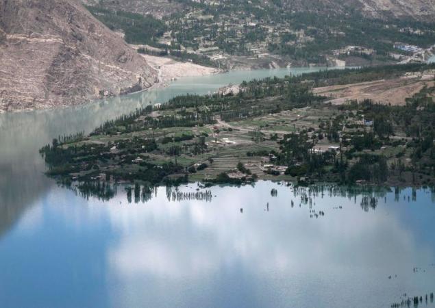
February 28 the second largest bridge on the highway Karakuri plunged into the water of the lake between the two largest settlements in the valley - Shishkat and Gulmi. At that time the bridge was closed for the passage of
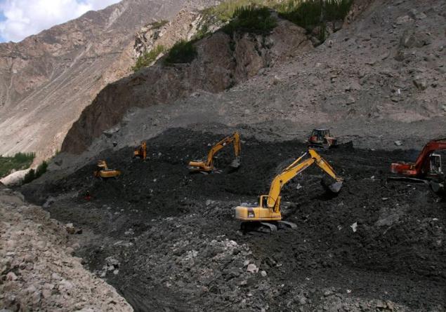
Workers dig drain using heavy machinery to make a little bit of water from the lake landslide.
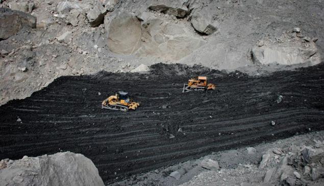
Bulldozers equate land to make draining the water from the lake near the village landslide Attabad.
People from villages Gojayev things are essentials in place a landslide on January 12th.
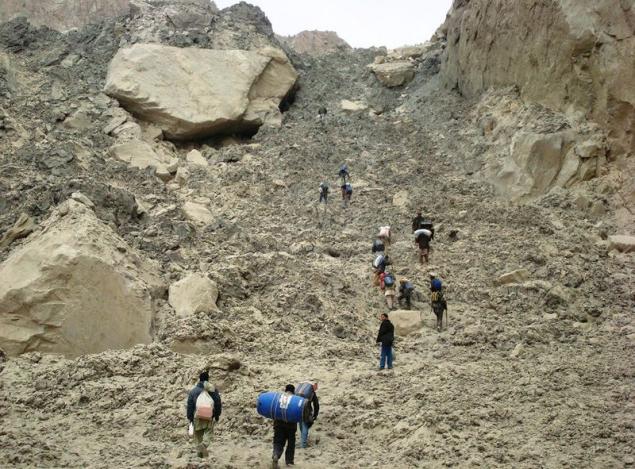
People climb the 200-meter landslide deposits, to get to the boat, heading to the valley Gojayev March 28.
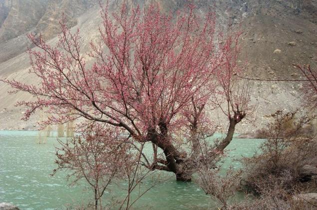
Some of the trees are destined for long color in this year.
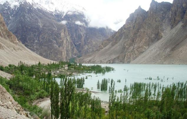
Flooded orchards and houses of the villagers Ainabad May 8th. Hard work, at least three generations was destroyed by a landslide.
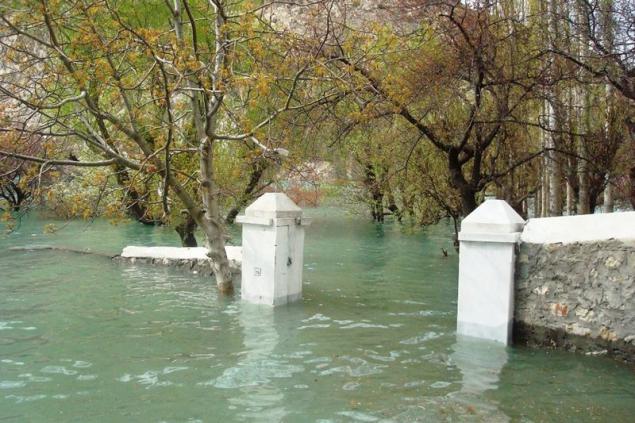
Gate near the orchard partially in the water in the upper valley of the river Hunza April 14. About 40 houses in the village and Ainabad Shishkat Pain were virtually dismantled the stones to save valuable items for people.
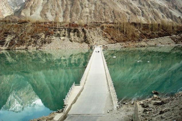
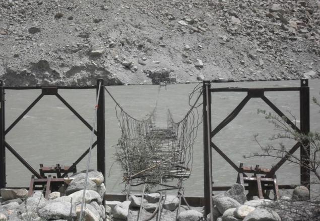
Partially submerged pedestrian bridge in the upper valley of the river Hunza May 7.
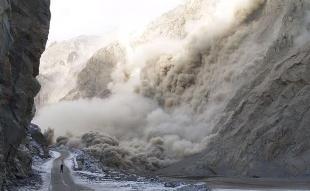
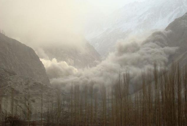
Huge clouds of dust rise during the landslide January 6 - the second day of the disaster at the village of Attabad.
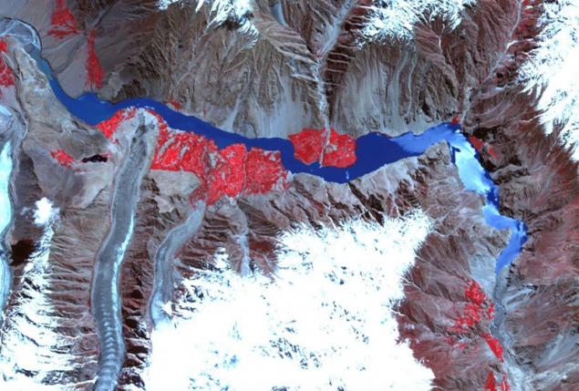
ASTER instrument on the Terra satellite took this picture of the landslide lake on 1 June. Now this lake for 16 km in length. Compared with the image №19, made in the 10 weeks before you can see that the lake has increased by 5 km. The water here is shown in different shades of blue. Bare rocks are shown in brown and gray shades.
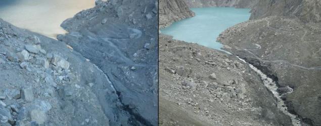
After the lake began to flow into the drain, which was cut workers, the flow of water has increased, but it still does not compare with the stream flowing into the lake from the river Hunza. In addition, as can be seen from these two images, the stream erodes landslide deposits, which again is good for the lake. Just a few months a strong stream of water can simply demolish the dam and flood the surrounding areas. Scientists and government monitoring the situation in some of the most dangerous areas have begun evacuation operation.
via source
the strongest landslide buried the village of Attabad, destroying 26 houses, killing 20 people and blocked the Hunza River.
As the newly formed lake authorities rushed to evacuate the local residents and to help the victims of the landslide.
Who formed the lake is 91 meters deep and 16 km in length, it has absorbed most of the highways, farms and homes.
Earlier this week, the lake reached the top of the natural dam and began to pour. This rapid erosion of the landslide debris
He forced the authorities became worried about a potential breakthrough dam, and local residents began to leave their homes.

Nearby residents came to the place of the strongest of the landslide that occurred in the valley of Hunza on January 5.

The newly-formed lake formed due to the overlap of the river Hunza (in the photo a few days after the landslide).

"Cracks lake" seen in the land, not far from what was left of the village of Attabad February 1. Geologists «FOCUS» warned that some places cracked rocks can fall at any time.

Another view of the fast-growing lake formed after the landslide. Picture taken from that place where once was a village Attabad February 1.

Local volunteers conduct search operations at the site of the former village Attabad January 6.

The funeral of the victims of a landslide in the Hunza Valley 6 January.

Men go for landslide blockages in the Hunza Valley on 7 January. In the background you can see a lake.

Since the only highway leading to the village was under the rubble, the authorities resorted to helicopters to evacuate the injured and bring provisions.

To make the rise of goods and to take a wooden boat to the lake, where it will be used for evacuation and delivery of provisions, hired heavy machinery

In this photo taken on April 30, locals carry their vehicles to China by boat on the lake, which cut off part of the highway. The lake is about to come out of the banks and the authorities are afraid of possible flooding, which leave thousands of people homeless.

In this photo taken on March 11 Pakistani transporters with goods imported from neighboring China, carry them across the lake. Strong landslide formed a natural dam in the Hunza Valley, which now absorbs the shore and spreads more and more. If the dam burst, flooding threatens the inhabitants of villages down the hill.

The view from the helicopter on the natural dam formed after a landslide. Thousands of people were evacuated from their homes this week in northern Pakistan because of fears that the lake could break the dam.

Aerial view of the natural dam in the village of Attabad, northern Pakistan.

Aerial view of the lake, absorbing the village near the river Hunza.

Sishghat Villagers living near the lake formed after the landslide, gather their belongings in preparation for evacuation.

Women who live far away from the landslide lake, cut barley in a field in the village Sishghat May 24.

The water level in the lake rises and the locals here are building bridges for evacuation and delivery provisions. Towering behind the left column of the "bridge of friendship", which is under construction in place of the partially destroyed highway.

In this photo taken from space, visible to the overlapped portion of the Hunza River and spreads the lake, then another 11 km in length, engulfed several villages and a part of the Karakoram Highway.

Columns under construction "bridge of friendship" instead of the Karakoram Highway, now flooded,

Although boats carrying people to the new lake, greatly helping those who suffer, their safety is still a major concern.

Pakistani soldiers are helping the villagers to climb aboard a military helicopter in the village Altitin near Hunza River. Due to the large-scale flooding, which may occur in northern Pakistan, affected 40,000 inhabitants of 34 villages. Now comes the urgent evacuation of people to a safe place

Children walk past the tents set for the refugees affected by the landslide lake, in the village of Attabad.

The girl was crying along with other protesters during the announcement of the government will not pay compensation to refugees, victims of the landslide lake

Residents of the valley Gojayev floating on the lake, the water level which rises daily

On this photograph, taken from a military helicopter, you can see the lake, the growing of the natural dam caused by a landslide.

February 28 the second largest bridge on the highway Karakuri plunged into the water of the lake between the two largest settlements in the valley - Shishkat and Gulmi. At that time the bridge was closed for the passage of

Workers dig drain using heavy machinery to make a little bit of water from the lake landslide.

Bulldozers equate land to make draining the water from the lake near the village landslide Attabad.

People from villages Gojayev things are essentials in place a landslide on January 12th.

People climb the 200-meter landslide deposits, to get to the boat, heading to the valley Gojayev March 28.

Some of the trees are destined for long color in this year.

Flooded orchards and houses of the villagers Ainabad May 8th. Hard work, at least three generations was destroyed by a landslide.

Gate near the orchard partially in the water in the upper valley of the river Hunza April 14. About 40 houses in the village and Ainabad Shishkat Pain were virtually dismantled the stones to save valuable items for people.

Partially submerged pedestrian bridge in the upper valley of the river Hunza May 7.

Huge clouds of dust rise during the landslide January 6 - the second day of the disaster at the village of Attabad.

ASTER instrument on the Terra satellite took this picture of the landslide lake on 1 June. Now this lake for 16 km in length. Compared with the image №19, made in the 10 weeks before you can see that the lake has increased by 5 km. The water here is shown in different shades of blue. Bare rocks are shown in brown and gray shades.

After the lake began to flow into the drain, which was cut workers, the flow of water has increased, but it still does not compare with the stream flowing into the lake from the river Hunza. In addition, as can be seen from these two images, the stream erodes landslide deposits, which again is good for the lake. Just a few months a strong stream of water can simply demolish the dam and flood the surrounding areas. Scientists and government monitoring the situation in some of the most dangerous areas have begun evacuation operation.

via source
