880
Greenland - a very "green" country (21 photos)
Now in the sunset of hot summer I think is very nice to look ... at the sparkling white ice "Green Country»
(All images are clickable for more detailed consideration of all the "green" charms)
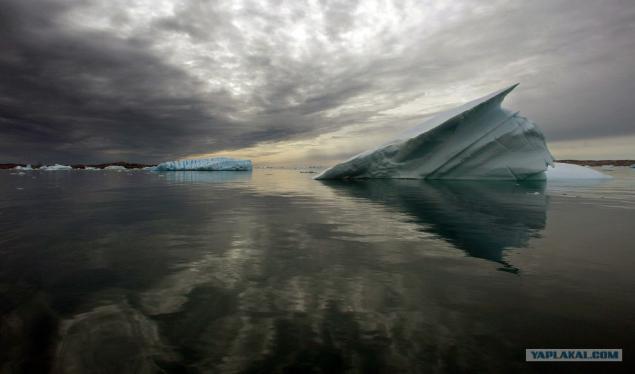
1. The scientist Jason Box of Ohio State University and an expert polar expedition Eric Phillips (both members of Greenpeace) with the help of experts in the field of polar logistics set the camera for time-lapse shooting 16-kilometer Petermann Glacier in the north-eastern part of Greenland 29 July 2009. Greenpeace ship "Arctic Dawn 'came to the area for a few weeks to conduct research on climate change, as well as to oversee the destruction of the glacier.
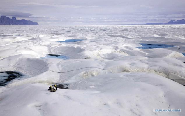
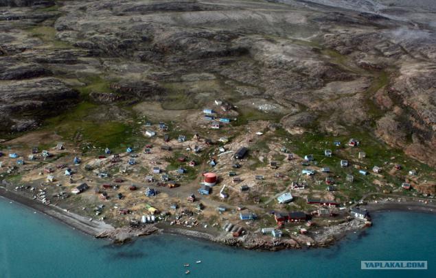
2. View of the village of Greenland qaarsut a bird's-eye 20 July 2007.
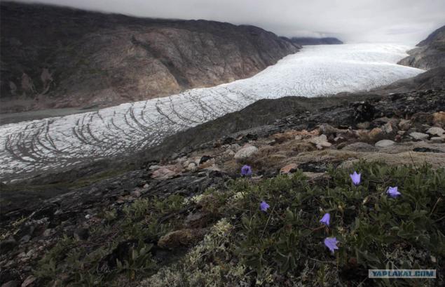
3. Wild flowers growing on a hill overlooking the Narsarsuaq glacier in southern Greenland, July 25, 2009.
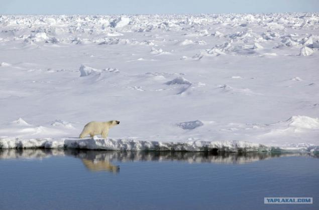
4. Polar bear walks along the shore ice Robeson channel between Greenland and Canada, June 29, 2009. Members of Greenpeace and leading climate scientists arrived in Greenland for 3 months on its icebreaker "Arctic Dawn" to gather the necessary data on the climate change summit to be held in Copenhagen in December 2009
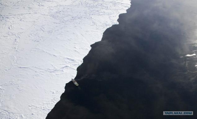
5. "Arctic Dawn" reached the ice edge Robeson channel between Greenland and Canada, June 29, 2009.
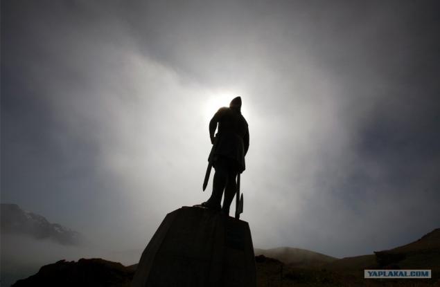
6. Statue of Viking explorer Leif Erickson looks at the village qassiarsuk July 30, 2009, in which the father of Erickson - Erik the Red founded his first settlement in southern Greenland in about 985 AD
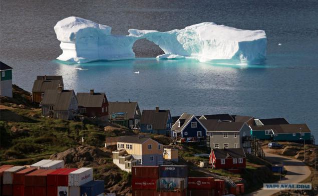
7. Iceberg floats past the city Kulusuk, East Greenland, August 1, 2009.
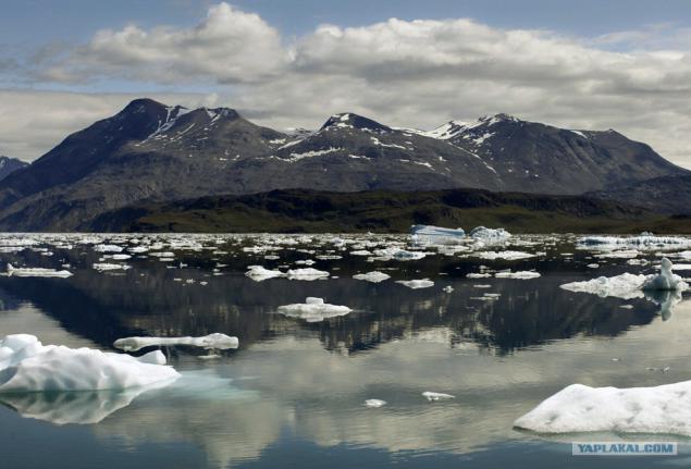
8. Icebergs are reflected in the waters of the fjord Eric near Narsarsuaq in southern Greenland July 26 209 years.
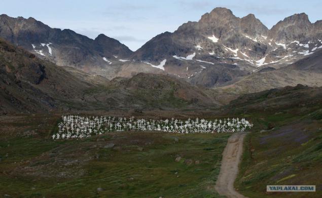
9. Dirty road leads to the local cemetery for the city of Greenland Tasiilaq, August 4, 2009.
10. Huge Moulin on the surface of the ice sheet in Greenland. Two recent studies of movement and melting of ice sheets revealed that the melting of the earth can cause drainage and seismic disturbances on the Greenland Ice Sheet. However, by itself the melting surface, which eventually lubricates the bottom of the ice formation and accelerates it slip through the soil, may not be sufficient to cause catastrophic loss of ice mass. The study appeared in the issue of "Science Express" on April 17, 2008.
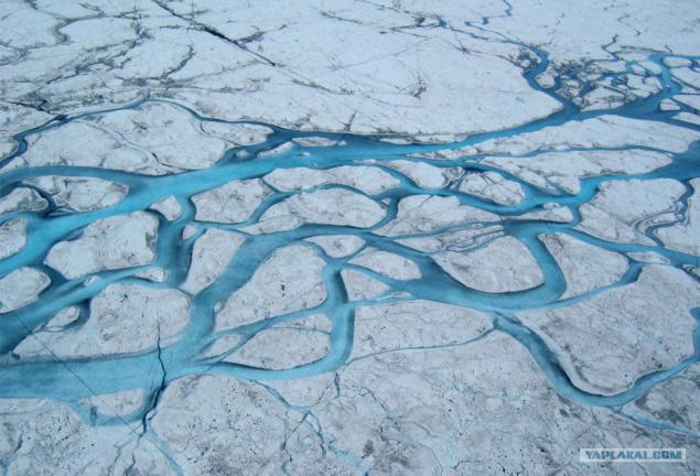
11. Large concealing stream flowing on the surface of the Greenland ice sheet, falling into the lake nadlednikovoe.
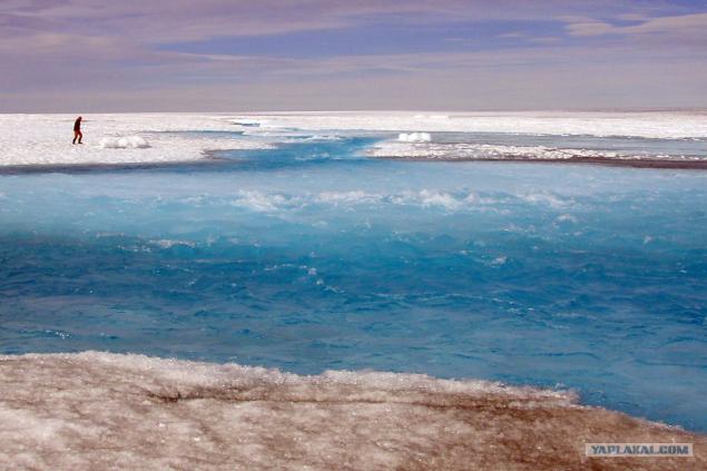
12. The fishing boat cuts through the water ice of Greenland Ilulissat fjord where icebergs full of 3 July 2009.
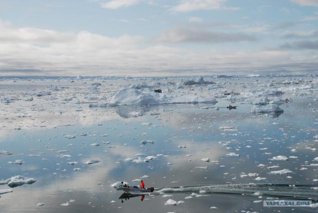
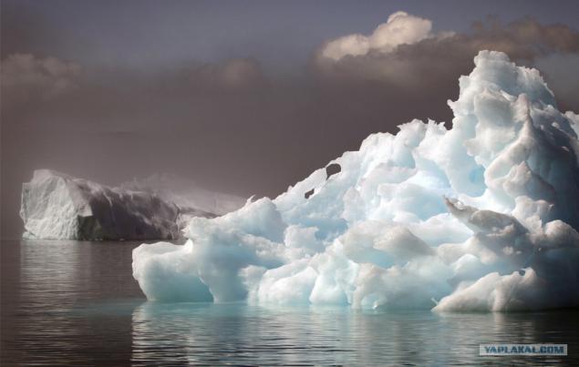
13. Icebergs hidden veil of early morning mist near the south Greenland town of Narsaq July 28, 2009.
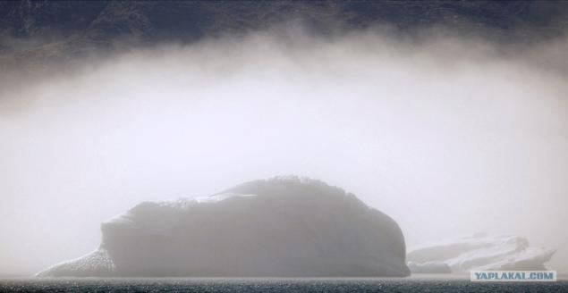
14. Icebergs floating in the fjord near the south Greenland town of Narsaq July 28, 2009.
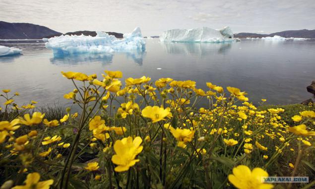
15. Wild flowers on a hill overlooking a fjord filled with icebergs near the south Greenland town of Narsaq July 27, 2009.
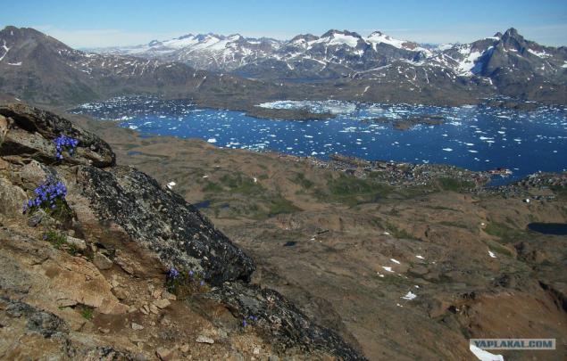
16. View from the top Somandsfeldet - mountains above the town of Tasiilaq; the city is seen along the shoreline in the center of the right.
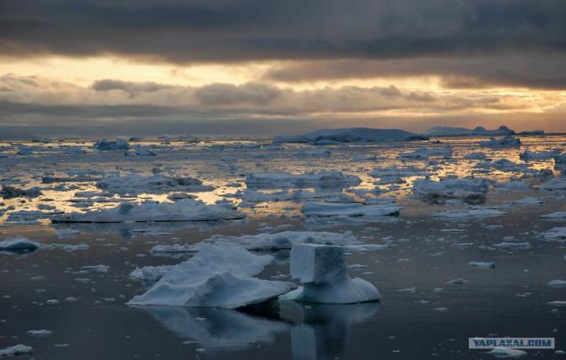
17. Filled icebergs fjord near Ilulissat in Greenland July 3, 2009.
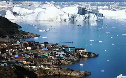
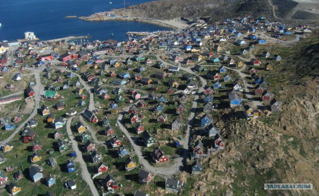
18. Upernavik, Greenland. The picture was taken from a helicopter July 11, 2007.
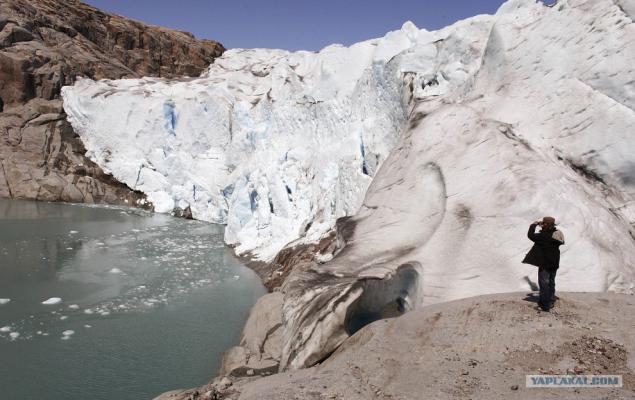
19. A tourist photographs the Twin Glacier near the south Greenland town of Narsaq July 28, 2009.
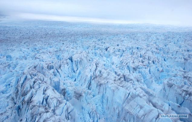
20. Type of Ilulissat glacier near the top of the Greenland town of Ilulissat, July 3, 2009.
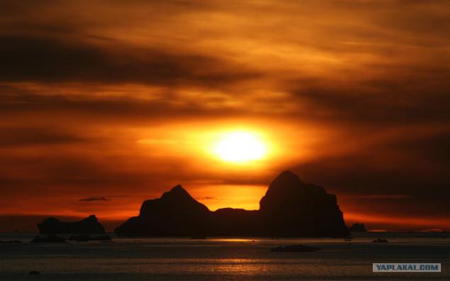
21. Sun and icebergs around Cape York, Greenland, in September 2005.
All
(Photo taken from letters and bigpicture.ru)
Source:
(All images are clickable for more detailed consideration of all the "green" charms)

1. The scientist Jason Box of Ohio State University and an expert polar expedition Eric Phillips (both members of Greenpeace) with the help of experts in the field of polar logistics set the camera for time-lapse shooting 16-kilometer Petermann Glacier in the north-eastern part of Greenland 29 July 2009. Greenpeace ship "Arctic Dawn 'came to the area for a few weeks to conduct research on climate change, as well as to oversee the destruction of the glacier.

2. View of the village of Greenland qaarsut a bird's-eye 20 July 2007.

3. Wild flowers growing on a hill overlooking the Narsarsuaq glacier in southern Greenland, July 25, 2009.

4. Polar bear walks along the shore ice Robeson channel between Greenland and Canada, June 29, 2009. Members of Greenpeace and leading climate scientists arrived in Greenland for 3 months on its icebreaker "Arctic Dawn" to gather the necessary data on the climate change summit to be held in Copenhagen in December 2009

5. "Arctic Dawn" reached the ice edge Robeson channel between Greenland and Canada, June 29, 2009.

6. Statue of Viking explorer Leif Erickson looks at the village qassiarsuk July 30, 2009, in which the father of Erickson - Erik the Red founded his first settlement in southern Greenland in about 985 AD

7. Iceberg floats past the city Kulusuk, East Greenland, August 1, 2009.

8. Icebergs are reflected in the waters of the fjord Eric near Narsarsuaq in southern Greenland July 26 209 years.

9. Dirty road leads to the local cemetery for the city of Greenland Tasiilaq, August 4, 2009.

10. Huge Moulin on the surface of the ice sheet in Greenland. Two recent studies of movement and melting of ice sheets revealed that the melting of the earth can cause drainage and seismic disturbances on the Greenland Ice Sheet. However, by itself the melting surface, which eventually lubricates the bottom of the ice formation and accelerates it slip through the soil, may not be sufficient to cause catastrophic loss of ice mass. The study appeared in the issue of "Science Express" on April 17, 2008.

11. Large concealing stream flowing on the surface of the Greenland ice sheet, falling into the lake nadlednikovoe.

12. The fishing boat cuts through the water ice of Greenland Ilulissat fjord where icebergs full of 3 July 2009.

13. Icebergs hidden veil of early morning mist near the south Greenland town of Narsaq July 28, 2009.

14. Icebergs floating in the fjord near the south Greenland town of Narsaq July 28, 2009.

15. Wild flowers on a hill overlooking a fjord filled with icebergs near the south Greenland town of Narsaq July 27, 2009.

16. View from the top Somandsfeldet - mountains above the town of Tasiilaq; the city is seen along the shoreline in the center of the right.

17. Filled icebergs fjord near Ilulissat in Greenland July 3, 2009.

18. Upernavik, Greenland. The picture was taken from a helicopter July 11, 2007.

19. A tourist photographs the Twin Glacier near the south Greenland town of Narsaq July 28, 2009.

20. Type of Ilulissat glacier near the top of the Greenland town of Ilulissat, July 3, 2009.

21. Sun and icebergs around Cape York, Greenland, in September 2005.
All
(Photo taken from letters and bigpicture.ru)

Source:
