1297
Lake Sarez
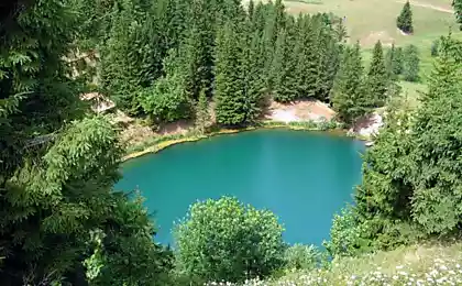
There are on the territory of Gorno-Badakhshan (Tajikistan) the stunning lake - Lake Sarez. It is called the most precious jewel of this mountain region.
33 photos + text © CatrinTheBest + chakhma + GBAO + Internet
= 1 =
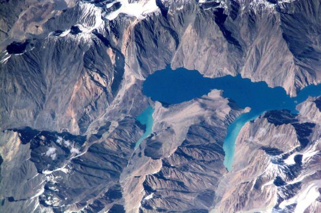
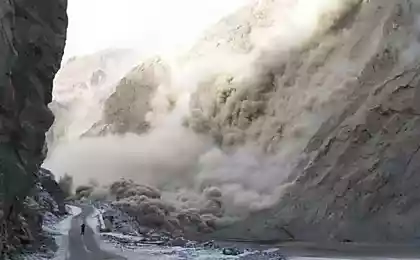
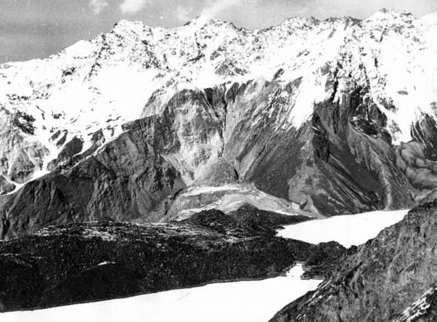
Murghab River flowed for centuries, foaming at the waterfalls and rapids through krutostennoe valley at the foot of the Pamir mountain range Muzkol. But a February night in 1911 on the slopes of the ridge shuddered powerful aftershocks. The earthquake on the starboard side of the gorge looked up a giant rock and fell down into the valley, after covering it for eight kilometers. The height of the dam has reached seven hundred meters - the height of the 200-storey building!
In Murghab valley collapsed while more than two billion cubic meters of rock debris completely filled up at the bottom of a small village - village Usa. Usoy collapse is considered the greatest scale of all, the case on the globe.
The waters of the river formed a natural dam stopped, began to accumulate behind it, filling the gorge. Thus arose the youngest on the planet mountain lake. It grew rapidly, and within six months was flooded located twenty kilometers above the dam village Sarez. Its inhabitants, without even having to remove the harvest from their gardens, abandoned house and moved to a new location. A village disappeared in the waters of the lake, which is in memory of him was called Sarez.
= 2 =
Now it stood at length by sixty kilometers, and its depth exceeds five hundred meters. The height of the water table Sarez above sea level is 3240 meters. Of the major reservoirs of the world few can compete with Pamir lake in this regard.
= 3 =
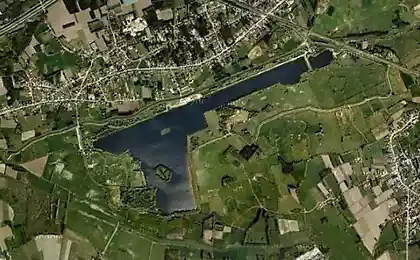
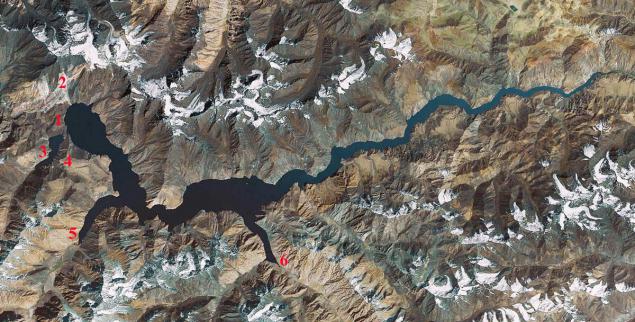
Sarez Lake View from space:
1- Usoy Dam
2- Place collapse landslide
3 Lake Shadau
4 Pass Mardjanay
5- Irkht bay
6- Bay Ramaif.
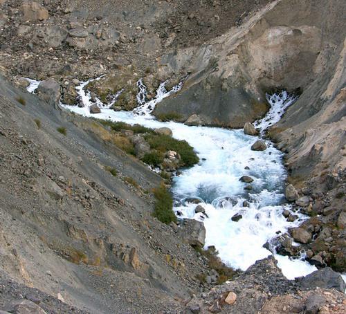
But the most amazing thing is that below the dam Murghab ... disappears! With high dam is not visible at the bottom of any water flow. River water leak, as it filtered through the body of the dam and for seven kilometers downstream of the dam flowing underground, deep in the gravel deposits on the bottom of the gorge. Only then they make their way to the surface of the abundant springs that merge to revive Murghab.
= 4 =
Hydrological Soviet expedition to the shores of Sarez
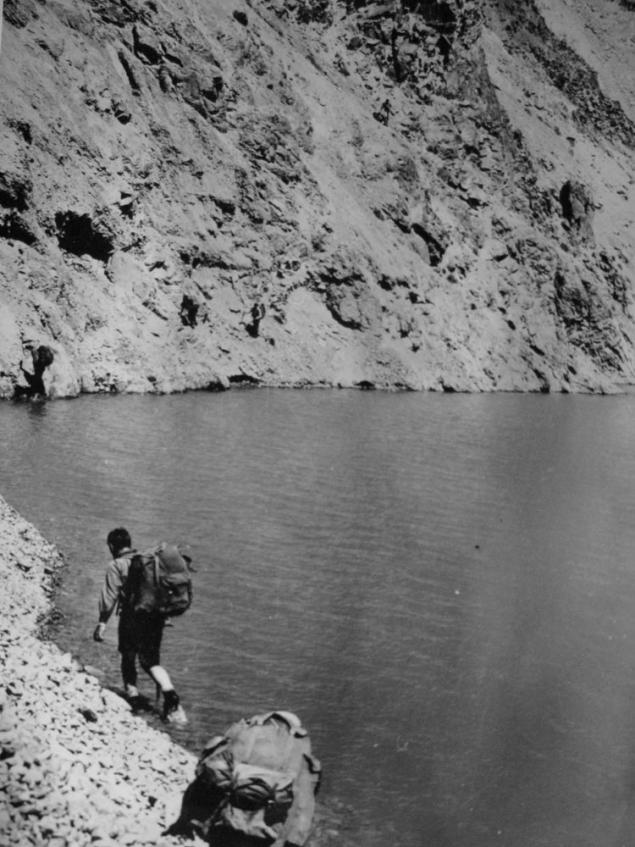
District Sarez is striking in its severity, lifeless and some amazing silence. First, it is difficult even to believe that there was once crumbling mountains, thundering waterfalls and rolling down the slopes of huge chunks of rock. But in our day sometimes can be seen on the slopes Muzkol suddenly there is a gray cloud, and gradually increasing in size rapidly going downhill. Having reached the lake, it plops down into the abyss, raising a huge column of water. It is coming off another collapse. Only a few minutes calming expanse of water, and over the lake again solemn silence reigns.
= 5 =
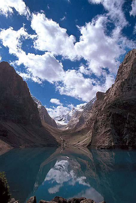
Dry air highlands extremely transparent. The human eye can not grasp perspective and the distant mountains seem as clear and sharp as standing nearby. Strikes and solitude on the banks of a huge (ninety square kilometers!) The pond. The nearest town to the east - the settlement Murgab - is two hundred kilometers up the river. Yes, and downstream to the village Bartang also not less than one hundred and fifty kilometers. Only a few hunters but geologists appear at the lake in summer. A winter calm Lake Sarez penalized unless "Bigfoot" legend which has long run local Tajiks. Although several expeditions have visited here and found no trace of our wild relative, hunters and shepherds in the Pamirs believe in its existence and tells of a meeting with him on his mountain trails and still little-studied edge.
= 6 =
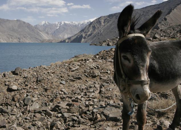
Sarez is situated on the border of two different parts of the Pamir: the high plateau to the east and much of the Western Pamirs dismembered or Badakhshan. Badakhshan - the land covered by glaciers high mountain ranges and turbulent rapid rivers, worked his way through the narrow canyons like the Murghab. In many of them the sun looks only for two or three hours in the middle of the day. And the water in the rivers of Badakhshan dull white, when the stream rushes out of most glaciers, the clear bright blue when the path of the river flows through the lake and leave it the sand and clay, to get her from melting ice and snow. In the mountains grow only stunted wormwood and thorny bushes, clung to the ground like great gray-green pillow. And in the gardens of the villages on the lower terraces of the valleys grow apples and apricots, grapes and melons. In short, Badakhshan - the land of contrasts: tall, color and plant.
= 7 =
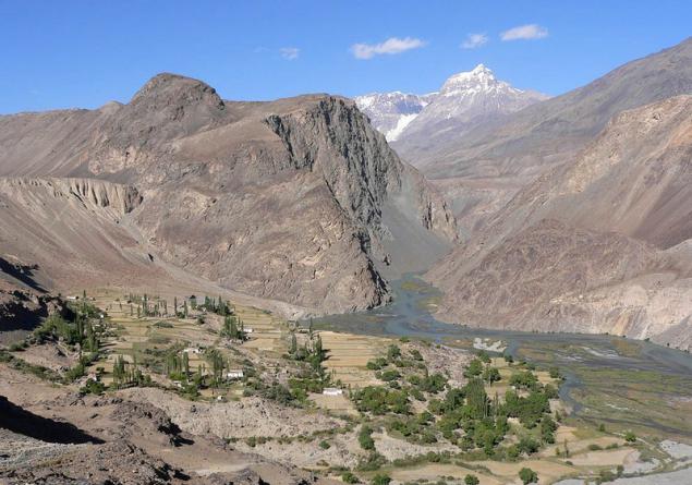
And the Eastern Pamirs is a plain, only raised to a height of four thousand meters. It fully justifies its proud name. (Pamir means - "Roof of the World".) The massive, six-semikilometrovoy height of the mountain plateau is surrounded on almost all sides. Clouds and moist, do not reach the Pamirs, leaving deposits on the outer slopes of the ridges, and the air is so dry that the traveler is often cracked skin on the lips. In addition, it remarkably transparent, so that by passing the snowy fields, it is necessary to protect the face mask, otherwise inevitable sunburn.
= 8 =
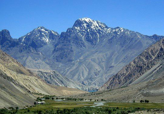
If the random cloud still shed a rare blue moon, then drops it evaporates before reaching the ground - all because of the same dry air. In this high desert rainfall is less than half in the Karakum Desert. A frost in January is minus forty-eight degrees! Even in summer the temperature rarely rises above ten plus. It happens that even in June at the pass caravan meets snowstorm. In short, a land of extreme conditions. It is no accident in the vast expanses of the Eastern Schmier stretching on four kilometers from north to south and two hundred - from west to east, there are almost no villages. You can drive through the plateau of Pamir Highway, from the Kyzyl-Art to Shugnan ridge and all the way trehsotkilometrovom meet only three tiny village, but the aforementioned settlement Murghab.
= 9 =
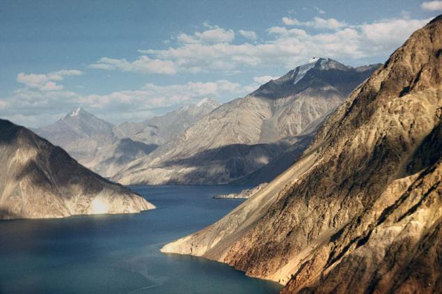
These "lunar" landscapes: solitude, lack of water, harsh cold lifelessness - there is only one place on the planet - on the Tibetan plateau. No wonder the Eastern Pamirs called "Tibet in miniature." Among the plants are caught only thorny cushion plants so squat bushes Eurotia - is unique fuel for the fire, that will help the traveler to pass a cold night on the plateau.
= 10 =
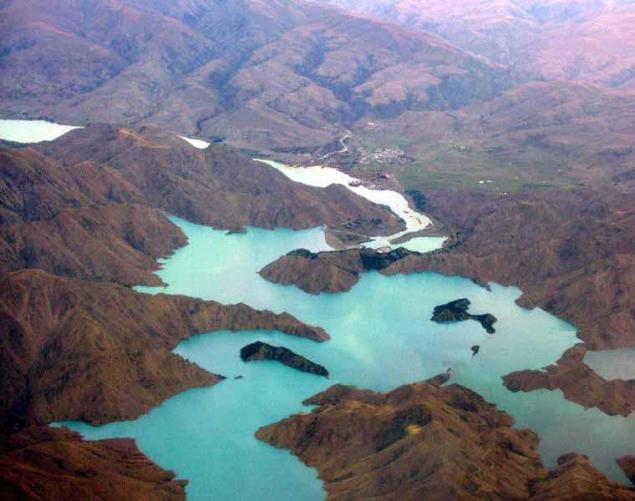
Through these places ran once the ancient trade routes from China to the Mediterranean. But the description of the Pamir we almost did not meet in the notes visited here merchants or pilgrims. Only Chinese traveler Xuan Zang of VII century Pamir dedicated a few lines:
"The kingdom is a terrible cold, and blow gusty winds. It is snowing in winter and summer. No grain bread or fruit grow here can not ».
= 11 =
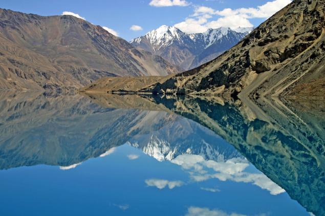
And after six centuries of caravan paths Pamir was a tireless Venetian Marco Polo. In his book he wrote in 1270 year:
"We rise to the highest, they say, a place in the world. Twelve days go for the plain, called it the Pamirs, and all the time there is no housing, no grass, you need to take food with them. Birds not here because high and cold. From the great cold and the fire is not so bright and the wrong color, as in other places, and the food is not as good cooks ».
Indeed, meat is a better cook in a pressure cooker: because the water in the pot boils at a height even at eighty degrees.
= 12 =
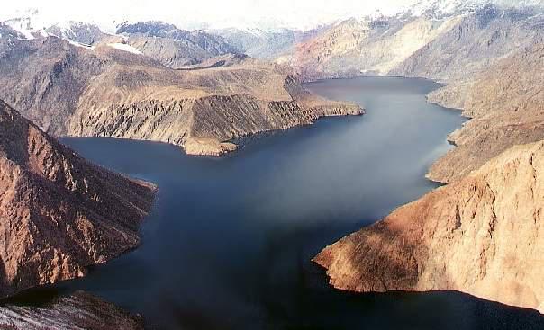
Lake Sarez safely hidden in the heart of the Badakhshan mountains. The path to it, and today is not easy and difficult. But people again and again making their way to the coveted lake, and not only because of its beauty.
= 13 =
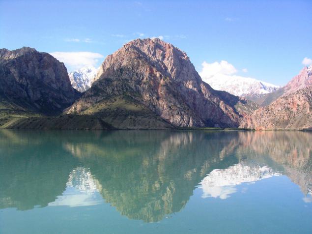
Hydrogeologists have long been anxious for the fate of Sarez. Imagine what would happen if the water is filtered through peaceful Usoy Dam, dilute it and burst the very tall dam semisotmetrovuyu! Giant water bank then rush down the gorge Murghab, tearing off the coast of boulders, twisting trees, razing villages and bridges and destroying everything in its path. Raging water and mud-rock flow - rural - will rush down to the confluence of the Murghab in Panj and further, where the Panj and Vakhsh merge to form the Amu Darya. Dozens of towns and villages will be razed to the ground. It would be the greatest catastrophe of modern times!
= 14 =
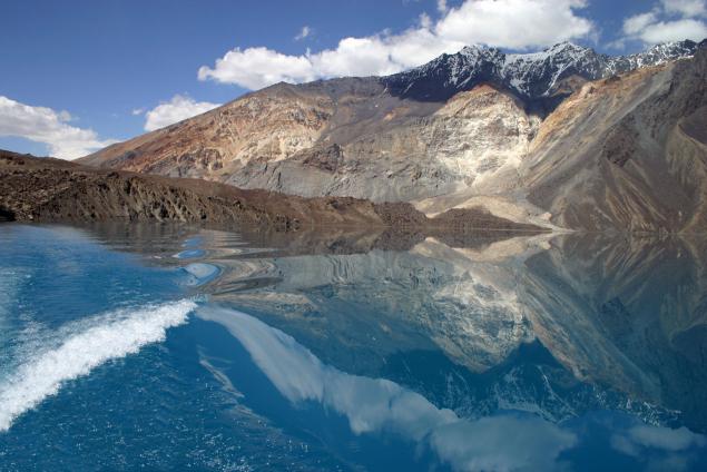
However, fortunately, is observing scientists did not inspire fear: natural dam behaves quietly. But who knows how to turn the matter after the next earthquake, which are not uncommon. And so throughout the year are hydrogeologists watch on Sarez. Pearl Pamir should not be a threat to people.
= 15 =
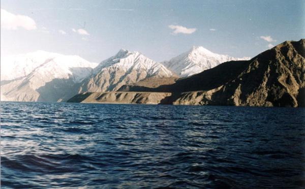
"6 (18) in February 1911goda 23ch.15 min. Khorog felt a strong push. The Sarez all rushed out of tents screaming and crying. Two tents were filled up, four cracked. From the west came the wild roar. He mingled with the howl of falling avalanches. Moon over Mardjanay beginning to fade. In the morning everything was dust hanging in the air and the earth continued to shake. When the guys came up to where he was Usa, village they saw. Instead, the towering mountain of boulders. " Eyewitness describes the birth of Lake Sarez.
= 16 =
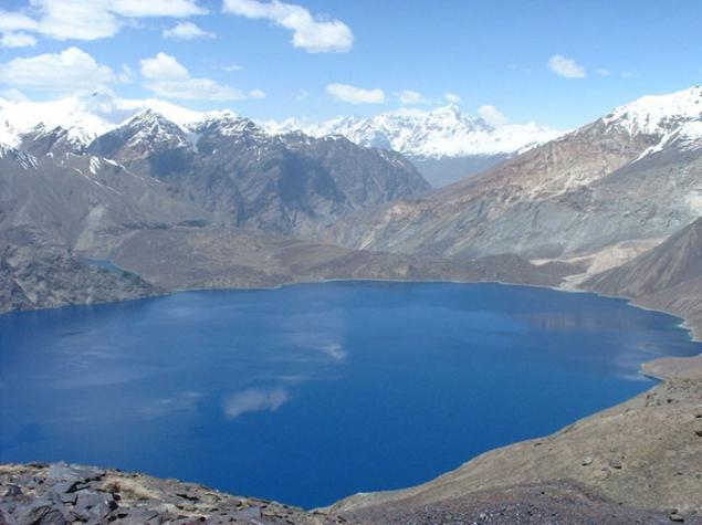
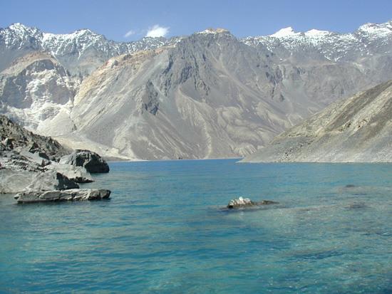
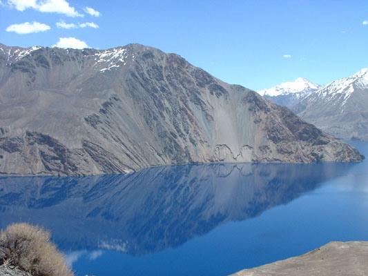
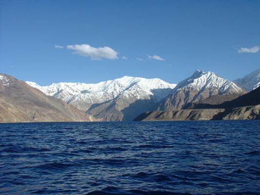
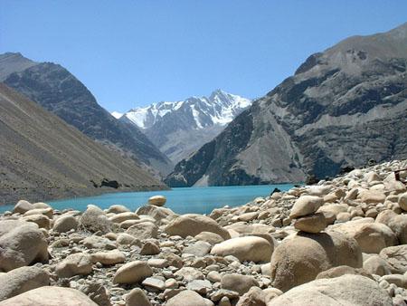
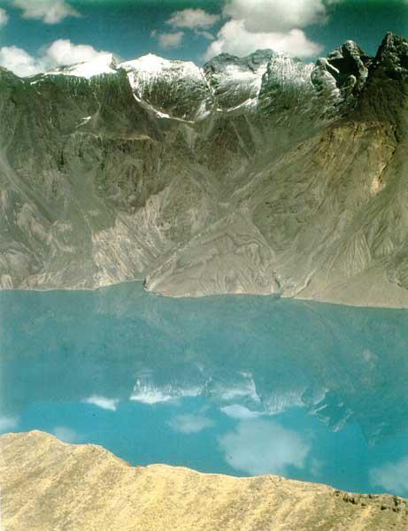
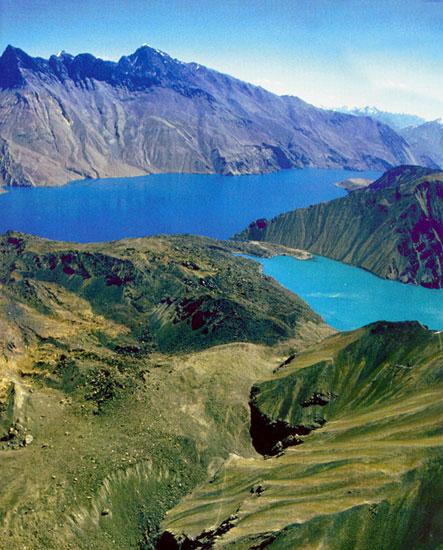
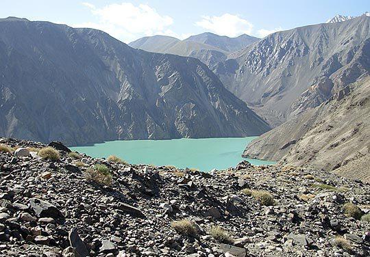
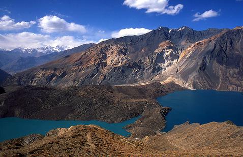
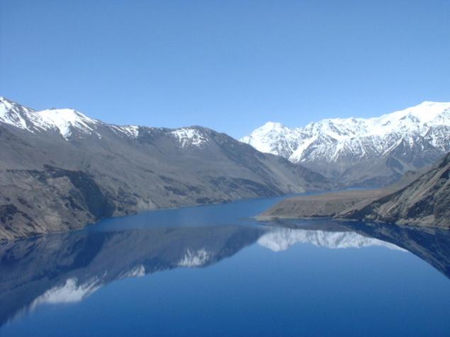
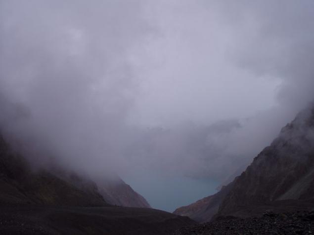
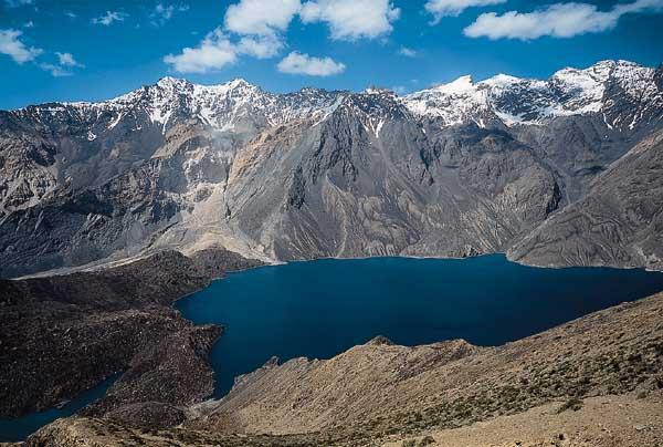
Water in the Lake Sarez is so clean and transparent that the bird's-eye view (helicopter), you can distinguish the color of the stones lie on the bottom. The lake is like a living creature, often changes the color of the water (like say a person), the mood of nature. On a clear day - bright blue, like the sky itself has decided to plunge into the shadowy water weightless and overcast hour - black, like an ominous sign of trouble (the notorious "black mark"). Perhaps that is why some call Sarez "a blue tadpole" for piercing blue clean water, with a purity of which can be compared only water is famous and legendary Baikal. However, the latter, unlike his fellow mountain, as a remnant of the ancient large reservoir, located below sea level in a tectonic cleft, taking forty rivers and losing only one Angara. Here are just a "Pamir Baikal" lies high in the mountains, if God absentmindedly left a large hurdzhin water over the festive and rich valleys dastarkhan.
= 17 =
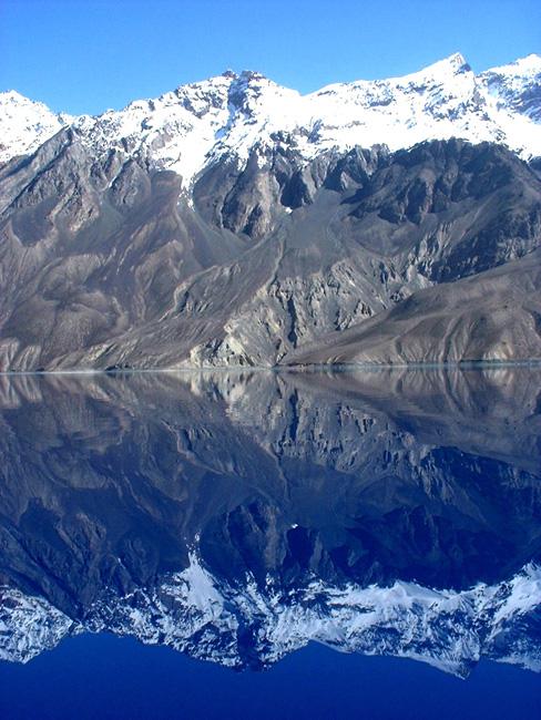
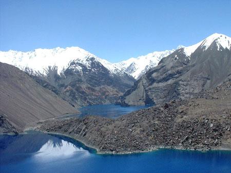
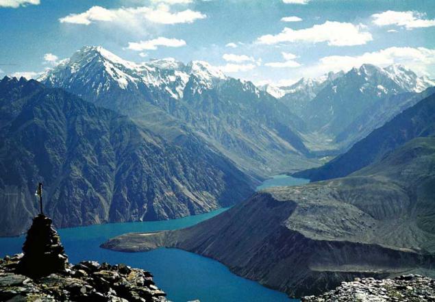
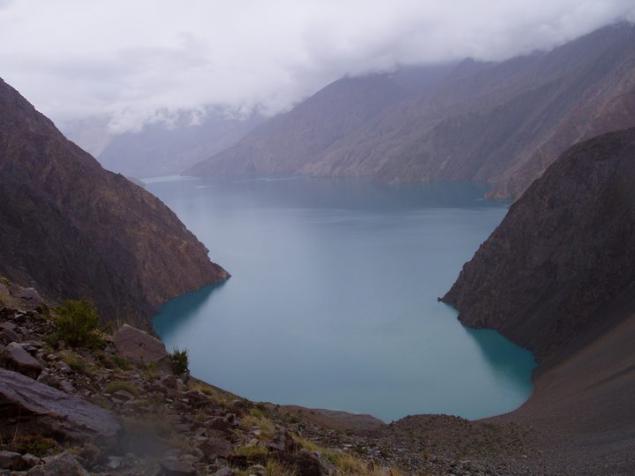
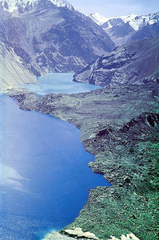
And a lot of pictures the most beautiful lake ...
= 18 =
= 19 =
= 20 =
= 21 =
= 22 =
= 23 =
= 24 =
= 25 =
= 26 =
= 27 =
= 28 =
Murghab
= 29 =
= 30 =
= 31 =
= 32 =
= 33 =
Last in this collection =)
Enjoy the beauty of the mountainous region =))
Source:
33 photos + text © CatrinTheBest + chakhma + GBAO + Internet
= 1 =

Murghab River flowed for centuries, foaming at the waterfalls and rapids through krutostennoe valley at the foot of the Pamir mountain range Muzkol. But a February night in 1911 on the slopes of the ridge shuddered powerful aftershocks. The earthquake on the starboard side of the gorge looked up a giant rock and fell down into the valley, after covering it for eight kilometers. The height of the dam has reached seven hundred meters - the height of the 200-storey building!
In Murghab valley collapsed while more than two billion cubic meters of rock debris completely filled up at the bottom of a small village - village Usa. Usoy collapse is considered the greatest scale of all, the case on the globe.
The waters of the river formed a natural dam stopped, began to accumulate behind it, filling the gorge. Thus arose the youngest on the planet mountain lake. It grew rapidly, and within six months was flooded located twenty kilometers above the dam village Sarez. Its inhabitants, without even having to remove the harvest from their gardens, abandoned house and moved to a new location. A village disappeared in the waters of the lake, which is in memory of him was called Sarez.
= 2 =

Now it stood at length by sixty kilometers, and its depth exceeds five hundred meters. The height of the water table Sarez above sea level is 3240 meters. Of the major reservoirs of the world few can compete with Pamir lake in this regard.
= 3 =
Sarez Lake View from space:
1- Usoy Dam
2- Place collapse landslide
3 Lake Shadau
4 Pass Mardjanay
5- Irkht bay
6- Bay Ramaif.

But the most amazing thing is that below the dam Murghab ... disappears! With high dam is not visible at the bottom of any water flow. River water leak, as it filtered through the body of the dam and for seven kilometers downstream of the dam flowing underground, deep in the gravel deposits on the bottom of the gorge. Only then they make their way to the surface of the abundant springs that merge to revive Murghab.
= 4 =
Hydrological Soviet expedition to the shores of Sarez

District Sarez is striking in its severity, lifeless and some amazing silence. First, it is difficult even to believe that there was once crumbling mountains, thundering waterfalls and rolling down the slopes of huge chunks of rock. But in our day sometimes can be seen on the slopes Muzkol suddenly there is a gray cloud, and gradually increasing in size rapidly going downhill. Having reached the lake, it plops down into the abyss, raising a huge column of water. It is coming off another collapse. Only a few minutes calming expanse of water, and over the lake again solemn silence reigns.
= 5 =

Dry air highlands extremely transparent. The human eye can not grasp perspective and the distant mountains seem as clear and sharp as standing nearby. Strikes and solitude on the banks of a huge (ninety square kilometers!) The pond. The nearest town to the east - the settlement Murgab - is two hundred kilometers up the river. Yes, and downstream to the village Bartang also not less than one hundred and fifty kilometers. Only a few hunters but geologists appear at the lake in summer. A winter calm Lake Sarez penalized unless "Bigfoot" legend which has long run local Tajiks. Although several expeditions have visited here and found no trace of our wild relative, hunters and shepherds in the Pamirs believe in its existence and tells of a meeting with him on his mountain trails and still little-studied edge.
= 6 =

Sarez is situated on the border of two different parts of the Pamir: the high plateau to the east and much of the Western Pamirs dismembered or Badakhshan. Badakhshan - the land covered by glaciers high mountain ranges and turbulent rapid rivers, worked his way through the narrow canyons like the Murghab. In many of them the sun looks only for two or three hours in the middle of the day. And the water in the rivers of Badakhshan dull white, when the stream rushes out of most glaciers, the clear bright blue when the path of the river flows through the lake and leave it the sand and clay, to get her from melting ice and snow. In the mountains grow only stunted wormwood and thorny bushes, clung to the ground like great gray-green pillow. And in the gardens of the villages on the lower terraces of the valleys grow apples and apricots, grapes and melons. In short, Badakhshan - the land of contrasts: tall, color and plant.
= 7 =

And the Eastern Pamirs is a plain, only raised to a height of four thousand meters. It fully justifies its proud name. (Pamir means - "Roof of the World".) The massive, six-semikilometrovoy height of the mountain plateau is surrounded on almost all sides. Clouds and moist, do not reach the Pamirs, leaving deposits on the outer slopes of the ridges, and the air is so dry that the traveler is often cracked skin on the lips. In addition, it remarkably transparent, so that by passing the snowy fields, it is necessary to protect the face mask, otherwise inevitable sunburn.
= 8 =

If the random cloud still shed a rare blue moon, then drops it evaporates before reaching the ground - all because of the same dry air. In this high desert rainfall is less than half in the Karakum Desert. A frost in January is minus forty-eight degrees! Even in summer the temperature rarely rises above ten plus. It happens that even in June at the pass caravan meets snowstorm. In short, a land of extreme conditions. It is no accident in the vast expanses of the Eastern Schmier stretching on four kilometers from north to south and two hundred - from west to east, there are almost no villages. You can drive through the plateau of Pamir Highway, from the Kyzyl-Art to Shugnan ridge and all the way trehsotkilometrovom meet only three tiny village, but the aforementioned settlement Murghab.
= 9 =

These "lunar" landscapes: solitude, lack of water, harsh cold lifelessness - there is only one place on the planet - on the Tibetan plateau. No wonder the Eastern Pamirs called "Tibet in miniature." Among the plants are caught only thorny cushion plants so squat bushes Eurotia - is unique fuel for the fire, that will help the traveler to pass a cold night on the plateau.
= 10 =

Through these places ran once the ancient trade routes from China to the Mediterranean. But the description of the Pamir we almost did not meet in the notes visited here merchants or pilgrims. Only Chinese traveler Xuan Zang of VII century Pamir dedicated a few lines:
"The kingdom is a terrible cold, and blow gusty winds. It is snowing in winter and summer. No grain bread or fruit grow here can not ».
= 11 =

And after six centuries of caravan paths Pamir was a tireless Venetian Marco Polo. In his book he wrote in 1270 year:
"We rise to the highest, they say, a place in the world. Twelve days go for the plain, called it the Pamirs, and all the time there is no housing, no grass, you need to take food with them. Birds not here because high and cold. From the great cold and the fire is not so bright and the wrong color, as in other places, and the food is not as good cooks ».
Indeed, meat is a better cook in a pressure cooker: because the water in the pot boils at a height even at eighty degrees.
= 12 =

Lake Sarez safely hidden in the heart of the Badakhshan mountains. The path to it, and today is not easy and difficult. But people again and again making their way to the coveted lake, and not only because of its beauty.
= 13 =

Hydrogeologists have long been anxious for the fate of Sarez. Imagine what would happen if the water is filtered through peaceful Usoy Dam, dilute it and burst the very tall dam semisotmetrovuyu! Giant water bank then rush down the gorge Murghab, tearing off the coast of boulders, twisting trees, razing villages and bridges and destroying everything in its path. Raging water and mud-rock flow - rural - will rush down to the confluence of the Murghab in Panj and further, where the Panj and Vakhsh merge to form the Amu Darya. Dozens of towns and villages will be razed to the ground. It would be the greatest catastrophe of modern times!
= 14 =

However, fortunately, is observing scientists did not inspire fear: natural dam behaves quietly. But who knows how to turn the matter after the next earthquake, which are not uncommon. And so throughout the year are hydrogeologists watch on Sarez. Pearl Pamir should not be a threat to people.
= 15 =

"6 (18) in February 1911goda 23ch.15 min. Khorog felt a strong push. The Sarez all rushed out of tents screaming and crying. Two tents were filled up, four cracked. From the west came the wild roar. He mingled with the howl of falling avalanches. Moon over Mardjanay beginning to fade. In the morning everything was dust hanging in the air and the earth continued to shake. When the guys came up to where he was Usa, village they saw. Instead, the towering mountain of boulders. " Eyewitness describes the birth of Lake Sarez.
= 16 =

Water in the Lake Sarez is so clean and transparent that the bird's-eye view (helicopter), you can distinguish the color of the stones lie on the bottom. The lake is like a living creature, often changes the color of the water (like say a person), the mood of nature. On a clear day - bright blue, like the sky itself has decided to plunge into the shadowy water weightless and overcast hour - black, like an ominous sign of trouble (the notorious "black mark"). Perhaps that is why some call Sarez "a blue tadpole" for piercing blue clean water, with a purity of which can be compared only water is famous and legendary Baikal. However, the latter, unlike his fellow mountain, as a remnant of the ancient large reservoir, located below sea level in a tectonic cleft, taking forty rivers and losing only one Angara. Here are just a "Pamir Baikal" lies high in the mountains, if God absentmindedly left a large hurdzhin water over the festive and rich valleys dastarkhan.
= 17 =

And a lot of pictures the most beautiful lake ...
= 18 =

= 19 =

= 20 =

= 21 =

= 22 =

= 23 =

= 24 =

= 25 =

= 26 =

= 27 =

= 28 =
Murghab

= 29 =

= 30 =

= 31 =

= 32 =

= 33 =
Last in this collection =)
Enjoy the beauty of the mountainous region =))

Source:
