1058
Peter, who will not see tourists
Kupcino a very large sleeping area of St. Petersburg, which is home to several hundred thousand people. The main building is made in the Brezhnev era. After 1991, is only a point construction of luxury housing, but like everywhere in the post-Soviet space.
Something similar can be observed in Kiev, in the form of a huge array - Troyeshchyna. Here are just Kupcino, unlike Troeschina geographically fully integrated into the city and has two subway lines, one of which is pulled further south (from the station "International»)
Geography Kupcino:
In the north it borders with the district Kupcino Volkov on connecting rail. On the east by the Sofia street industrial zone district Obuhovo. On the west by the river Volkovka and the railway track Vitebsk direction with the Moscow region. In the south industrial zone in the former state farm Shushary.
It is 9 kilometers from north to south and 4 kilometers from west to east. Disposition of the array is almost completely rectangular.
Historically (time development) Kupcino is divided into Southern (New) Kupcino (territory south of Prospect. Glory to the web District Railway, since the 1970s) and the North (Old) Kupcino (north ave. Glory, 1964) .
I just photographed on the border of North and South Kupcino.
In the process of housing construction in the 1970s, the river was concluded in Volkovka Volkovsky canal flowing along the lines of the October Vitebsk Railway.
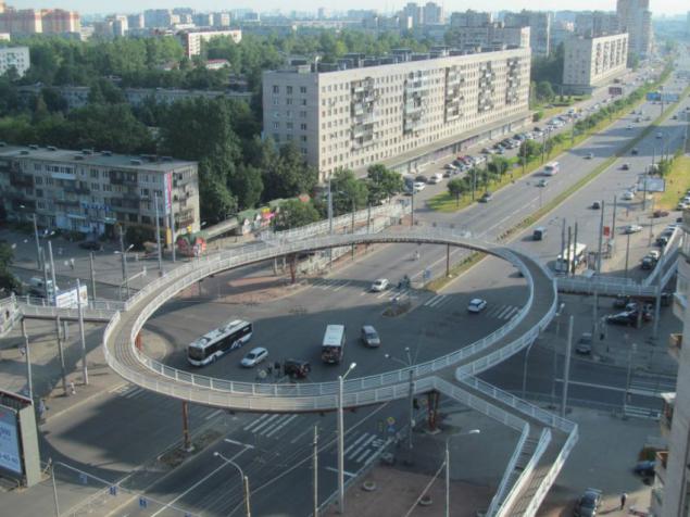
2. Prospect of Fame runs east to the Nevsky district in the metro area "Lomonosov" (Green Line). There's a depth, it crosses the railroad avenue of St. Petersburg - Moscow on a long overpass, under which is a huge yard. I went there in the winter and fotkal from the bridge. To the right of the prospectus is a beautiful and well-maintained fleet of soldiers - internationalists with temples and monuments.
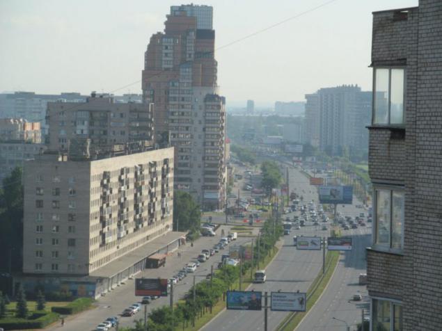
3. View of the industrial area in Moscow and later in the Admiralty district. Saint Petersburg is a very large industrial center of Russia (USSR). There are so many plants that sobesh account and half of them are well-known in Russia and abroad. Most businesses, despite the mayhem 90s, survived and running.
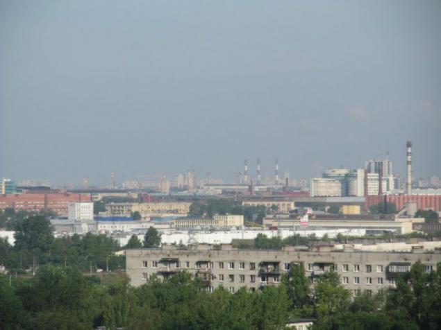
4. Typical brick Brezhnev 9 etazhka on the Avenue of Fame.
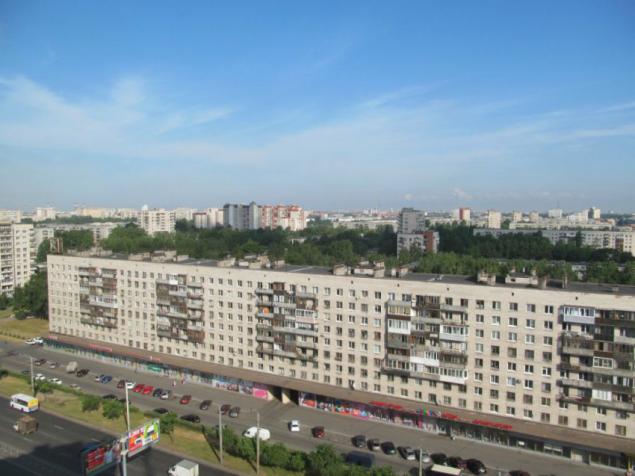
5. Vision Dome of St. Isaac's Cathedral, which is almost 10 kilometers. Unfortunately the photo came out very badly. Unable to focus.
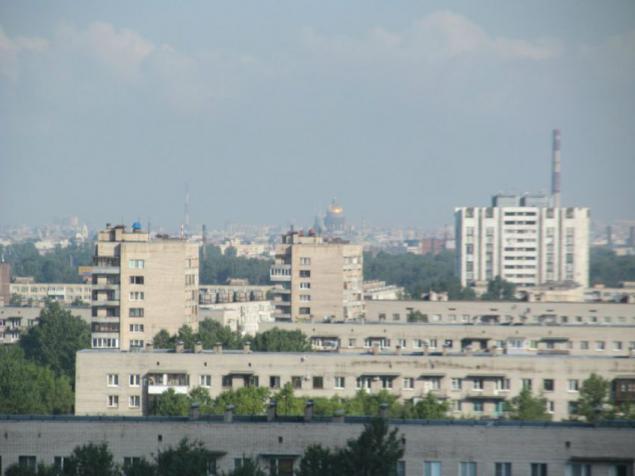
6. In the back is visible central part of St. Petersburg, with its spiers and domes of world famous cathedrals. Unfortunately due to the haze Photo also turned out badly. As you can see - in the central part of the city there are no modern high-rise buildings. In this direction, just a kilometer away, is the ultimate "purple" subway line - the station "International».
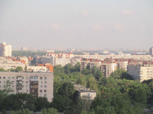
7. The intersection of Avenue of Fame with the Vitebsk direction of the railroad., Which is the boundary of the area Kupcino. In the depths of the Moscow region has seen the city, where among other things reviewed homes Stalinist buildings. Prospect of Fame in this area is limited to the area of the Moscow area, where I was and photographed. There goes "blue" subway line.
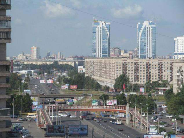
8. This is the same place sfotkal when passing freight train, though a bit late.
Seen another footbridge.
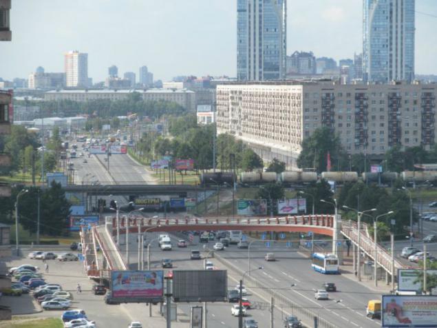
9. Finally views to the south, in the direction of the edge of town. How much is clear - at home and more time at home. Constantly seen soaring and sitting down planes at the international airport "Pulkovo". And still visible strange Brezhnev 9 etazhki who have no balconies. I have been in the apartments of this (or similar) project in the metro area "Ulitsa Dybenko».
In the Nevsky district. In the most part, which is visible in the depths of the picture number 2. This is the area in the metro area "Lomonosov". Today I was in the area, but these pictures are made 2 weeks ago, when a joint outing with Sergei Sigacheva (also known blogger Reriskop).
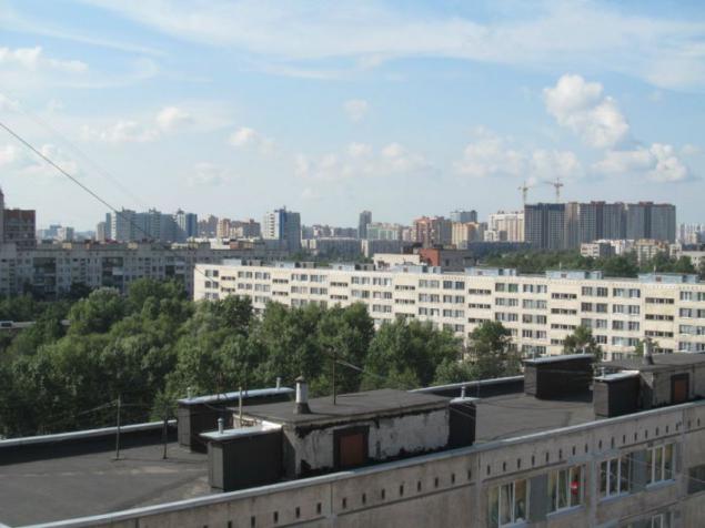
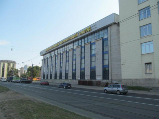
11. Close to the metro "Lomosovskaya." Station apparently so named because it is located near the famous Lomonosov Porcelain Factory, who recently returned to the historical name - Imperial Porcelain Factory.
Here, on the street Grandma prevail home Stalinist buildings.
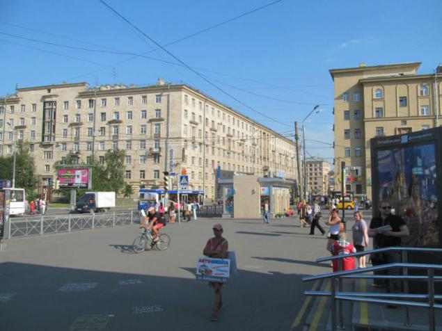
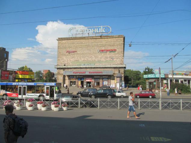
12. Cinema directly in front of the subway exit.
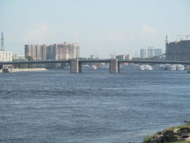
13. A very close to this place Neva flows through which spanned adjustable Volodarsky Bridge. This bridge was built to replace the old little over 20 years ago.
In the depths seen passenger river port and high-rise buildings in the fishing.
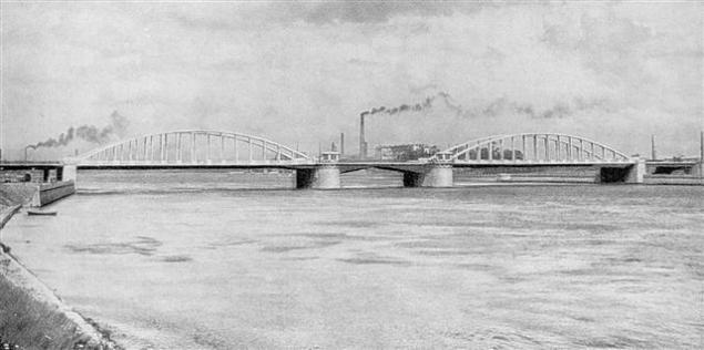
Old Bridge in 1936 looked like:
14.
The entire left-bank part of Nevsky District consists entirely of industrial zones.
Industrial area on the left bank starts from Nevsky Plant (Neva Gate, located south of the Finnish railway bridge) to the north and ends Obukhov factory in the south (in the south-eastern outskirts of the city). And this industrial zone stretches as much as 8 kilometers, all of the old mills, whose history stretches from the time of the Imperial St. Petersburg.
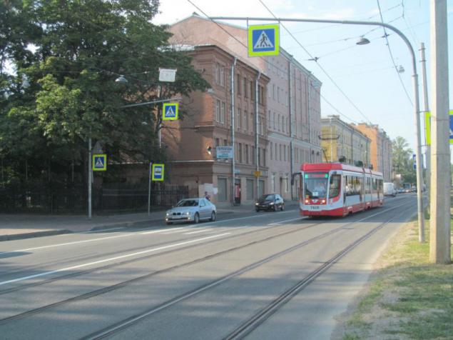
15. Prospect Obukhov defense is the axial trunk left bank of the Nevsky district.
Avenue was named after the first Russian political action of the workers, which occurred in 1901. Most of the workers were from the Obukhov plant, which as now, military work. And as the Obukhov factory is located in the area, then the prospectus with the same name exists it is here.
16. The building of the porcelain factory is facing the facade of the Neva.
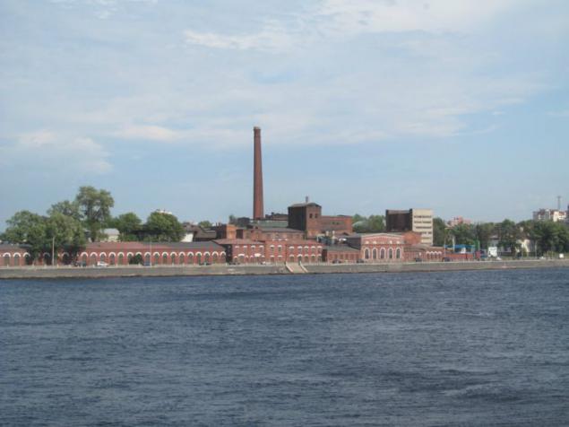
17. "Neva Manufacture" with a set of pre-revolutionary buildings from the characteristic red brick.
This is the opposite bank of the Neva, which is also full of industrial districts.
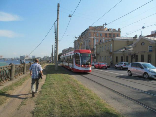
18. Prospect Obukhov Defense, looking south. In the depths seen Volodarsky Bridge. On the avenue still preserved old metal poles tramway Stalinist era.
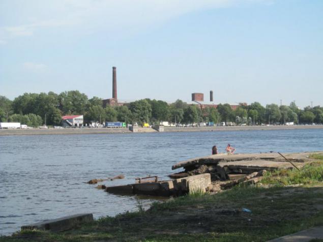
19. Neva, not clad in granite. Does not look very presentable. Some where, despite signs prohibiting basking people looking for salvation from the heat.
On the other side is visible once the royal factory buildings.
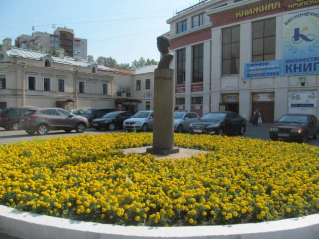
20. Around DC Krupskaya, which houses the Book Fair (something like the Kiev "Petrovka", but much less), there is a bust of Nicholas Krupskaya.
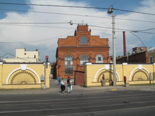
21. I can not remember - what kind of plant. He is also on the Avenue Obukhov defense.
Yet there is a street Grandma, who also goes from north to south, duplicating Avenue Obukhov defense.
Grandmother is a famous revolutionary. In this operating area, many streets are named after figures of the first Russian revolution.
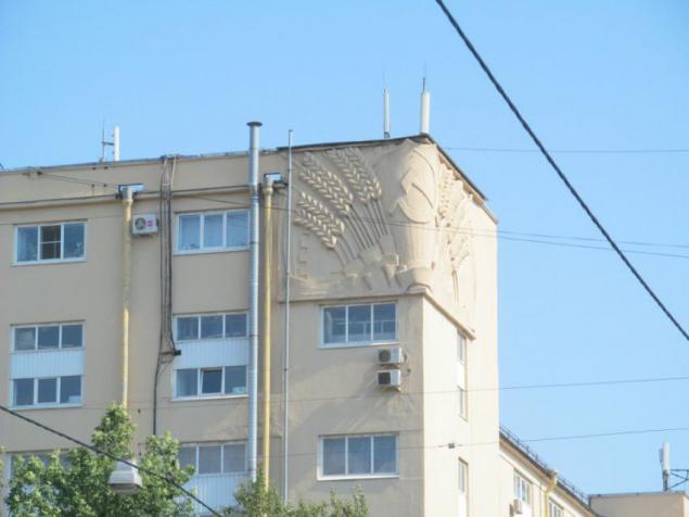
22. Bas-relief on the house of Stalin construction.
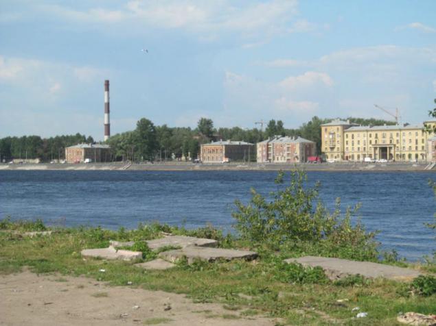
23. The opposite bank of the Neva. In this case, the October embankment.
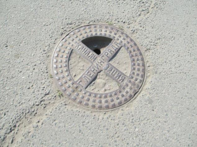
24. Old manhole sends us greetings from the mid-20th century.
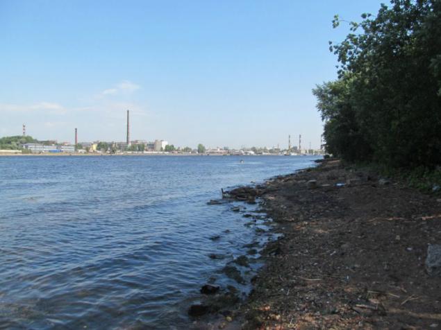
25. Just for show Neva. Similar to the bank of the Dnieper somewhere on Telichka.
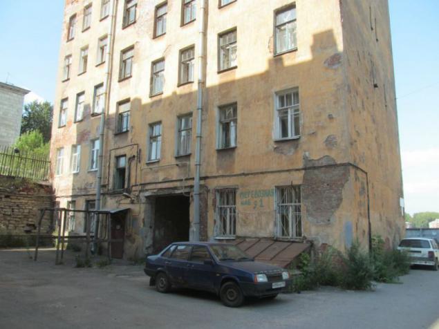
26. There are still people live. This is the area of Nevsky Plant, that is closer to the northern edge of an industrial area.
The nearest metro station here, it's - "Elizarovskaya", and even a hundred meters to the bank of the Neva.
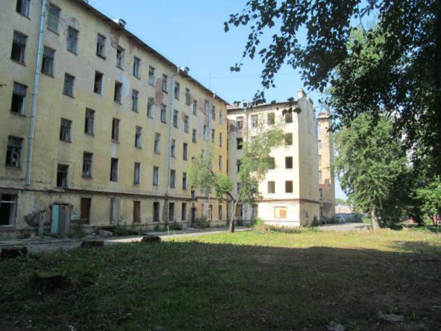
27. And it already resettled house. Once upon a time there lived mostly workers surrounding plants, probably in communal. Although this is nothing more than my assumption.
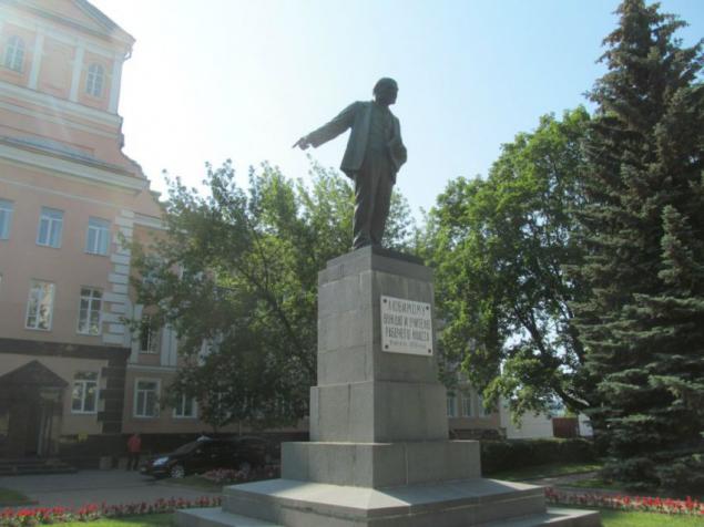
One of the world's first monument to Lenin. Opened just a year and a half after his death.
Source: flackelf.livejournal.com
Something similar can be observed in Kiev, in the form of a huge array - Troyeshchyna. Here are just Kupcino, unlike Troeschina geographically fully integrated into the city and has two subway lines, one of which is pulled further south (from the station "International»)
Geography Kupcino:
In the north it borders with the district Kupcino Volkov on connecting rail. On the east by the Sofia street industrial zone district Obuhovo. On the west by the river Volkovka and the railway track Vitebsk direction with the Moscow region. In the south industrial zone in the former state farm Shushary.
It is 9 kilometers from north to south and 4 kilometers from west to east. Disposition of the array is almost completely rectangular.
Historically (time development) Kupcino is divided into Southern (New) Kupcino (territory south of Prospect. Glory to the web District Railway, since the 1970s) and the North (Old) Kupcino (north ave. Glory, 1964) .
I just photographed on the border of North and South Kupcino.
In the process of housing construction in the 1970s, the river was concluded in Volkovka Volkovsky canal flowing along the lines of the October Vitebsk Railway.

2. Prospect of Fame runs east to the Nevsky district in the metro area "Lomonosov" (Green Line). There's a depth, it crosses the railroad avenue of St. Petersburg - Moscow on a long overpass, under which is a huge yard. I went there in the winter and fotkal from the bridge. To the right of the prospectus is a beautiful and well-maintained fleet of soldiers - internationalists with temples and monuments.

3. View of the industrial area in Moscow and later in the Admiralty district. Saint Petersburg is a very large industrial center of Russia (USSR). There are so many plants that sobesh account and half of them are well-known in Russia and abroad. Most businesses, despite the mayhem 90s, survived and running.

4. Typical brick Brezhnev 9 etazhka on the Avenue of Fame.

5. Vision Dome of St. Isaac's Cathedral, which is almost 10 kilometers. Unfortunately the photo came out very badly. Unable to focus.

6. In the back is visible central part of St. Petersburg, with its spiers and domes of world famous cathedrals. Unfortunately due to the haze Photo also turned out badly. As you can see - in the central part of the city there are no modern high-rise buildings. In this direction, just a kilometer away, is the ultimate "purple" subway line - the station "International».

7. The intersection of Avenue of Fame with the Vitebsk direction of the railroad., Which is the boundary of the area Kupcino. In the depths of the Moscow region has seen the city, where among other things reviewed homes Stalinist buildings. Prospect of Fame in this area is limited to the area of the Moscow area, where I was and photographed. There goes "blue" subway line.

8. This is the same place sfotkal when passing freight train, though a bit late.
Seen another footbridge.

9. Finally views to the south, in the direction of the edge of town. How much is clear - at home and more time at home. Constantly seen soaring and sitting down planes at the international airport "Pulkovo". And still visible strange Brezhnev 9 etazhki who have no balconies. I have been in the apartments of this (or similar) project in the metro area "Ulitsa Dybenko».
In the Nevsky district. In the most part, which is visible in the depths of the picture number 2. This is the area in the metro area "Lomonosov". Today I was in the area, but these pictures are made 2 weeks ago, when a joint outing with Sergei Sigacheva (also known blogger Reriskop).

11. Close to the metro "Lomosovskaya." Station apparently so named because it is located near the famous Lomonosov Porcelain Factory, who recently returned to the historical name - Imperial Porcelain Factory.
Here, on the street Grandma prevail home Stalinist buildings.

12. Cinema directly in front of the subway exit.

13. A very close to this place Neva flows through which spanned adjustable Volodarsky Bridge. This bridge was built to replace the old little over 20 years ago.
In the depths seen passenger river port and high-rise buildings in the fishing.

Old Bridge in 1936 looked like:
14.
The entire left-bank part of Nevsky District consists entirely of industrial zones.
Industrial area on the left bank starts from Nevsky Plant (Neva Gate, located south of the Finnish railway bridge) to the north and ends Obukhov factory in the south (in the south-eastern outskirts of the city). And this industrial zone stretches as much as 8 kilometers, all of the old mills, whose history stretches from the time of the Imperial St. Petersburg.

15. Prospect Obukhov defense is the axial trunk left bank of the Nevsky district.
Avenue was named after the first Russian political action of the workers, which occurred in 1901. Most of the workers were from the Obukhov plant, which as now, military work. And as the Obukhov factory is located in the area, then the prospectus with the same name exists it is here.

16. The building of the porcelain factory is facing the facade of the Neva.

17. "Neva Manufacture" with a set of pre-revolutionary buildings from the characteristic red brick.
This is the opposite bank of the Neva, which is also full of industrial districts.

18. Prospect Obukhov Defense, looking south. In the depths seen Volodarsky Bridge. On the avenue still preserved old metal poles tramway Stalinist era.

19. Neva, not clad in granite. Does not look very presentable. Some where, despite signs prohibiting basking people looking for salvation from the heat.
On the other side is visible once the royal factory buildings.

20. Around DC Krupskaya, which houses the Book Fair (something like the Kiev "Petrovka", but much less), there is a bust of Nicholas Krupskaya.

21. I can not remember - what kind of plant. He is also on the Avenue Obukhov defense.
Yet there is a street Grandma, who also goes from north to south, duplicating Avenue Obukhov defense.
Grandmother is a famous revolutionary. In this operating area, many streets are named after figures of the first Russian revolution.

22. Bas-relief on the house of Stalin construction.

23. The opposite bank of the Neva. In this case, the October embankment.

24. Old manhole sends us greetings from the mid-20th century.

25. Just for show Neva. Similar to the bank of the Dnieper somewhere on Telichka.

26. There are still people live. This is the area of Nevsky Plant, that is closer to the northern edge of an industrial area.
The nearest metro station here, it's - "Elizarovskaya", and even a hundred meters to the bank of the Neva.

27. And it already resettled house. Once upon a time there lived mostly workers surrounding plants, probably in communal. Although this is nothing more than my assumption.

One of the world's first monument to Lenin. Opened just a year and a half after his death.

Source: flackelf.livejournal.com

