608
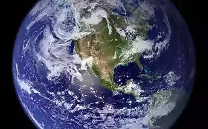
Our planet in 30 years: then and now
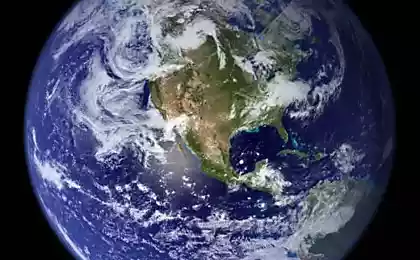
Let's see how our planet has changed over the past 30 years.
These images were collected as part of an ongoing joint project of the US Geological Survey and NASA, known as Landsat. These satellites take photos of the Earth from space by 1970. All the acquired images sent to Earth and archived in the tape drives USGS, which look something like this:

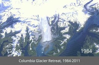
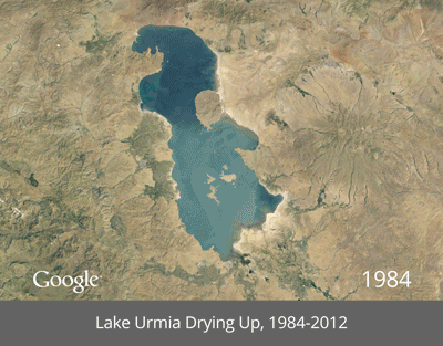
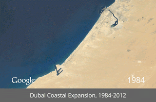
Google in 2009, began working with the USGS over the digitization of the archive images. With the help of Google Earth Engine technology they moved 2,068,467 images - a total of 909 terabytes of data - to select the best quality (for example, no clouds), for each year from 1984, and for each place in the world. They are then assembled in their huge planetary images 1, 78 terapikseley each, one for each year.


These images were collected as part of an ongoing joint project of the US Geological Survey and NASA, known as Landsat. These satellites take photos of the Earth from space by 1970. All the acquired images sent to Earth and archived in the tape drives USGS, which look something like this:

Google in 2009, began working with the USGS over the digitization of the archive images. With the help of Google Earth Engine technology they moved 2,068,467 images - a total of 909 terabytes of data - to select the best quality (for example, no clouds), for each year from 1984, and for each place in the world. They are then assembled in their huge planetary images 1, 78 terapikseley each, one for each year.