788
Nazca - the greatest mystery of the world
Nazca - mysterious plateau has for a century not giving rest to scientists all over the world. Almost a hundred years, the world's luminaries struggling with mysterious drawings that covered the Peruvian desert plateau.
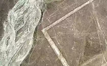
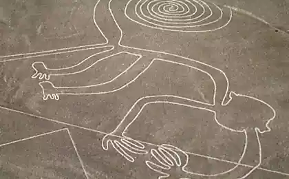
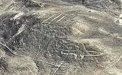
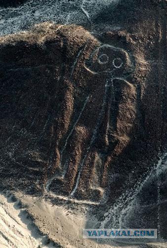
Or Pampa Nazca Plateau is located 450 km south of the Peruvian capital - the city of Lima. Plateau covers 60 kilometers and about 500 square meters of its territory is covered with strange lettering lines emerging in the fanciful shapes. The main mystery of Nazca - geometric shapes in the form of triangles and more than thirty huge drawings of animals, birds, fish, insects and people of unusual species. All images on the surface Nazca dug in sandy soil, the depth of the lines ranges from 10 to 30 centimeters, and the width of the strips may be as high as 100 meters. Line drawings stretch for kilometers, while completely changing under the influence of topography - lines up the hill and down with them while remaining almost perfectly smooth and continuous. Who and what made these drawings - unknown tribes, or aliens from outer space - the question is still no answer. Today, there are many hypotheses, but none of them can be solved.
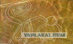
What's more or less exactly the scientists were able to establish, as is the age of the image. Based on found here ceramic fragments and data analysis of organic residues, they found that in the period between 350 BC and 600 BC there existed a civilization. However, this theory can not be accurate, since the objects of civilization could be brought here long after the appearance of images. One theory is that it works the Nazca Indians who inhabited the regions of Peru to the formation of the Inca Empire. Nazca have left behind nothing except burial sites, so it is not known - whether they had written, and whether they are "painted" desert.
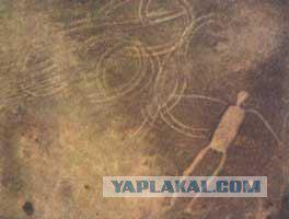
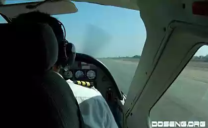
The first mention of the Nazca figures met in the annals of Spanish explorers XV-XVII centuries, but at one time they did not attract the attention of the public and the scientific world. This explosion happened with the development of aviation - the fact that the whole vast system of lines can be seen only from the air, but the first person who discovered the drawings, considered the Peruvian archaeologist Mejia Ksesspe. In 1927 he saw the images of the steep slope of the mountain. But only in the 40's, the Nazca became really investigate, that's when the American historian Paul Kosok photos provided public figures, taken from an airplane. Over the Nazca actually flew to discover the sources of water in the wilderness, and found the greatest mystery of the world ...
Kosok brought one of the first theories that the Nazca drawings - is a huge astronomical calendar. He held similar patterns with the starry sky, and it became clear that some of the lines indicate constellations, as well as a fixed point of sunrise and sunset. Kosok continued to develop the theory of the German mathematician and astronomer Maria Reiche. As many as 40 years, she has devoted to study and attempt to systematize the Nazca lines to explain their meaning. She found that all the pictures on the territory of the desert carried out in the same way and is likely to do it manually. The first in the plateau were "scratched" figures of birds and animals, and only then, on top, had suffered additional lines. In addition, Reich found some small sketches of figures, which are then repeated in full. At the ends of some figures in the land they were driven wooden piles. They were not drawing tool, and the coordinates for the unknown artists. That figure can only be seen from a height, prompted Reiche and other scientists to believe that during the creation of drawings of people (if they were, of course, people) already know how to fly. In this regard, there is a theory that the Nazca was once the airfield for ancient civilizations.
Source:
Or Pampa Nazca Plateau is located 450 km south of the Peruvian capital - the city of Lima. Plateau covers 60 kilometers and about 500 square meters of its territory is covered with strange lettering lines emerging in the fanciful shapes. The main mystery of Nazca - geometric shapes in the form of triangles and more than thirty huge drawings of animals, birds, fish, insects and people of unusual species. All images on the surface Nazca dug in sandy soil, the depth of the lines ranges from 10 to 30 centimeters, and the width of the strips may be as high as 100 meters. Line drawings stretch for kilometers, while completely changing under the influence of topography - lines up the hill and down with them while remaining almost perfectly smooth and continuous. Who and what made these drawings - unknown tribes, or aliens from outer space - the question is still no answer. Today, there are many hypotheses, but none of them can be solved.

What's more or less exactly the scientists were able to establish, as is the age of the image. Based on found here ceramic fragments and data analysis of organic residues, they found that in the period between 350 BC and 600 BC there existed a civilization. However, this theory can not be accurate, since the objects of civilization could be brought here long after the appearance of images. One theory is that it works the Nazca Indians who inhabited the regions of Peru to the formation of the Inca Empire. Nazca have left behind nothing except burial sites, so it is not known - whether they had written, and whether they are "painted" desert.

The first mention of the Nazca figures met in the annals of Spanish explorers XV-XVII centuries, but at one time they did not attract the attention of the public and the scientific world. This explosion happened with the development of aviation - the fact that the whole vast system of lines can be seen only from the air, but the first person who discovered the drawings, considered the Peruvian archaeologist Mejia Ksesspe. In 1927 he saw the images of the steep slope of the mountain. But only in the 40's, the Nazca became really investigate, that's when the American historian Paul Kosok photos provided public figures, taken from an airplane. Over the Nazca actually flew to discover the sources of water in the wilderness, and found the greatest mystery of the world ...

Kosok brought one of the first theories that the Nazca drawings - is a huge astronomical calendar. He held similar patterns with the starry sky, and it became clear that some of the lines indicate constellations, as well as a fixed point of sunrise and sunset. Kosok continued to develop the theory of the German mathematician and astronomer Maria Reiche. As many as 40 years, she has devoted to study and attempt to systematize the Nazca lines to explain their meaning. She found that all the pictures on the territory of the desert carried out in the same way and is likely to do it manually. The first in the plateau were "scratched" figures of birds and animals, and only then, on top, had suffered additional lines. In addition, Reich found some small sketches of figures, which are then repeated in full. At the ends of some figures in the land they were driven wooden piles. They were not drawing tool, and the coordinates for the unknown artists. That figure can only be seen from a height, prompted Reiche and other scientists to believe that during the creation of drawings of people (if they were, of course, people) already know how to fly. In this regard, there is a theory that the Nazca was once the airfield for ancient civilizations.

Source:
