930
The highest mountain in the world (10 photos)
The most dangerous and high mountains of the planet.
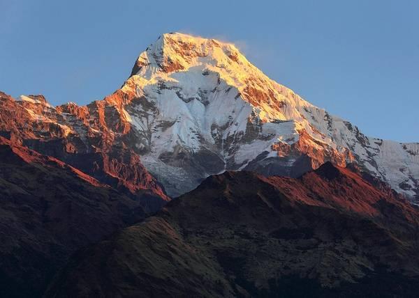
Annapurna (Morshiadi)
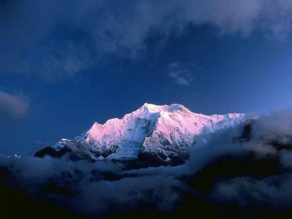
Height - 8091m
Coordinates: 28o36 's.sh.83o49' E.
Median peak - 8051 m.Vostochnaya peak - 8029 m.
Black rock - predvershinnoy eastern peak - 7485 m.Annapurna located in the eastern part of the Central Nepal between the gorges of the rivers Kali Gandaki and Marsiandi. It is the highest peak in the whole range of mountains stretching from west to east.
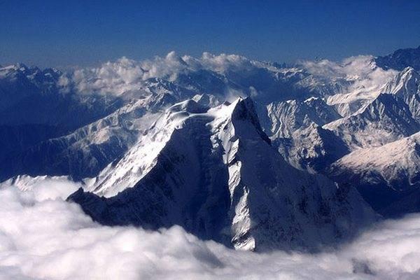
Nanga Parbat (Diamir)

Height - 8125m
Coordinates: 35o13 's.sh.74o35' E.
Predvershinnoy - 7910 m.Severnaya top of I - 7816 m.Severnaya top of II - 7785 m.Serebryany spur - 7597 m.Severo eastern peak - 7530 m.
This huge array of western extremity of the 2000-kilometer arc of the Himalayan mountain range is located in the bend of the Indus in Pakistan. With its numerous ridges, hanging glaciers and rock bastions, with the 5000-meter wall it is more than 1,000 meters towers over its neighbors. Gore makes quite an impressive impression. Although Baltic tribes called it Diamir (king of the mountains), it is more commonly known as the Nanga Parbat, which in Sanskrit means "naked mountain of horror».
Manaslu (Kutang)
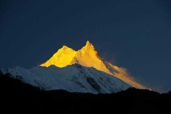
Height - 8156m
Coordinates: 28o33 's.sh.84o34' E
Eastern peak - 7895 m.Severnaya peak - 7154 m.
The only eight-to-Gurkha Himalaya in Central Nepal, east Marsiandi Gandaki and Dhaulagiri, Annapurna group. Suitable explanation name of the mountain still could not be found. Initially Geodetic Survey of India it was known as peak-30, and later, up to the 50s, also called Kutang-I.
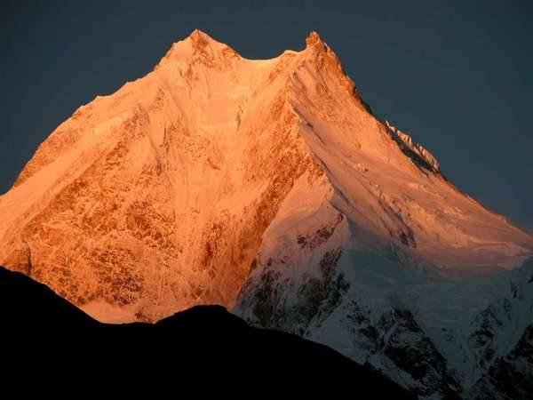
Dhaulagiri I
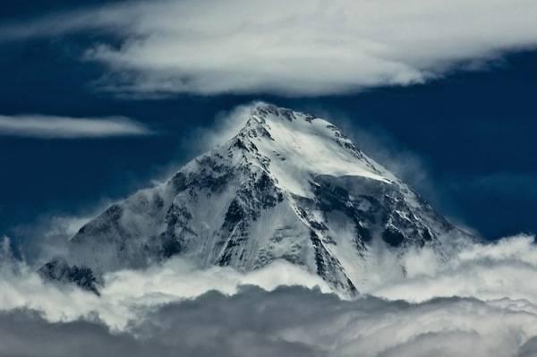
Height - 8167m
Coordinates: 28o42 's.sh.83o30' E.
Hard to reach far-flung mountain with one vertex is located in the central part of Nepal in Dhauli-Himalaya, west of the Kali Gandaki Canyon.

Cho Oyu
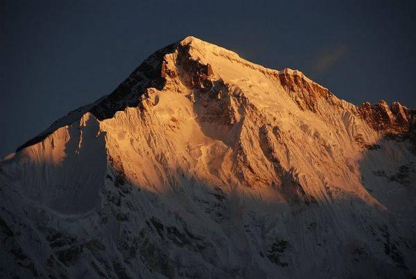
Height - 8153m
Coordinates: 28o06 's.sh.86o40' E.
East side vertex Ngoyumba Ri-1 - 7806 m.Yuzhnaya vertex Ngoyumba Ri-2 - 7646 m.
The mountain is located 29 km northwest of Chomolungma in Mahalangur-Himalaya on the border between Nepal and China. The name means turquoise goddess.
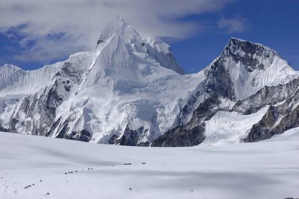
Makalu (Makalufeng)
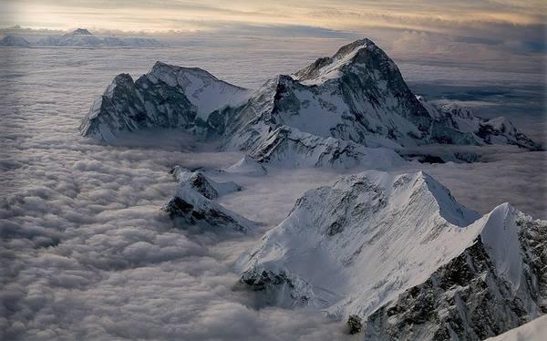
Height - 8481m
Coordinates: 27o53 's.sh.87o05' E.
Southeast peak - 8010 m.
Perfectly contoured, ribbed granite peak in the 16 km southeast of Chomolungma in Mahalangur-Himalaya (Eastern Nepal). Gore is clearly visible from Darjeeling.
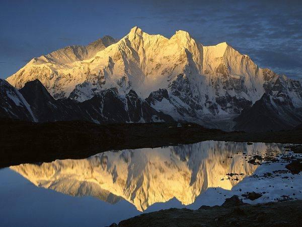
Lhotse
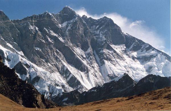
Height - 8511m
Coordinates: 27o58 's.sh.86o56' E.
West intermediate peak - 8426 m.Vostochnaya intermediate peak - 8376 m.Lhotsze Bowl (Eastern peak) - 8398 m.
The Tibetan name "Lho-chieh" means "southern peak." The mountain is located three kilometers south of Chomolungma. Previously, it was seen as a side predvershinnoy, but it turned out that it is clearly separated from her South saddle.
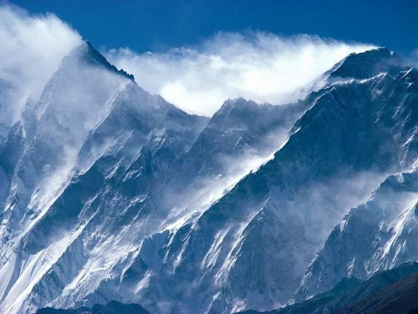
Kangchenjunga (Kanchenjunga, Kanchenfanga)
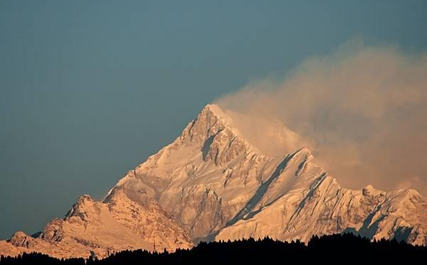
Height - 8598m
Coordinates: 27o42 's.sh.88o09' E.
South Peak - 8490 m.Promezhutochny peak - 8496 m.Zapadnaya vertex Dzhalung Kang - 8433 m.Vostochnaya peak - 7700 m.
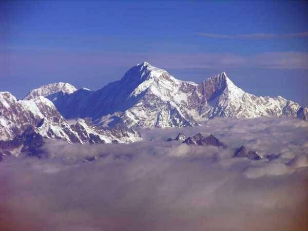
The Tibetan name Kang-chen-jo-nga (five treasures of the great snow) accurately describes this mountain with its five glaciers. Before the discovery of Kanchenjunga Everest for many years was considered the highest point Zemli.Obshirny array of 12x7 km area with many peaks located in the eastern part of the Himalayas in the triangle of Nepal, India and China. Its main ridge over more than 6 km altitude of 8000 m. It is the most eastern and also the southernmost eightthousander.
K-2 (Chogori, Kyaogelifeng)
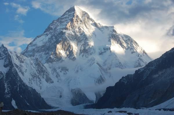
Height - 8611m
Coordinates: 35o53 's.sh.76o31' E
East predvershinnoy - m.Yuzhnaya predvershinnoy 8230 - 8132 m.
K-2 is located in the Baltoro Muztagh-Pakistani Karakoram. In the language balti Chogori means "big mountain". Geodesic Room-2 has nothing to do with the fact that this mountain was the second highest peak of the Earth.

Qomolangma (Everest Dzhumulangfeng, Sagarmatha)

Height - 8848m
Coordinates: 27o59'16 & quot; s.sh.86o55'40 & quot; E
South Peak - 8760 m.Severo-east shoulder - 8393 m.
Three-sided pyramid, which consists mainly of sediments, located in the ridge Mahalangur-Himal (Khumbu Himal-) on the eastern border of Nepal.

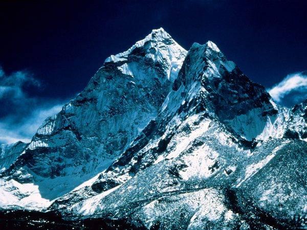
Annapurna (Morshiadi)

Height - 8091m
Coordinates: 28o36 's.sh.83o49' E.
Median peak - 8051 m.Vostochnaya peak - 8029 m.
Black rock - predvershinnoy eastern peak - 7485 m.Annapurna located in the eastern part of the Central Nepal between the gorges of the rivers Kali Gandaki and Marsiandi. It is the highest peak in the whole range of mountains stretching from west to east.

Nanga Parbat (Diamir)

Height - 8125m
Coordinates: 35o13 's.sh.74o35' E.
Predvershinnoy - 7910 m.Severnaya top of I - 7816 m.Severnaya top of II - 7785 m.Serebryany spur - 7597 m.Severo eastern peak - 7530 m.
This huge array of western extremity of the 2000-kilometer arc of the Himalayan mountain range is located in the bend of the Indus in Pakistan. With its numerous ridges, hanging glaciers and rock bastions, with the 5000-meter wall it is more than 1,000 meters towers over its neighbors. Gore makes quite an impressive impression. Although Baltic tribes called it Diamir (king of the mountains), it is more commonly known as the Nanga Parbat, which in Sanskrit means "naked mountain of horror».

Manaslu (Kutang)

Height - 8156m
Coordinates: 28o33 's.sh.84o34' E
Eastern peak - 7895 m.Severnaya peak - 7154 m.
The only eight-to-Gurkha Himalaya in Central Nepal, east Marsiandi Gandaki and Dhaulagiri, Annapurna group. Suitable explanation name of the mountain still could not be found. Initially Geodetic Survey of India it was known as peak-30, and later, up to the 50s, also called Kutang-I.

Dhaulagiri I

Height - 8167m
Coordinates: 28o42 's.sh.83o30' E.
Hard to reach far-flung mountain with one vertex is located in the central part of Nepal in Dhauli-Himalaya, west of the Kali Gandaki Canyon.

Cho Oyu

Height - 8153m
Coordinates: 28o06 's.sh.86o40' E.
East side vertex Ngoyumba Ri-1 - 7806 m.Yuzhnaya vertex Ngoyumba Ri-2 - 7646 m.
The mountain is located 29 km northwest of Chomolungma in Mahalangur-Himalaya on the border between Nepal and China. The name means turquoise goddess.

Makalu (Makalufeng)

Height - 8481m
Coordinates: 27o53 's.sh.87o05' E.
Southeast peak - 8010 m.
Perfectly contoured, ribbed granite peak in the 16 km southeast of Chomolungma in Mahalangur-Himalaya (Eastern Nepal). Gore is clearly visible from Darjeeling.

Lhotse

Height - 8511m
Coordinates: 27o58 's.sh.86o56' E.
West intermediate peak - 8426 m.Vostochnaya intermediate peak - 8376 m.Lhotsze Bowl (Eastern peak) - 8398 m.
The Tibetan name "Lho-chieh" means "southern peak." The mountain is located three kilometers south of Chomolungma. Previously, it was seen as a side predvershinnoy, but it turned out that it is clearly separated from her South saddle.

Kangchenjunga (Kanchenjunga, Kanchenfanga)

Height - 8598m
Coordinates: 27o42 's.sh.88o09' E.
South Peak - 8490 m.Promezhutochny peak - 8496 m.Zapadnaya vertex Dzhalung Kang - 8433 m.Vostochnaya peak - 7700 m.
The Tibetan name Kang-chen-jo-nga (five treasures of the great snow) accurately describes this mountain with its five glaciers. Before the discovery of Kanchenjunga Everest for many years was considered the highest point Zemli.Obshirny array of 12x7 km area with many peaks located in the eastern part of the Himalayas in the triangle of Nepal, India and China. Its main ridge over more than 6 km altitude of 8000 m. It is the most eastern and also the southernmost eightthousander.

K-2 (Chogori, Kyaogelifeng)

Height - 8611m
Coordinates: 35o53 's.sh.76o31' E
East predvershinnoy - m.Yuzhnaya predvershinnoy 8230 - 8132 m.
K-2 is located in the Baltoro Muztagh-Pakistani Karakoram. In the language balti Chogori means "big mountain". Geodesic Room-2 has nothing to do with the fact that this mountain was the second highest peak of the Earth.

Qomolangma (Everest Dzhumulangfeng, Sagarmatha)

Height - 8848m
Coordinates: 27o59'16 & quot; s.sh.86o55'40 & quot; E
South Peak - 8760 m.Severo-east shoulder - 8393 m.
Three-sided pyramid, which consists mainly of sediments, located in the ridge Mahalangur-Himal (Khumbu Himal-) on the eastern border of Nepal.


