677
Using satellite imagery, archaeologists discovered an unknown Viking settlement in the New World
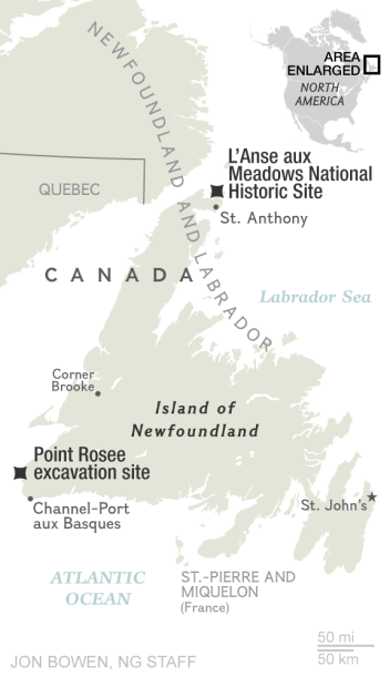
Archaeologist Sarah Parsak [Sarah Parcak] from the University of Alabama at Birmingham found another Viking settlement in the south of the island of Newfoundland, in the area called Point Rosie [Point Rosee]. Before that it was known only one Viking settlement in the north of the island. Parsak discovered the location of the ruins of ancient buildings with a digital analysis of satellite photos of the area.
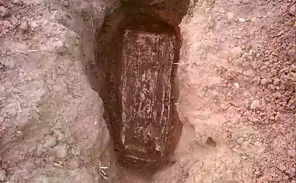
At the moment, the scientists assumed that of all Europeans is the first to discover the Vikings to North America, despite the fact that the continent for more than 11 thousand. Years before inhabited by indigenous peoples. It happened at the end of the 10th century AD, approximately 986 year - 500 years before Columbus. Archaeological evidence confirms the veracity of the saga, "Saga of Eric fawn" and "Saga of the Greenlanders", was discovered in 1960 in the village of L'Anse aux Meadows in Newfoundland. The Vikings called Vinland open their land.
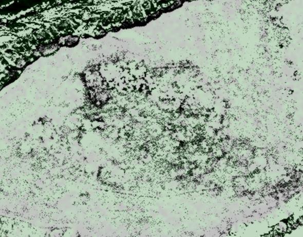
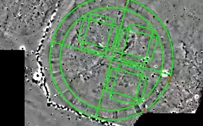
example of satellite imagery, which worked Parsak
Sarah Parsak belongs to the so-called Space archaeologists - the followers of the modern trend in this science, which use satellite photos to analyze the features of the planet's surface. Often such analysis helps to find traces of the ruins of ancient settlements. Even being buried under a layer of soil, ruins affect retention and redistribution of moisture in it, and thus indirectly - on the character of distribution of vegetation on the surface. Computer analysis and visual inspection of the high-resolution photos helps detect such deviations.
Sarah Parsak, Egyptologist and associate professor of the department of archeology, using this method, already found in 2011 in Egypt 17, the lost pyramids, more than 1,000 tombs and 3,100 ancient settlements in infrared satellite imagery. She and her team was able to detect previously unseen structures, including streets with a lot of houses, tombs and pyramids. After working with satellite images team of French archaeologists conducted excavations in these locations and confirmed that Parsak not mistaken.
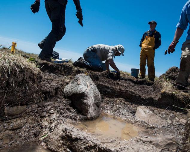
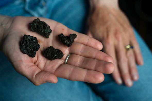
Finding location of intended settlement of the Vikings, the team began excavations Parsak, and with the help of a magnetometer stumbled upon 14 kilograms lain all this time in the land of iron slag, indicating the place of manufacture Viking weapons and tools.
While it is not known whether the Vikings called Vinland only the island of Newfoundland, or whether they have achieved and the main, mainland Canada. The opening of a new settlement archaeologists encouraging and offers hope for new interesting findings, which will be able to expand the known history of ancient peoples.
Earlier work together archaeologists from Harvard University and the Massachusetts Institute of Technology in 2012, has developed its own methodology for processing of satellite images allowed to find the north-eastern Syria several thousand previously unknown settlements. The oldest of them are aged eight thousand years.
Source: geektimes.ru/post/273836/


Happy birthday, laptop! 35 years of the first commercially successful portable computer
Breathe deeply: Astronomers have found a white dwarf with an atmosphere of pure oxygen