1312
Lava Flow
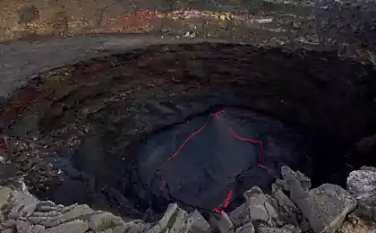
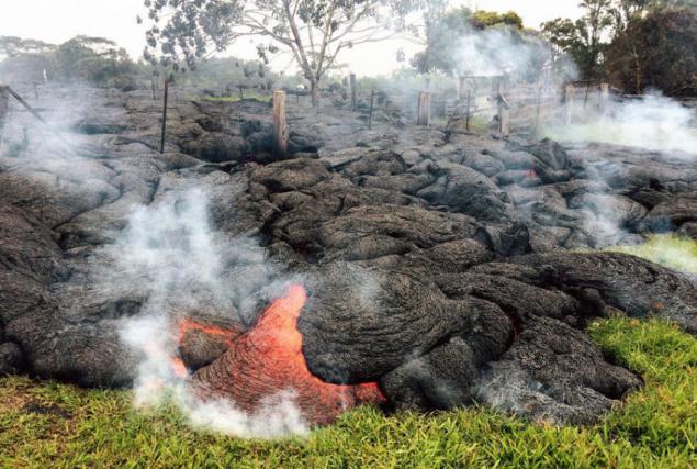
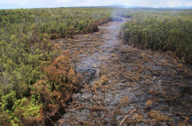
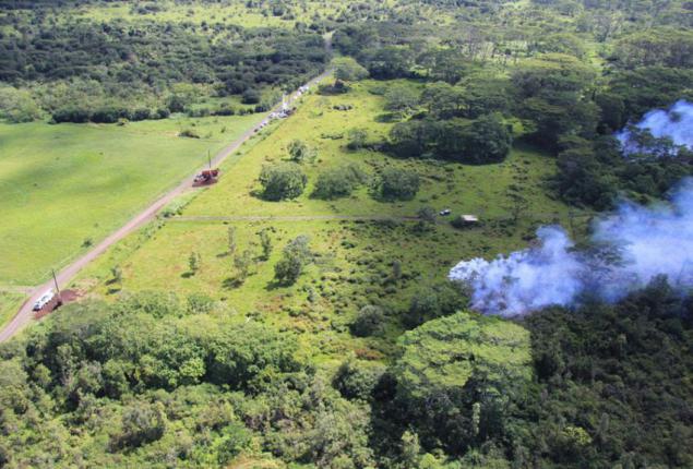
The flow of lava erupting June 27 from Kilauea volcano continues to move towards the north-east, close to the small town of Pahoa, Hawaii. Part of the lava in the foreground, is still moving through the open field, while the basic "language" of the flow is directed to the cemetery Pahoa, October 26, 2014.
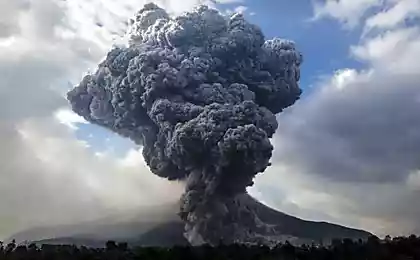
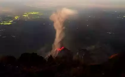
On the morning of June 27, 2014, increased pressure in the crater «Pu'u« O'o 'volcano Kilauea has reached a critical point, the magma broke through the crater and began to erupt from cracks on the northeast side of the volcano. These new cracks feed the main stream, which is already at 11 am was long about 1, 5 km.
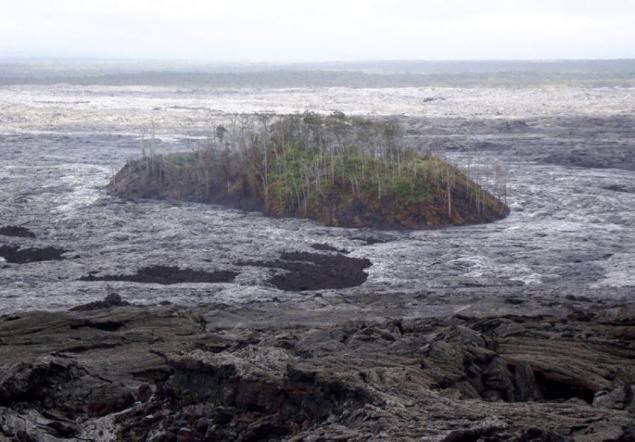
By July 18 the lava flow, which in this photo looks like a silver lava surrounds what's left of Pu'u Kahauale'a - a volcanic cone, covered with forests, which for several hundred years.
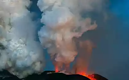
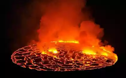
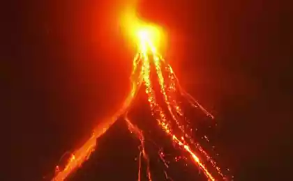
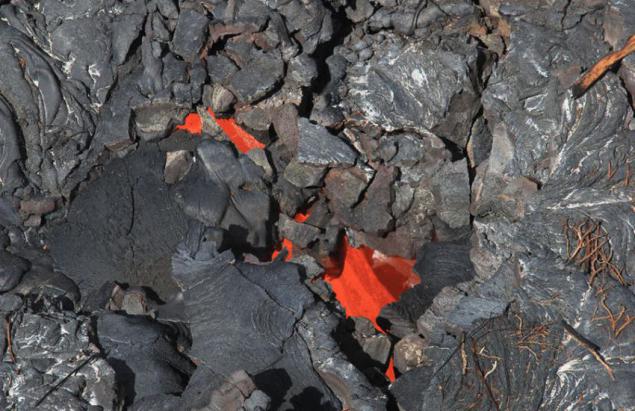
August 12 under the light visible liquid lava flow mainly lava flow, revealing its complex structure. Bright red-hot area - a stream of molten lava that slowly but surely, as the flows through the "pipe" into the mainstream.
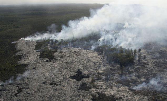
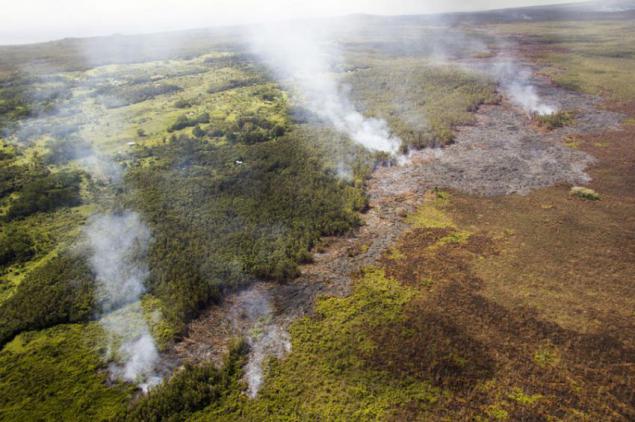
August 6 lava flow continues to spread rapidly, reaching the border of the forest.
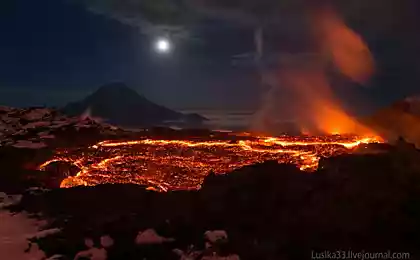
August 22. "Alive" cascade of lava is seen at top of frozen stream. Feed feed eruptions from cracks on Pu'u «O'o on the" pipe "of lava.
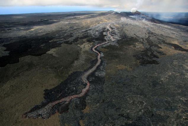
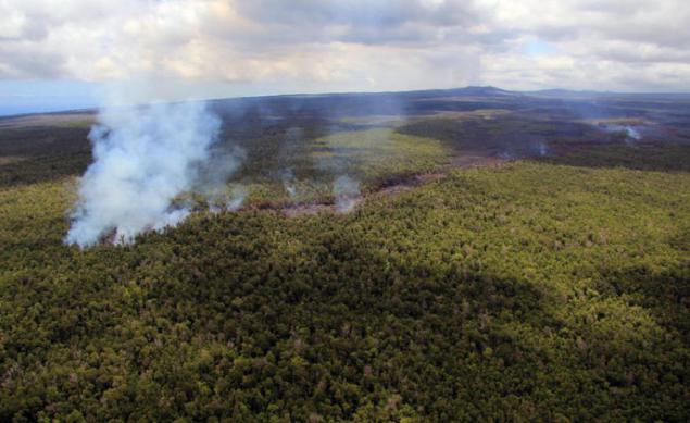
August 12, a week lava flow moved straight into the woods. The length of the main stream was 8, 5 km to the north-east of the eruption site.
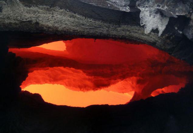
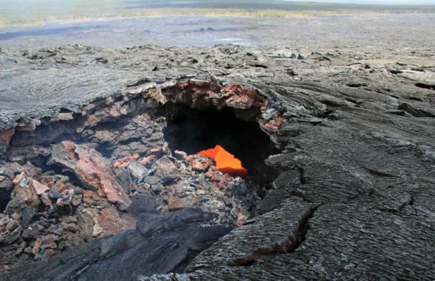
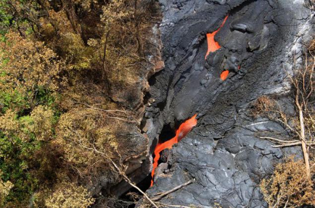
August 14 The photo is visible collapse of the lava and the resulting window, which is visible through the stream of molten lava, located a few meters from the surface.
September 1 at the surface near the leading edge of the fast-moving lava lava flow poured into a deep crack (in the center). Pu'u «O'o is located in the upper part of the photo.
September 1, the view of lava flowing down into a deep crevasse near.
October 10, the close up view on a narrow flow front. In the upper left corner of the photo home Kaohe.
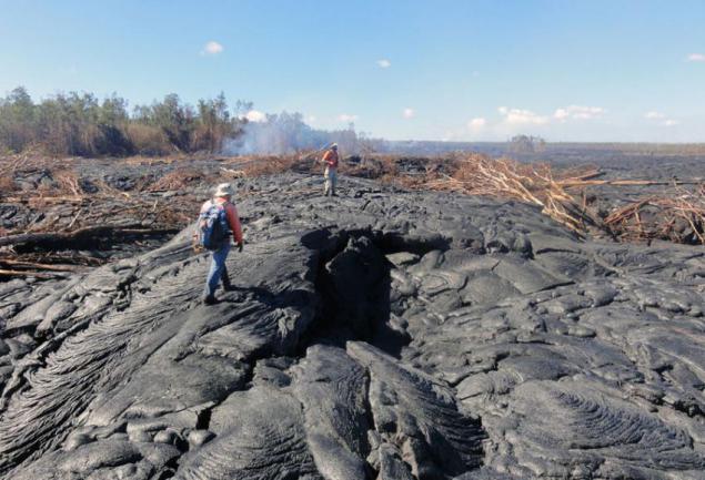
October 22 geologists Hawaiian volcanic observation point are on the surface of the stream. They track surface breaks along the edge of the stream at a distance of about one kilometer.
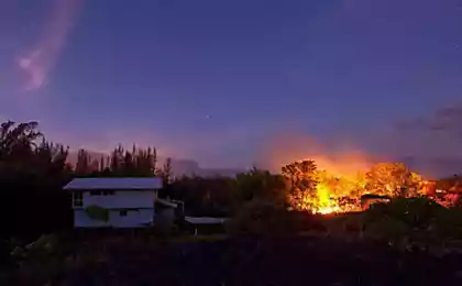
October 24 the team of «Hawaii Electric Light Company» for protection of electric poles along the road near the cemetery Pahoa, isolate them using special materials and cement barriers.
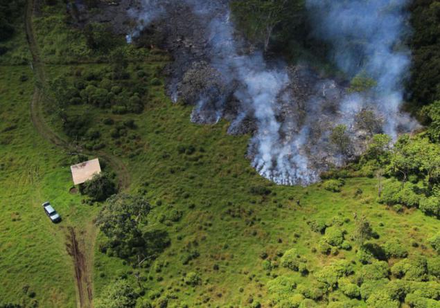
October 24, geologists Hawaiian volcanic vantage point in a pasture near the road adjacent to the cemetery Pahoa. They map the position of the lava flow.
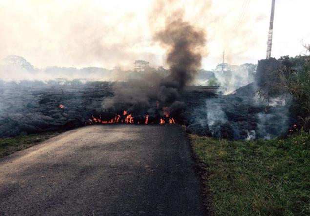
Lava flow crosses Apa'a Street / Cemetery Road at 3:50 am on Saturday morning, October 25, 2014. This photograph, taken at 9 am on Saturday, the flow moves from right to left. Clearly, both the edge flow lit asphalt. Pillar (pictured far right) was also surrounded by lava, but at the time of shooting was. There is hope that the protective insulation and cement barrier around the pole to save him from burning.
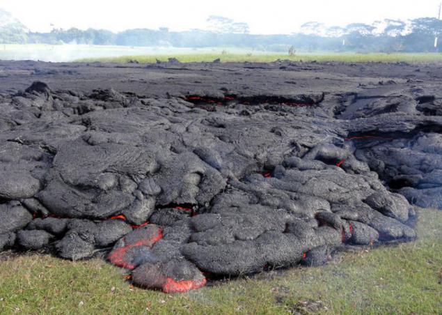
A typical part of the lava flow in Pahoe only downslope Cemetery Road / Apa'a Street. Horizontal cracks are visible in the center and on the right of the photograph. They point out that the flow of bad bubbled. Bloating is caused by continuous replenishment of fresh lava beneath the surface crust that slowly rises and bursts.
Source: daypic.ru

On the morning of June 27, 2014, increased pressure in the crater «Pu'u« O'o 'volcano Kilauea has reached a critical point, the magma broke through the crater and began to erupt from cracks on the northeast side of the volcano. These new cracks feed the main stream, which is already at 11 am was long about 1, 5 km.

By July 18 the lava flow, which in this photo looks like a silver lava surrounds what's left of Pu'u Kahauale'a - a volcanic cone, covered with forests, which for several hundred years.

August 12 under the light visible liquid lava flow mainly lava flow, revealing its complex structure. Bright red-hot area - a stream of molten lava that slowly but surely, as the flows through the "pipe" into the mainstream.

August 6 lava flow continues to spread rapidly, reaching the border of the forest.

August 22. "Alive" cascade of lava is seen at top of frozen stream. Feed feed eruptions from cracks on Pu'u «O'o on the" pipe "of lava.

August 12, a week lava flow moved straight into the woods. The length of the main stream was 8, 5 km to the north-east of the eruption site.

August 14 The photo is visible collapse of the lava and the resulting window, which is visible through the stream of molten lava, located a few meters from the surface.

September 1 at the surface near the leading edge of the fast-moving lava lava flow poured into a deep crack (in the center). Pu'u «O'o is located in the upper part of the photo.

September 1, the view of lava flowing down into a deep crevasse near.

October 10, the close up view on a narrow flow front. In the upper left corner of the photo home Kaohe.

October 22 geologists Hawaiian volcanic observation point are on the surface of the stream. They track surface breaks along the edge of the stream at a distance of about one kilometer.

October 24 the team of «Hawaii Electric Light Company» for protection of electric poles along the road near the cemetery Pahoa, isolate them using special materials and cement barriers.

October 24, geologists Hawaiian volcanic vantage point in a pasture near the road adjacent to the cemetery Pahoa. They map the position of the lava flow.

Lava flow crosses Apa'a Street / Cemetery Road at 3:50 am on Saturday morning, October 25, 2014. This photograph, taken at 9 am on Saturday, the flow moves from right to left. Clearly, both the edge flow lit asphalt. Pillar (pictured far right) was also surrounded by lava, but at the time of shooting was. There is hope that the protective insulation and cement barrier around the pole to save him from burning.

A typical part of the lava flow in Pahoe only downslope Cemetery Road / Apa'a Street. Horizontal cracks are visible in the center and on the right of the photograph. They point out that the flow of bad bubbled. Bloating is caused by continuous replenishment of fresh lava beneath the surface crust that slowly rises and bursts.

Source: daypic.ru