877
12 unique maps, which is easy to understand the real dimensions of the world

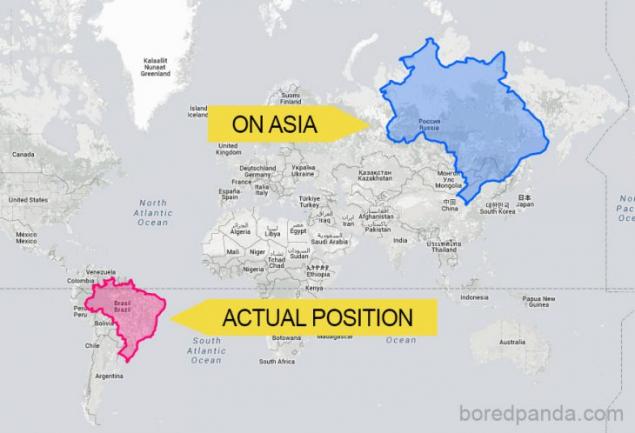
reason that some countries appear on the map more or less than others, is to use the Mercator projection. Apply a three-dimensional map on a flat planet was something of a call to the pioneers of modern cartography, and the Flemish geographer Gerardus Mercator invented a way to deal with this problem. In 1569, Mercator created the map, which was quite suitable for use as a navigation aid, but its major shortcoming was that they invented a system distorted the size of objects based on their position in relation to the equator. Because of this, part of the land such as Antarctica or Greenland, which are much closer to the poles, were much larger than its present size.
For example, according to the Mercator projection, Romania would be a huge island in the Arctic Ocean

Photo source: Boredpanda.comDlya to demonstrate how our perception of the size of countries and continents erroneously due to the use of this system, the creators thetruesize.com site made it possible for any user to move on the territory of the countries of the Earth's surface for a visual comparison
If Australia was located on the site of Europe

If India was to place Russia

Antarctica is comparable in size to Brazil

Japan would be stretched across Canada

Australia in North America

California is comparable in size to the UK

If China was location Russia

Canada is not so huge, if you move it to South America

Gay travel Greenland on the world map
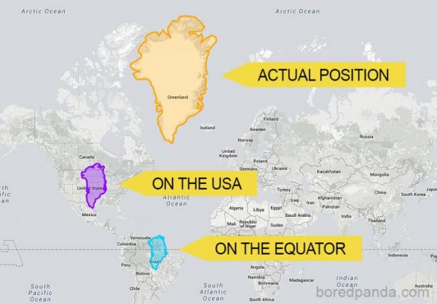
If Indonesia is closer to the North pole, on the extent it would have been comparable to the territory of Russia

Brazil in Asia would look just giant
 < br>
< br> via www.boredpanda.com/true-size-countries-mercator-map-projection-james-talmage-damon-maneice/
20 subtle jokes from critics, proving that people have changed little over the past thousand years,
Moisturizing hair mask: 9 best recipes