Lake Ala-Kul
 Bashny.Net
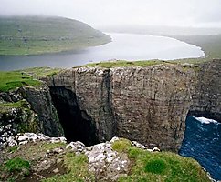
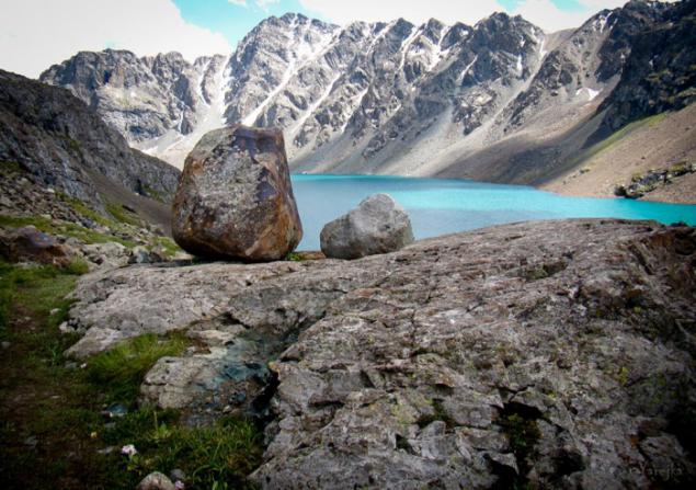
The most famous attraction of Kyrgyzstan, when viewed Water ownership is Issyk-Kul, a truly beautiful lake. But do not deprive attention and other aquatic gems of this country. Today I want to tell you about the way the title of "motley lake", which translated into sounds Kyrgyz Ala-Kul. This lake is located in the more remote mountainous areas of Kyrgyzstan. To him, in contrast to the Issyk-Kul, will not approach the tourist bus or jeep. What would swim in the clear waters of Ala-Köhl, will have to work hard and walk up to a height of 3532 meters.

Ala-Ala-Kol or Kul - lake near Terskey-Alatau, in the Central Tien Shan, Kyrgyzstan. Located in the upper reaches of the river Kurgaktor, right tributary of Karakol, at an altitude of 3532 meters.
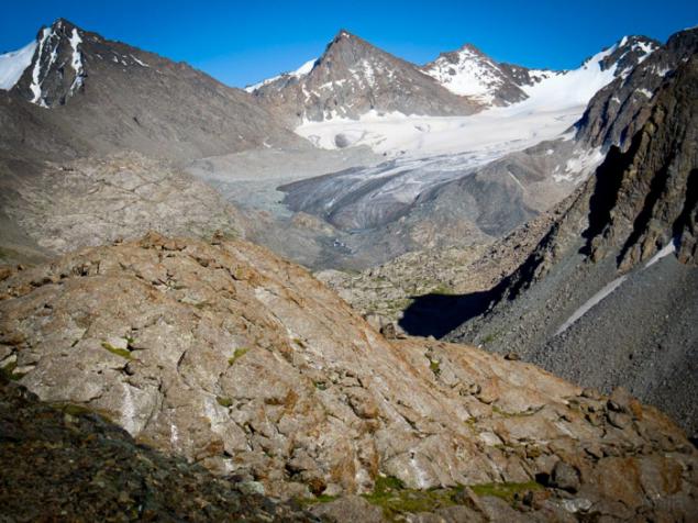
The lake is of glacial origin. It was formed in the recess vypahannom glacier, which retreated, still occupies the upper part of the valley.
Here it is in all its glory, the same glacier, from which the lake takes its origin and which is not one hundred years, feeds "Motley" with new water.
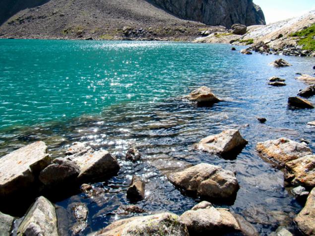
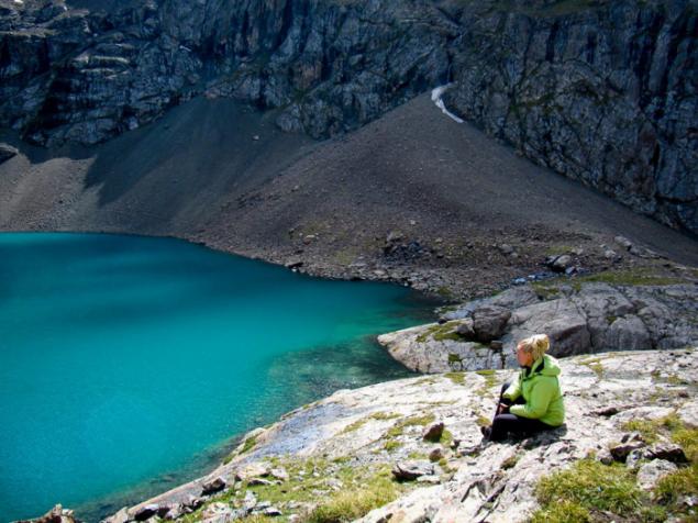
For me it remains a mystery purity of the lake. Mountain rivers are usually murky, meltwater from the glacier has always been, quite frankly, a grayish color from being in her washed rocks, sand, etc. etc., and then a color, such transparency.
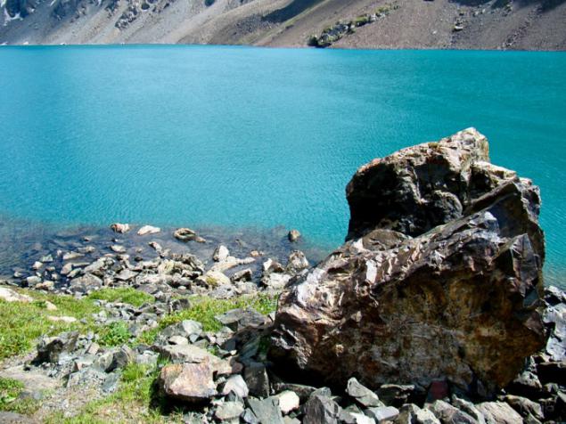
Cold water Ala Köhl just ice. From here one important rule.
If you decide to swim, this should be done immediately. Undress and run into the water, dive, fall, jump, above all to make hard and fast. When you first decide to "help his feet," says swimming escaped.
But, how to get here. There are several options, either below or on one of the passes through the rocky ridges surrounding the lake.
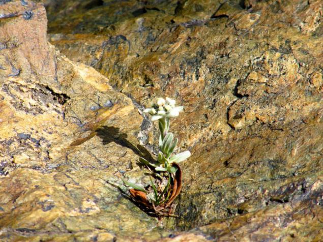
Edelweiss.
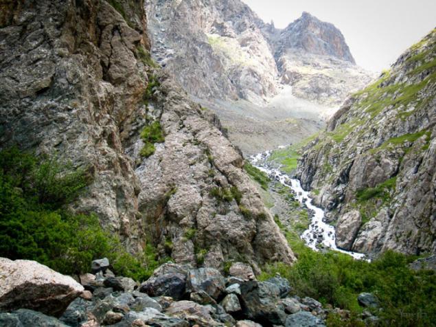
The road to the lake from the valley of the Karakol river begins just below Ayutor, "dry" gorge. Well-trodden path soon leaves the forest.
It first rises fairly gently, but gradually gaining slope. It passes through forest serpentine road, and almost lost in the moraine, goes straight to the river Kurgaktor that this place goes under the stones.
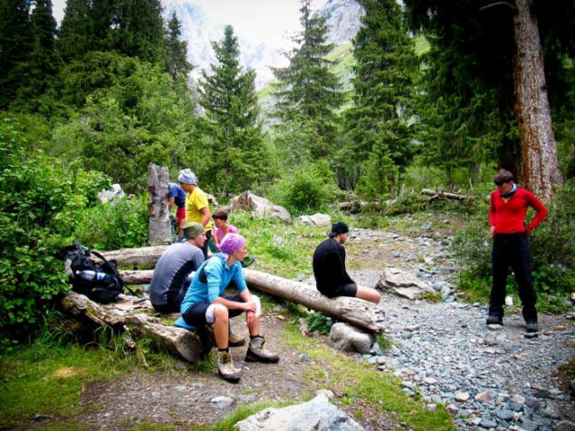
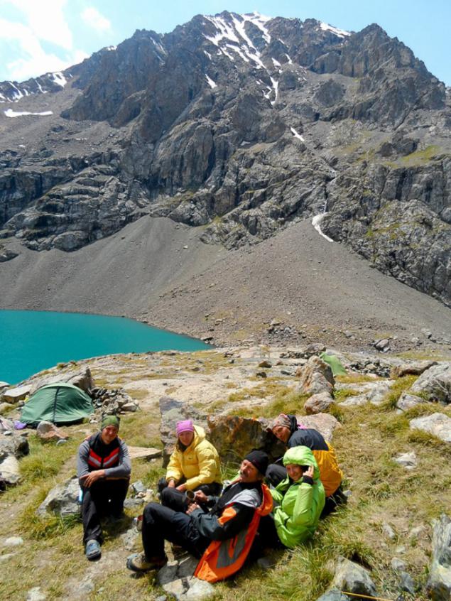
Just upstream find shelter "Orphan" is a small log cabin with a cleared space for tents around. In the house, by the way, is the perfect place to spend the night in case of bad weather or any other circumstances.
From the shelter is well-trodden trail goes right along the river. But after narrowing gorge should be left to pick up the rocks.
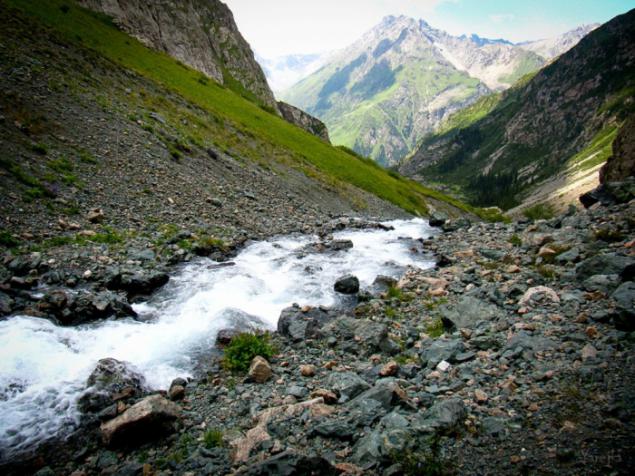
Just above the trail takes a steep rocky moraine with licked site. It breaks out the waterfall. The height of drop of water about 50 meters.
It is very nice to relax after a steep climb and admire the beautiful views of the waterfall, which follows directly from the lake.
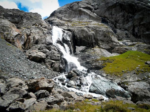
Treat Falls should be on the left. The trail is clearly visible on the moraine and promechena Turik.
Above, mutton foreheads, they cost at sypuhe as close to the rocks.
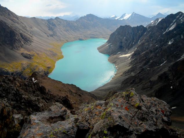
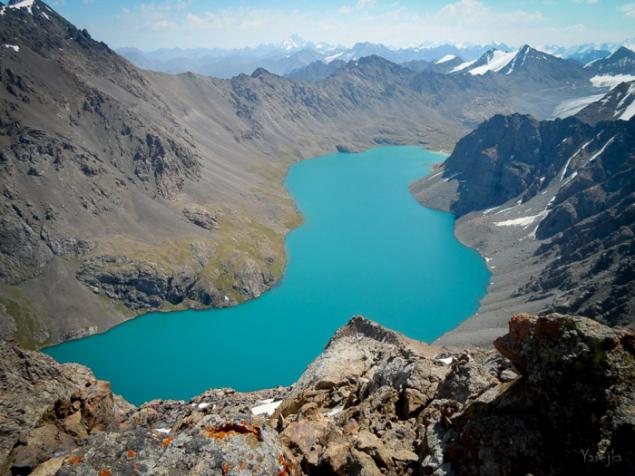
And here we have goals.
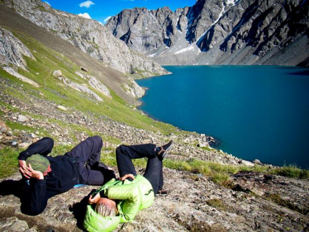
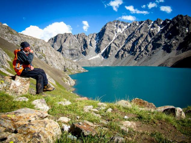
At first glance, the lake is striking in its beauty. And raising flour are far in the past. I would like to just sit and contemplate the perfection of color and line in the majestic Tien Shan Mountains.
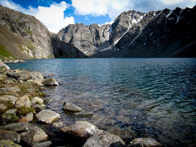

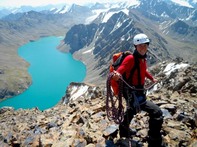
Here in the coastal flat slabs we camped to tomorrow with renewed vigor to make a climb to the peak of 30 years of the Komsomol, at 4090 m.
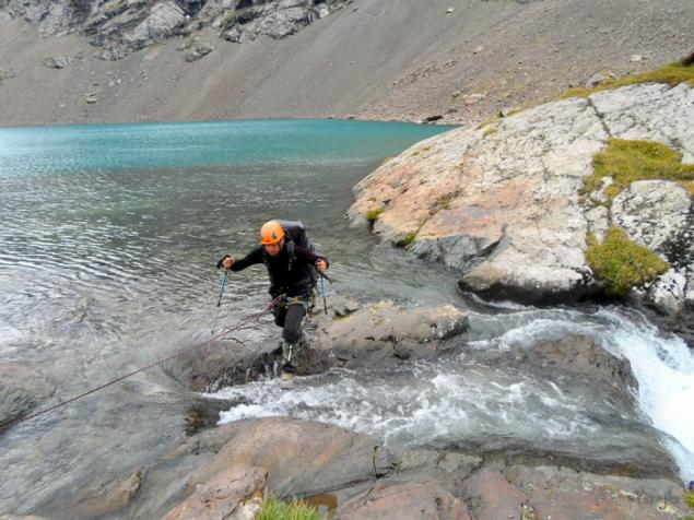
The route to the mountain starts from the lake itself, but for starters, you need a place to cross the water flow.
Place like and not widespread, but there is better to use insurance, accident after hitting into the raging water, overlooking the waterfall, waiting for help is no longer necessary.
Next on sypuhe trail goes to the pass, which offers gorgeous views, no wonder it is called "Panorama».
The route continues to the peak of the ridge to the right. Here we caught and rain.
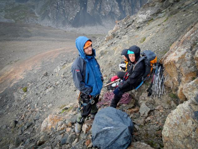
I had to wait not very long. As soon as the weather got much better, we have continued to go up.
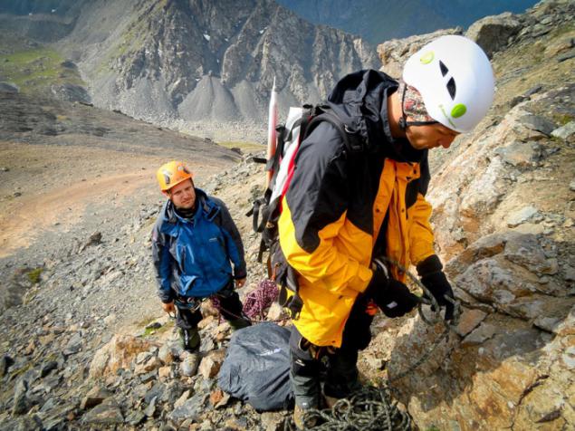
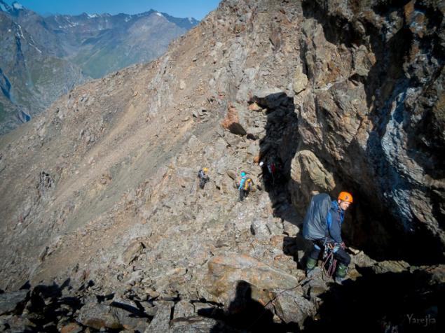
To lift the 30 years of the Komsomol special equipment is required. The mountain has a rocky talus, the nature and quietly traversed on foot in bundles.
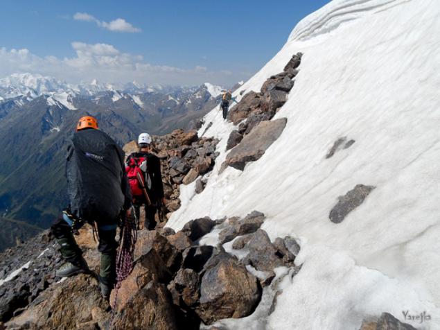
A few more meters and we are on the top, then begins a snowy field, with a narrow strip of scree on which it is possible to go.
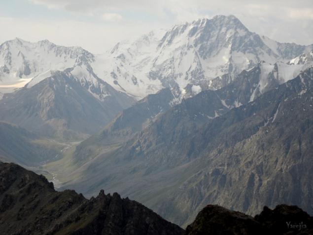
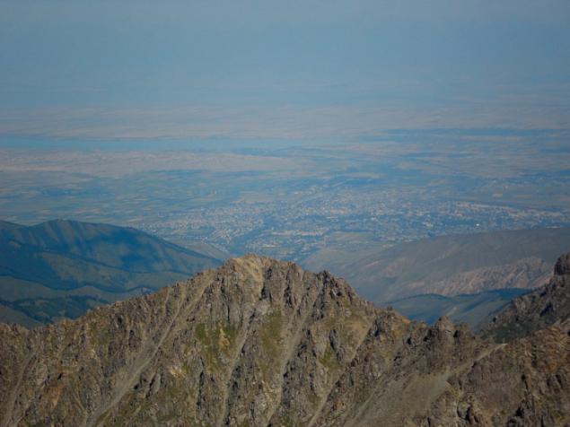
From the top you can see the lake Issyk-Kul, or rather its eastern Gulf.
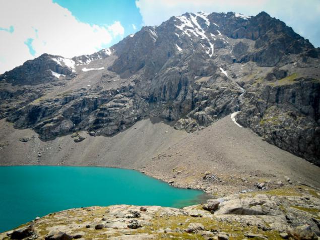
A little short, you can see the Ala-Kul, in all its grandeur and scale.
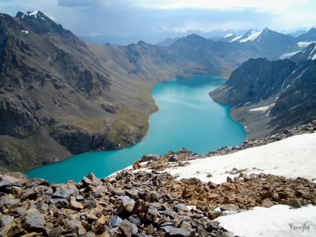
More than 70 meters deep, with an area 1, 26 square kilometers and a long coastline 6, 8 km, the lake stretches from west to east for 2.8 km, and its width - an average of about 500 meters.
And the overall picture in the memory, on the background of the newly conquered peaks.
July 2013
©

Ala-Ala-Kol or Kul - lake near Terskey-Alatau, in the Central Tien Shan, Kyrgyzstan. Located in the upper reaches of the river Kurgaktor, right tributary of Karakol, at an altitude of 3532 meters.


The lake is of glacial origin. It was formed in the recess vypahannom glacier, which retreated, still occupies the upper part of the valley.
Here it is in all its glory, the same glacier, from which the lake takes its origin and which is not one hundred years, feeds "Motley" with new water.


For me it remains a mystery purity of the lake. Mountain rivers are usually murky, meltwater from the glacier has always been, quite frankly, a grayish color from being in her washed rocks, sand, etc. etc., and then a color, such transparency.

Cold water Ala Köhl just ice. From here one important rule.
If you decide to swim, this should be done immediately. Undress and run into the water, dive, fall, jump, above all to make hard and fast. When you first decide to "help his feet," says swimming escaped.

But, how to get here. There are several options, either below or on one of the passes through the rocky ridges surrounding the lake.

Edelweiss.

The road to the lake from the valley of the Karakol river begins just below Ayutor, "dry" gorge. Well-trodden path soon leaves the forest.
It first rises fairly gently, but gradually gaining slope. It passes through forest serpentine road, and almost lost in the moraine, goes straight to the river Kurgaktor that this place goes under the stones.

Just upstream find shelter "Orphan" is a small log cabin with a cleared space for tents around. In the house, by the way, is the perfect place to spend the night in case of bad weather or any other circumstances.

From the shelter is well-trodden trail goes right along the river. But after narrowing gorge should be left to pick up the rocks.

Just above the trail takes a steep rocky moraine with licked site. It breaks out the waterfall. The height of drop of water about 50 meters.
It is very nice to relax after a steep climb and admire the beautiful views of the waterfall, which follows directly from the lake.

Treat Falls should be on the left. The trail is clearly visible on the moraine and promechena Turik.
Above, mutton foreheads, they cost at sypuhe as close to the rocks.
And here we have goals.

At first glance, the lake is striking in its beauty. And raising flour are far in the past. I would like to just sit and contemplate the perfection of color and line in the majestic Tien Shan Mountains.


Here in the coastal flat slabs we camped to tomorrow with renewed vigor to make a climb to the peak of 30 years of the Komsomol, at 4090 m.

The route to the mountain starts from the lake itself, but for starters, you need a place to cross the water flow.
Place like and not widespread, but there is better to use insurance, accident after hitting into the raging water, overlooking the waterfall, waiting for help is no longer necessary.

Next on sypuhe trail goes to the pass, which offers gorgeous views, no wonder it is called "Panorama».

The route continues to the peak of the ridge to the right. Here we caught and rain.

I had to wait not very long. As soon as the weather got much better, we have continued to go up.

To lift the 30 years of the Komsomol special equipment is required. The mountain has a rocky talus, the nature and quietly traversed on foot in bundles.

A few more meters and we are on the top, then begins a snowy field, with a narrow strip of scree on which it is possible to go.

From the top you can see the lake Issyk-Kul, or rather its eastern Gulf.

A little short, you can see the Ala-Kul, in all its grandeur and scale.

More than 70 meters deep, with an area 1, 26 square kilometers and a long coastline 6, 8 km, the lake stretches from west to east for 2.8 km, and its width - an average of about 500 meters.

And the overall picture in the memory, on the background of the newly conquered peaks.

July 2013
©
Tags
See also
10 natural wonders that people can not explain
The myth of the famous sights
Belovezhskaya Pushcha
Russian attractions
Panoramas of the most beautiful places on Earth
Hassan Aliev: the world through the eyes of the physiologist, from the point of view of the device of the brain
Masterpieces of the rocks
Artificial geyser Fly Geyser