1633
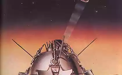
What we had not shown "Mars-3"?
Today - 42 years since the first successful landing on Mars spacecraft from Earth - "Mars-3". It is known that he successfully sat because radio broadcasts started - it began airing the first panorama photo from the surface. Antennas can be revealed only in the case of successful primarseniya.
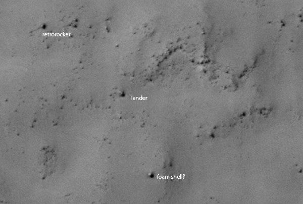
As you probably know, this year again reminded of it when it became known that Zelenyikot subscribers and his group Vkontakte < a href = "https://vk.com/curiosity_live"> «Curiosity - the rover» found "Mars-3" on Mars.
A few days after the discovery of "Mars-3", I felt horror as wondering what kinds and not transmitted to Earth the unit. By the time I had an experience of creation of volumetric objects in Blender 3D images based on Curiosity and attached thereto height maps. So I thought - "And whether to make the same but with a model of the landing" Mars-3 "by placing the camera on behalf of the unit?".
In theory, it's simple. We had to take the data of the satellite Mars Reconnaissance Orbiter, on which NASA experts have created anaglyph surface . Googling, I have not found a way to convert anaglyph in the height map.
Under Curiosity issued a call for help. He found the response for that, I express my deep gratitude to Daniel Tolkachov , who responded and did a height map based on satellite data.
Here is his description of the process:
«Tools: Python + OpenCV. The algorithm written by himself, though standard:
1. The images are sought characteristic features (algorithm SIFT)
2. Produced comparison of point features from the two images. The result is a matrix linking the point on one image and the other line (fundamental matrix)
3. On the basis of the fundamental matrix aligning the image thus obtained, that one and the same object on the two images lies on the horizontal. Anaglyph is based on rectified images. Stereosopostavlenie hereinafter also made on the basis of these same
4. Using the algorithm Semiglobal Stereo Matching is done building disparity maps. There are some subtleties to the setting of the algorithm and processing large images.
It should be noted that the method used for constructing the height map does not yield absolute values and in general - there may be some distortion associated with the feature satellite imaging ». I>
(It seems Habré it is not, but if the process is interesting, try to invite him for a verbose description).
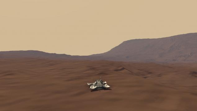
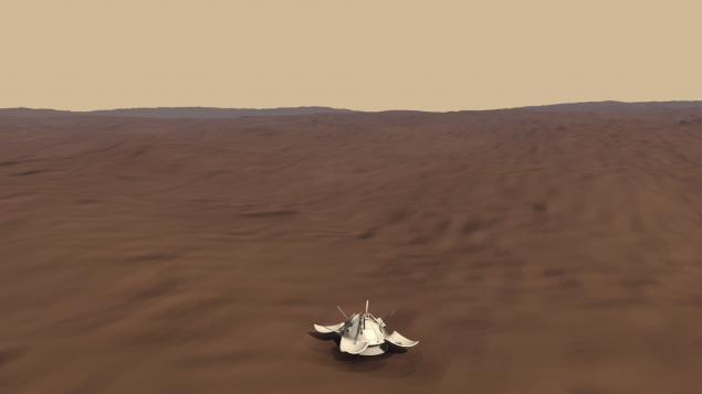
By the time of "marsohodnoy" group had competition to create 3D model of" Mars-3 », and it can be added to the panorama.
Next trick. In short: I cut a square piece of the desired portion of the picture for the texture and the same on the height map. In Blender 3D creates a surface, put it on a height map, slightly corrected proportionality, apply a texture, set up the sun, the color of the sky, the atmosphere and put the model of the device in its place on the satellite image (which is the texture).
Here on proportionality would like to discuss in more detail. Any normal person asks, "And where is the guarantee that this view of the picture more or less corresponds to reality?". It's very simple. First, the card is based on satellite data. Secondly, there is such an interesting thing - the objects in the program are scaled proportionally. Each side of the model is increased to the same number of times. Therefore, stretching the model just below the diameter of the device on the satellite photos, we automatically make her pro rata with all the landscape.
In the end, it turned out:
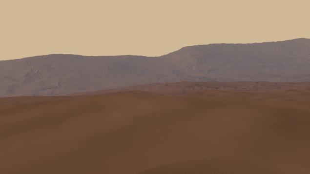
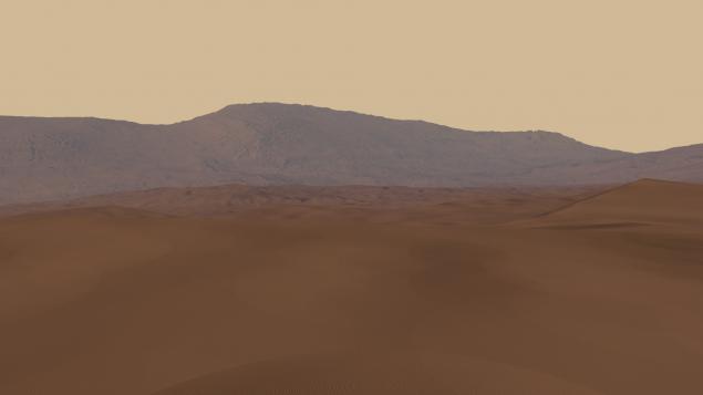
Here are the pictures which were obtained by placing the camera on behalf of the cameras of the "Mars-3" (length and height of the image matches the size of the camera unit):
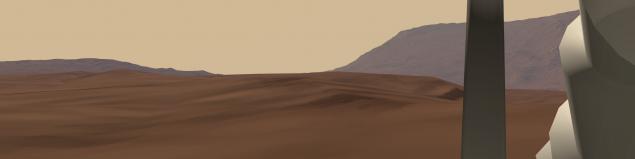
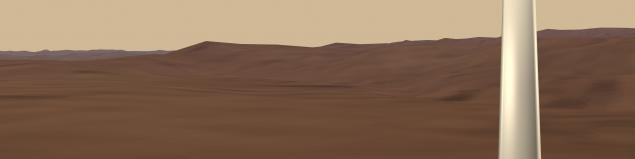
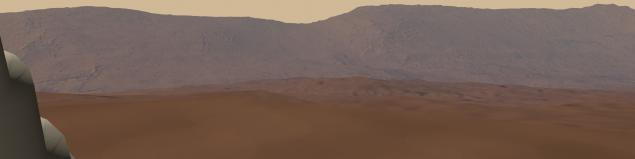
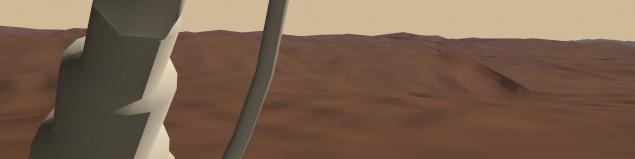
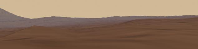
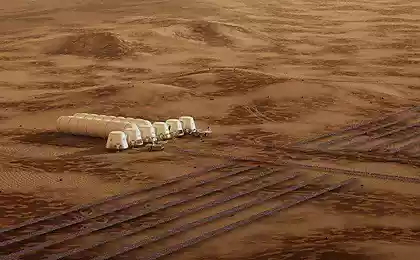
In the pictures the most remarkable part are the mountains in the background - a shaft 18-kilometer crater Reutov, who was so named in August 2013 year.
I emphasize - they do not claim to gipertochnost, but I'm sure 60% corresponds to what we have seen, if the unit is still transferred pictures from the surface (and the quality of its cameras would exceed what was found there in 70 ies).
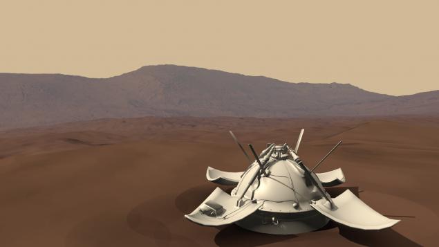
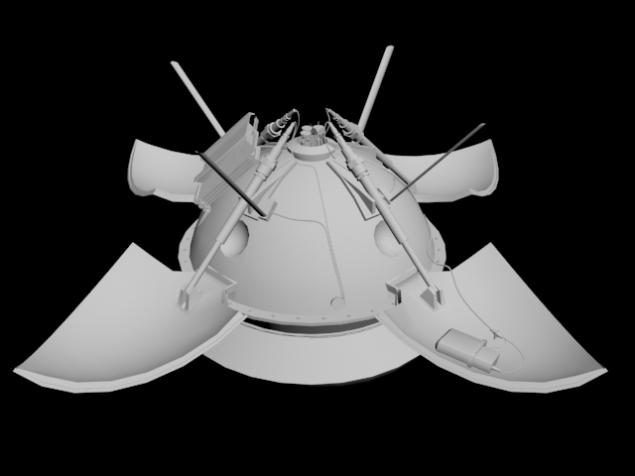
Unfortunately, we do not have 3D models of the engine brake, chain linked to the lower part of toroidal container, and there is no model of the foam casing, which defended the probe at the time of impact with the surface. Therefore, we can not establish a complete picture of the landing site. Drawings either, even a model of the "Mars-3" created "by eye", based on the photos.
As can be seen, the simulation is not enough surface stones, all sorts of small details that can be seen in the picture from the satellite. Therefore, if there are those among habrayuzerov people who can tell you how to do it competently, or do it yourself - I will be very happy, and ready to help.
Source: habrahabr.ru/post/204562/