729
Earth through time
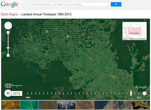
By working together Google, NASA, Time magazine and the American Geological review, a draft interim interactive maps of the Earth. With it came the opportunity to watch via satellite imagery changes taking place with the terrestrial landscape in the last 30 years. Thus, alternating with shots show the situation in the Amazonian forests, urban growth, the effects of volcanic eruptions and earthquakes and so on. For a detailed review of all the available surface of the planet. The implementation of this large-scale project was made possible by ordering and handling more than two million satellite images of Earth taken in 1984. Work on the project began in 2009, and the total volume of materials used amounted to 909 terabytes.
Source: mirfactov.com/