1563
Earth satellite photos «GeoEye - 1"
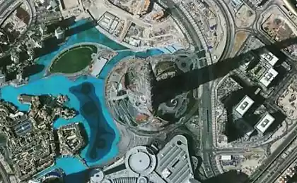
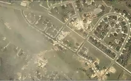
Company «GeoEye» is one of the leaders in the field of geo-spatial information. Its first satellite was launched in 2008, and the second is practically designed. You the most interesting pictures taken first satellite.
Employees timed this series of shots to the recent International Day of the Earth. Do not forget to click on the pictures, they are impressive size;)
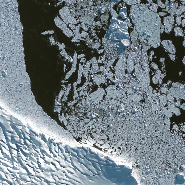
In the photo - the coast of Adelaide Island, in the Gulf of Margarita in the west of Antarctica.
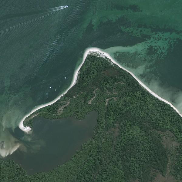
South shore of Botany Bay, reserve Towra Point, Australia.
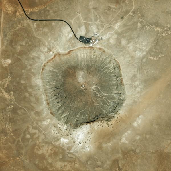
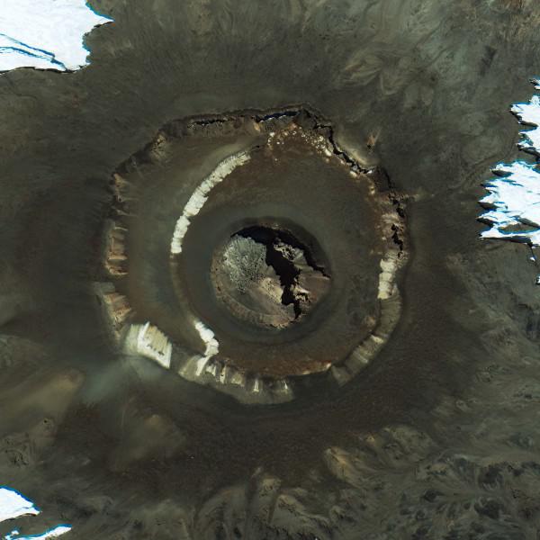
Meteor Crater in northern Arizona, near Winslow, North America.
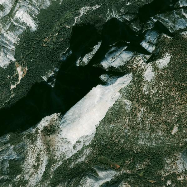
Granite outcrops to the surface in Yosemite National Park, California, USA.
Mount Kilimanjaro, Tanzania, Africa.
Average channel Indus, Pakistan.
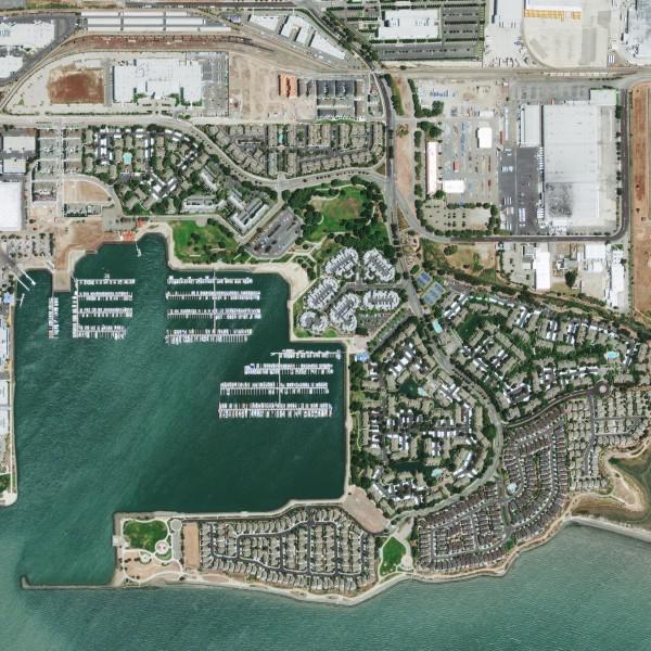
Bay in Richmond, California, USA.
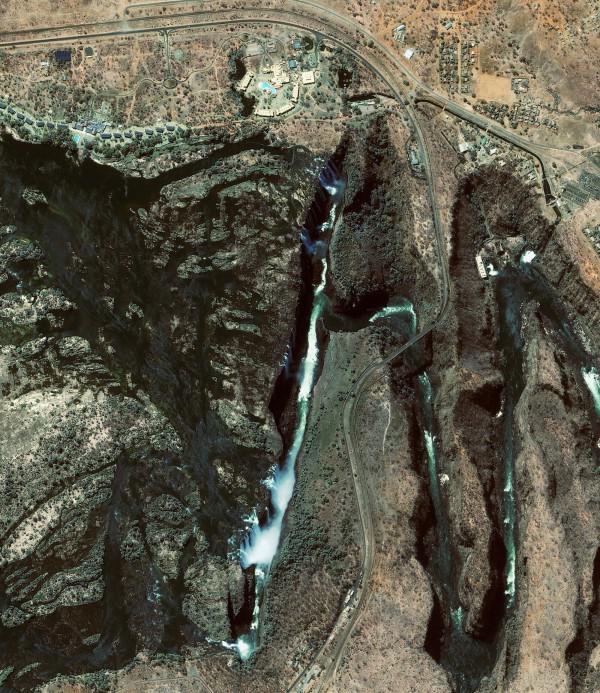
Victoria National Park and Victoria Falls, Zimbabwe, Africa.
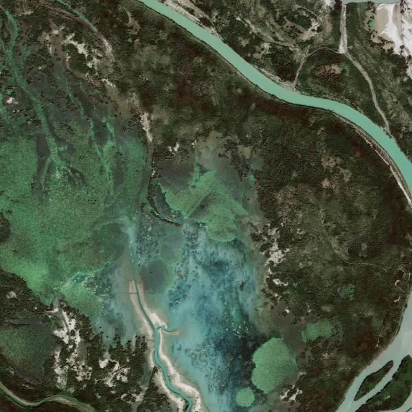
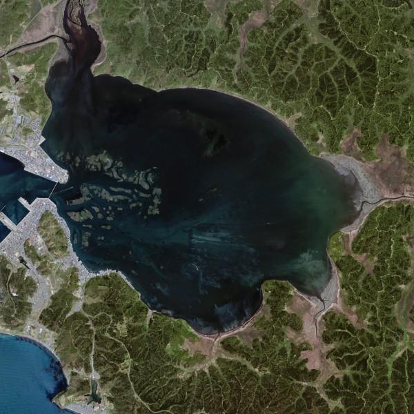
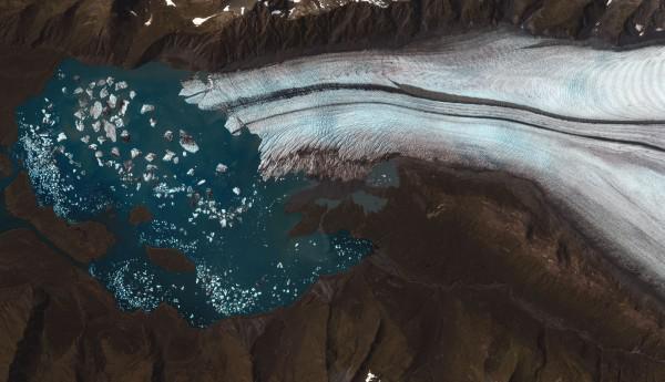
Atsukasi lake in Hokkaido, Japan.
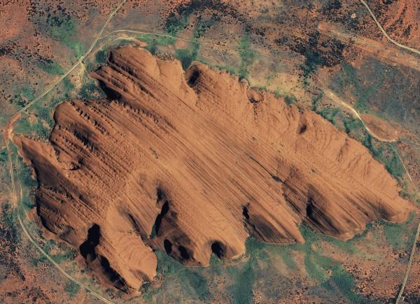
Uluru, Northern Territory, Australia.
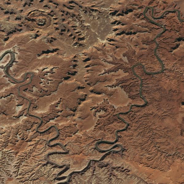
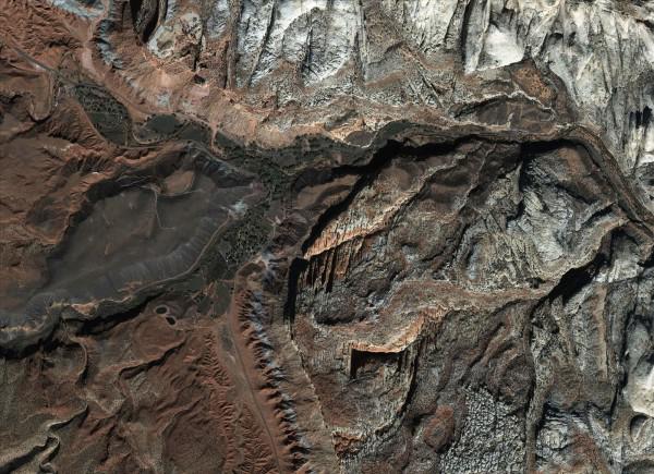
National Park «Canyonlands», Utah, USA.
National Park «Capitol Reef», Utah, USA.
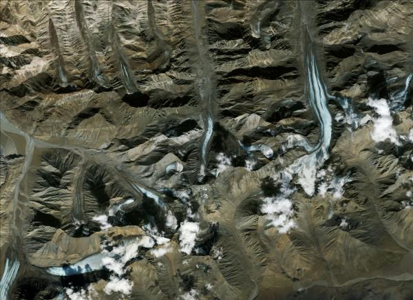
National Park «Denali», Alaska, USA.
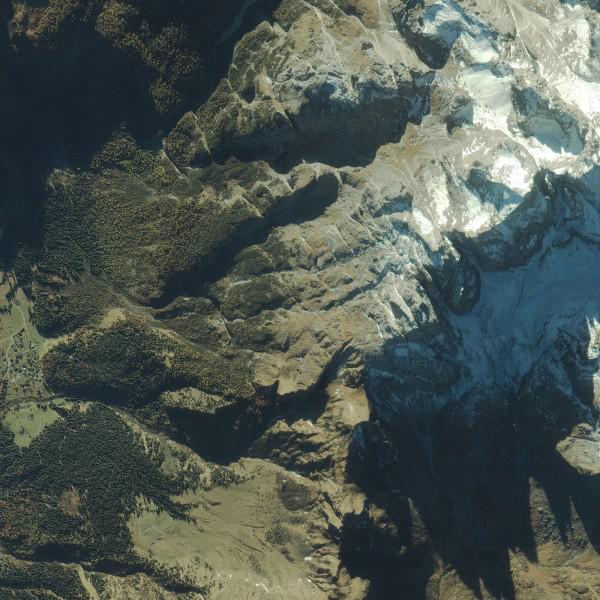
Dolomites, Eastern Alps, Italy.
National Park «Kenai Fjords», Alaska, USA.
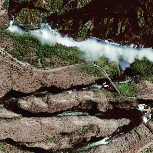
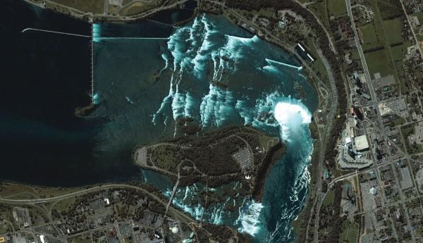
Niagara Falls, North America.
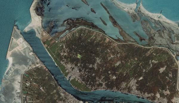
Nile Delta, North Africa.
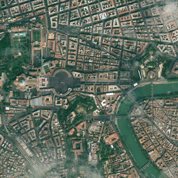
Easter celebration at St. Peter's Square at the Vatican.
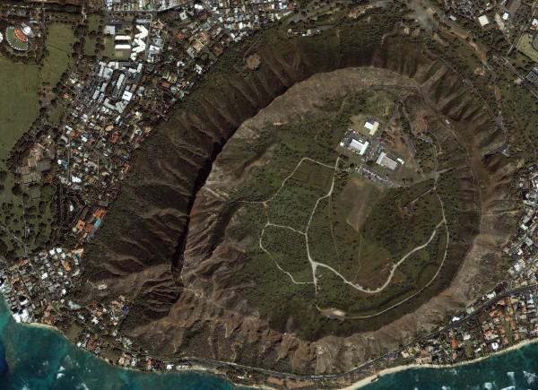
Diamond Head Volcano, Hawaii.
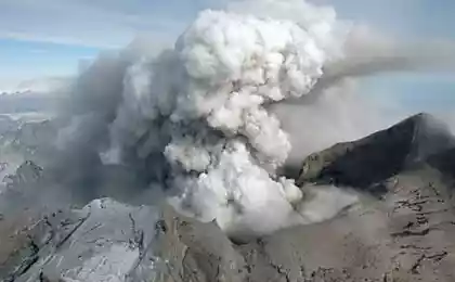
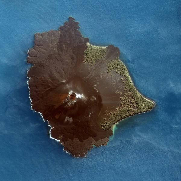
Krakatoa volcano, Indonesia.
Gobi Desert, northwest China.
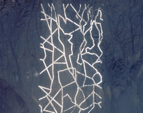
Photo by GeoEye
Employees timed this series of shots to the recent International Day of the Earth. Do not forget to click on the pictures, they are impressive size;)
In the photo - the coast of Adelaide Island, in the Gulf of Margarita in the west of Antarctica.

South shore of Botany Bay, reserve Towra Point, Australia.

Meteor Crater in northern Arizona, near Winslow, North America.

Granite outcrops to the surface in Yosemite National Park, California, USA.

Mount Kilimanjaro, Tanzania, Africa.

Average channel Indus, Pakistan.

Bay in Richmond, California, USA.

Victoria National Park and Victoria Falls, Zimbabwe, Africa.


Atsukasi lake in Hokkaido, Japan.

Uluru, Northern Territory, Australia.

National Park «Canyonlands», Utah, USA.

National Park «Capitol Reef», Utah, USA.

National Park «Denali», Alaska, USA.

Dolomites, Eastern Alps, Italy.

National Park «Kenai Fjords», Alaska, USA.

Niagara Falls, North America.

Nile Delta, North Africa.

Easter celebration at St. Peter's Square at the Vatican.

Diamond Head Volcano, Hawaii.

Krakatoa volcano, Indonesia.

Gobi Desert, northwest China.

Photo by GeoEye