Cars Google Street View will create a map of air quality
 Bashny.Net
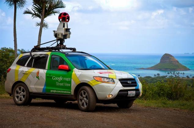
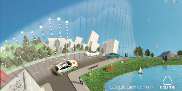
The Google Street View cars that make the streets for a panoramic view of Google Maps, I plan to equip special environmental sensors to determine air quality. For this, Google has already teamed up with ACLIMA company distributor of HVAC equipment.
The first tests took place on three vehicles in one area of Denver (Colorado, USA). During this time, the car drove about 750 hours, making 150 million measurements.
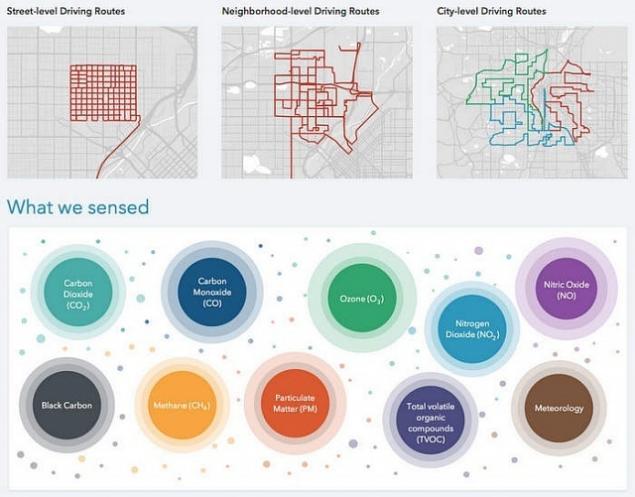
The aim of the project is to create maps of air quality in different cities. To determine this would be using the Street View cars equipped with sensors that allow them to carry out measurements of the concentration of carbon dioxide, carbon monoxide, nitrogen dioxide, nitrogen oxide, ozone, methane, particulate and volatile organic compounds, all of which can have a negative impact on human health.
Google and ACLIMA intend to conduct more extensive measurements in San Francisco this fall, and will continue to work with scientists and organizations to determine the best ways to use all the new data.
Incidentally, with regard to the data, they will be combined with measurements from a network of stationary monitoring equipment of the Department of environmental protection United States.published
P. S. And remember, only by changing their consumption — together we change the world! ©
Source: ecotown.com.ua/news/Avtomobili-Google-Street-View-stvoryat-kartu-yakosti-povitrya/
The first tests took place on three vehicles in one area of Denver (Colorado, USA). During this time, the car drove about 750 hours, making 150 million measurements.


The aim of the project is to create maps of air quality in different cities. To determine this would be using the Street View cars equipped with sensors that allow them to carry out measurements of the concentration of carbon dioxide, carbon monoxide, nitrogen dioxide, nitrogen oxide, ozone, methane, particulate and volatile organic compounds, all of which can have a negative impact on human health.

Google and ACLIMA intend to conduct more extensive measurements in San Francisco this fall, and will continue to work with scientists and organizations to determine the best ways to use all the new data.
Incidentally, with regard to the data, they will be combined with measurements from a network of stationary monitoring equipment of the Department of environmental protection United States.published
P. S. And remember, only by changing their consumption — together we change the world! ©
Source: ecotown.com.ua/news/Avtomobili-Google-Street-View-stvoryat-kartu-yakosti-povitrya/
Tags
See also
Spain will run buses with roof gardens to clean urban air
The heart of the empire Google
Google Street Veiw goes down
Things from sci-fi movies
Things of fiction that became everyday reality
Google Glass: release date, specifications, price and partnership with Ray-Ban and Oakley
NASA offered a mapping service for exploring Mars
Smeller can determine the quality of the products smell
The Japanese exclusion zone can be seen on Google Street View
Technical and scientific myths. Why planes fly