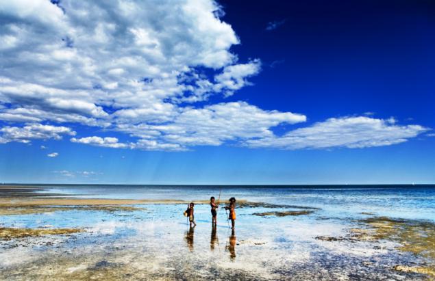
The beauty of our Earth
 Bashny.Net
April 22 marks the Day of the Earth (Earth Day). This truly global festival was founded 40 years ago, the US state of Wisconsin Senator G. Nelson (Gaylord Nelson) and since then is celebrated annually in many countries. Our Earth is enormous. If you want to bypass around the equator, then you have to walk about 40 thousand kilometers. And to visit all of the country - even more. For those who have no time for such a trip, -
photo galleries, 35 photos, add your own!
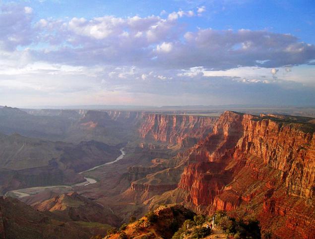
which opens the Grand Canyon in the United States
ps just say - has affected not all ...
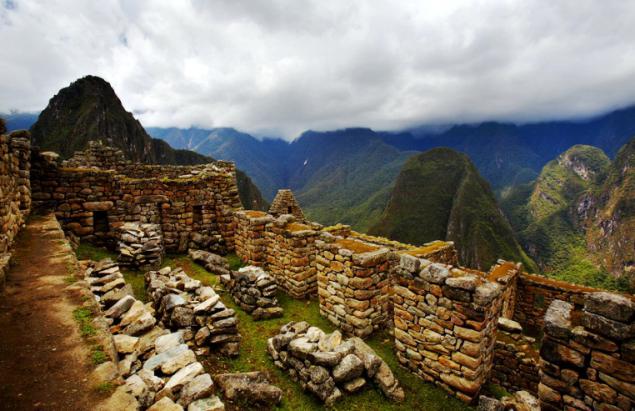
2. Machu Picchu (the language of the Indian Quechua: Machu Pikchu, in translation - the "old peak") - a city of ancient America, located in present-day Peru. As Machu Picchu is often called a "city in the sky" or "city in the clouds," sometimes referred to as "The Lost City of the Incas." Some archaeologists believe that the city was established as a sacred mountain refuge of the Inca ruler Pachacutec great century before the conquest of his empire, that is, around 1440, and operated until 1532, when the Spaniards invaded the Inca Empire. In 1532 all its inhabitants mysteriously disappeared. Similar to Machu Picchu mountain city Choquequirao lasted much longer, up to 1570s.
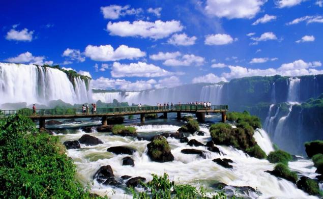
3. Iguazu Falls on the border of Argentina and Brazil. Iguazu Falls - one of the most powerful waterfalls in the world. This whole system of 275 two-stage cascade. One of the key located at the head of the arc, the border of Brazil and Argentina. It is called in Spanish Gargante del Diablo, which means "Devil's Throat" - unconditional reflected in the attitude of the time when people felt weak grain of sand next to the raging storm water.
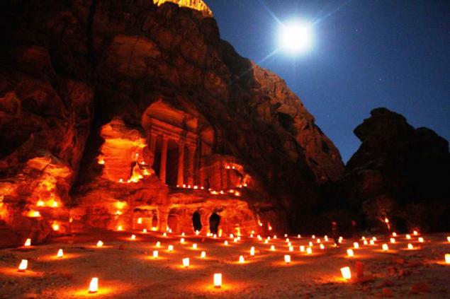
4. Nabatean city of Petra in Jordan. Tales of lost in the rocks and sand Nabatean towns excited the minds of European scholars and travelers since the times of the Crusaders. Today, Peter studied in detail only about 15% of the territory. Some believe the Nabataeans simple nomads who settled in this convenient location only because of its favorable geographical location. Others do not agree with this, pointing to too extensive knowledge of the Nabataeans in the field of agriculture and irrigation. Some call them the ancestral home of Assyria, or even Yemen. The theories are many, but to see which of them is true, it is difficult.
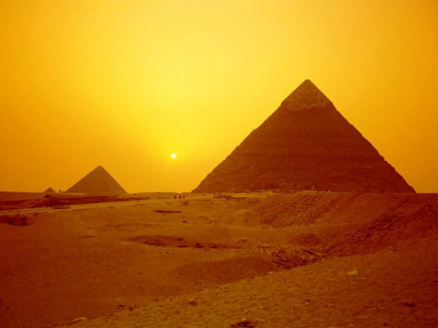
5. Pyramids of Giza - one of the seven wonders of the ancient world. At the mention of the Egyptian pyramids, usually have in mind the Great Pyramids, located in Giza, near Cairo. Pyramids are a huge pyramid-shaped stone structures that were used as tombs for pharaohs of ancient Egypt.
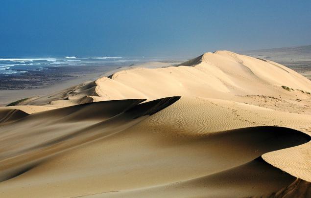
6. Sahara - the largest desert in the world, located in North Africa. It stretched about 4,800 km from west to east and from 800 to 1200 km from north to south; It has an area of about 8, 6 million square feet. km.
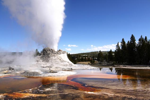
7. Yellowstone National Park, or Yellowstone National Park (Eng. Yellowstone National Park) - International Biosphere Reserve, a World Heritage Site by UNESCO, the world's first national park (established March 1, 1872). Located in the US, the states of Wyoming, Montana and Idaho. The park is famous for the numerous geysers and other geothermal sites, rich in wildlife, picturesque landscapes. The area of the park - 898, 3 thousand. Hectares.
On the vast territory of the park there are lakes, rivers, canyons and caves. Yellowstone Lake, one of the largest alpine lake in North America, located in the center of the Yellowstone Caldera, the largest supervolcano on the continent.
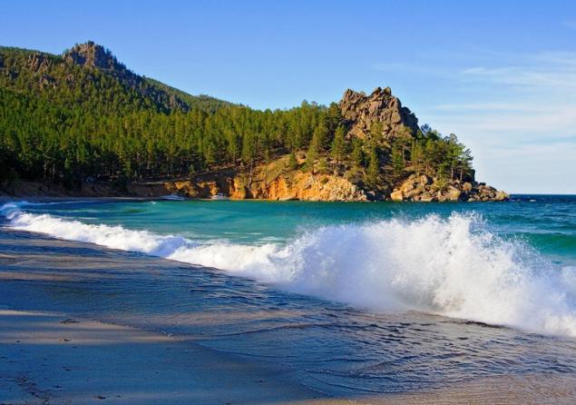
8. Lake Baikal - the deepest lake on the planet. Local residents and many people in Russia traditionally call Baikal Sea. In Baikal water more than all put together the five Great Lakes and 25 times greater than in Lake Ladoga. According to the Limnological Institute of the Siberian Branch of RAS, in Baikal there are 2630 species and varieties of plants and animals, two thirds of which are endemic, ie found only in this reservoir. Such an abundance of living organisms is due to the high oxygen content throughout the entire thickness of Baikal water.
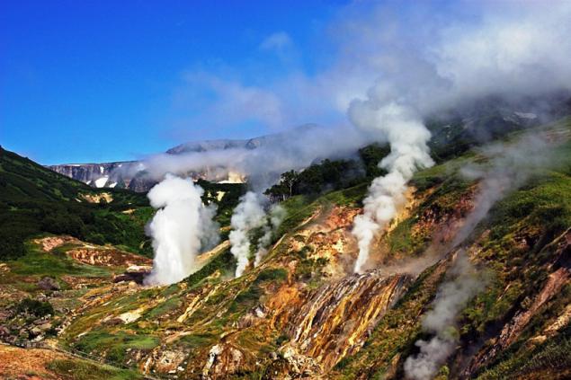
9. Geyser Valley - one of the largest geyser field in the world and the only in Eurasia. The Valley of Geysers in Kamchatka is the Kronotsky State Biosphere Reserve. One of the Seven Wonders of Russia. Currently, part of the valley covered with a major landslide.
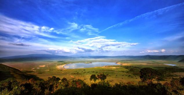
10. Ngorongoro - a huge crater in Tanzania, on the edge of the savannah Serengeti, resulting from a large eruption of the volcano about 2, 5 million years ago. The bottom of the crater is located at an altitude of 2380 meters above sea level. Its edges are approximately 600 m above and to rise to 3,000 meters above sea level. The diameter of the Ngorongoro Crater is 17 to 21 km and has a total area of about 26,400 hectares. At the bottom of the crater is Lake Magadi, the famous flamingo population. Ngorongoro Crater is unique in that for many years it formed its own habitat for many species of animals that are not able to get out.
11. Kuril Islands - a chain of volcanic islands between the Kamchatka Peninsula and the island of Hokkaido. February 10, 1984 is created the State Natural Reserve "Kuril". On its territory inhabited by 84 species included in the Red Book of Russia.
In the photo - the island of Iturup.
12. Komodo National Park. This national park was founded in 1980. It is spread over 603 square kilometers of land and 1,214 square kilometers of marine waters. The territory of the national park consists of three main islands: Komodo, Rinca and Padar, as well as many small islands. The most famous animal park is the Komodo dragon.
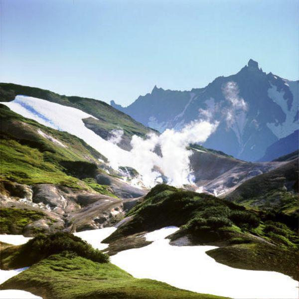
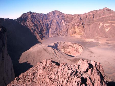
13. Volcanoes are the main attractions of the Kamchatka Peninsula. Total Kamchatka there are more than 160 volcanoes, of which 30 are considered to be valid. The largest active volcanoes on the peninsula - Kluchevskaya, Icha, Koryak and Kronotsky volcano.
14. Antarctica - a continent located in the south of the Earth. It was here that emperor penguins live. Antarctica was officially opened on 16 (28) January 1820 Russian expedition led by Thaddeus Bellingshausen and Mikhail Lazarev, who on the sloops "Vostok" and "Peace" came to her in the area of modern ice shelf Bellingshausen. Previously, the existence of a southern continent (lat. Terra Australis) argued hypothetically, it is often combined with South America (for example, on a map drawn Piri Reis in 1513) and Australia (and named in honor of the "southern continent"). However, the expedition was Thaddeus Bellingshausen and Mikhail Lazarev in the south polar seas, skirting around the world the Antarctic ice, has confirmed the existence of the sixth continent.
The first came in the continental part of 24 January 1895 the captain of the Norwegian ship "Antarctica" Christensen and Science teacher Carsten Borchgrevink.
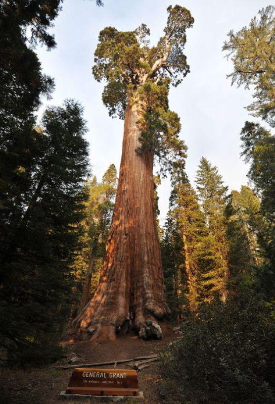
15 Sequoia National Park in the United States. The park is best known for its giant redwoods, including wood General Sherman, the largest tree in the world. General Sherman tree grows in the Giant Forest, which contains five out of the ten largest trees in the world by volume of wood. Giant Forest is connected dear generals, with Grant Grove National Park Kings Canyon, where among other sequoias growing tree General Grant (pictured).
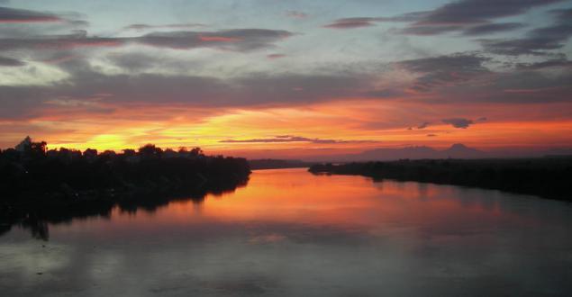
16. Red River or Red River - a river in southern China and northern Vietnam, the main cultural and historical center of Vietnam. Here, in the tenth century there was the first independent state. In China, it called Yuantszyan or Honghe,
17. Lake Sarez - the deep lake of Pamir.
The lake was formed 6 (18) in February 1911 after a strong earthquake (7 points), when the river Murghab was filled by a powerful landslide buried village Usa, forming thus a natural dam height of 567 m. Fill the basin in the same year flooded the village Sarez which gave the name to the lake.
Scientists believe that the natural dam formed by the earthquake, known as Usoy dam is unstable in view of local seismicity, and that the land located at the foot of the dam threatens catastrophic flooding if the dam collapse at a future earthquake. In this case, flooding may be subject to the territory of several states.
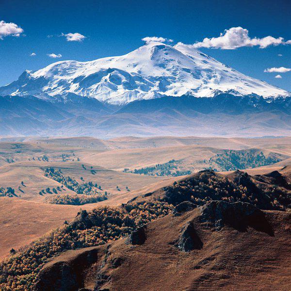
18. Caucasus Mountains.
Divided into two mountain ranges: the Greater Caucasus and the Lesser Caucasus.
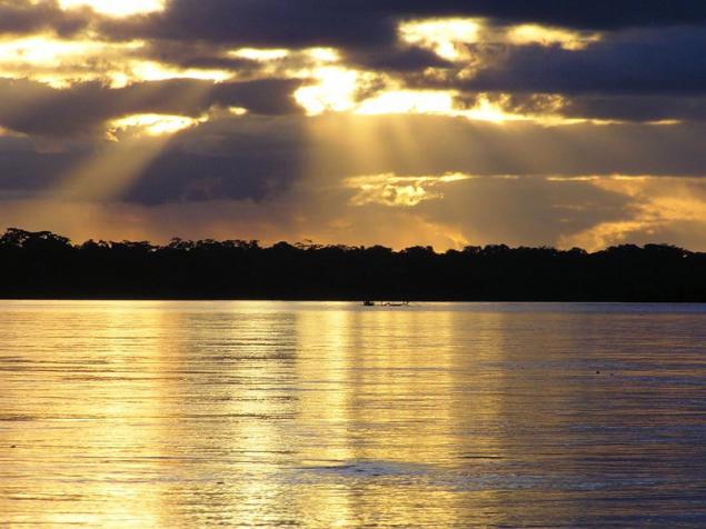
Greater Caucasus stretches over 1,100 km from northwest to southeast, the area of Anapa and Taman peninsula to Apsheron peninsula on the coast of the Caspian Sea near Baku. The maximum width of the Greater Caucasus reaches near Elbrus (180 km).
Traditionally, the Greater Caucasus is divided into 3 parts: the Western Caucasus (from the Black Sea up to Elbrus), Central Caucasus (from Elbrus to Kazbek) and the eastern Caucasus (Kazbek to the Caspian Sea).
Lesser Caucasus is connected with the Greater Caucasus Likhi Range, in the west it is separated from the Colchis lowlands in the east - the Kura depression. Length - 600 km, height - up to 3724 m.
19. Lapland (Sami Sápmi, Sámeednam, Fin. Lappi, a Swede. Lappland and NOK. Lapland) - the name of the cultural region traditionally inhabited by the Sami (Lapps, the Lapps). Located in Northern Europe (north of Fennoscandia). Lapland has never been a single State; it is now divided between four countries: Norway, Sweden, Finland and Russia (Kola Peninsula).
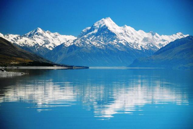
20. New Zealand (English. New Zealand, the Maori Aotearoa) - a state in the south-western Pacific Ocean, located on two large islands (North Island and South Island), and a large number (approximately 700) adjacent smaller islands. The country's capital - the city of Wellington. The population of New Zealand is about 4.284 million people (as of November 2008). The country is built on the principles of constitutional monarchy and parliamentary democracy and is among the world's developed countries.
In the XI-XIV centuries, the country was inhabited by natives of Polynesia, European explorers discovered the islands in 1642. Active development of land began with Britain in 1762. One of the main features of New Zealand's geographical isolation is. The nearest neighbors are the country - to the west of Australia, separated by the Tasman Sea (the shortest distance - about 1700 km); north island territories - New Caledonia (about 1400 km), Tonga (about 1800 km) and Fiji (about 1900 km).
Realm of New Zealand includes independent in the government, but free association with New Zealand island countries Cook Islands, Niue and Tokelau and the Non-Self-Antarctic territory of Russia.
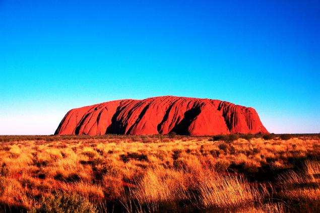
21. Ayers Rock in Australia.
Uluru (Ayers Rock) - formed about 680 million years ago, 348-meter-high orange-brown oval-shaped rock. Located in the Northern Territory Central Australia 450 km from the town of Alice Springs. Its length is 3, 6 km, width - about 3 km, and the base is indented caves decorated with ancient rock paintings and stone carvings.
Once in the center of the continent towering mountain range, which is an island in the middle of the lake Lake Amadeus. The products of destruction of rocks were deposited at the bottom of the reservoir to form a rock, which in appearance resembles lying on the side of a giant elephant.
22. Madagascar (Malaga. Madagasikara, fr. And Eng. Madagascar) - a state in the western Indian Ocean, Madagascar and the adjacent small islands off the east coast of Africa. Area - 587 thousand sq. Km, the population - 20, 7 million people. (2009). Capital - Antananarivo.
In the photo - the crab fishers in Madagascar.
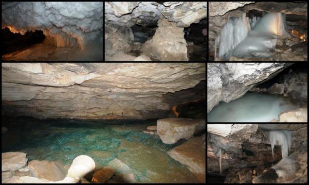
23. The unique geological monument - one of the largest karst caves in the European part of Russia Kungur ice cave - located 100 km from Perm - in the village Filippovka.
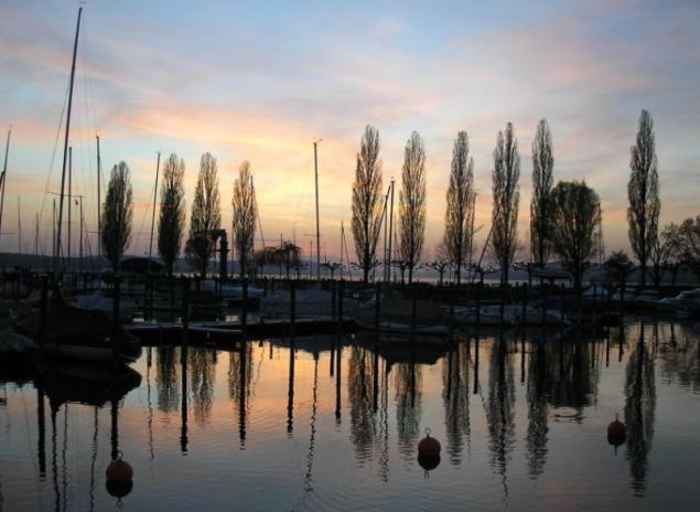
24. Lake Constance (German. Bodensee) is located in Predalpah on the border of Germany, Switzerland and Austria. Speaking of Lake Constance, have in mind three of the water: Lake Superior (it. Obersee), Lower Lake (Untersee) and Rhine (Seerhein), which connects two of the reservoir.
The lake is located in the ancient glacial valley at an altitude of 395 m and has an area of 536 square kilometers with a length of 63 km and a depth of 254 m. In its north-western part of the branches into three separate plot. Lakeside hilly and only in the south-eastern rocky. At the lake there are several nature reserves.
After Lake Constance is the river Rhine, the lake freezes only in the most severe winters. The lake is navigable, operates ferry. On the shores of the lake are the German city of Konstanz and Friedrichshafen, and the Austrian city of Bregenz, and the island of Reichenau declared World Heritage.
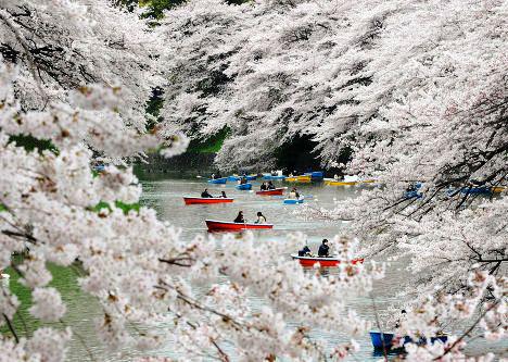
25. The cherry blossoms in Japan.
Haar Japanese spring - flowering ornamental cherry "cherry", which is associated with one of the most beautiful festivals of Japan. From late March to early April, Japan is completely transformed: hundreds of trees are blooming everywhere white and pinkish-white flowers, which is why it seems from a distance, as if they were shrouded in clouds or covered with snow flakes. Every year in parks, alleys, gardens, palaces and temples near a lot of people going to enjoy a truly wonderful and exciting spectacle. This custom is called "hanami" (from the word "Khan" - flower and "mi" - watch), which literally means "flower viewing».
26. raung volcano on the island of Java. The height of 3332 m. Difficult andesitic and basaltic lavas. At the top - a caldera about 2 km in diameter, to a depth of 600 meters. At the bottom of a small caldera volcanic cone of 2nd order. Frequent eruptions (the last - in 1971).
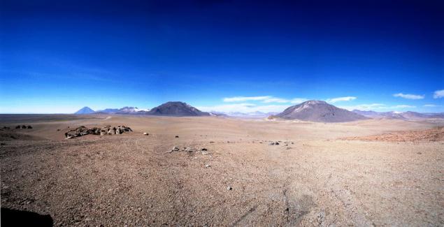
27. The Atacama Desert (Sp. Desierto de Atacama) - the desert on the west coast of South America, in Chile.
Peruvian current cools the lower layers of the atmosphere and creates a temperature inversion that prevents precipitation (less than 50 mm per year). The driest place mainland. Average January temperatures on the coast of 19-20 ° C, July 13-14 ° C. In the winter in some parts of the desert frequent fogs; high humidity. Dunes, sandy and rocky deserts. The vegetation is sparse or absent: cacti places (for example, sort Kopyapoa) and shrubs. The fauna is small, but on the cliffs colony fish-eating birds.
On the border of the desert on the shores of the Pacific Ocean are large Chilean ports - Arica and Iquique.
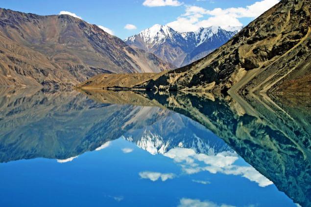
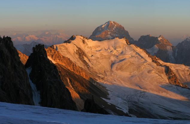
28. Pamir - a mountain range, most of which is located in the northeast of the Republic of Tajikistan, is a veritable ocean of white and blue mountains. When you fly in a helicopter over the Pamirs, as if in a movie, you see rows of mountain ranges, snow-white peaks, hanging glaciers, ice "rivers", broken by cracks and green valleys. Pamir translated from Farsi means "Roof of the World" ("Pa-mi-ihr"). These majestic mountains, the sky really relate to. So it seems when you look from the bottom up. And when you look from the top of one of the points, it can be seen at a glance that the Pamir - this is the assembly, which in different directions the world's highest mountain ranges, including the Karakoram and Himalayas to the south, in the west of the Hindu Kush, and Tien Shan in the northeast.
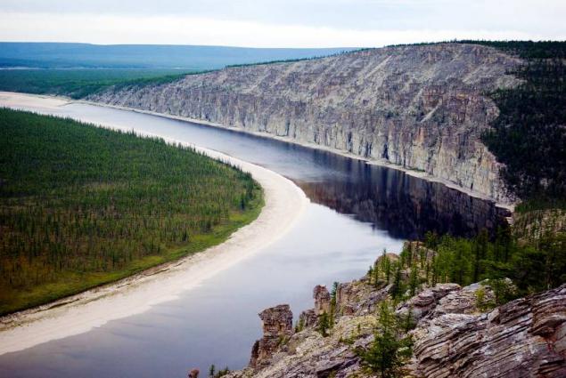
29. National Park "Lena Pillars", located in the basin of the middle reaches of the Lena River. Lena Pillars - a geological formation and the eponymous national park in Russia, on the banks of the Lena River. It located in Khangalassky region of Yakutia 104 km from the town of Pokrovsk. Lena Pillars are stretching for many kilometers vertically elongated rocks complex, intricately piled along the bank of the Lena, the deep valley cutting through Prilenskoye plateau. The highest density of poles reach between the villages of Peter and Tit-Ary.
30. Amazon (port. Amazonas) - a river in South America, the greatest in the world in the size of the pool, water content and length. Formed by the confluence of the rivers Marañón and Ucayali. The length of the main source Marañon 6437 km, from the open end of the 20th century. Apacheta source - approx. 7000 km from the source of the Ucayali over 7,000 km. Basin area 7180 thousand sq. Km (according to other sources 6915 thousand sq. Km). Most of the Amazon basin belongs to Brazil, south-western and western regions - Bolivia, Peru, Ecuador and Colombia. Flowing mostly on the Amazon region in sublatitudinal direction near the equator, the Amazon flows into the Atlantic Ocean, forming the world's largest delta (area of over 100 thousand sq. Km).
31. Ritz - mountain lake glacial-tectonic origin in the West Caucasus, Abkhazia. Located at an altitude of 950 meters above sea level in the valley Lashipsy, east of the Gagra Range. From the lake Riza follows p cont. Lashipsy - p. Yupshara, tributary. Bzyb. The lake was formed about 1000 years ago, when part of the mountain collapsed into the river Pshegishhva Lashipsu and jammed it.
Extremely picturesque lake made him one of the main tourist attractions of Abkhazia.
Source:
photo galleries, 35 photos, add your own!
which opens the Grand Canyon in the United States
ps just say - has affected not all ...

2. Machu Picchu (the language of the Indian Quechua: Machu Pikchu, in translation - the "old peak") - a city of ancient America, located in present-day Peru. As Machu Picchu is often called a "city in the sky" or "city in the clouds," sometimes referred to as "The Lost City of the Incas." Some archaeologists believe that the city was established as a sacred mountain refuge of the Inca ruler Pachacutec great century before the conquest of his empire, that is, around 1440, and operated until 1532, when the Spaniards invaded the Inca Empire. In 1532 all its inhabitants mysteriously disappeared. Similar to Machu Picchu mountain city Choquequirao lasted much longer, up to 1570s.

3. Iguazu Falls on the border of Argentina and Brazil. Iguazu Falls - one of the most powerful waterfalls in the world. This whole system of 275 two-stage cascade. One of the key located at the head of the arc, the border of Brazil and Argentina. It is called in Spanish Gargante del Diablo, which means "Devil's Throat" - unconditional reflected in the attitude of the time when people felt weak grain of sand next to the raging storm water.

4. Nabatean city of Petra in Jordan. Tales of lost in the rocks and sand Nabatean towns excited the minds of European scholars and travelers since the times of the Crusaders. Today, Peter studied in detail only about 15% of the territory. Some believe the Nabataeans simple nomads who settled in this convenient location only because of its favorable geographical location. Others do not agree with this, pointing to too extensive knowledge of the Nabataeans in the field of agriculture and irrigation. Some call them the ancestral home of Assyria, or even Yemen. The theories are many, but to see which of them is true, it is difficult.

5. Pyramids of Giza - one of the seven wonders of the ancient world. At the mention of the Egyptian pyramids, usually have in mind the Great Pyramids, located in Giza, near Cairo. Pyramids are a huge pyramid-shaped stone structures that were used as tombs for pharaohs of ancient Egypt.

6. Sahara - the largest desert in the world, located in North Africa. It stretched about 4,800 km from west to east and from 800 to 1200 km from north to south; It has an area of about 8, 6 million square feet. km.

7. Yellowstone National Park, or Yellowstone National Park (Eng. Yellowstone National Park) - International Biosphere Reserve, a World Heritage Site by UNESCO, the world's first national park (established March 1, 1872). Located in the US, the states of Wyoming, Montana and Idaho. The park is famous for the numerous geysers and other geothermal sites, rich in wildlife, picturesque landscapes. The area of the park - 898, 3 thousand. Hectares.
On the vast territory of the park there are lakes, rivers, canyons and caves. Yellowstone Lake, one of the largest alpine lake in North America, located in the center of the Yellowstone Caldera, the largest supervolcano on the continent.

8. Lake Baikal - the deepest lake on the planet. Local residents and many people in Russia traditionally call Baikal Sea. In Baikal water more than all put together the five Great Lakes and 25 times greater than in Lake Ladoga. According to the Limnological Institute of the Siberian Branch of RAS, in Baikal there are 2630 species and varieties of plants and animals, two thirds of which are endemic, ie found only in this reservoir. Such an abundance of living organisms is due to the high oxygen content throughout the entire thickness of Baikal water.

9. Geyser Valley - one of the largest geyser field in the world and the only in Eurasia. The Valley of Geysers in Kamchatka is the Kronotsky State Biosphere Reserve. One of the Seven Wonders of Russia. Currently, part of the valley covered with a major landslide.

10. Ngorongoro - a huge crater in Tanzania, on the edge of the savannah Serengeti, resulting from a large eruption of the volcano about 2, 5 million years ago. The bottom of the crater is located at an altitude of 2380 meters above sea level. Its edges are approximately 600 m above and to rise to 3,000 meters above sea level. The diameter of the Ngorongoro Crater is 17 to 21 km and has a total area of about 26,400 hectares. At the bottom of the crater is Lake Magadi, the famous flamingo population. Ngorongoro Crater is unique in that for many years it formed its own habitat for many species of animals that are not able to get out.

11. Kuril Islands - a chain of volcanic islands between the Kamchatka Peninsula and the island of Hokkaido. February 10, 1984 is created the State Natural Reserve "Kuril". On its territory inhabited by 84 species included in the Red Book of Russia.
In the photo - the island of Iturup.

12. Komodo National Park. This national park was founded in 1980. It is spread over 603 square kilometers of land and 1,214 square kilometers of marine waters. The territory of the national park consists of three main islands: Komodo, Rinca and Padar, as well as many small islands. The most famous animal park is the Komodo dragon.

13. Volcanoes are the main attractions of the Kamchatka Peninsula. Total Kamchatka there are more than 160 volcanoes, of which 30 are considered to be valid. The largest active volcanoes on the peninsula - Kluchevskaya, Icha, Koryak and Kronotsky volcano.

14. Antarctica - a continent located in the south of the Earth. It was here that emperor penguins live. Antarctica was officially opened on 16 (28) January 1820 Russian expedition led by Thaddeus Bellingshausen and Mikhail Lazarev, who on the sloops "Vostok" and "Peace" came to her in the area of modern ice shelf Bellingshausen. Previously, the existence of a southern continent (lat. Terra Australis) argued hypothetically, it is often combined with South America (for example, on a map drawn Piri Reis in 1513) and Australia (and named in honor of the "southern continent"). However, the expedition was Thaddeus Bellingshausen and Mikhail Lazarev in the south polar seas, skirting around the world the Antarctic ice, has confirmed the existence of the sixth continent.
The first came in the continental part of 24 January 1895 the captain of the Norwegian ship "Antarctica" Christensen and Science teacher Carsten Borchgrevink.

15 Sequoia National Park in the United States. The park is best known for its giant redwoods, including wood General Sherman, the largest tree in the world. General Sherman tree grows in the Giant Forest, which contains five out of the ten largest trees in the world by volume of wood. Giant Forest is connected dear generals, with Grant Grove National Park Kings Canyon, where among other sequoias growing tree General Grant (pictured).

16. Red River or Red River - a river in southern China and northern Vietnam, the main cultural and historical center of Vietnam. Here, in the tenth century there was the first independent state. In China, it called Yuantszyan or Honghe,

17. Lake Sarez - the deep lake of Pamir.
The lake was formed 6 (18) in February 1911 after a strong earthquake (7 points), when the river Murghab was filled by a powerful landslide buried village Usa, forming thus a natural dam height of 567 m. Fill the basin in the same year flooded the village Sarez which gave the name to the lake.
Scientists believe that the natural dam formed by the earthquake, known as Usoy dam is unstable in view of local seismicity, and that the land located at the foot of the dam threatens catastrophic flooding if the dam collapse at a future earthquake. In this case, flooding may be subject to the territory of several states.

18. Caucasus Mountains.
Divided into two mountain ranges: the Greater Caucasus and the Lesser Caucasus.
Greater Caucasus stretches over 1,100 km from northwest to southeast, the area of Anapa and Taman peninsula to Apsheron peninsula on the coast of the Caspian Sea near Baku. The maximum width of the Greater Caucasus reaches near Elbrus (180 km).
Traditionally, the Greater Caucasus is divided into 3 parts: the Western Caucasus (from the Black Sea up to Elbrus), Central Caucasus (from Elbrus to Kazbek) and the eastern Caucasus (Kazbek to the Caspian Sea).
Lesser Caucasus is connected with the Greater Caucasus Likhi Range, in the west it is separated from the Colchis lowlands in the east - the Kura depression. Length - 600 km, height - up to 3724 m.

19. Lapland (Sami Sápmi, Sámeednam, Fin. Lappi, a Swede. Lappland and NOK. Lapland) - the name of the cultural region traditionally inhabited by the Sami (Lapps, the Lapps). Located in Northern Europe (north of Fennoscandia). Lapland has never been a single State; it is now divided between four countries: Norway, Sweden, Finland and Russia (Kola Peninsula).

20. New Zealand (English. New Zealand, the Maori Aotearoa) - a state in the south-western Pacific Ocean, located on two large islands (North Island and South Island), and a large number (approximately 700) adjacent smaller islands. The country's capital - the city of Wellington. The population of New Zealand is about 4.284 million people (as of November 2008). The country is built on the principles of constitutional monarchy and parliamentary democracy and is among the world's developed countries.
In the XI-XIV centuries, the country was inhabited by natives of Polynesia, European explorers discovered the islands in 1642. Active development of land began with Britain in 1762. One of the main features of New Zealand's geographical isolation is. The nearest neighbors are the country - to the west of Australia, separated by the Tasman Sea (the shortest distance - about 1700 km); north island territories - New Caledonia (about 1400 km), Tonga (about 1800 km) and Fiji (about 1900 km).
Realm of New Zealand includes independent in the government, but free association with New Zealand island countries Cook Islands, Niue and Tokelau and the Non-Self-Antarctic territory of Russia.

21. Ayers Rock in Australia.
Uluru (Ayers Rock) - formed about 680 million years ago, 348-meter-high orange-brown oval-shaped rock. Located in the Northern Territory Central Australia 450 km from the town of Alice Springs. Its length is 3, 6 km, width - about 3 km, and the base is indented caves decorated with ancient rock paintings and stone carvings.
Once in the center of the continent towering mountain range, which is an island in the middle of the lake Lake Amadeus. The products of destruction of rocks were deposited at the bottom of the reservoir to form a rock, which in appearance resembles lying on the side of a giant elephant.

22. Madagascar (Malaga. Madagasikara, fr. And Eng. Madagascar) - a state in the western Indian Ocean, Madagascar and the adjacent small islands off the east coast of Africa. Area - 587 thousand sq. Km, the population - 20, 7 million people. (2009). Capital - Antananarivo.
In the photo - the crab fishers in Madagascar.

23. The unique geological monument - one of the largest karst caves in the European part of Russia Kungur ice cave - located 100 km from Perm - in the village Filippovka.

24. Lake Constance (German. Bodensee) is located in Predalpah on the border of Germany, Switzerland and Austria. Speaking of Lake Constance, have in mind three of the water: Lake Superior (it. Obersee), Lower Lake (Untersee) and Rhine (Seerhein), which connects two of the reservoir.
The lake is located in the ancient glacial valley at an altitude of 395 m and has an area of 536 square kilometers with a length of 63 km and a depth of 254 m. In its north-western part of the branches into three separate plot. Lakeside hilly and only in the south-eastern rocky. At the lake there are several nature reserves.
After Lake Constance is the river Rhine, the lake freezes only in the most severe winters. The lake is navigable, operates ferry. On the shores of the lake are the German city of Konstanz and Friedrichshafen, and the Austrian city of Bregenz, and the island of Reichenau declared World Heritage.

25. The cherry blossoms in Japan.
Haar Japanese spring - flowering ornamental cherry "cherry", which is associated with one of the most beautiful festivals of Japan. From late March to early April, Japan is completely transformed: hundreds of trees are blooming everywhere white and pinkish-white flowers, which is why it seems from a distance, as if they were shrouded in clouds or covered with snow flakes. Every year in parks, alleys, gardens, palaces and temples near a lot of people going to enjoy a truly wonderful and exciting spectacle. This custom is called "hanami" (from the word "Khan" - flower and "mi" - watch), which literally means "flower viewing».

26. raung volcano on the island of Java. The height of 3332 m. Difficult andesitic and basaltic lavas. At the top - a caldera about 2 km in diameter, to a depth of 600 meters. At the bottom of a small caldera volcanic cone of 2nd order. Frequent eruptions (the last - in 1971).

27. The Atacama Desert (Sp. Desierto de Atacama) - the desert on the west coast of South America, in Chile.
Peruvian current cools the lower layers of the atmosphere and creates a temperature inversion that prevents precipitation (less than 50 mm per year). The driest place mainland. Average January temperatures on the coast of 19-20 ° C, July 13-14 ° C. In the winter in some parts of the desert frequent fogs; high humidity. Dunes, sandy and rocky deserts. The vegetation is sparse or absent: cacti places (for example, sort Kopyapoa) and shrubs. The fauna is small, but on the cliffs colony fish-eating birds.
On the border of the desert on the shores of the Pacific Ocean are large Chilean ports - Arica and Iquique.

28. Pamir - a mountain range, most of which is located in the northeast of the Republic of Tajikistan, is a veritable ocean of white and blue mountains. When you fly in a helicopter over the Pamirs, as if in a movie, you see rows of mountain ranges, snow-white peaks, hanging glaciers, ice "rivers", broken by cracks and green valleys. Pamir translated from Farsi means "Roof of the World" ("Pa-mi-ihr"). These majestic mountains, the sky really relate to. So it seems when you look from the bottom up. And when you look from the top of one of the points, it can be seen at a glance that the Pamir - this is the assembly, which in different directions the world's highest mountain ranges, including the Karakoram and Himalayas to the south, in the west of the Hindu Kush, and Tien Shan in the northeast.

29. National Park "Lena Pillars", located in the basin of the middle reaches of the Lena River. Lena Pillars - a geological formation and the eponymous national park in Russia, on the banks of the Lena River. It located in Khangalassky region of Yakutia 104 km from the town of Pokrovsk. Lena Pillars are stretching for many kilometers vertically elongated rocks complex, intricately piled along the bank of the Lena, the deep valley cutting through Prilenskoye plateau. The highest density of poles reach between the villages of Peter and Tit-Ary.

30. Amazon (port. Amazonas) - a river in South America, the greatest in the world in the size of the pool, water content and length. Formed by the confluence of the rivers Marañón and Ucayali. The length of the main source Marañon 6437 km, from the open end of the 20th century. Apacheta source - approx. 7000 km from the source of the Ucayali over 7,000 km. Basin area 7180 thousand sq. Km (according to other sources 6915 thousand sq. Km). Most of the Amazon basin belongs to Brazil, south-western and western regions - Bolivia, Peru, Ecuador and Colombia. Flowing mostly on the Amazon region in sublatitudinal direction near the equator, the Amazon flows into the Atlantic Ocean, forming the world's largest delta (area of over 100 thousand sq. Km).

31. Ritz - mountain lake glacial-tectonic origin in the West Caucasus, Abkhazia. Located at an altitude of 950 meters above sea level in the valley Lashipsy, east of the Gagra Range. From the lake Riza follows p cont. Lashipsy - p. Yupshara, tributary. Bzyb. The lake was formed about 1000 years ago, when part of the mountain collapsed into the river Pshegishhva Lashipsu and jammed it.
Extremely picturesque lake made him one of the main tourist attractions of Abkhazia.
Source:
Tags
See also
Deep space through the eyes of the artist (21 photos)
Numeric codes on January 15, 2016
Individuals Haiti. Next terrible shots, be careful! (46 pieces + text)
Things that can not bring through customs
Sultry El Paso
Honest Chinese brands Electronics
How to choose a profession that will be relevant through 5-10-15 years?