Flooding in Hungary - top view
 Bashny.Net
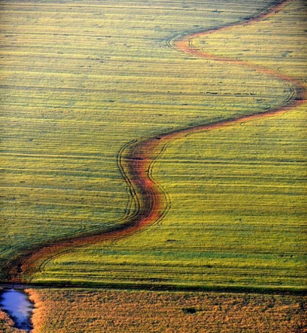
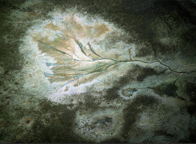
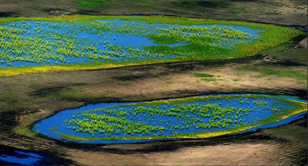
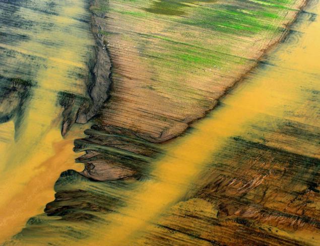
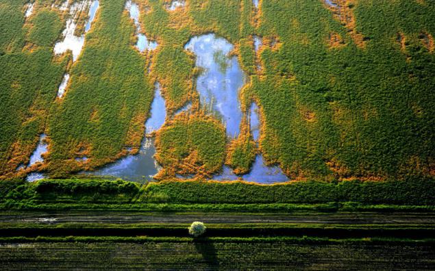
June 10 Photographer Sandor Szabo of the Hungarian MTI news agency took a flight to make those aerial photographs of places, filled with flood waters during the recent floods in Eastern Europe. An aerial view of the Hungarian land affected by the flooding, which resulted in more than four thousand people were forced to leave their homes, it looks like a modern abstract painting avant-garde artists.
5 ph via bigpicture
1) gradually decline floodwaters near Harsanyi, which is located 160 kilometers north-east of Budapest. (Sandor H. Szabol / MTI via European Pressphoto Agency)
2) Not far from Shayolada, 180 kilometers north-east of Budapest. (Sandor H. Szabol / MTI via European Pressphoto Agency)
3) Near the Tisapyushpёki, 70 kilometers east of Budapest. (Sandor H. Szabol / MTI via European Pressphoto Agency)
4) Close to Ong, 200 kilometers north-east of Budapest. (Sandor H. Szabol / MTI via European Pressphoto Agency)
5) Not far from the town Heveshvezeken, 113 kilometers east of Budapest. (Sandor H. Szabol / MTI via European Pressphoto Agency)
Source:
5 ph via bigpicture
1) gradually decline floodwaters near Harsanyi, which is located 160 kilometers north-east of Budapest. (Sandor H. Szabol / MTI via European Pressphoto Agency)

2) Not far from Shayolada, 180 kilometers north-east of Budapest. (Sandor H. Szabol / MTI via European Pressphoto Agency)

3) Near the Tisapyushpёki, 70 kilometers east of Budapest. (Sandor H. Szabol / MTI via European Pressphoto Agency)

4) Close to Ong, 200 kilometers north-east of Budapest. (Sandor H. Szabol / MTI via European Pressphoto Agency)

5) Not far from the town Heveshvezeken, 113 kilometers east of Budapest. (Sandor H. Szabol / MTI via European Pressphoto Agency)

Source:
Tags
See also
Bird's-eye view (14 photos)
30 photos of 2013, which is hard to believe
Beauty Yamal: Aerial view of tundra
20 stunned pictures that are hard to believe
30 photos of 2013, which is hard to believe
30 photos of 2013
Silent on nuclear weapons (35 photos)
Flooding in Europe (14 photos)
Top view
Night Photography