Lake Baskunchak (14 photos)
 Bashny.Net
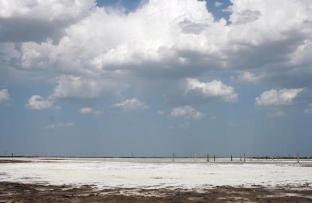
On the banks worth a few small factory, the railway on which carry salt. No conditions for tourism not. Passages are all closed boxes, local children for 20 rubles rush to tell you how to go to the place of bathing. Feeling of poverty and devastation supported 42 degree heat.
30 fotochek and a short story.
upd.
Very interesting comment given geologist Michael Leykum on my forum:
I can comment a little bit - at the level of those memories that stayed with me from the institute's course "Regional Geology of the USSR»
Will have to start from afar ... In the Permian-Triassic time, and it's somewhere 260-230 million years ago in the area Plekan shallow sea ... Here it should be noted that from the point of view of many geologists and mine, in particular, the "real" Oceans, what we know them now then simply did not exist ...
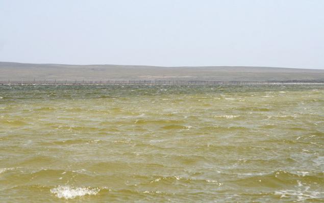
In general, the area occupied by the sea quietly dropped and lifts the "breathing" as a result of tectonic processes, but regression - the retreat of the sea, still prevailed ... The very shallow marine basin was divided into a number of bays, estuaries and closed drainage basins that conditions prevailed here then arid climate led to the accumulation of thick strata of the so-called gypsum-evaporite (gypsum-salt) deposits ... In further stages of the geological development of these strata have plunged into the depths of the earth. Now in the neighboring areas of these geological formations are located at depths of 1-1.5 km ... But I must say that the salt - is the formation of a tricky ... Being quite fragile in normal conditions, when it is tremendous pressure subsurface and for a long geological time has high plasticity and fluidity . Therefore, if kaom some areas of the earth's crust pressure on these beds for one reason or another weakened relative to adjacent, this salt rushes up, lifting and sometimes piercing the overlying sediments and flowing into the region of low pressure ... so formed salt domes or diapirs ... In the same way formed a large Baskunchak salt-raising or dome ... Its surface is uneven due to some already-local domes diapirs and compensating their troughs, basins. Here is one such diapirs sticks out from the land of Triassic sediments Bogda Mountain, which continues to grow until now though not with roofing felt great speed - millimeters per year ... And bowels of the mountain, composed of gypsum deposits, actively dissolve groundwater and karsted to form a light system of caves ... And the lake Baskunchak in turn - local basin-trough, the bottom of which continues to sag as well ... Because of the number of features - it undrained and is located below sea level, it is an active evaporation. New portions of river water dissolved salt-bearing strata of the ancient and active evaporation leads to the deposition on the surface of a very pure salt, sodium chloride - the mineral halite ... It produces nearly 80% of dietary salt in Russia ...
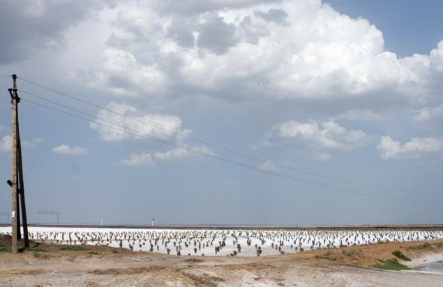
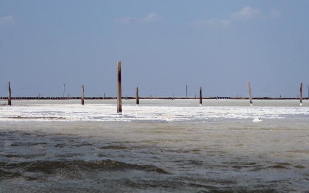
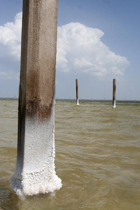
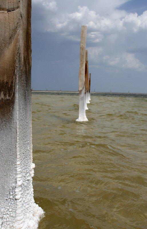
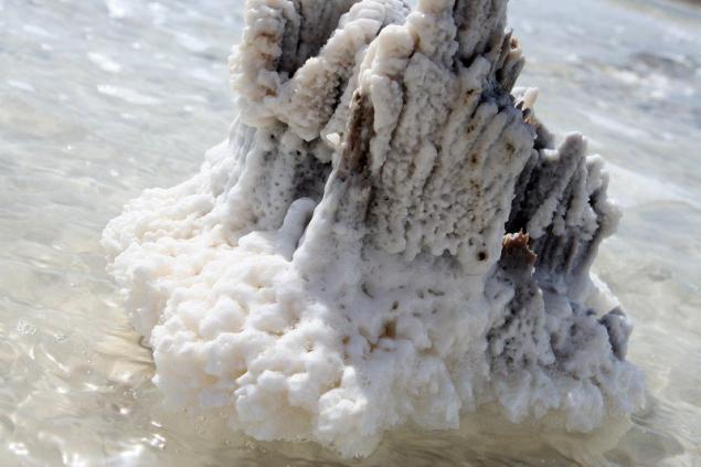
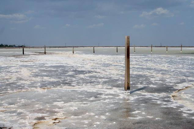
A wooden posts, probably in some way contribute to evaporation, the truth is already afraid to lie ...
Everywhere hammered post for which I did not understand. Can anyone tell me why they?
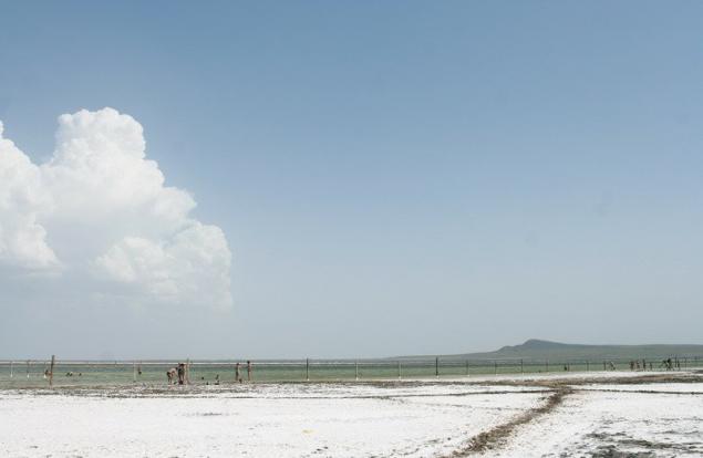
Cars leave 800 meters from the property and go swimming peshochkom.
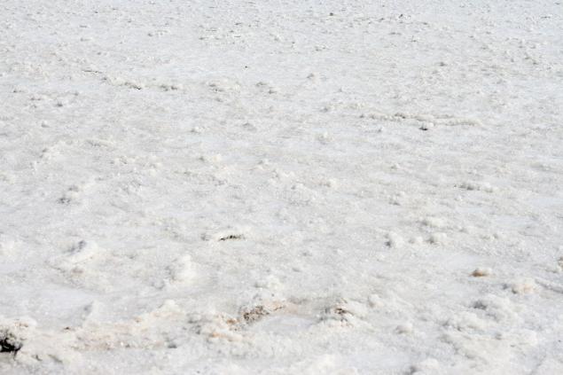
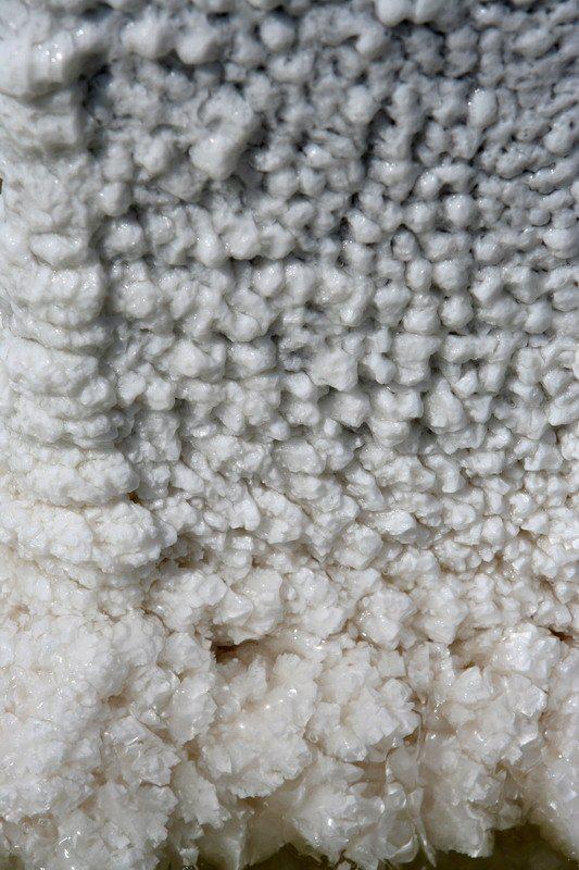
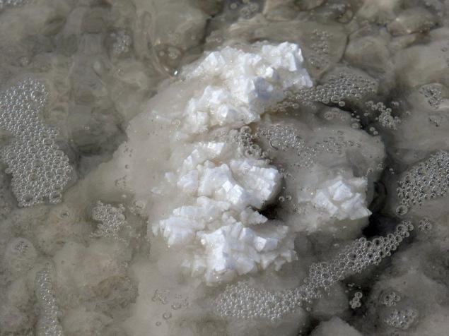
All covered with salt. A Pordoi salt mud.
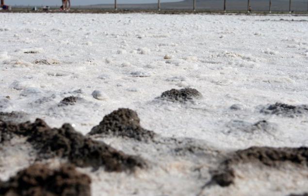
On the poster beautiful salt build-up.
Vodicka warm, heat facilitates a very strong wind, which in turn interfere with swimming. If the salt spray will get unpleasant sensation in the eye.
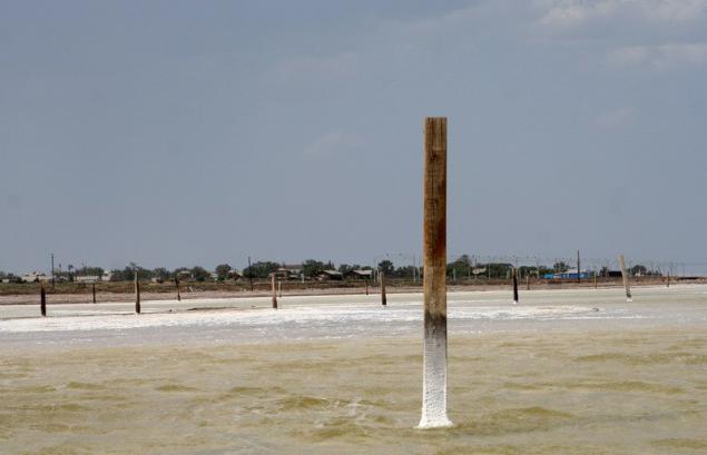
The bottom of the structure of the lower part of this column - bosichkom impossible to walk.

30 fotochek and a short story.
upd.
Very interesting comment given geologist Michael Leykum on my forum:
I can comment a little bit - at the level of those memories that stayed with me from the institute's course "Regional Geology of the USSR»
Will have to start from afar ... In the Permian-Triassic time, and it's somewhere 260-230 million years ago in the area Plekan shallow sea ... Here it should be noted that from the point of view of many geologists and mine, in particular, the "real" Oceans, what we know them now then simply did not exist ...
In general, the area occupied by the sea quietly dropped and lifts the "breathing" as a result of tectonic processes, but regression - the retreat of the sea, still prevailed ... The very shallow marine basin was divided into a number of bays, estuaries and closed drainage basins that conditions prevailed here then arid climate led to the accumulation of thick strata of the so-called gypsum-evaporite (gypsum-salt) deposits ... In further stages of the geological development of these strata have plunged into the depths of the earth. Now in the neighboring areas of these geological formations are located at depths of 1-1.5 km ... But I must say that the salt - is the formation of a tricky ... Being quite fragile in normal conditions, when it is tremendous pressure subsurface and for a long geological time has high plasticity and fluidity . Therefore, if kaom some areas of the earth's crust pressure on these beds for one reason or another weakened relative to adjacent, this salt rushes up, lifting and sometimes piercing the overlying sediments and flowing into the region of low pressure ... so formed salt domes or diapirs ... In the same way formed a large Baskunchak salt-raising or dome ... Its surface is uneven due to some already-local domes diapirs and compensating their troughs, basins. Here is one such diapirs sticks out from the land of Triassic sediments Bogda Mountain, which continues to grow until now though not with roofing felt great speed - millimeters per year ... And bowels of the mountain, composed of gypsum deposits, actively dissolve groundwater and karsted to form a light system of caves ... And the lake Baskunchak in turn - local basin-trough, the bottom of which continues to sag as well ... Because of the number of features - it undrained and is located below sea level, it is an active evaporation. New portions of river water dissolved salt-bearing strata of the ancient and active evaporation leads to the deposition on the surface of a very pure salt, sodium chloride - the mineral halite ... It produces nearly 80% of dietary salt in Russia ...
A wooden posts, probably in some way contribute to evaporation, the truth is already afraid to lie ...
Everywhere hammered post for which I did not understand. Can anyone tell me why they?

Cars leave 800 meters from the property and go swimming peshochkom.

All covered with salt. A Pordoi salt mud.


On the poster beautiful salt build-up.


Vodicka warm, heat facilitates a very strong wind, which in turn interfere with swimming. If the salt spray will get unpleasant sensation in the eye.


The bottom of the structure of the lower part of this column - bosichkom impossible to walk.


Tags
See also
Salt Lake Baskunchak
National Geographic Photos
24, the main contenders for the Best National Geographic photographer 2015
Jellyfish Lake (14 photos)
Photo Medvedev - in the top of the most expensive
Lake Baikal Circum-Baikal Railway
Baskunchak: Dead Sea in Russian (30 photos)
Morning Glory Pool (6 photos)
25 places that capture the imagination
Trans-Siberian Railway