The history of navigation
 Bashny.Net
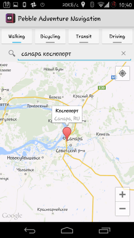
Once people were guided by the stars. Now everything is much simpler - just get out of the pocket phone, drive in Yandex correct address and they will pave the route. Or enable the navigator in the car. Or look at the "smart watches" - a lot of ways. But did you know how to look first navigators? In the post - a brief history of navigation: from mechanical wrist device to projectors in the helmet.
Getting Started h4>
In space! H4>
For military and civilian h4>
Today h4>
Getting Started h4>
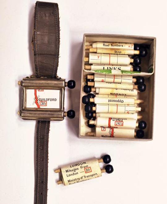
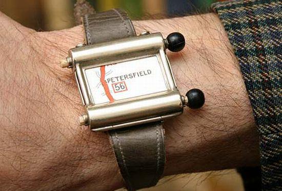
The first navigator appeared in 1920. Included with the device Plus Fours Routefinder, similar to a watch, go card. Twist them had to be manually.
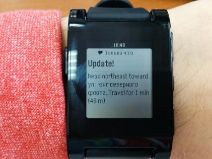
It was necessary to add the device to History smart hours . After all, it will take only 90 years old, and navigator function will perform a watch like Pebble .
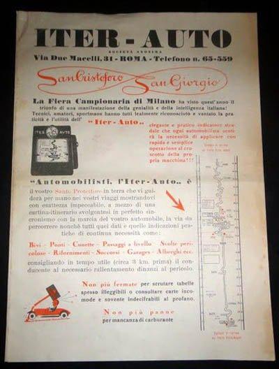
Navigator of the next generation, Iter-Auto, appeared in 1930. Its main difference from the Plus Fours Routefinder consisted automatically scrolling the map - the speed with which the mechanism is made, dependent on the vehicle speed. But it was enough to turn off the road - as the driver had to get maps, search for the necessary, install it in the browser and search for your current location.
Advertising Iter-Auto.
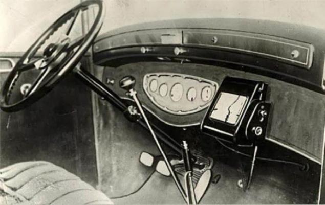
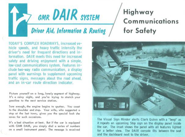
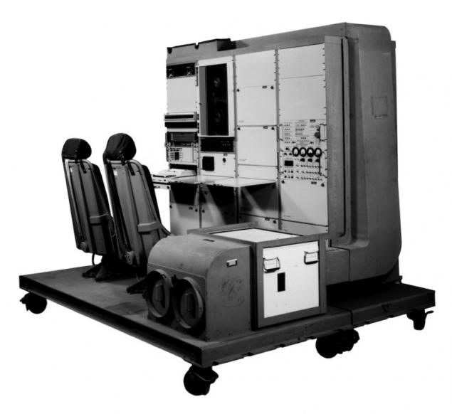
General Motors in 1966 released «Driver Aid Information and Routing». The system has been designed to assist the driver and take on some of the functions of the driver so that he could concentrate properly on driving. Among the useful features - the ability to call on the radio in an emergency or referral service. Press Release February 1, 1967. As the media used punched cards: Navigator guided by him and reported the speed limit, direction and other important factors.


In space! H4>
In 1957, the Soviet Union sent into space the first artificial Earth satellite, and the US military learned that the frequency of the signal depends on the proximity of the satellite. Therefore, knowing the coordinates, you can find out the position and velocity of the satellite, and knowing the position of the satellite, you can define your own speed and coordinates. global satellite navigation technology: what are the system parameters and functions .
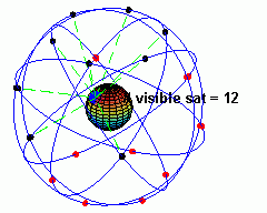
In 1974, the idea of satellite navigation has been implemented, and the United States launched the first of 24 GPS-satellites needed to cover the entire Earth. The last one launched in 1994. At the moment, these satellites 32. As can be seen from one point satellites:
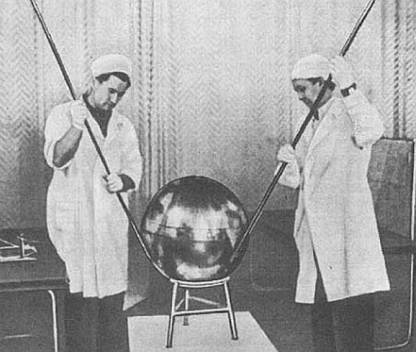
The satellite does not run, he is in a museum in San Diego.
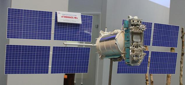
Officially, the GLONASS system began to develop in the Soviet Union in 1976, but in 1984 launched the first two satellites. In the photo - the second generation GLONASS satellite. For complete coverage of the Earth also requires 24 satellites.


For military and civilian h4>
The first GPS-receiver, designed for the US military, was a two-seater with wheels. Weighed about 122 pounds. In 1983 it was decided to establish a system of civil GPS - after flying over the Soviet Union shot down the plane of Korean Airline.
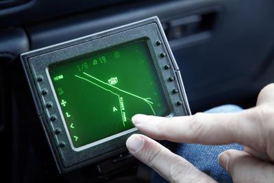
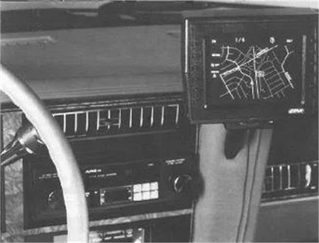
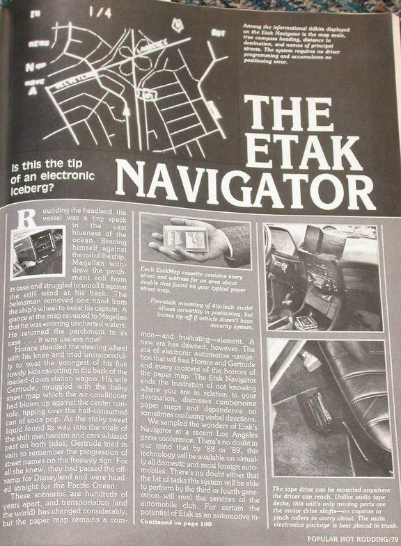
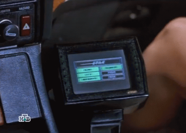
In 1985, the United States already appears first mass Navigator - The Etak Navigator. The display - a nice green color. Music and movies on it, of course, it was impossible to watch, but with his work, he coped. Maps for him were stored on tape.
In 1991, The Etak Navigator lit up in the film "nothing but trouble» (Nothing But Trouble). In the frame - in fact, he and Demi Moore leg.
As GLONASS and GPS was originally developed for military purposes. In the photo - facia Black Hawk helicopter with GPS navigation, the beginning of the 1990s.
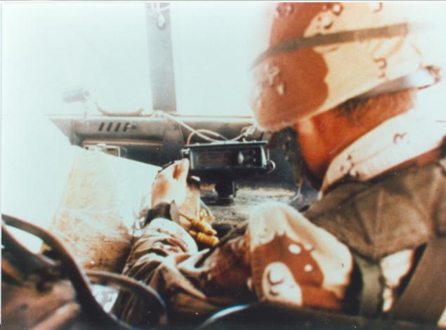
January or February of 1991, "Operation Desert Storm". GPS-navigator installed in the Hummer.
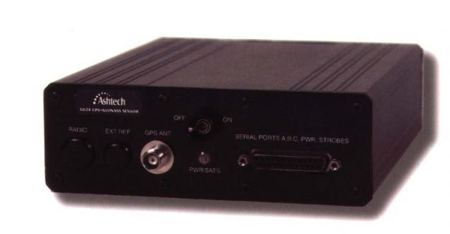
The first receiver designed to work with GLONASS and GPS at the same time, was released in 1995 by Ashtech. It was not designed for the mass market.
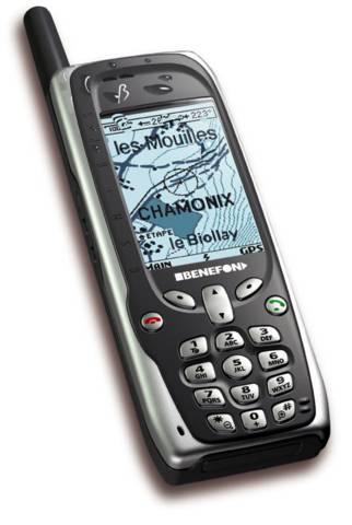
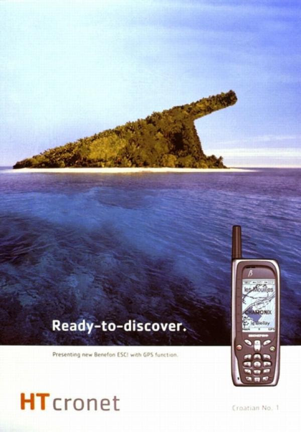
But five years later, the market appears first smartphone with GPS - it Benefon ESC. It was available to the mass consumer.
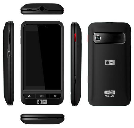
The first smartphone equipped with GLONASS receiver, went on sale in 2011 - MTS 945.


Today h4>
At the moment, the role of the navigator can perform not only special gadgets, but smart phones and a variety of portable devices - watches and glasses. For example, Google Glass allow the driver is not distracted from the road.
Returning to the clock - an application for Pebble allows you to display hints on how much further to go, right on the wristwatch. This is one of the 10 applications of this gadget . They work in conjunction with the application running on the smartphone.
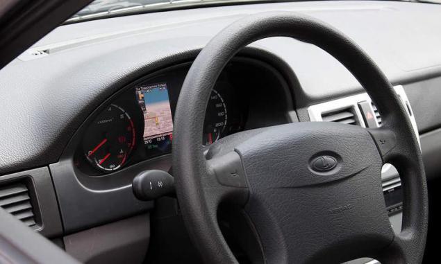
Staff navigators often equip cars at the factory - even the Russian auto manufacturers do.
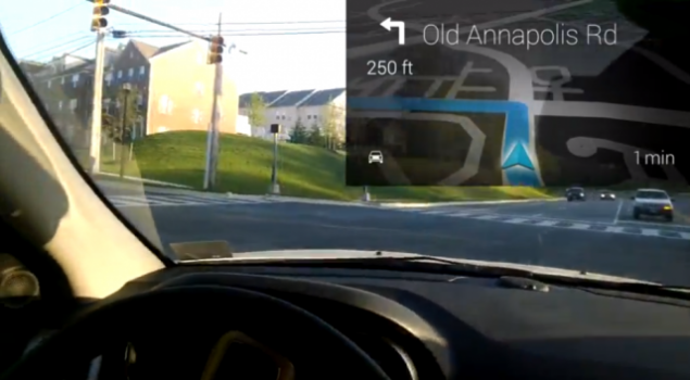
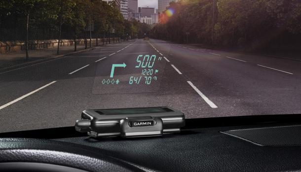
But much more interesting, of course, the unit purchased separately. For example, the navigator Garmin HUD is equipped with a projector - the driver sees the direction of the next turn in the form of an arrow on the windshield of the car. The device is synchronized with your smartphone on iOS or Android, and uses the running software on it. And it gets stoppers via Bluetooth.
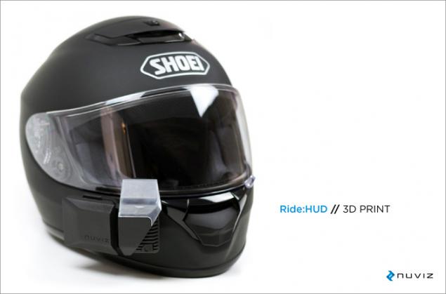
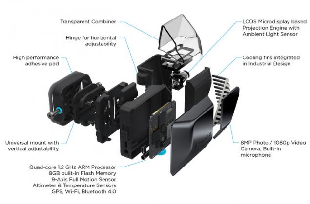
Motorcyclists also use navigators, which is associated with a number of inconveniences: while driving in a helmet is not very convenient tilt your head to the navigator - this time, we have to stop to drive the address - that's two. Therefore, among the wearable devices with navigation can be noted motorcycle helmet NUVIZ - It is necessary to improve safety. The project has already received enough money on Kickstarter.
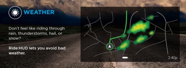
Software devaysa allow even overtake the bad weather that for two-wheeler is a tangible bonus.
In Russia, a similar project is being developed for five years - is LiveMap for bikers, motorcycle helmet with GPS navigation. Now you can pre-order on the site - for $ 1,500, and when it will be available - price is already 2000.
This is interesting:
connected Volvo at MWC 2014
History smart hours
History of personal computers in the advertisement. Part 3: 1990
Source: habrahabr.ru/company/boxowerview/blog/214333/


Tags
See also
I did the bar for 30 days, and here is the result
How to raise emotional intelligence in children: the 3 keys to success
The Hidden History of Tesla, part 3/3
The history of sound film. From Mono to Dolby Atmos
It's time to close: Stories of famous stock exchanges of Chicago
The development of GLONASS