Journey to Mars (43 photos)
 Bashny.Net
HiRISE - this high-resolution camera mounted on board the Mars research satellite Orbiter (MRO). This spacecraft is currently one of the terrestrial day makes approximately 13 revolutions around Mars. November 8, 2006, scientists officially announced the launch of the first research phase (main phase of the mission surveying). This phase lasted two Earth years. Detailed research phase will continue for as long as the spacecraft and the camera will not go down.
In the Control Center HiRISE, which is called HiROC, held daily work planning shots, camera control, receipt, processing and distribution of information. The center is located at the University of Arizona in Tucson.
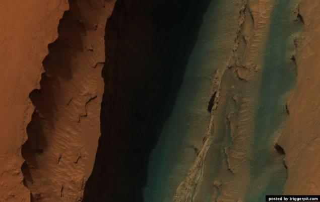
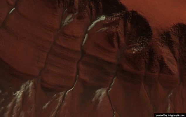
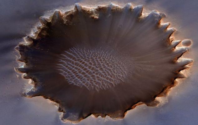
1. Layered sediments in the canyon Hebe. (NASA / JPL / University of Arizona)

2. Holes in the wall of the crater Gus. (NASA / JPL / University of Arizona)
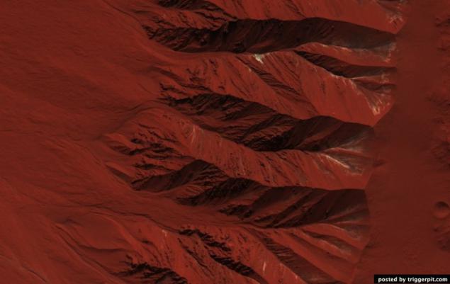
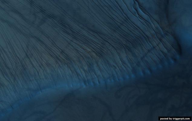
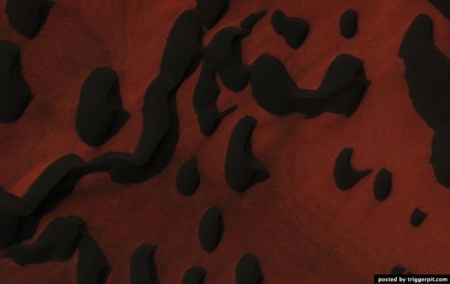
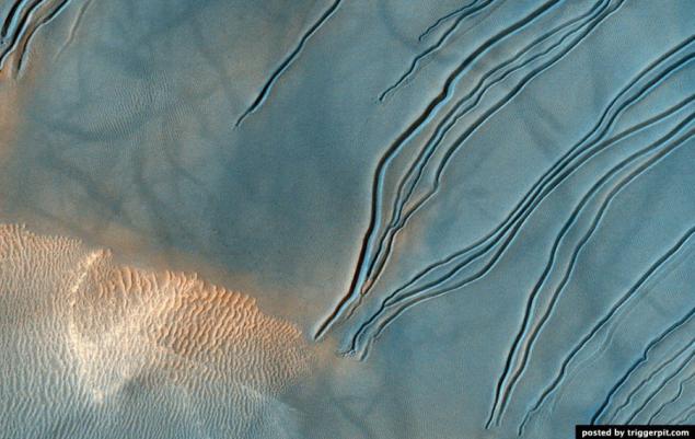
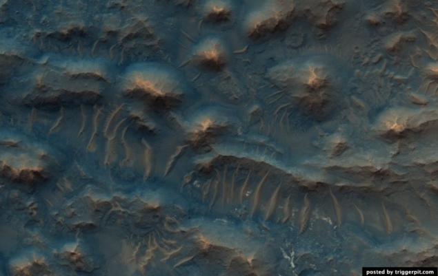
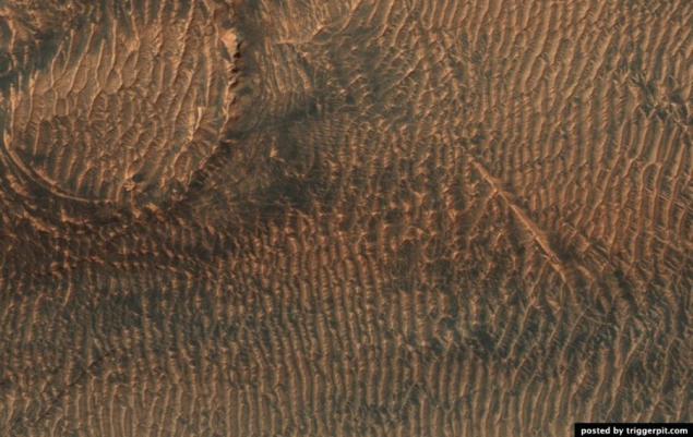
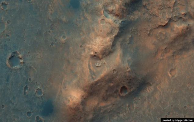
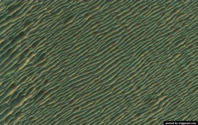
3. Russell Crater Dunes. (NASA / JPL / University of Arizona)
4. Geysers Manhattan. (NASA / JPL / University of Arizona)
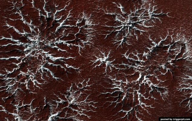
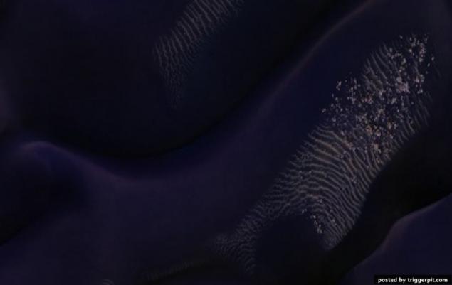
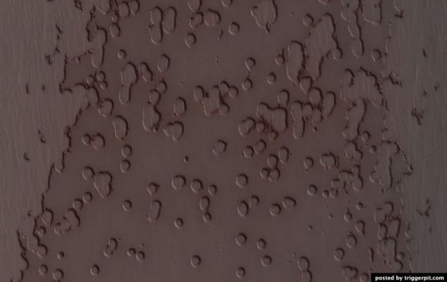
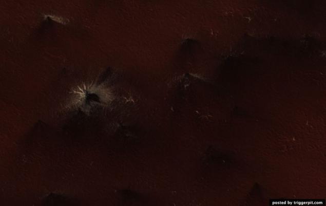
5. The surface of Mars is covered with dry ice. Have you ever ever play with dry ice (of course in leather gloves!)? Then you have probably noticed that the dry ice from solid directly to a gas passes, unlike ordinary ice, which is heated, turns into water. Mars ice caps are composed of dry ice (carbon dioxide). When in the spring on the ice fall sun's rays, it goes into a gaseous state, which causes erosion surface. Erosion creates whimsical spider shape. In this picture shows the channels that have arisen as a result of erosion and light-filled with ice, which comes in contrast to the muted red surrounding surface. In summer, the ice dissolves in the atmosphere, and instead will only channels like ghostly spiders carved on the surface. This type of erosion is typical only for Mars is not possible under natural conditions on earth, as the climate of our planet too warm. Lyricist: Candy Hansen (21 March 2011) (NASA / JPL / University of Arizona)
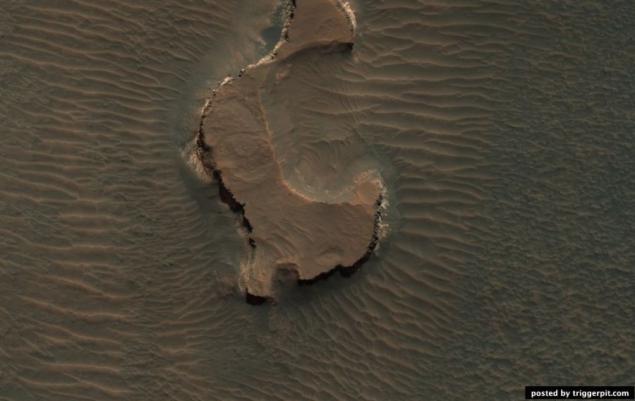
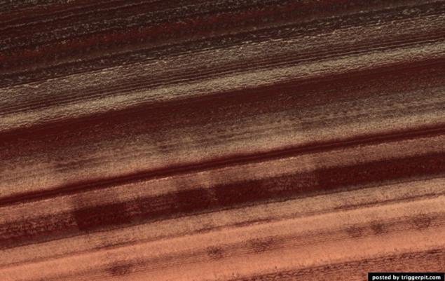
6. The layered mineral deposits located on the southern tip of the crater in the middle latitudes. Bright layered deposits are visible in the center of the picture; they appear along the edges of the mesas, situated on a hill. Such deposits can be found in many places on Mars, including craters and canyons near the equator. He could have been formed as a result of sedimentary processes by wind and / whether water. Around the mesa seen dunes or folded education. The folded structure is the result of differential erosion: when some materials can be erosion easier than others. Perhaps, this area was once covered by soft sediments, which have now disappeared as a result of erosion. Lyricist: Kelly Kolb (15 April 2009) (NASA / JPL / University of Arizona)
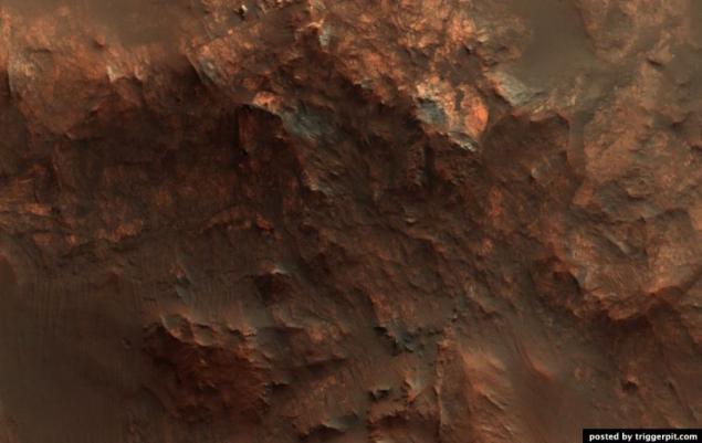
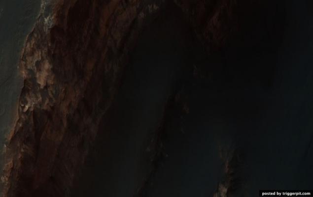
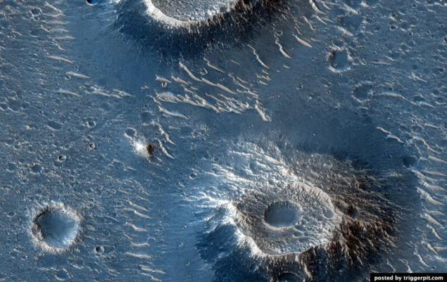
7. bedrock acting on the walls and the central hill of the crater. (NASA / JPL / University of Arizona)
8. Solid structure salt mountain canyon Ganges. (NASA / JPL / University of Arizona)

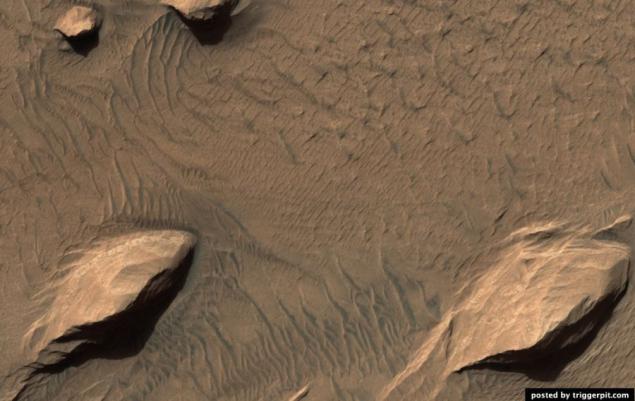
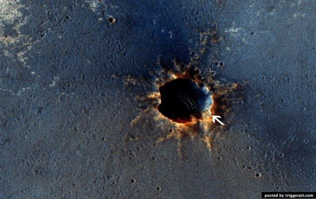
9. Someone cut a piece of the planet! (NASA / JPL / University of Arizona)
10. Sand mound formed by the spring sand storms in the North Pole. (NASA / JPL / University of Arizona)
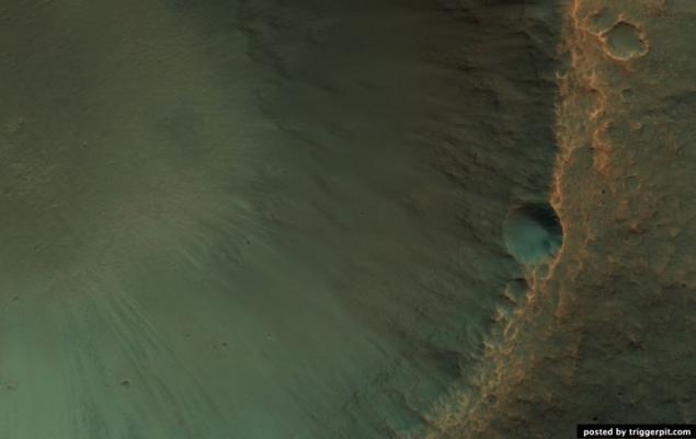
11. crater with a central slide, a diameter of 12 kilometers. (NASA / JPL / University of Arizona)
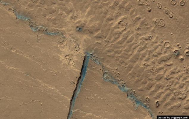
12. The system of faults Cerberus Fossae on the surface of Mars. (NASA / JPL / University of Arizona)
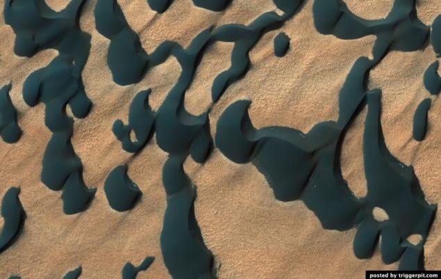
13. Purple Proctor Crater Dunes. (NASA / JPL / University of Arizona)
14. The light rock outcrops on the walls of the mesa located in the Land of the Sirens. (NASA / JPL / University of Arizona)
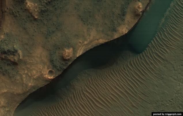
15. Spring changes in the Ithaca area. (NASA / JPL / University of Arizona)
16. Russell Crater Dunes. Photos taken in the crater Russell studied repeatedly in order to monitor changes in the landscape. In this picture shows individual dark education, which probably arose under the influence of multiple dust storms that killed bright dust from the surface of the dunes. Narrow channels continue to be formed on the surfaces of steep sand dunes. The recesses in the end channels may be the place where the accumulated blocks of dry ice before proceeding to a gaseous state. Lyricist: Ken Herkenhoff (9 March 2011) (NASA / JPL / University of Arizona)
17. Chutes on the walls of the crater under the outcrop. (NASA / JPL / University of Arizona)
18. Chutes on the walls of the crater under the outcrop. (NASA / JPL / University of Arizona)
19. Areas where possible contain a lot of olivine. (NASA / JPL / University of Arizona)
20. Ravines between dunes on the crater floor Kaiser. (NASA / JPL / University of Arizona)

21. Mort Valley. (NASA / JPL / University of Arizona)
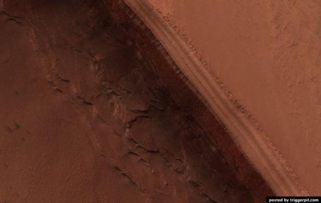
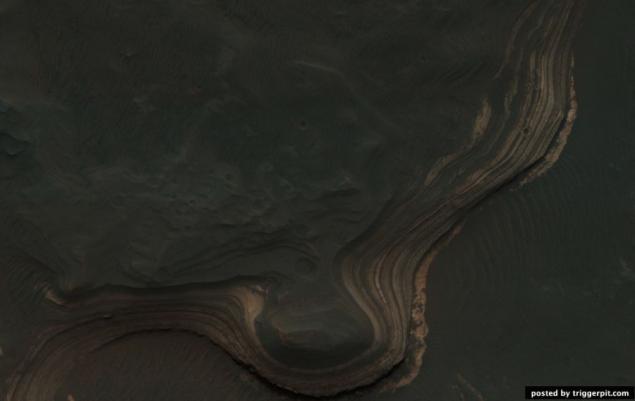
22. Deposits on the bottom of the canyon Labyrinth night. (NASA / JPL / University of Arizona)
23. Holden Crater. (NASA / JPL / University of Arizona)
24. Crater St. Mary (Santa Maria Crater). The device is made HiRISE color image crater St. Mary which has the AGV Opportunity, which is stuck in southeastern edge of the crater. AGV to collect data on this relatively new crater with a diameter of 90 meters, in order to determine what factors influenced his appearance. Pay attention to the surrounding blocks and beams formations. CRISM spectral analysis reveals the presence of hydrosulfates in this area. Fragments of AGV are at a distance of 6 kilometers from the edge of the crater Endeavour Crater, basic materials which are hydrosulfates and phyllosilicates. (NASA / JPL / University of Arizona)
25. The central mound of large, well-preserved crater. (NASA / JPL / University of Arizona)
26. Russell Crater Dunes. (NASA / JPL / University of Arizona)
27. Layered deposits in the canyon Hebe. (NASA / JPL / University of Arizona)
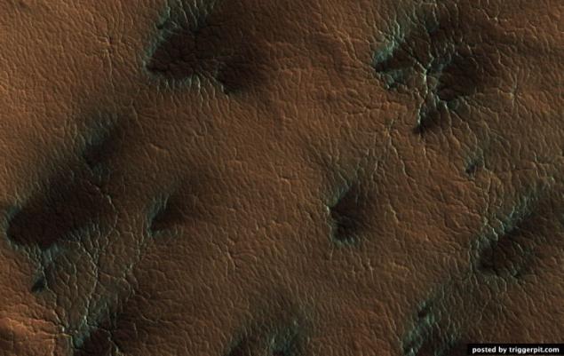
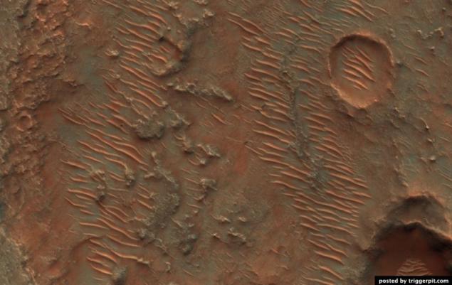
28. Neighborhood Yardang Eumenides Dorsum. (NASA / JPL / University of Arizona)
29. Movement of sand in Gusev Crater, located not far from the hills of Colombia. (NASA / JPL / University of Arizona)
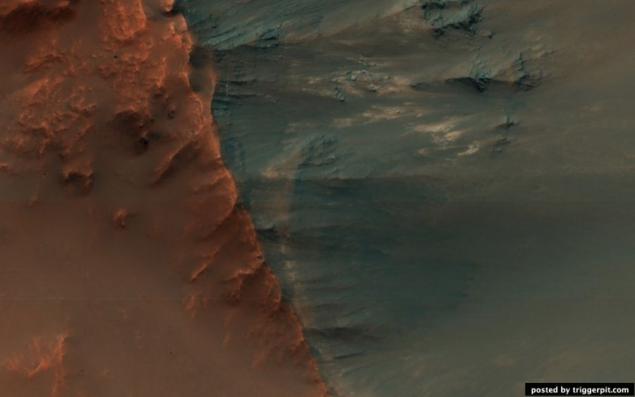
30. North ridge Hellas Planitia, which is probably rich in olivine. (NASA / JPL / University of Arizona)
31. Seasonal changes in the area of the South Pole, is covered with cracks and potholes. (NASA / JPL / University of Arizona)
32. Remains of the southern polar caps in spring. (NASA / JPL / University of Arizona)
33. Frozen troughs and potholes on the pole. (NASA / JPL / University of Arizona)
34. Deposits (probably of volcanic origin) in the Maze of the night. (NASA / JPL / University of Arizona)
35. The layered outcrops on the wall of the crater, located at the North Pole. (NASA / JPL / University of Arizona)
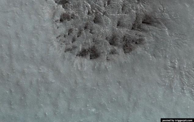
36. A single spider education. This formation is a channel carved into the surface, which were formed under the influence of evaporation of carbon dioxide. Channels arranged radially widened and deepened as they approach the center. On Earth, these processes do not occur. (NASA / JPL / University of Arizona)
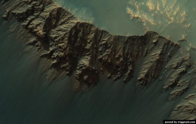
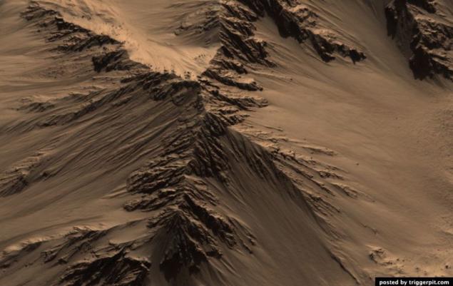
37. Relief Athabasca Valley. (NASA / JPL / University of Arizona)
38. Cone crater Utopia Planitia (Utopia Planitia). Utopia Planitia (Utopia Planitia) - a gigantic plain, located in the eastern part of the northern hemisphere of Mars, and adjacent to the northern Great Plains. Craters in the area of volcanic origin, as evidenced by their shape. Craters hardly prone to erosion. Cone-shaped hills or craters like formations depicted in this picture, are quite common in the northern latitudes of Mars. (NASA / JPL / University of Arizona)
39. Polar sand dunes. (NASA / JPL / University of Arizona)
40. The interior of the crater Tooting. (NASA / JPL / University of Arizona)
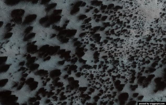
41. Trees on Mars !!! In this photo we see something strikingly similar to trees growing among the Martian dunes. But these "trees" - an optical illusion. This is actually a dark deposits on the lee side of the dunes. They appeared due to the evaporation of carbon dioxide, "dry ice". The evaporation process begins at the bottom of the ice formation as a result of this process, a pair of gas escape through the pores on the surface and simultaneously render dark deposits that remain lying napoverhnosti. This picture was taken with the device HiRISE, installed on board NASA Orbiter reconnaissance satellite in April 2008. (NASA / JPL / University of Arizona)

42. Victoria Crater. The photographs showed deposits on the wall of the crater. The bottom of the crater is covered sand dunes. On the left are fragments of AGV NASAOpportunity. The picture was taken apparatus HiRISE, installed on board reconnaissance satellite NASA Orbiter, in July 2009. (NASA / JPL-Caltech / University of Arizona)
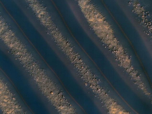
43. Linear dunes. These strips - linear sand dunes on the crater floor near Noachis Terra. Dark areas - this yourself dunes and bright - the gaps between the dunes. The photo was taken December 28, 2009 astronomical high resolution camera HiRISE (High-Resolution Imaging Science Experiment), installed aboard reconnaissance satellite NASA Orbiter. (NASA / JPL / University of Arizona)
In the Control Center HiRISE, which is called HiROC, held daily work planning shots, camera control, receipt, processing and distribution of information. The center is located at the University of Arizona in Tucson.
1. Layered sediments in the canyon Hebe. (NASA / JPL / University of Arizona)

2. Holes in the wall of the crater Gus. (NASA / JPL / University of Arizona)

3. Russell Crater Dunes. (NASA / JPL / University of Arizona)

4. Geysers Manhattan. (NASA / JPL / University of Arizona)

5. The surface of Mars is covered with dry ice. Have you ever ever play with dry ice (of course in leather gloves!)? Then you have probably noticed that the dry ice from solid directly to a gas passes, unlike ordinary ice, which is heated, turns into water. Mars ice caps are composed of dry ice (carbon dioxide). When in the spring on the ice fall sun's rays, it goes into a gaseous state, which causes erosion surface. Erosion creates whimsical spider shape. In this picture shows the channels that have arisen as a result of erosion and light-filled with ice, which comes in contrast to the muted red surrounding surface. In summer, the ice dissolves in the atmosphere, and instead will only channels like ghostly spiders carved on the surface. This type of erosion is typical only for Mars is not possible under natural conditions on earth, as the climate of our planet too warm. Lyricist: Candy Hansen (21 March 2011) (NASA / JPL / University of Arizona)

6. The layered mineral deposits located on the southern tip of the crater in the middle latitudes. Bright layered deposits are visible in the center of the picture; they appear along the edges of the mesas, situated on a hill. Such deposits can be found in many places on Mars, including craters and canyons near the equator. He could have been formed as a result of sedimentary processes by wind and / whether water. Around the mesa seen dunes or folded education. The folded structure is the result of differential erosion: when some materials can be erosion easier than others. Perhaps, this area was once covered by soft sediments, which have now disappeared as a result of erosion. Lyricist: Kelly Kolb (15 April 2009) (NASA / JPL / University of Arizona)

7. bedrock acting on the walls and the central hill of the crater. (NASA / JPL / University of Arizona)

8. Solid structure salt mountain canyon Ganges. (NASA / JPL / University of Arizona)

9. Someone cut a piece of the planet! (NASA / JPL / University of Arizona)

10. Sand mound formed by the spring sand storms in the North Pole. (NASA / JPL / University of Arizona)

11. crater with a central slide, a diameter of 12 kilometers. (NASA / JPL / University of Arizona)

12. The system of faults Cerberus Fossae on the surface of Mars. (NASA / JPL / University of Arizona)

13. Purple Proctor Crater Dunes. (NASA / JPL / University of Arizona)

14. The light rock outcrops on the walls of the mesa located in the Land of the Sirens. (NASA / JPL / University of Arizona)

15. Spring changes in the Ithaca area. (NASA / JPL / University of Arizona)

16. Russell Crater Dunes. Photos taken in the crater Russell studied repeatedly in order to monitor changes in the landscape. In this picture shows individual dark education, which probably arose under the influence of multiple dust storms that killed bright dust from the surface of the dunes. Narrow channels continue to be formed on the surfaces of steep sand dunes. The recesses in the end channels may be the place where the accumulated blocks of dry ice before proceeding to a gaseous state. Lyricist: Ken Herkenhoff (9 March 2011) (NASA / JPL / University of Arizona)

17. Chutes on the walls of the crater under the outcrop. (NASA / JPL / University of Arizona)

18. Chutes on the walls of the crater under the outcrop. (NASA / JPL / University of Arizona)

19. Areas where possible contain a lot of olivine. (NASA / JPL / University of Arizona)

20. Ravines between dunes on the crater floor Kaiser. (NASA / JPL / University of Arizona)

21. Mort Valley. (NASA / JPL / University of Arizona)

22. Deposits on the bottom of the canyon Labyrinth night. (NASA / JPL / University of Arizona)

23. Holden Crater. (NASA / JPL / University of Arizona)

24. Crater St. Mary (Santa Maria Crater). The device is made HiRISE color image crater St. Mary which has the AGV Opportunity, which is stuck in southeastern edge of the crater. AGV to collect data on this relatively new crater with a diameter of 90 meters, in order to determine what factors influenced his appearance. Pay attention to the surrounding blocks and beams formations. CRISM spectral analysis reveals the presence of hydrosulfates in this area. Fragments of AGV are at a distance of 6 kilometers from the edge of the crater Endeavour Crater, basic materials which are hydrosulfates and phyllosilicates. (NASA / JPL / University of Arizona)

25. The central mound of large, well-preserved crater. (NASA / JPL / University of Arizona)

26. Russell Crater Dunes. (NASA / JPL / University of Arizona)

27. Layered deposits in the canyon Hebe. (NASA / JPL / University of Arizona)

28. Neighborhood Yardang Eumenides Dorsum. (NASA / JPL / University of Arizona)

29. Movement of sand in Gusev Crater, located not far from the hills of Colombia. (NASA / JPL / University of Arizona)

30. North ridge Hellas Planitia, which is probably rich in olivine. (NASA / JPL / University of Arizona)

31. Seasonal changes in the area of the South Pole, is covered with cracks and potholes. (NASA / JPL / University of Arizona)

32. Remains of the southern polar caps in spring. (NASA / JPL / University of Arizona)

33. Frozen troughs and potholes on the pole. (NASA / JPL / University of Arizona)

34. Deposits (probably of volcanic origin) in the Maze of the night. (NASA / JPL / University of Arizona)

35. The layered outcrops on the wall of the crater, located at the North Pole. (NASA / JPL / University of Arizona)

36. A single spider education. This formation is a channel carved into the surface, which were formed under the influence of evaporation of carbon dioxide. Channels arranged radially widened and deepened as they approach the center. On Earth, these processes do not occur. (NASA / JPL / University of Arizona)

37. Relief Athabasca Valley. (NASA / JPL / University of Arizona)

38. Cone crater Utopia Planitia (Utopia Planitia). Utopia Planitia (Utopia Planitia) - a gigantic plain, located in the eastern part of the northern hemisphere of Mars, and adjacent to the northern Great Plains. Craters in the area of volcanic origin, as evidenced by their shape. Craters hardly prone to erosion. Cone-shaped hills or craters like formations depicted in this picture, are quite common in the northern latitudes of Mars. (NASA / JPL / University of Arizona)

39. Polar sand dunes. (NASA / JPL / University of Arizona)

40. The interior of the crater Tooting. (NASA / JPL / University of Arizona)

41. Trees on Mars !!! In this photo we see something strikingly similar to trees growing among the Martian dunes. But these "trees" - an optical illusion. This is actually a dark deposits on the lee side of the dunes. They appeared due to the evaporation of carbon dioxide, "dry ice". The evaporation process begins at the bottom of the ice formation as a result of this process, a pair of gas escape through the pores on the surface and simultaneously render dark deposits that remain lying napoverhnosti. This picture was taken with the device HiRISE, installed on board NASA Orbiter reconnaissance satellite in April 2008. (NASA / JPL / University of Arizona)

42. Victoria Crater. The photographs showed deposits on the wall of the crater. The bottom of the crater is covered sand dunes. On the left are fragments of AGV NASAOpportunity. The picture was taken apparatus HiRISE, installed on board reconnaissance satellite NASA Orbiter, in July 2009. (NASA / JPL-Caltech / University of Arizona)

43. Linear dunes. These strips - linear sand dunes on the crater floor near Noachis Terra. Dark areas - this yourself dunes and bright - the gaps between the dunes. The photo was taken December 28, 2009 astronomical high resolution camera HiRISE (High-Resolution Imaging Science Experiment), installed aboard reconnaissance satellite NASA Orbiter. (NASA / JPL / University of Arizona)

Tags
See also
On space (17 photos)
Spacecraft Maven successfully arrived in orbit of Mars
Meeting and parting with Mercury
3D picture of Mars on the basis of photographs of Indian orbiting satellite Mangalyaan + photos of Rosetta
Why spacecraft transmit only photos and not video?
Operation "Mars Reconnaissance Orbiter" orbit planets
Around the Solar System
China's space program— journey to Mars
The many ways in which Mars can kill You
Vegetarians move to Mars