South-North Water Transfer Project
 Bashny.Net
Chinese grand engineering project for the transfer of water of the Yangtze River to the north, in the basins of the Yellow River and Hai aims to help arid north-east of the country to get out of the economic crisis. From the very start of the project has already managed to make a lot of hype, because its value is estimated at billions of dollars. Let us see how the Chinese have decided to turn back the river.
Until 2050 part of the flow of the Yangtze River with the help of hydraulic structures will be transferred to the north of China. Canals and aqueducts in thousands of kilometers long, tens of billions of dollars and cubic meters of water ...
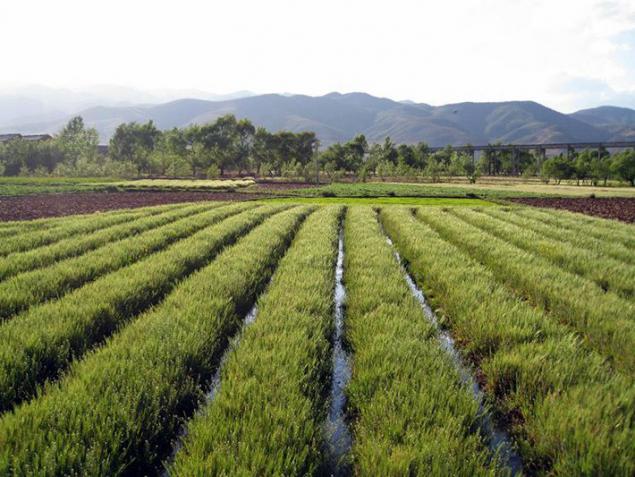
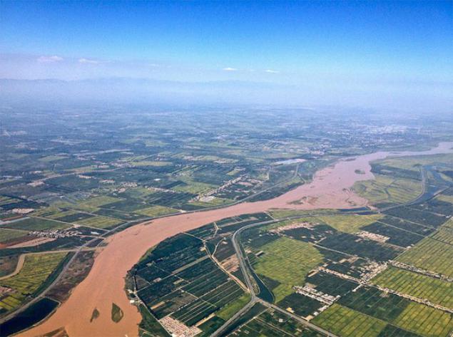
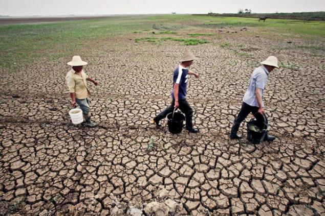
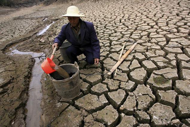
In China, home to about 20% of the world's population, while the supply of fresh water account for only 7% of the world. Everything else they are distributed over a vast country is uneven. If the residents of the southern regions of China with affluent Yangtze more or less water provided, the population of the North China Plain, the Yellow River and Huaihe River between the rivers, and it is up to a third of the obschekitayskih 1, 3 billion people regularly suffer from a dry climate. Yellow River, the largest source of water in the north of China, in the 1990s did constantly dry up downstream. Measures taken by the Chinese government allowed more or less normalize gidrorezhim Yellow River, but now its different downstream shortage of water, have a negative impact on the development of agriculture and industry in the country.
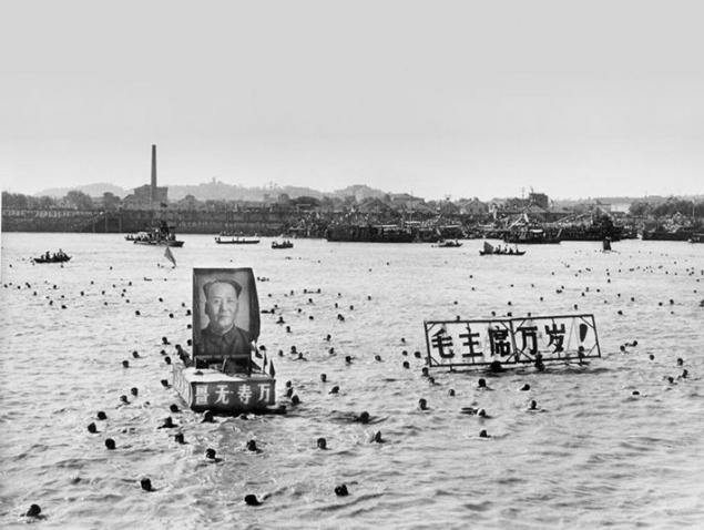
This is not a new problem for China. As early as 1952, Mao Zedong said: "In the north, a little water, plenty of it in the south, so if this is possible, why not redistribute this water?" As is the case with other major Chinese projects, the implementation of conceptual thought chairman lasted for decades , surviving author. Only in 1979 the Ministry of water resources of the country was established a special department, whose main task was the development plan for the "South-North Water Transfer Project" from south to north.
In fact, the Chinese government chose the lesser of two evils. To save populous agricultural north of thirst and droughts, it was necessary to run the program or mass displacement of the local population in the better-off in relation to climate and hydrological southern areas, or, conversely, some way to deliver water from the south suffer from its lack of northerners.
And he and the other projects require huge financial costs and long-term implementation. Perhaps the final choice of a certain influence exerted by technocrats who came to power in China in the late 1980s. Li Peng, Premier of the State Council in the 1988-1998 years, was educated hydropower, hydraulic engineering department and graduated in Chinese President Hu Jintao 2003-2013 years. In the 1990 decision to implement a "turning the rivers" was approved, and in 2002, after half a century after Chairman Mao for the first time this conceptual idea sounded, large-scale work, designed for decades, finally started to take place.
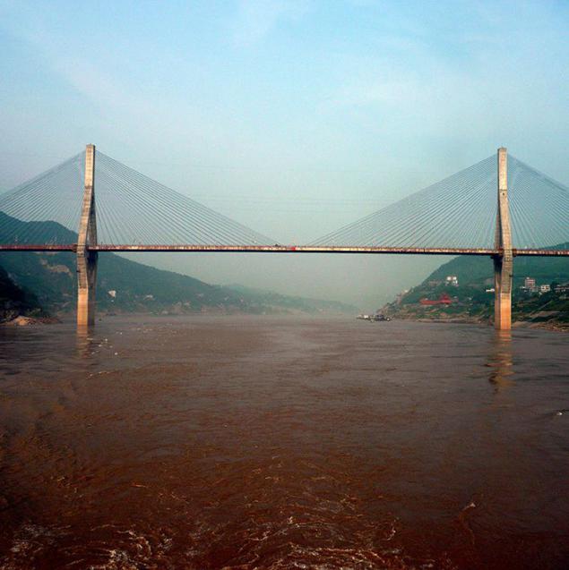
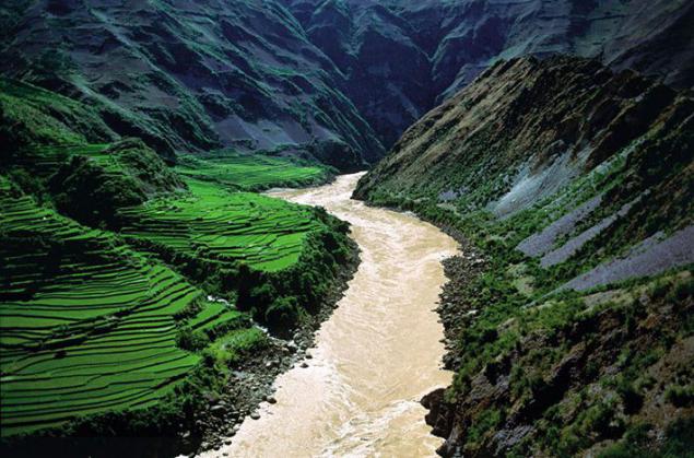
Strictly speaking, there is no literal "turn the rivers" is not expected. The plan called for transfer of part of the flow South China Yangtze River and its tributaries in the northern provinces of the country with the help of hydraulic structures. The average annual water flow of the Yangtze at its mouth is about 950 billion cubic meters, and even in the driest years below 600 billion cubic meters of falls. From this huge volume of only about 5% (on average up to 45 billion cubic meters per year) should be in the final of the project (2050) to go to the north.
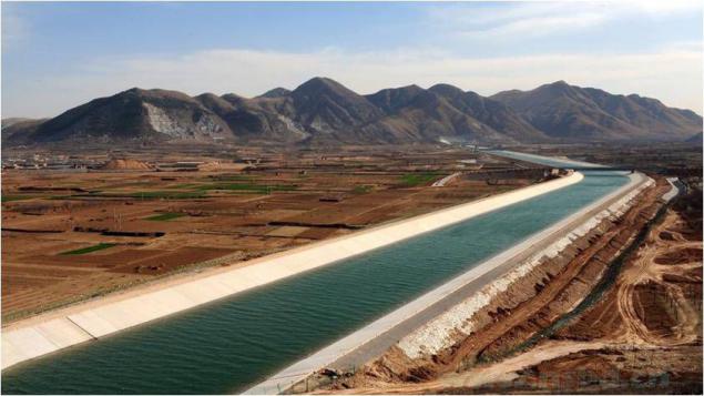
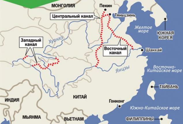
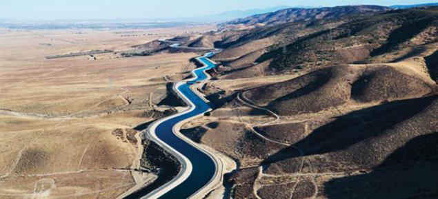
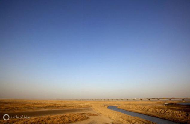
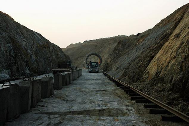
In the next 48 years (from 2002 to 2050-th) pools of four major Chinese rivers (Yangtze, Yellow, Huaihe and Haihe) will be joined by three grand channels: Eastern, Central and Western. This will significantly increase the deepness northern Chinese rivers, to eliminate the risk of drying out and provide resources to the reservoir near the largest cities in the north of the country - Beijing and Tianjin.
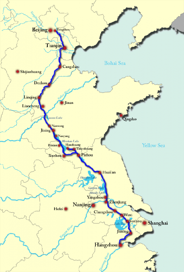
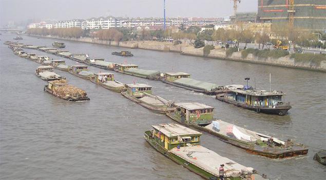
Work on the first stage of super project began in December 2002. East channel is largely assumed the use of the infrastructure of the Grand Canal Beijing - Hangzhou, a unique hydraulic structure, build two thousand years (VI century BC. E. - XIII century BC. E.) And for the first time linked the Yangtze to the Yellow River.
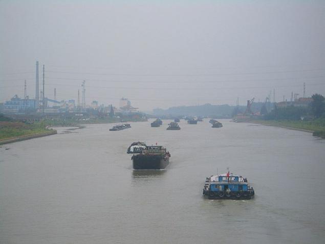
Within a decade, is expanding the Grand Canal and the construction of 23 new pumping stations along the route, which together with the already existing 7 objects of this kind were to pump water to the Yangtze River Yellow River - the Yellow River.
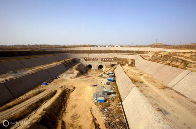
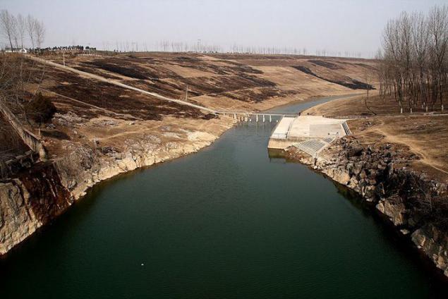
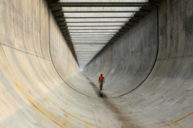
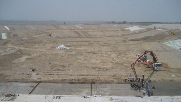
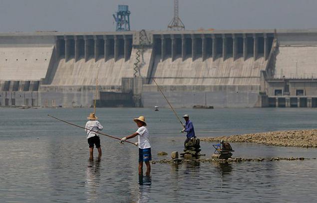
Unique new hydraulic works here has become an underground complex built at the intersection of the Grand Canal from the Yellow River. Yangtze water will force the Yellow River with two underground tunnels, culverts diameter of 9, 3 meters long each and 585 meters. Next gravity millions of cubic meters of securities in the North China Plain in the end will be in the reservoir in Tianjin. Actually, the supply of this particular city, its metropolitan area, as well as densely populated province of Shandong, one of the main agricultural regions of the country - the main goal of "turning the rivers" in the east.

Work on the East Channel lasted 11 years. Late last year, the complex was put into operation. Its total length was 1150 kilometers further north China will be shifted to a billion cubic meters of fresh water per year.
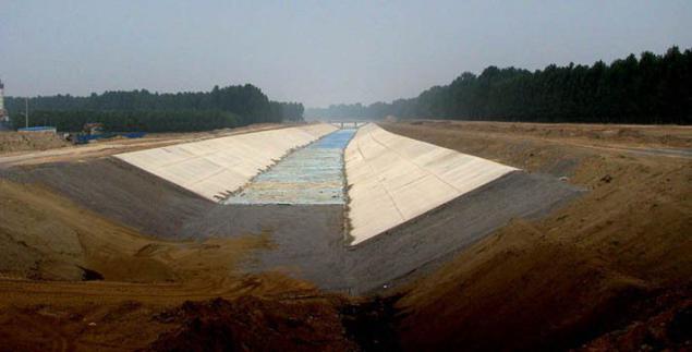
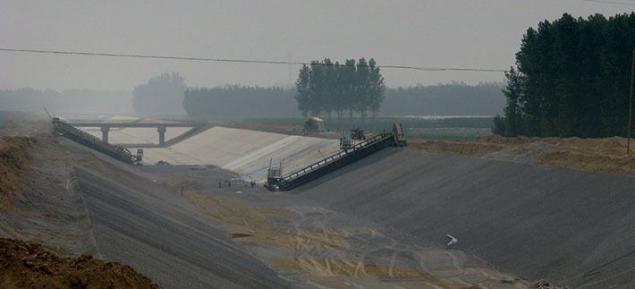
Unlike the Eastern Channel, to rely on the basis of already existing hydraulic infrastructure, the Central Canal was a building from scratch. Work on it began in late 2003 and had the ultimate goal of the organization of water supply in Beijing and the central Chinese province of Hubei, Henan and Hebei.
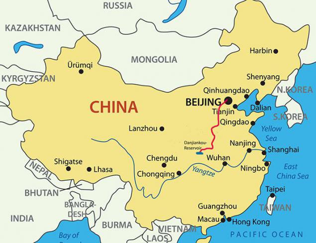
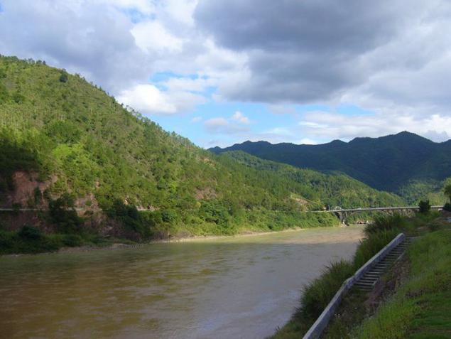
The central channel begins in the Danjiangkou Reservoir, which is located on the River Han, a major tributary of the Yangtze. The project authors calculated that from this point of water can be delivered to the North China Plain, near Beijing, gravity, thus avoiding the construction of expensive engineering structures, such as, for example, pumping stations.
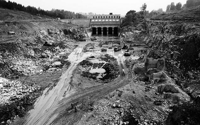
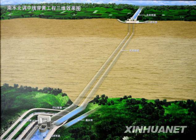
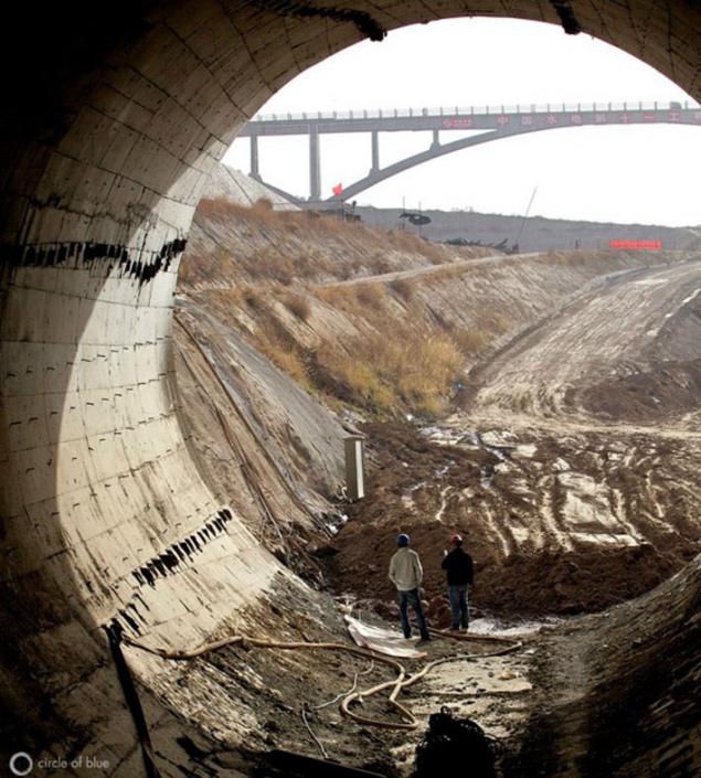
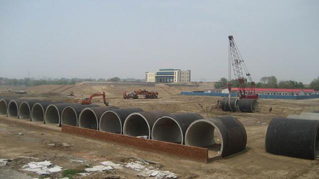
Nevertheless, the central portion of "South-North Water Transfer Project" faced two challenges. The first of these was the need to cross the Yellow River, which decided exactly the same as in the east - the construction of an underground tunnel, conduit.
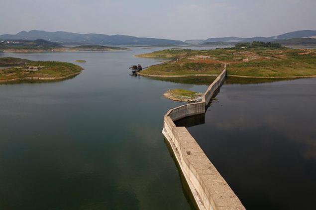
The second problem was much larger and require significant financial investments. In order to provide a natural drift of the reservoir in the direction Danjiangkou Beijing required to raise the water level therein at from 157 to 170 meters. These additional 13 meters, of course, greatly increases the surface area of the reservoir and thereby forced the country's leadership to begin a program of mass relocation of residents from flooded artificial pond areas. The red line on the label indicates the level of water after flooding.
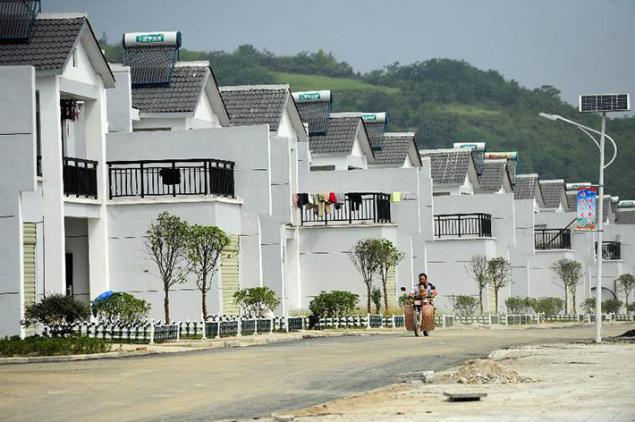
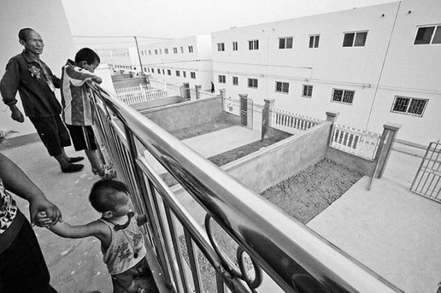
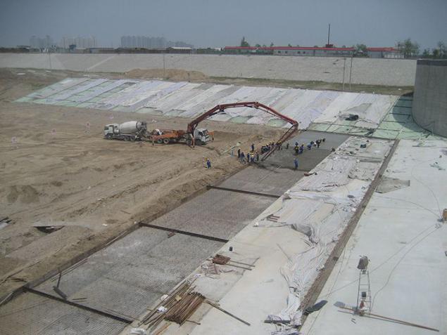
According to various estimates, a new location during the construction of the center channel has been moved from 250 thousand. Up to 330 thousand. Man - a figure, of course, is much more modest than 1, 23 million internally displaced people from the flood zone HPP "Three Gorges", but nevertheless, require the authorities to billions of dollars of investment. In addition, from the construction were made dozens of large and hundreds of small businesses: Eliminate potential sources of water pollution in the canals and reservoirs.
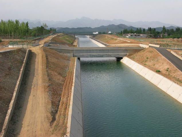
Commissioning of the center channel is planned by the end of this, in 2014, although some parts of it are already successfully functioning. The total length of the hydraulic complex will be 1,264 kilometers. At the initial stage to Beijing will be shifted further 9, 5 billion cubic meters of fresh water by 2030 this figure will rise to 12-13 billion in the middle (not dry) years.
This volume takes away from the Han river runoff in the long term it can cause drying of the areas below the dam Danjiangkou. In this regard, the Chinese engineers have developed a draft of the additional channel, which would link the Danjiangkou with similar and very affluent reservoir hydropower plant "Three Gorges" at the Yangtze. Construction of this facility in the future will dramatically reduce the load on the Han River and avoid potential environmental disaster in the lands along its lower reaches.
The most ambitious part of the project transferring water from the south to the north of China will be the Western channel. Recall, "turn the rivers" is designed for several decades - a grand work should be completed only in 2050. In this case, the eastern and central parts of the complex has already been largely completed. It is on the construction of the Western Channel in the coming three decades will be to focus the Chinese leadership.
The main objective of the west will be the connection headwaters of the Yangtze River with Yellow River. Such redistribution of water will allow re-do the Yellow River overflowing and restore normal water supply industry and agriculture populous provinces along its banks.
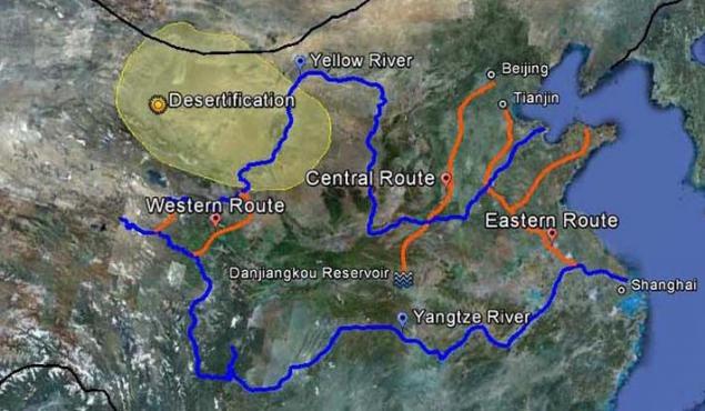
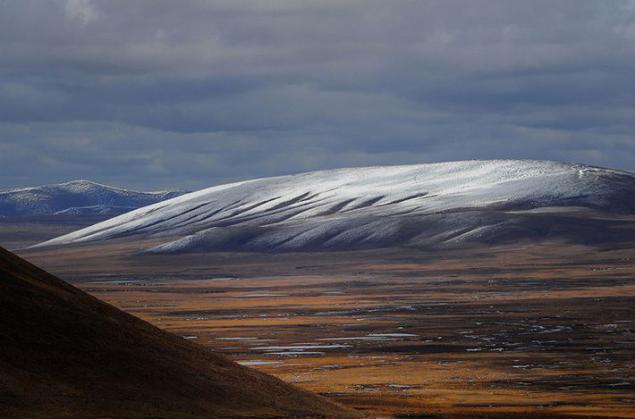
About a third of all China's water resources are concentrated on the Qinghai-Tibet Plateau, where the origins of the three main tributaries of the Yangtze River in its upper reaches: Yalong River, T'o and Tatu. It is the water of these rivers is planned to partially redirect the Western channel. Its estimated length is "only" 500 kilometers, but the construction of the complex will be in difficult mining conditions at altitudes of 3000-5000 meters above sea level.
In addition, the Western channel to overcome the natural watershed between the basins of the Yangtze and Yellow - ridge Bayan Har Mountains, 750 km long mountain range up to 5500 meters. Here, engineers and builders face the need to create a whole system of reservoirs, dams with hydroelectric power plants, as well as the enormous length of tunnels, conduits through which Western channel directly through the thickness of the Kunlun and will be released in the upper Yellow River.
In the second stage as a promising channel is considered and its inclusion in the system of rivers Mekong and the Salween, in the Yangtze basin is not included, and with the current direction of the Tibetan Plateau in South-East Asia. However, just taking into account the resistance of these countries the prospect of implementing the idea of the Mekong and the Salween with, yet looks ghostly.
West channel is still in the design stage, and the specific terms of the beginning of work on its construction is not defined. Most likely, before to get involved in this mountainous hydro-technical epic, the Chinese leadership in the coming years will analyze the success (or lack thereof) has already built the eastern and central parts of the complex. In the end, all the theoretical predictions about the prospective impact of "turning the rivers" on the environment and climate as southern regions of the country where water is collected, and the northern provinces, its abundance in the receivers need to be tested in practice.
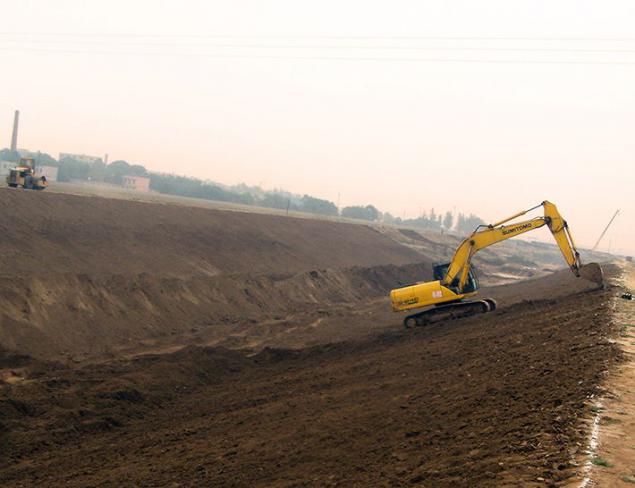
For the first 11 years of the project "South-North Water Transfer Project" on it was spent, according to various estimates $ 28-35 billion. The scale of the construction work is striking: during the construction of the Eastern and Central channel was moved about 11 billion cubic meters of soil and laid 22 billion cubic meters of concrete .
The most difficult, at least in engineering terms, a milestone still ahead. In Tibet, the western section of the complex is planned until 2050 to spend another $ 25-35 billion. In the end, the country should see a major engineering works of our time, which has no analogues in the world. All previous experience implementing their superprojects China suggests that now only he is capable of carrying out work of enormous proportions, with a similar level of spending and is the accompanying risk.
Source: realt.onliner.by
Until 2050 part of the flow of the Yangtze River with the help of hydraulic structures will be transferred to the north of China. Canals and aqueducts in thousands of kilometers long, tens of billions of dollars and cubic meters of water ...

In China, home to about 20% of the world's population, while the supply of fresh water account for only 7% of the world. Everything else they are distributed over a vast country is uneven. If the residents of the southern regions of China with affluent Yangtze more or less water provided, the population of the North China Plain, the Yellow River and Huaihe River between the rivers, and it is up to a third of the obschekitayskih 1, 3 billion people regularly suffer from a dry climate. Yellow River, the largest source of water in the north of China, in the 1990s did constantly dry up downstream. Measures taken by the Chinese government allowed more or less normalize gidrorezhim Yellow River, but now its different downstream shortage of water, have a negative impact on the development of agriculture and industry in the country.


This is not a new problem for China. As early as 1952, Mao Zedong said: "In the north, a little water, plenty of it in the south, so if this is possible, why not redistribute this water?" As is the case with other major Chinese projects, the implementation of conceptual thought chairman lasted for decades , surviving author. Only in 1979 the Ministry of water resources of the country was established a special department, whose main task was the development plan for the "South-North Water Transfer Project" from south to north.

In fact, the Chinese government chose the lesser of two evils. To save populous agricultural north of thirst and droughts, it was necessary to run the program or mass displacement of the local population in the better-off in relation to climate and hydrological southern areas, or, conversely, some way to deliver water from the south suffer from its lack of northerners.


And he and the other projects require huge financial costs and long-term implementation. Perhaps the final choice of a certain influence exerted by technocrats who came to power in China in the late 1980s. Li Peng, Premier of the State Council in the 1988-1998 years, was educated hydropower, hydraulic engineering department and graduated in Chinese President Hu Jintao 2003-2013 years. In the 1990 decision to implement a "turning the rivers" was approved, and in 2002, after half a century after Chairman Mao for the first time this conceptual idea sounded, large-scale work, designed for decades, finally started to take place.

Strictly speaking, there is no literal "turn the rivers" is not expected. The plan called for transfer of part of the flow South China Yangtze River and its tributaries in the northern provinces of the country with the help of hydraulic structures. The average annual water flow of the Yangtze at its mouth is about 950 billion cubic meters, and even in the driest years below 600 billion cubic meters of falls. From this huge volume of only about 5% (on average up to 45 billion cubic meters per year) should be in the final of the project (2050) to go to the north.

In the next 48 years (from 2002 to 2050-th) pools of four major Chinese rivers (Yangtze, Yellow, Huaihe and Haihe) will be joined by three grand channels: Eastern, Central and Western. This will significantly increase the deepness northern Chinese rivers, to eliminate the risk of drying out and provide resources to the reservoir near the largest cities in the north of the country - Beijing and Tianjin.

Work on the first stage of super project began in December 2002. East channel is largely assumed the use of the infrastructure of the Grand Canal Beijing - Hangzhou, a unique hydraulic structure, build two thousand years (VI century BC. E. - XIII century BC. E.) And for the first time linked the Yangtze to the Yellow River.


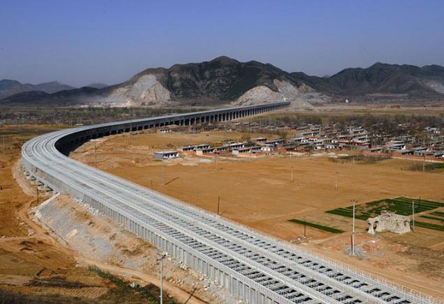
Within a decade, is expanding the Grand Canal and the construction of 23 new pumping stations along the route, which together with the already existing 7 objects of this kind were to pump water to the Yangtze River Yellow River - the Yellow River.


Unique new hydraulic works here has become an underground complex built at the intersection of the Grand Canal from the Yellow River. Yangtze water will force the Yellow River with two underground tunnels, culverts diameter of 9, 3 meters long each and 585 meters. Next gravity millions of cubic meters of securities in the North China Plain in the end will be in the reservoir in Tianjin. Actually, the supply of this particular city, its metropolitan area, as well as densely populated province of Shandong, one of the main agricultural regions of the country - the main goal of "turning the rivers" in the east.


Work on the East Channel lasted 11 years. Late last year, the complex was put into operation. Its total length was 1150 kilometers further north China will be shifted to a billion cubic meters of fresh water per year.


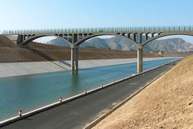
Unlike the Eastern Channel, to rely on the basis of already existing hydraulic infrastructure, the Central Canal was a building from scratch. Work on it began in late 2003 and had the ultimate goal of the organization of water supply in Beijing and the central Chinese province of Hubei, Henan and Hebei.

The central channel begins in the Danjiangkou Reservoir, which is located on the River Han, a major tributary of the Yangtze. The project authors calculated that from this point of water can be delivered to the North China Plain, near Beijing, gravity, thus avoiding the construction of expensive engineering structures, such as, for example, pumping stations.


Nevertheless, the central portion of "South-North Water Transfer Project" faced two challenges. The first of these was the need to cross the Yellow River, which decided exactly the same as in the east - the construction of an underground tunnel, conduit.

The second problem was much larger and require significant financial investments. In order to provide a natural drift of the reservoir in the direction Danjiangkou Beijing required to raise the water level therein at from 157 to 170 meters. These additional 13 meters, of course, greatly increases the surface area of the reservoir and thereby forced the country's leadership to begin a program of mass relocation of residents from flooded artificial pond areas. The red line on the label indicates the level of water after flooding.

According to various estimates, a new location during the construction of the center channel has been moved from 250 thousand. Up to 330 thousand. Man - a figure, of course, is much more modest than 1, 23 million internally displaced people from the flood zone HPP "Three Gorges", but nevertheless, require the authorities to billions of dollars of investment. In addition, from the construction were made dozens of large and hundreds of small businesses: Eliminate potential sources of water pollution in the canals and reservoirs.


Commissioning of the center channel is planned by the end of this, in 2014, although some parts of it are already successfully functioning. The total length of the hydraulic complex will be 1,264 kilometers. At the initial stage to Beijing will be shifted further 9, 5 billion cubic meters of fresh water by 2030 this figure will rise to 12-13 billion in the middle (not dry) years.

This volume takes away from the Han river runoff in the long term it can cause drying of the areas below the dam Danjiangkou. In this regard, the Chinese engineers have developed a draft of the additional channel, which would link the Danjiangkou with similar and very affluent reservoir hydropower plant "Three Gorges" at the Yangtze. Construction of this facility in the future will dramatically reduce the load on the Han River and avoid potential environmental disaster in the lands along its lower reaches.

The most ambitious part of the project transferring water from the south to the north of China will be the Western channel. Recall, "turn the rivers" is designed for several decades - a grand work should be completed only in 2050. In this case, the eastern and central parts of the complex has already been largely completed. It is on the construction of the Western Channel in the coming three decades will be to focus the Chinese leadership.

The main objective of the west will be the connection headwaters of the Yangtze River with Yellow River. Such redistribution of water will allow re-do the Yellow River overflowing and restore normal water supply industry and agriculture populous provinces along its banks.

About a third of all China's water resources are concentrated on the Qinghai-Tibet Plateau, where the origins of the three main tributaries of the Yangtze River in its upper reaches: Yalong River, T'o and Tatu. It is the water of these rivers is planned to partially redirect the Western channel. Its estimated length is "only" 500 kilometers, but the construction of the complex will be in difficult mining conditions at altitudes of 3000-5000 meters above sea level.

In addition, the Western channel to overcome the natural watershed between the basins of the Yangtze and Yellow - ridge Bayan Har Mountains, 750 km long mountain range up to 5500 meters. Here, engineers and builders face the need to create a whole system of reservoirs, dams with hydroelectric power plants, as well as the enormous length of tunnels, conduits through which Western channel directly through the thickness of the Kunlun and will be released in the upper Yellow River.


In the second stage as a promising channel is considered and its inclusion in the system of rivers Mekong and the Salween, in the Yangtze basin is not included, and with the current direction of the Tibetan Plateau in South-East Asia. However, just taking into account the resistance of these countries the prospect of implementing the idea of the Mekong and the Salween with, yet looks ghostly.

West channel is still in the design stage, and the specific terms of the beginning of work on its construction is not defined. Most likely, before to get involved in this mountainous hydro-technical epic, the Chinese leadership in the coming years will analyze the success (or lack thereof) has already built the eastern and central parts of the complex. In the end, all the theoretical predictions about the prospective impact of "turning the rivers" on the environment and climate as southern regions of the country where water is collected, and the northern provinces, its abundance in the receivers need to be tested in practice.


For the first 11 years of the project "South-North Water Transfer Project" on it was spent, according to various estimates $ 28-35 billion. The scale of the construction work is striking: during the construction of the Eastern and Central channel was moved about 11 billion cubic meters of soil and laid 22 billion cubic meters of concrete .


The most difficult, at least in engineering terms, a milestone still ahead. In Tibet, the western section of the complex is planned until 2050 to spend another $ 25-35 billion. In the end, the country should see a major engineering works of our time, which has no analogues in the world. All previous experience implementing their superprojects China suggests that now only he is capable of carrying out work of enormous proportions, with a similar level of spending and is the accompanying risk.


Source: realt.onliner.by
Tags
See also
By train to a height of five kilometers
Prison "Crosses"
Gold pretzels "United Russia"
Khmer version of the "bright future"
Putin went all and start a war with Ukraine on the mainland
Mysterious Kamchatka
The opening of the new building "Centre Georges Pompidou"
India launches project to change the channels of major rivers
Pamir - Gorno-Badakhshan